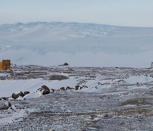
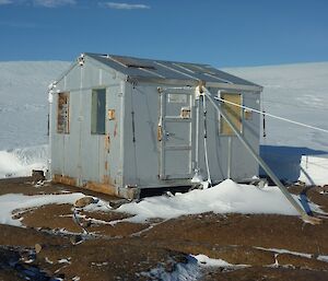
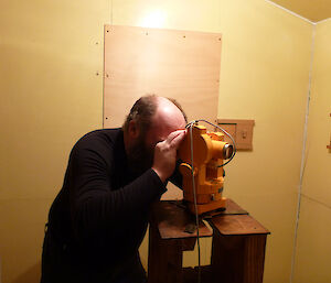
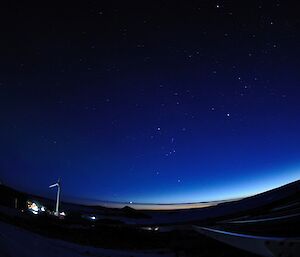
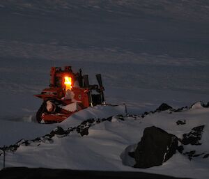
One of the sciences that happens all year round at Mawson is geomagnetism. Antarctic geomagnetic reporting was performed by Webb, Bage and assistants on the 1911–13 expedition at Commonwealth Bay. They peformed their observations, taking up to three hours, in a hut made of scrap material, mostly wood and copper nails (to reduce introduced magnetic fields) with no heating and only poor lighting. Today, magnetic observations are performed at Mawson, Casey and Macquarie Island by one of the expeditioners (usually a Communications Technical Officer) on behalf of Geoscience Australia. The Absolute Huts are still made from wood and brass fittings, however, we have the luxury of a non magnetic heater and two 150W electric globes. The Absolute Hut at Mawson is one of the oldest buildings on station which was moved here from Heard Island in 1954, and it smells like it. The purpose of the observations is to record the field accurately without any introduced fields. This means making youself less magnetic. For me, this means unloading all the equipment I carry everyday such as watch, belt, pens, notepad (spiral bound), glasses, pedometer, pager, radio, etc.
Nice you think, but you have a few questions on your mind.
1.) Why do we do magnetic observations? Can’t they be done automatically with remote sensors and computer links?,
2.) what’s involved in doing a Magnetic Observation?, and
3.) what affect does this have on me?
The answer to question 1 is: Yes, the observation can be performed remotely. In fact we do that on the station in the Variometer Hut located close to the Absolute Hut. In the Variometer Hut at Mawson are two sets of three-axis magnetic sensors(of different makes). They send back real time information to Geoscience Australia in Canberra and this information can be accessed on their website (www.ga.gov.au). However, they use the information I collect as a reference/ check of these sensors to make sure they are reading correctly.
To answer question 2.
A magnetic observation consist of 3 major sets of readings, these are Field Strength, Declination and Inclination. Each set is performed twice, the second time in reverse order. Field Strength measures the total Magnetic field strength in nanoTeslas. Declination is the direction of the magnetic field East or West of True North and Inclination measures the angle at which the magnetic field exits the earth.
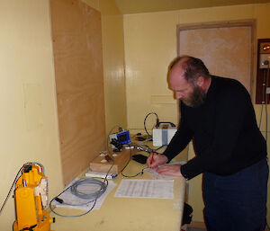
Of course it is no good doing a set of readings to compare against the automated instruments if you can’t compare the times, so the first thing I do before each set of observations is to synchronise a watch against the time signal from a GPS receiver. This watch then becomes the time reference for every measurement taken. All observations are taken at the exact same spot every time to maintain consistency. To do this the Absolute Hut is fitted with a plinth on which the instruments are mounted.
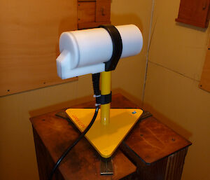
Total field strength is measured using the magnetometer which feeds into an electronics box that outputs the readings to a pocket PC.
Declination and inclination are measured using a theodolite which has been modified to incorporate a magnetic fluxgate that is aligned exactly with the azimuth and elevation axis. The output of the fluxgate is fed into a Danish Meteorological Institute box which displays the relative field strength on a digital display.
To measure the total field strength, I place the magnetometer on the plinth aligning it with a set mark and record the readings every 10 seconds for two minutes.
To measure the declination and inclination is a bit more involved. First, the theodolite has to be secured on the plinth and accuratly levelled, then using a reference mark I set the azimuth (horizontal) to a set value. This then becomes the reference for azimuth angles.
For declination measurements, I set the theodolite at 90 or 270 degrees in the vertical plane (parrallel to Earth’s surface) then swing the azimuth to null the meter. When the meter is nulled it means that the field is exactly 90 degrees off, because the field is always changing, instead of trying to record the angles, we set the angle to a whole minute, record the angle and then every five seconds for 40 seconds, record the offset field strength.
For inclination measurements the azimuth is set to an value calculated from the declination measurements and then the theodolite is moved in the vertical plane until the reading is null yet again, this gives us the inclination angle offset by 90 degrees again. As with the inclination, the angle is set to a whole minute, recorded and then the offset field strength is recorded.
After doing this, it is all done again in the reverse order, the measurements are typed up and forwarded to Geoscience Australia to be analysed.
The answer to question 3 is probably not that much in your daily activities unless you happen to be out using a compass and chart daily. All the results from the Australian Antarctic stations and other stations around the world go into producing magnetic offsets on your charts e.g.in south western Western Australia the offset is to the west whereas in the rest of Australia it is to the east. Makes the difference between having a safe trip or ending up on the rocks.
Hendo


