
Temperature
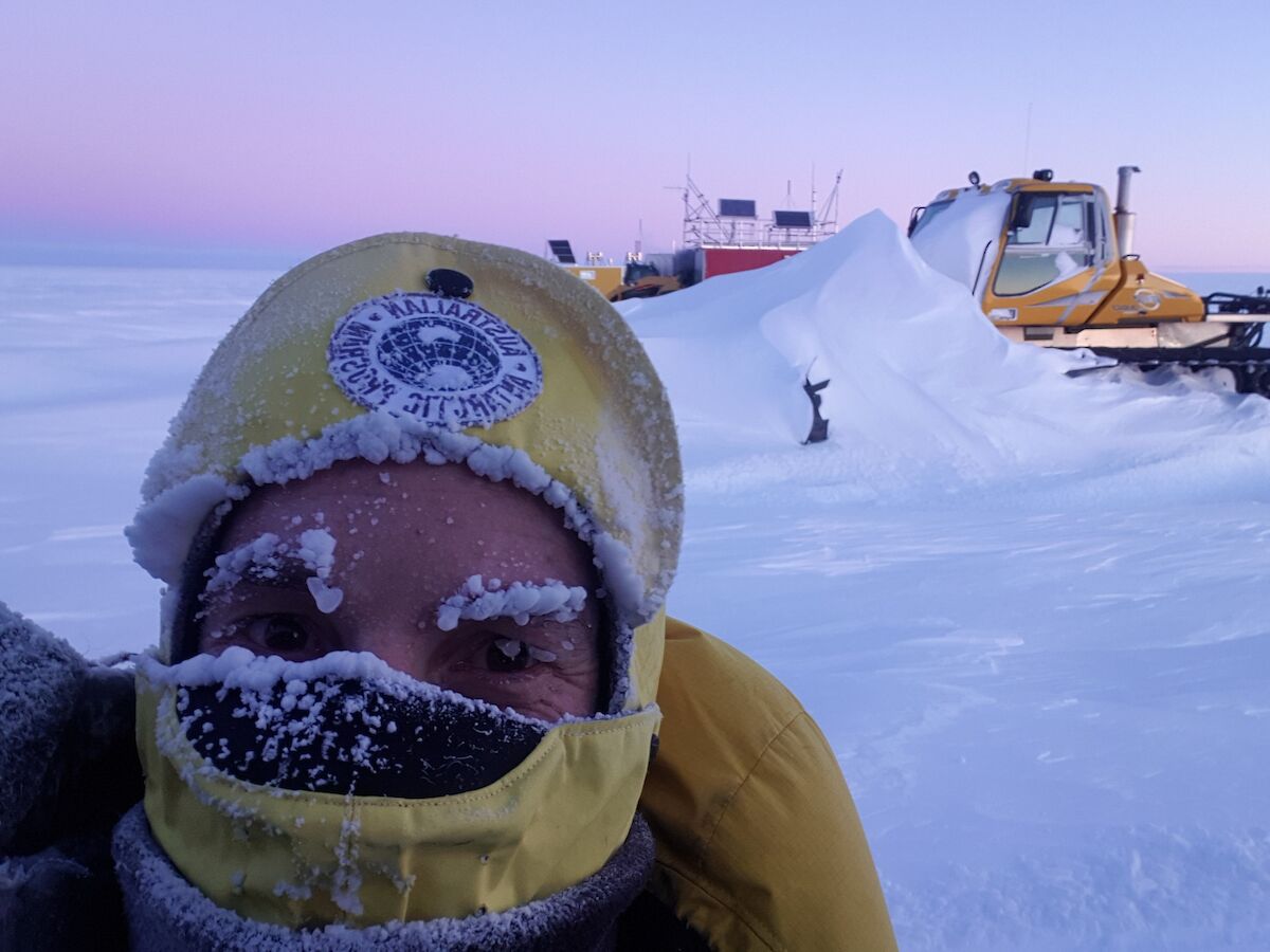
Antarctica’s average annual temperature ranges from about −10°C on the coast to −60°C at the highest parts of the interior.
Near the coast, the temperature can exceed +10°C in summer and fall to below −40°C in winter. Over the elevated inland, it can rise to about −30°C in summer but fall below −80°C in winter.
The lowest temperature ever recorded on the Earth’s surface was −89.2°C at Vostok station on 21 July 1983.
Wind
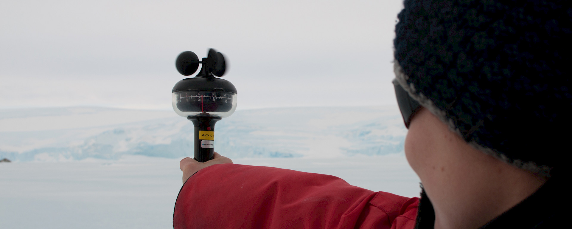
Antarctica’s environment has special conditions that make it the windiest continent on Earth.
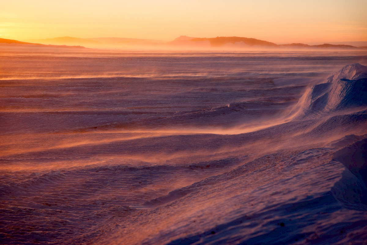
Antarctica is usually surrounded by a belt of low pressure which contains multiple low centres. This is called the ‘circumpolar trough’. But the interior of the continent is dominated by high pressure. These conditions set the scene for the formation of katabatic winds.
Katabatic winds are created when radiative cooling over the elevated Antarctic ice sheet produces very cold, dense air. The cold, dense air flows downhill, and is replaced by subsiding air from above. The resulting katabatic winds accelerate downhill, enhanced by the confluence of glacial valleys.
Katabatic winds blow with great consistency over large areas. At the coast they lose their driving force and soon dissipate offshore.
Low-pressure systems near the coast can interact with katabatic winds to increase their strength. Resulting wind speeds can exceed 100 km/h for days at a time. Wind gusts well over 200 km/h have been measured.
Precipitation
The dry, subsiding air over the interior of Antarctica creates little cloud. Around the coast however, more moisture is available and low-pressure systems have a greater influence. This means that cloudy conditions more common near the coast, particularly on the Antarctic Peninsula.
Rain is observed near the coast, but most precipitation over Antarctica is in the form of snow or ice crystals.
Windy conditions make it difficult to measure snowfall accurately. The average accumulation of snow over the whole continent is estimated to be equivalent to about 150 mm of water per year. Over the elevated plateau, the annual value is less than 50 mm. Near the coast, it generally exceeds 200 mm, the heaviest being over 1,000 mm for an area near the Bellingshausen Sea.
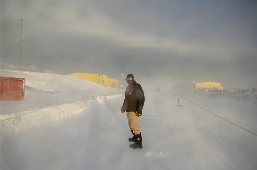
Drifting and blowing snow
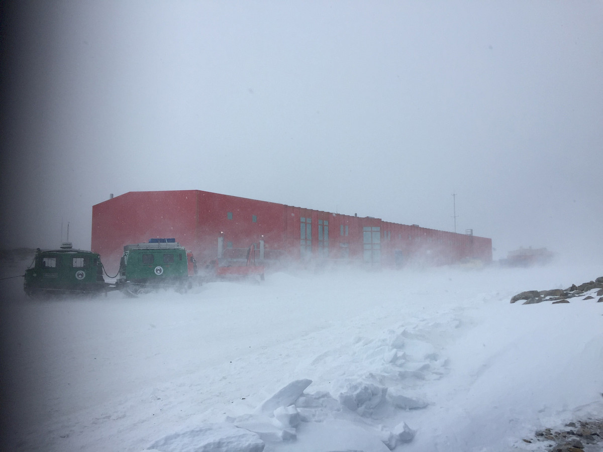
Loose snow can be picked up and carried along by the wind. When the snow is still below eye level, this is called drifting snow. When it is raised above eye level, it is called blowing snow. Wind speeds of over 30 km/h can lead to drifting snow, while wind speeds over 60 km/h are more likely to produce blowing snow. Blowing snow can make it very hard to see.
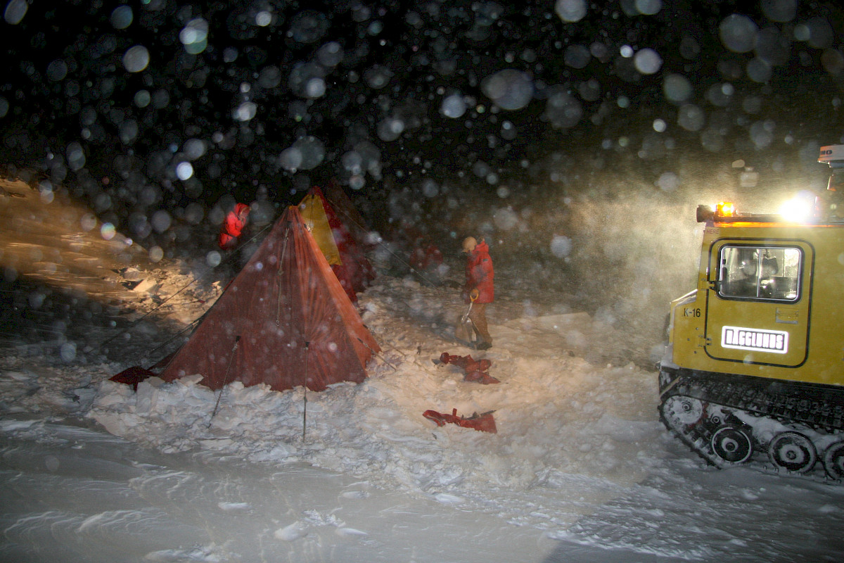
Blizzards
When wind speeds are gale force or stronger for at least one hour, the temperature is less than 0°C and visibility is reduced to 100 m or less, it is a Blizzard.
These conditions are dangerous and disruptive for outdoor activities. Sometimes blizzards last for days.
Whiteout
Whiteout is an optical phenomenon. Uniform light conditions can make it impossible to distinguish shadows, landmarks or the horizon. This can happen when the snow cover is unbroken and the sky is overcast. Whiteout is a serious hazard as it causes a loss of perspective and direction.