Chris the ranger has a story about the island heritage.
Gone but not forgotten
Gone, but not Forgotten…
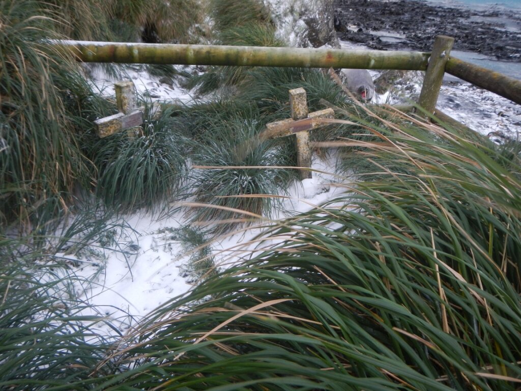
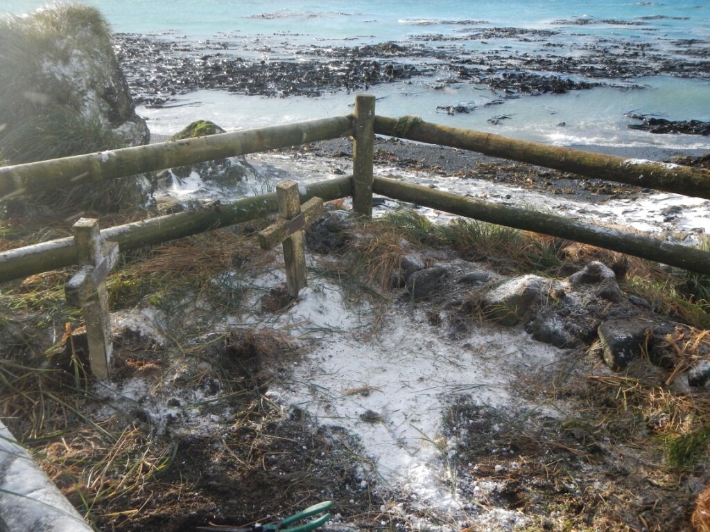
Simple but heartfelt words, inscribed on a small plaque, a headstone on the grave of a departed colleague buried on a shingle-covered beach on a small island in the middle of the Southern Ocean.
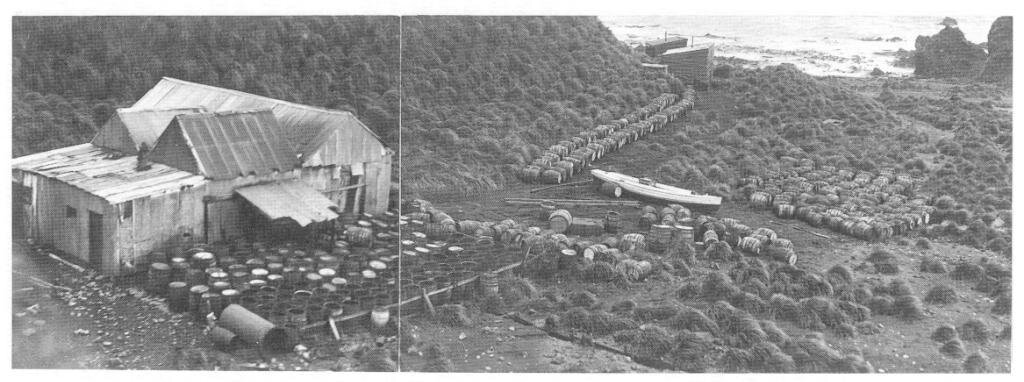
Charles Anderson died and was buried near to a work camp located near the Nuggets, Macquarie Island on 6th April 1903. At the time he was employed in the harvesting of penguins for the production of oil for Joseph Hatch, a well known early entrepreneur associated with Macquarie Island. His grave is today located on a picturesque beach with a view down the rugged east coast of Macquarie Island, alongside another well–known Macquarie Island identity, Otto Bauer ( dec’d 1st May 1918).
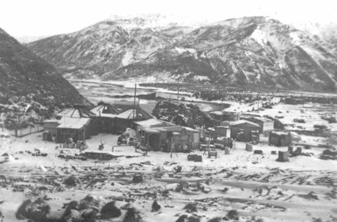
Macquarie Island is well known today for its status as a Wildlife Conservation reserve. Of recent times, people have become aware of the tremendous effort and energy going into the eradication of feral animals from this isolated subantarctic wilderness. Fewer people would perhaps be aware of the rich heritage layer that is also present on the island. The fact that that the first recorded sighting of Macquarie island was on 11th July 1810 by the sealing brig, Perserverance commanded by Captain Frederick Hasselburg. A few people would remember the Nella Dan foundering on rocks on Macquarie Island during a storm in December 1987, but a little bit of research will soon reveal the names of another 11 ships that have wrecked on the rugged shoreline since the early 1800’s.
A quick look online at the Macquarie Island webcam will give a brief peek at station activity today — Icy news will give the latest snippets of what is current. However, start to research the ‘offline’ resources and other less accessible archives and be amazed by the depth of heritage that is present and recorded for this remarkable location.
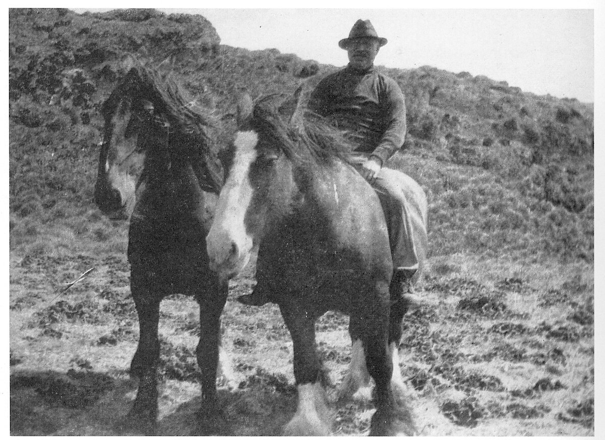
Sepia photographs of rugged sealers eking out an existence living in simple shacks with seal oil lamps. Alongside these images are those of the first truly scientific Australian Antarctic Expedition (AAE) activities on Macquarie in 1911 — 1914. These voyages of discovery were of course the precursor to the Australian Antarctic Research Expeditions (ANARE) that continues to this day as the Australian Antarctic Division.
The Tasmanian Parks and Wildlife Service has a responsibility to ensure the management of all aspects of the island including heritage. It provides some very real challenges for rangers based here as many of the assets and sites are located in remote corners of the island. This can however be a great challenge for it means that the tasks can be so varied — there is no time to get bored. The long dark nights of winter have been fantastic for reading and researching the rich historical heritage of Macca.
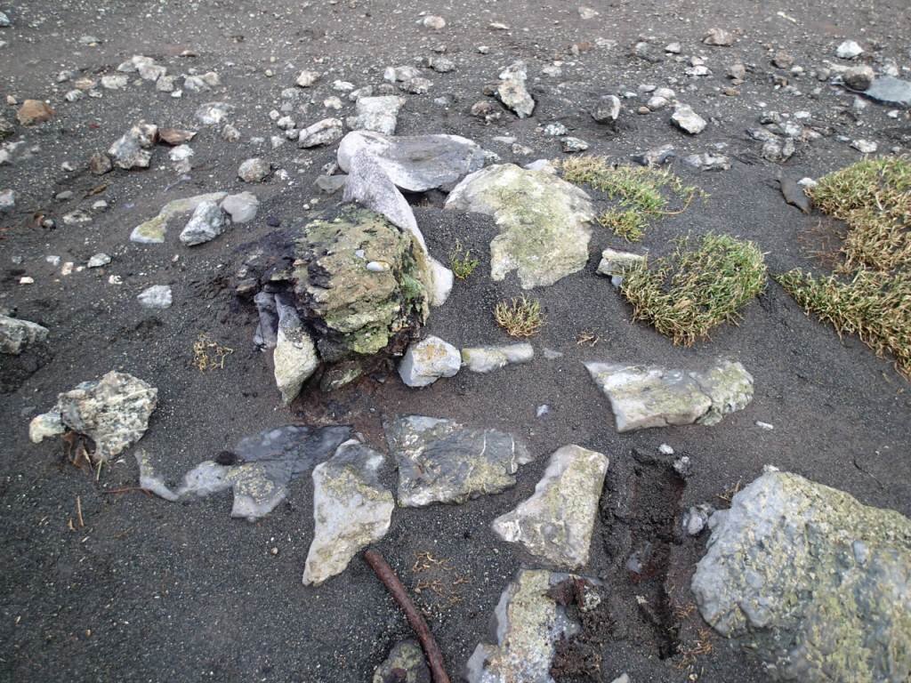
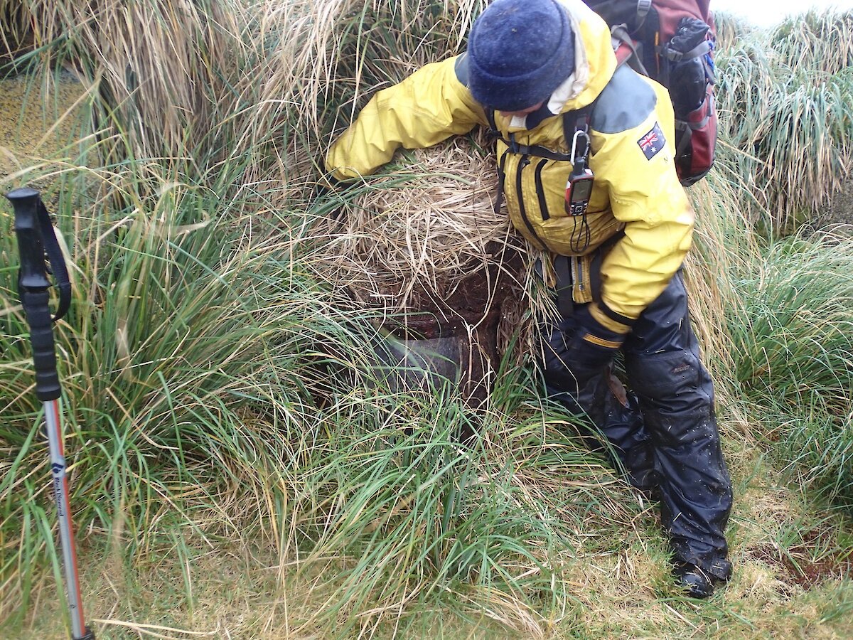
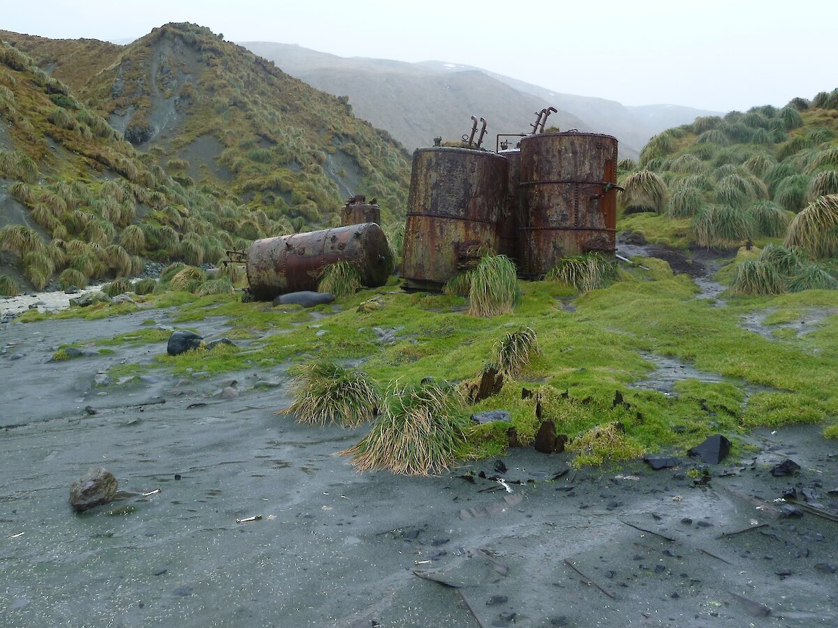
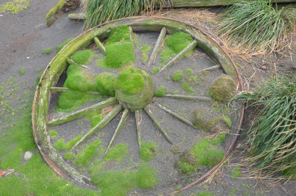
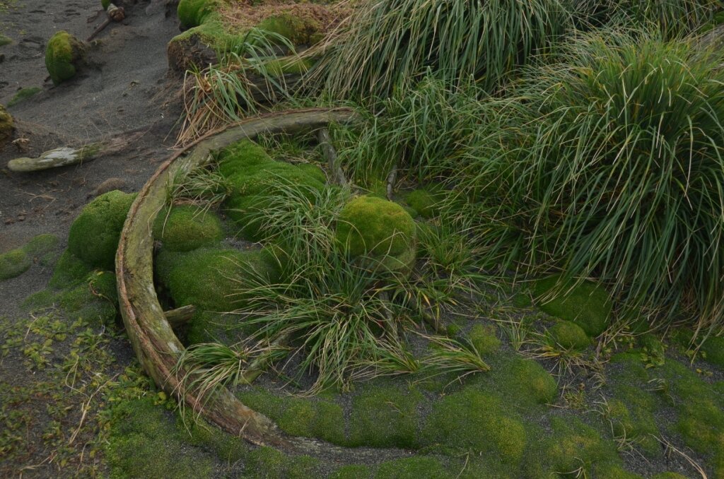
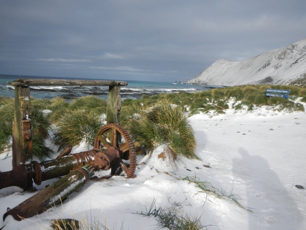
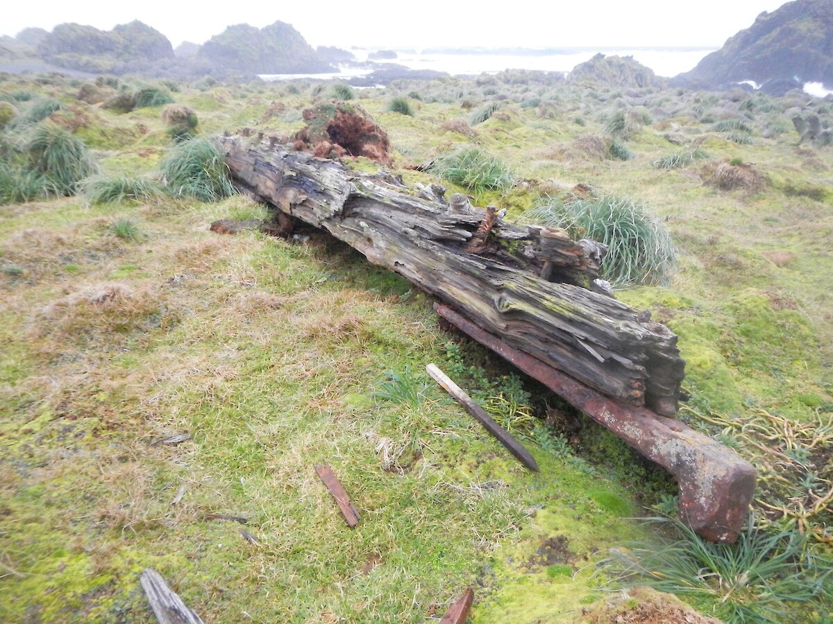
I’ve commented briefly in the past on tasks such as marine debris surveys, wandering albatross chicks monitoring and conducting monthly bird surveys. Interspersed amongst these tasks, I’ve been undertaking photographic assessments on the current state of some of these historic sites. Some of the sites may be complex remnants linked to the days of sealing, others could simply be a large piece of timber associated with an early unknown shipwreck. A large beam located buried amongst the cushion plants at Aurora Point.
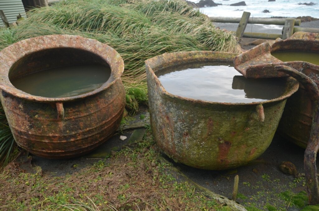
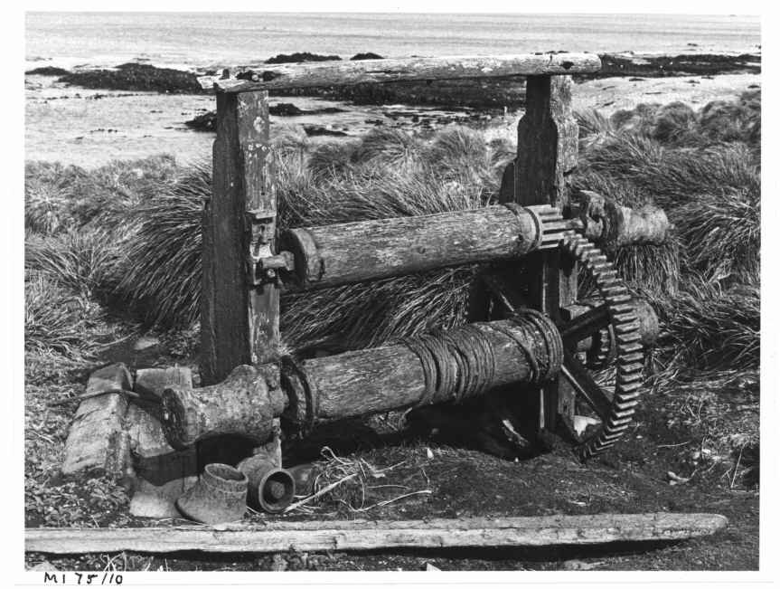
Eagle Point, located on the upper western coast of the island, is a flat tussock-covered rocky peninsula jutting out into the cold Southern Ocean — it is also an important refuge and nesting location for nest giant petrels. From a heritage perspective, it is also the location of two try pots associated with the earlier sealing activities on the island. Try pots were used to render down the animal fat. These two pots are rapidly disappearing due to the strongly regenerating tussock grass.
The photographs taken during the field trips are notated and placed on file alongside others and provide a valuable insight into changes over time. In the case of some of the movable artefacts, the true heritage significance of the items is best maintained by leaving it in suit: this keeps the item in the context of the landscape in which it was used. Try pots in isolated locations, fragments of stone work associated with early buildings, large rusted boilers are all irreplaceable links to past heritage and history.
Occasionally, it is not possible to leave an artefact where it is found such as small fragile items or perhaps those of such value that are considered to valuable if lost. Protocols exist to ensure as much evidence as possible is gathered before the object is moved. These objects are subsequently catalogued and placed in safe storage.
I am not alone in my quest to ensure the protection and management of the heritage fabric here on Macquarie Island. Patty Villegas, on light duties from MIPEP at the moment, has been gently working behind the scenes on another task. She has very carefully undertaken some preliminary stabilisation works of some of those delicate artefacts that have previously been recovered (a story on this will be in next weeks Icy News). The long–term plan is to develop an interpretation display here on Macquarie Island, so that visitors to the island over the summer months can also gain a greater appreciation of the depth and richness of this remarkable location.
The history and the heritage of Macca, in some ways is gone, but not forgotten.
A trip down the island
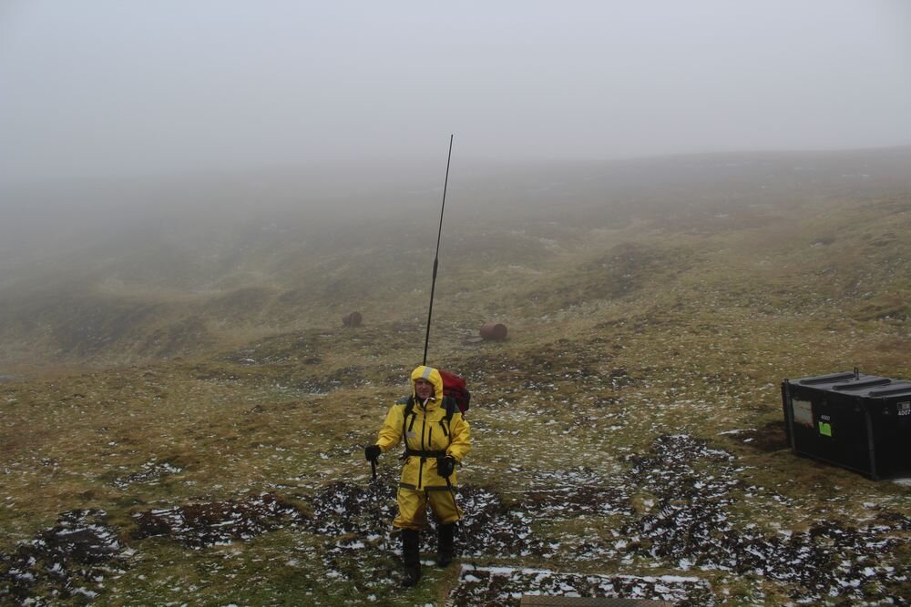
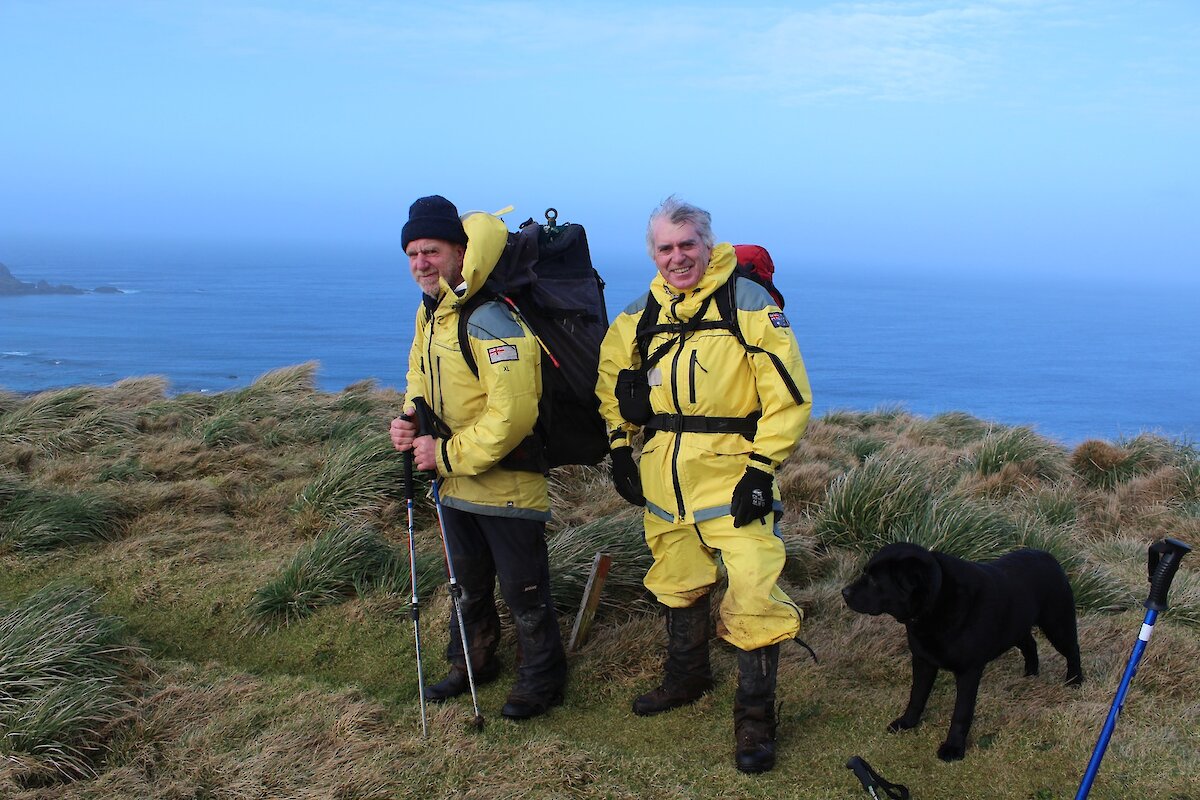
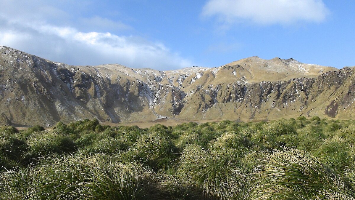
Another trip by one of those ‘commsey’ blokes down the island to attend to a few technical issues affecting our communications equipment. Loaded up with personal equipment and the much needed spares, test equipment and a few tools to supplement those located at each hut, I set off on a trip half way down the Island. A few minor issues to attend to at Green George then some much anticipated rest and recreation. This would have me travelling about 16km then returning after doing the ‘comms’ work and at the same time have a couple of days off to have a look around. Well that was the plan anyway but as you will see this place tends to turn your plans into an optimistic guess. Guess what, guess where, guess when, guess how long…just guess?
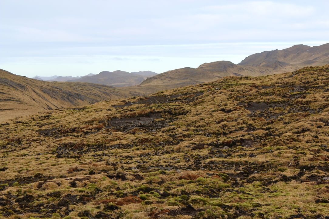
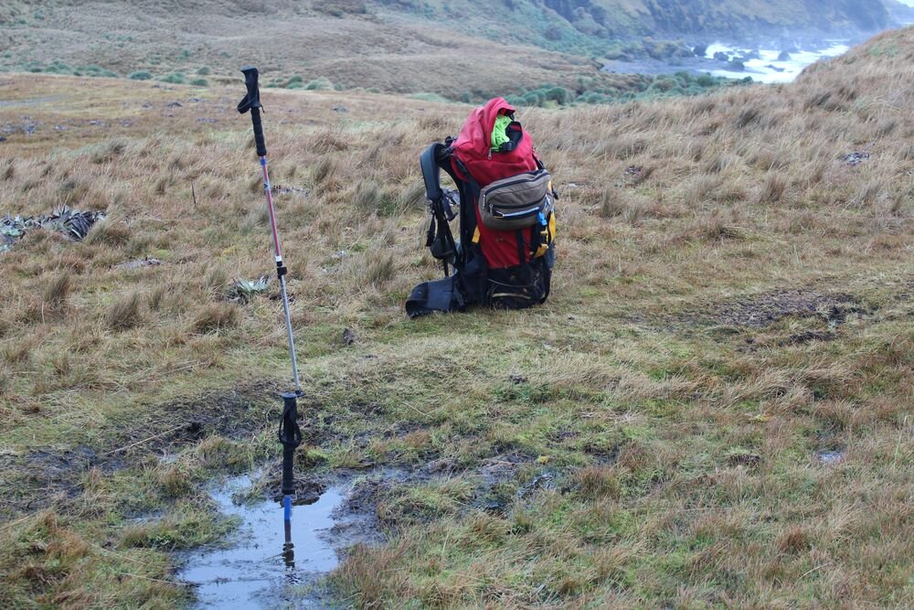
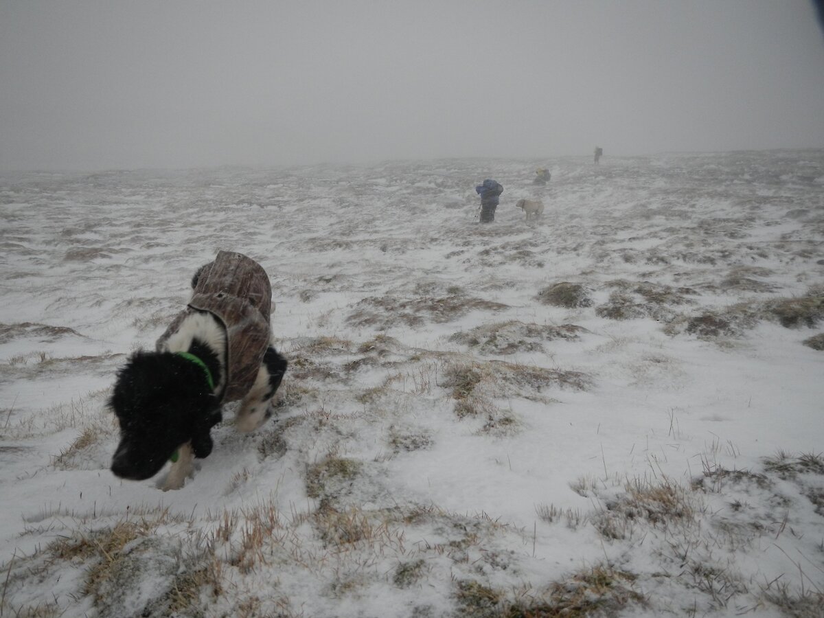
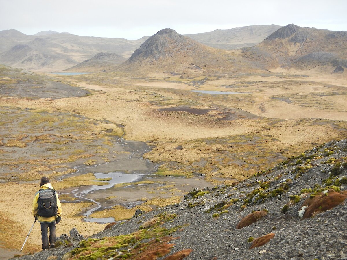
The path from the station varies considerably but one thing you can be assured of is that there is plenty of water about, and mud. Some sections are easy going and firm but mostly you are walking in mud of variable depth and then there is the saturated ground full of water traps turning each step into a lottery — will I be lucky and only sink 100mm or will it be up to my waist?
Travelling up on the plateau is much easier than on the slopes but while it is called a plateau it is far from flat. Most of the day is spent going up then down only to go up again. My destination on the first day is Green George hut. On the approach to the hut there is a stark reminder to be wary — watch out where you plant your feet. Right in the middle of the track is what looks like a small puddle. Probing it with one of my walking poles proved to be the correct thing. The pole kept going down with little resistance, the puddle was over one meter deep!
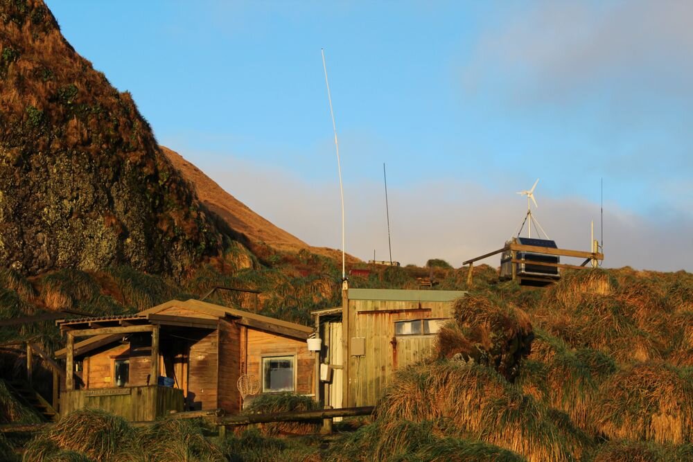
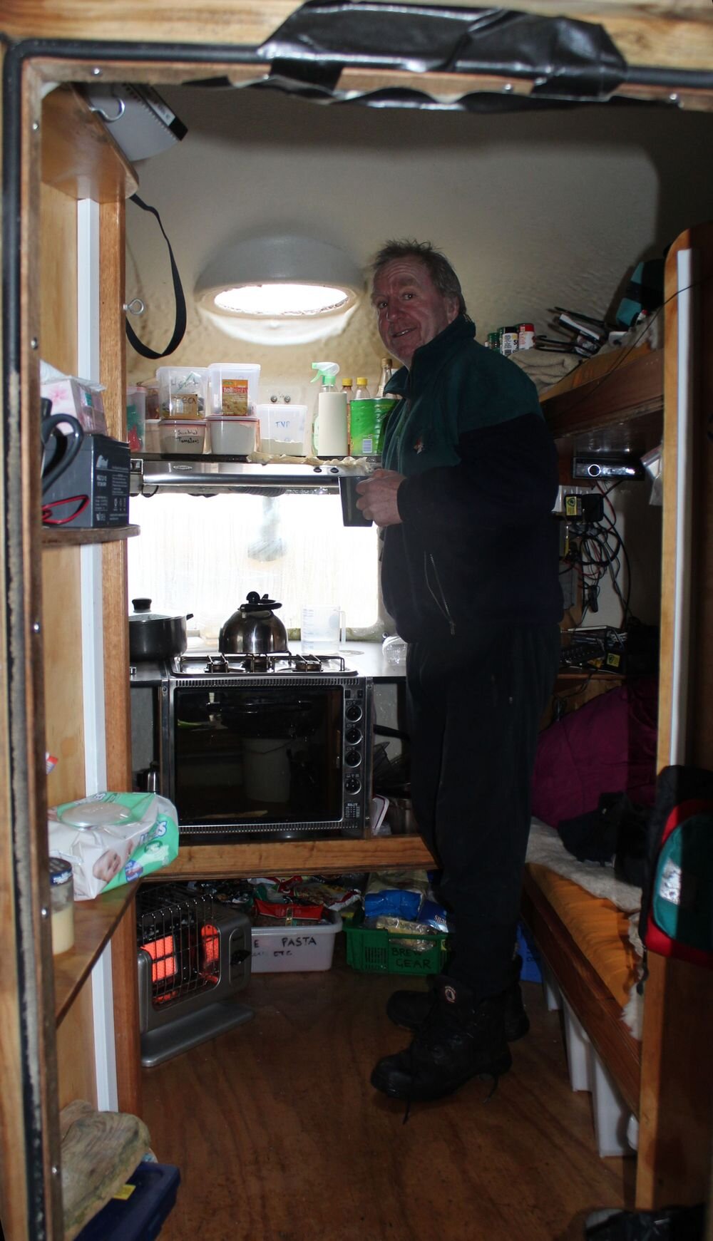
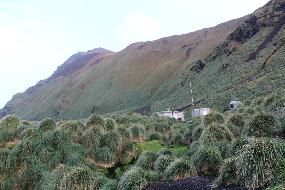
Green George hut is nestled on a grassy slope just above the beach, an idyllic location. Who else has an office like this? A couple of days fixing the radio equipment and surveying the site to see what is there and what may be needed in the future. While this was going on yet another site needed attention. The aerial at Mt Jeffryes radio repeater site had broken off. Probably with the high winds that regularly whip across the island. There go my plans. As the spare aerial at Green George had just been used to repair that site’s radio another had to be brought down to me. Dave arrived with it that night.
The next morning there was another walk, this time to Waterfall Bay hut, close enough to Mt Jeffryes to allow the repair to be completed and then travel to the next hut for the night. As I was leaving Green George, Dave the station builder (and ‘tradie’ supervisor) was up to his knees in mud. Assisted by Tony the chef, they were digging holes for fence posts through mud and worst of all rocks, big ugly ones making the task all but impossible.
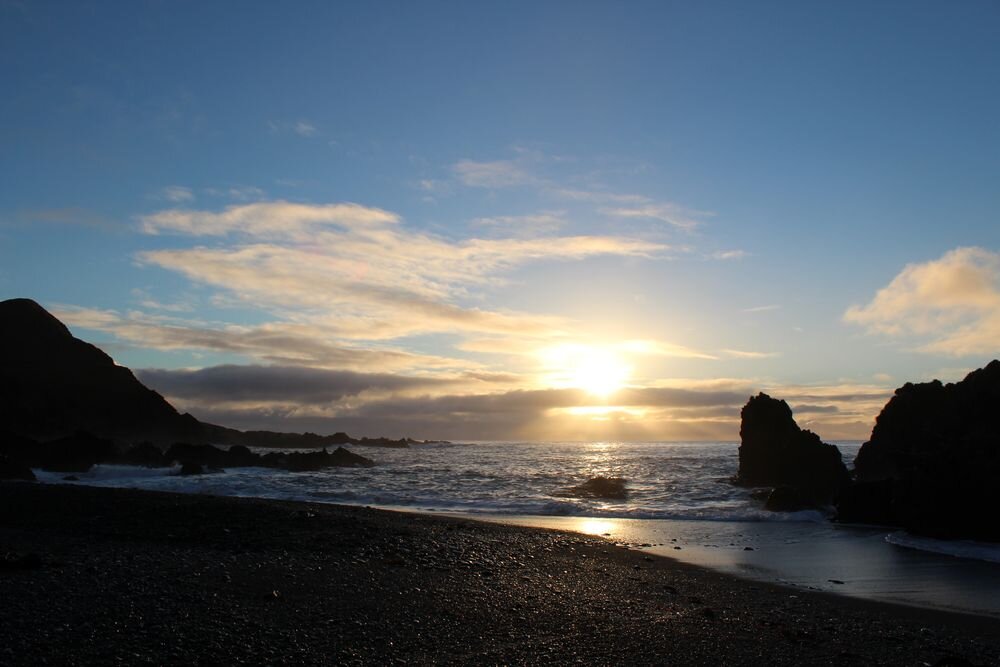
Waterfall Bay was also just beside the beach and a pleasant place to spend the night. A check of the map to go over the route for the next day. The only catch in getting to the next hut meant a steep climb from sea level to 160 meters. Now back up on the plateau walking in the low cloud or mist meant visibility was somewhat limited but at least today there was none of the high winds that Windy Ridge is named after. Nick was waiting at the hut; he was to be my guide for the rest of the trip south. The first (but not only) indication of his suitability for the task was a much needed cup of tea he insisted was needed.
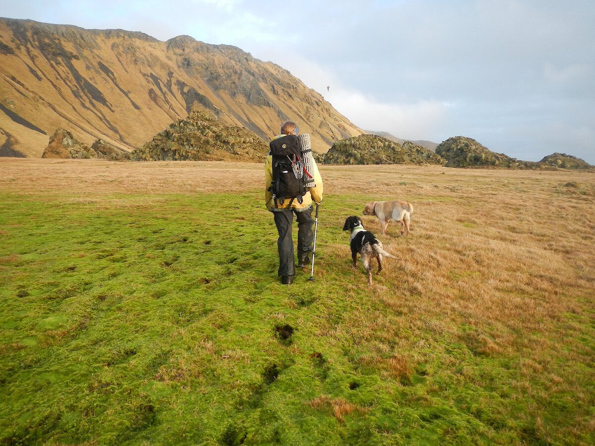
Nick is one of the MIPEP hunters employed to check the island for rabbits, rats and mice, all of which have thought to have been removed from the island. Nick is from the same town in New Zealand that I grew up in, a small rural town in the Mackenzie called Fairlie. Small world isn’t it.
Mt Jeffryes was a short distance from the hut, again in the cloud layer with a cold wind making things a tad unpleasant particularly when we were not walking about (you get cold quickly then). So we got the fault fixed as quickly as possible. Yes, we — Nick was only too happy to pitch in and help where he could. On our way again, we both got warm again and made our way to a hut at the southern end of the Island about 33km in total from the station.
We arrived at Hurd Point late in the afternoon, another cup of tea then dinner. By this time Mike had arrived. Tomorrow was Sunday, the hunters have this as a rest day as we do too. The larger huts like Hurd Point are much more comfortable to stay in than the smaller water tanks on the plateau especially when there for the whole day. Monday saw the hunters depart for their next survey area. As for myself, Green George Hut was full already for that night so I had to stay at Hurd Point another day. What a pity… NOT.
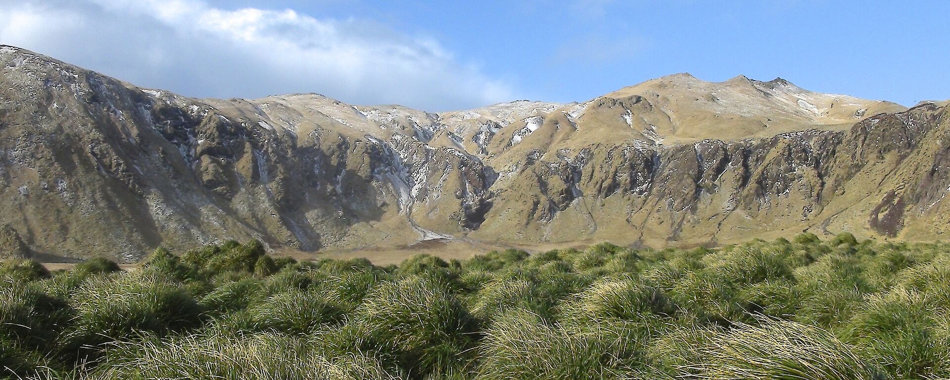
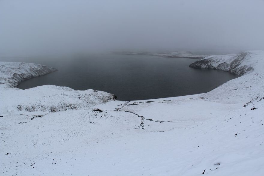
Tuesday I woke to find snow on the upper levels. This time a climb 220m up (670 ft) in less than 500m, a slope of about 45 degrees all the way the same slope we dropped down on Saturday. Into the snow and the seemingly ever present cloud so visibility was variable. Hiked the 16km to Green George, spent the night there and the next day hiked 17km to the station.
I wished the Island was a bit flatter as I was going up and down hills all day. I swear that I climbed higher than I went down so North must truly be ‘up'. For us staying in the main huts all located near sea level typically means climbing up in the morning then up and down all day with the last section down to the next hut or the station. The hunters often have to climb up to a hut at the end of the day.
While not entirely as planned, the trip went well and was very enjoyable despite arriving back at the station a tad weary. Much of this island is like a giant, very wet sponge and as a result it is impossible to keep your feet dry and very lucky if the rest of you is not wet as well. At last back at the station, wet and tired so what’s the first thing you do? More water, a shower — much needed and rather therapeutic.
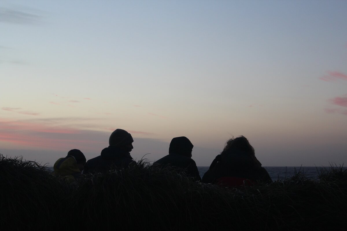
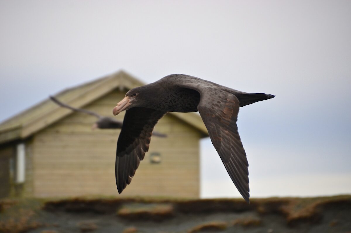
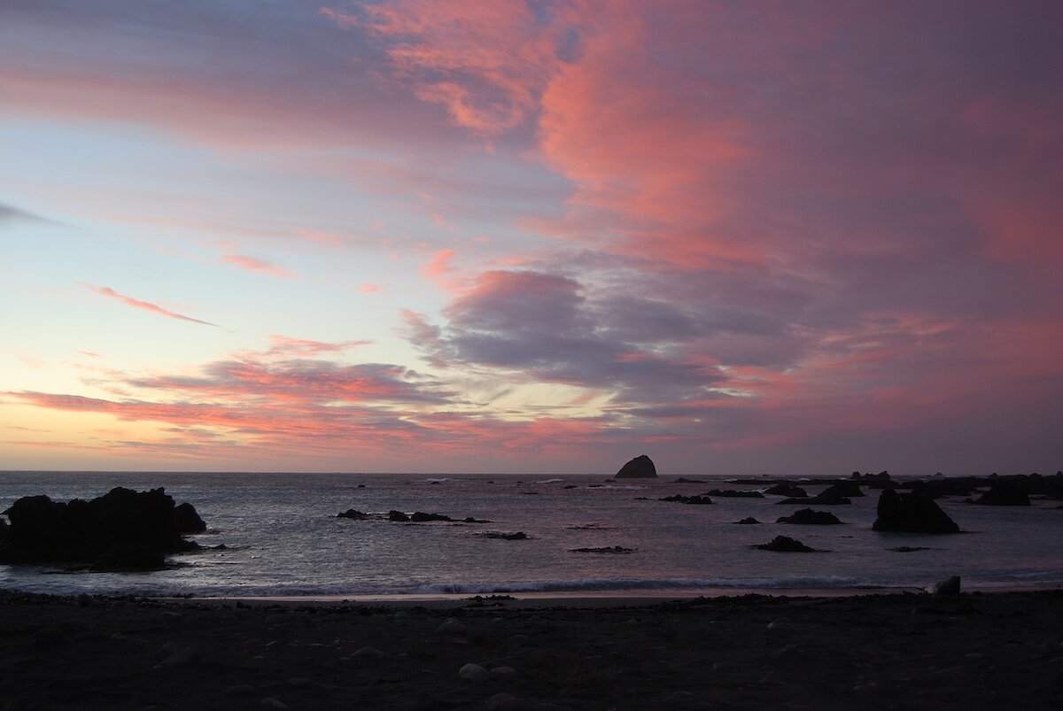
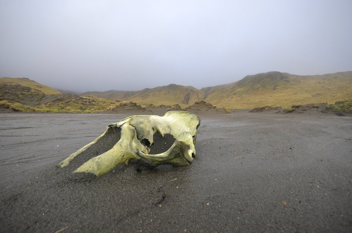
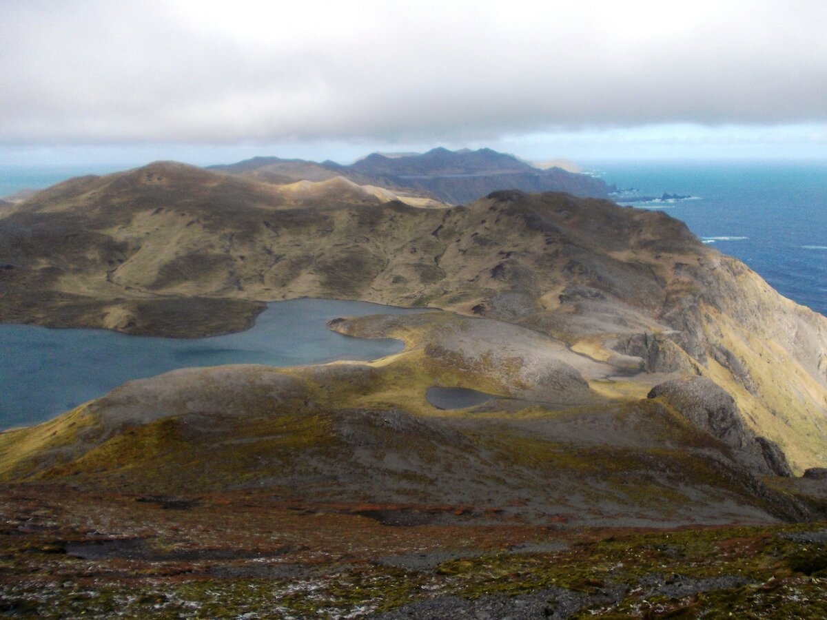
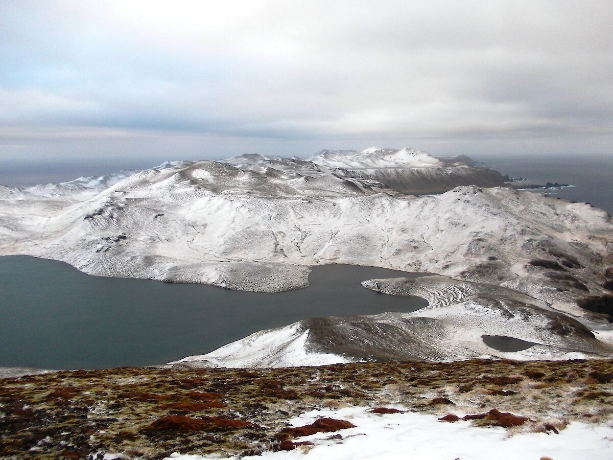
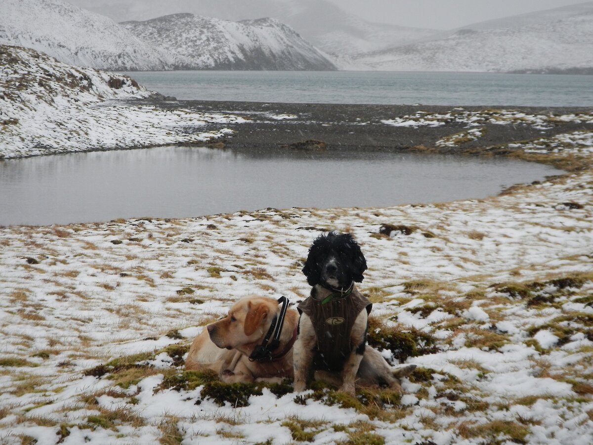
Macca Gallery
This weeks Macca Gallery has a wide variety of photos from four different photographers.