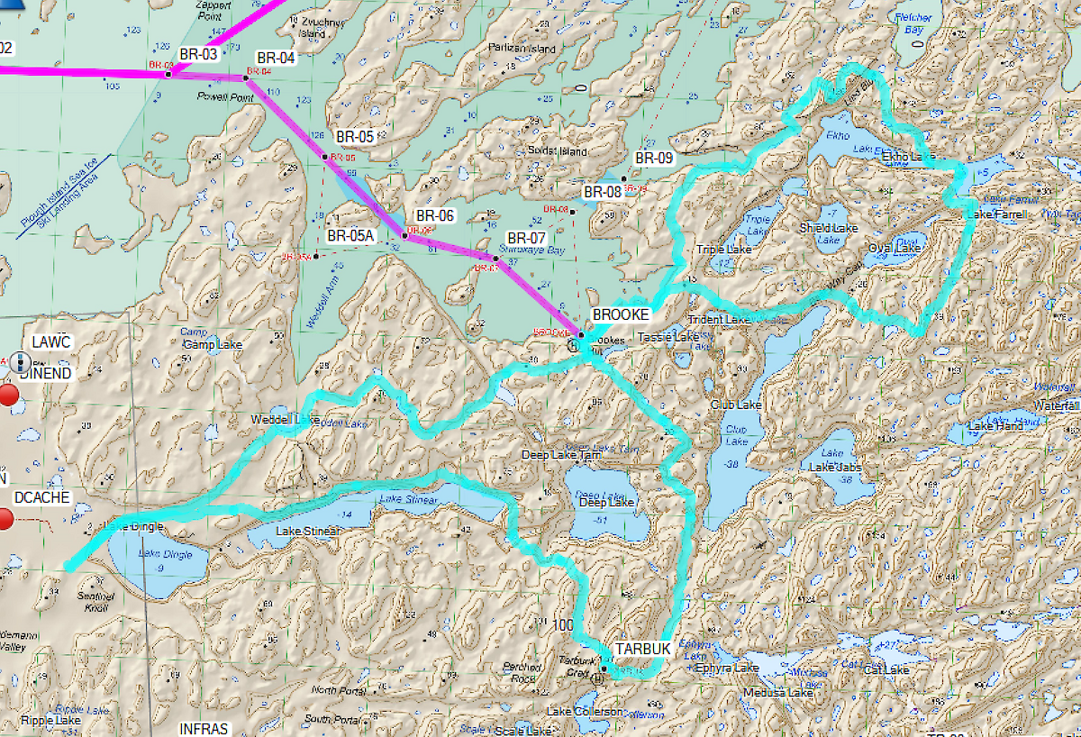

Field trip to Brookes Hut, surrounding lakes and hills
Anyone who has ever been to Davis station knows that the Vestfold Hills quite aptly describes the terrain, and in addition — it’s quite rocky and definitely not called the Vestfold Flats!
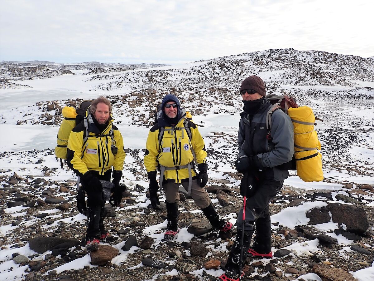
A group of four expeditioners — Derryn, Dan, Simon, and I (Graham) thought it would be nice to take advantage of the scenery at the top of a few of the well known peaks in the area. We decided to base ourselves out of Brookes Hut, where we would spend 2 nights.
The walk to Brookes is only 9km from ‘the bus stop’ located down Dingle Rd, which is the only road on station. By driving to the bus stop you save a cheeky 5km.
Myself and Dan had been to Brookes a couple of times before, but during summer and via helicopter. So to hone our map reading skills, it was decided that we should be in charge of day one navigation. We set off after lunch and went via Weddell Lake. As were going to be doing a bit of uphill work over the coming days, a nice flat day one would be nice.
The day before afforded us some snow cover, so that provided us with quite nice walking conditions. Weddell Lake, like many of the lakes and cairns in the Vestfold Hills was frozen so it made for easy walking scooting around the edge. A quick hop via two other unnamed lakes which would prove to be useful landmarks.
That night a Brookes, a few rounds of cards and dinner highlights included cryovaced chocolate brownies (for dessert) that were left over from the previous night — with quite a decedent chocolate sauce. One of the fun things about staying in field huts with Simon is that he insists on using the least amount of water possible, so licking your plates clean is just part of the etiquette!
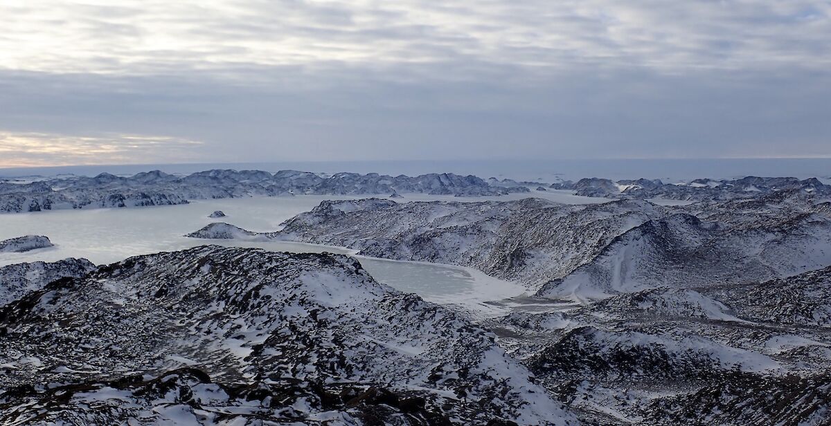
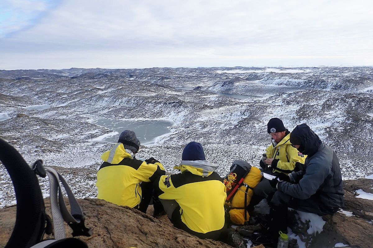
The next day’s walk would include hiking to the top of Lied Bluff, 126m above sea level. We set out nice and early at the crack of 9:45am, due to sunrise being at 9:15am. With some spectacular views from the top of Lied Bluff under our belts, we navigated our way on the rest of our lakes tour. Traversing our way from Echo Lake to Narcissus Lake, then Lake Farrell, then via ‘spot height 109', through Best Way Gap back to Brookes. The team clocked up 17km over a respectable 7 hours.
That night more cards — we played rich man/poor man, where the loser (the poor man) of the previous hand gets to give the winner (the rich man) their two highest cards (also know by different name, unfit for publishing). We also reflected on a good days walking and luckily there was also more chocolate brownies for dessert.
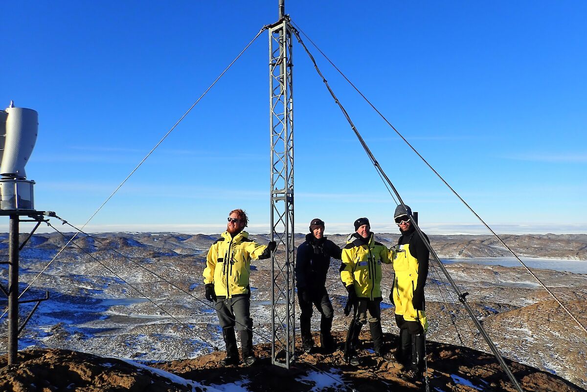
Day three would have us hike to the top of Tarbuck Crag with a height of 140 meters above sea level. It is also home to one of the Davis station’s radio repeaters.
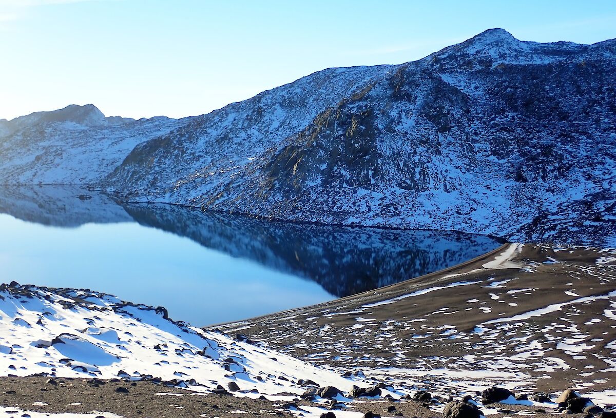
We also checked out the beach at the southern end of Club Lake. We thought that the day before we had a good weather day, but today — not a breath of wind. This lead to some magical reflections in the lake.
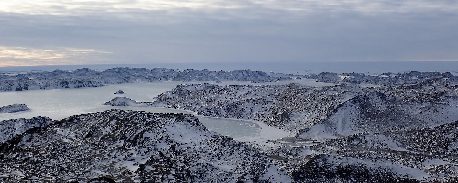
At the top of Tarbuck we discovered the station’s radio repeater equipment and wind generator, it was here we decided to spend a bit of time admiring the views. You can see just about every where, the giant Sørsdal Glacier in one direction, and all the way to the ocean in the other. Looking north west, a view of Gardner Island and our tiny home, Davis research station.
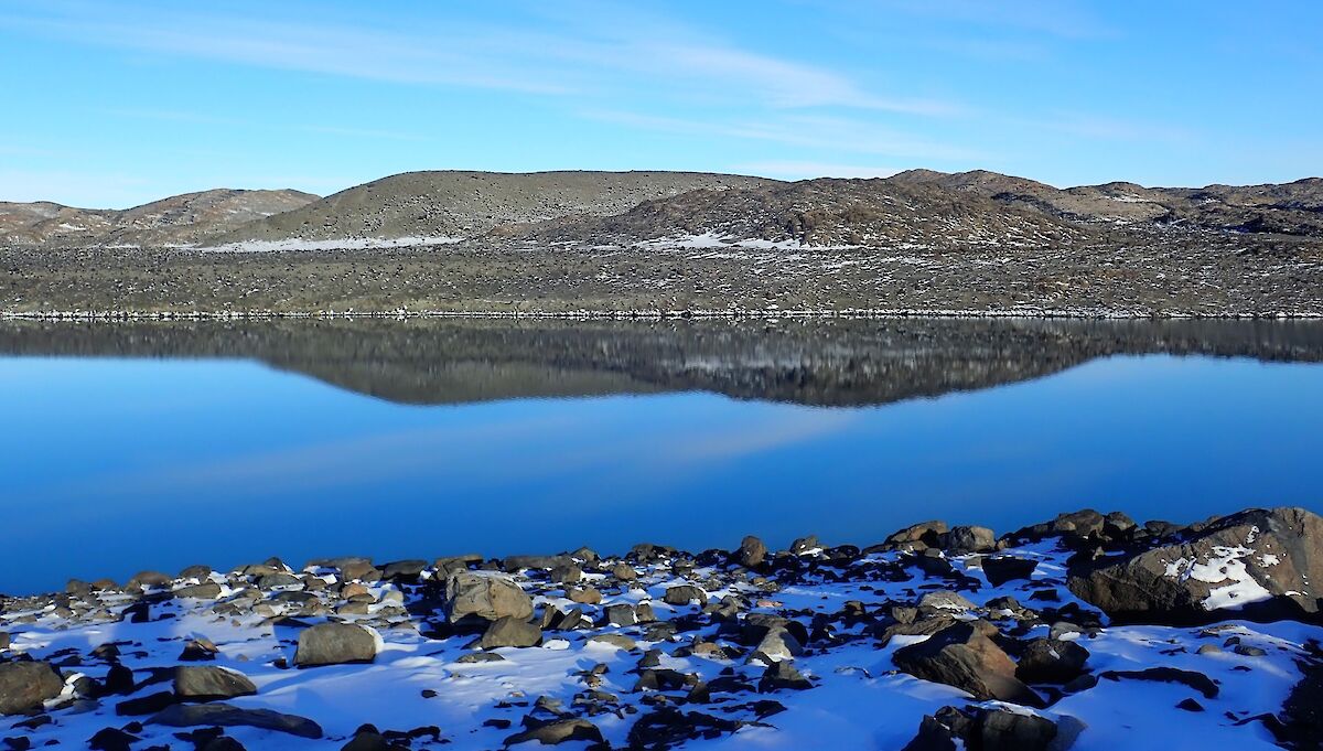
After descending Tarbuck we travelled via the northern side of Lake Stinear and Lake Dingle, which was like a millpond once again, providing perfect reflections. From there, it was a very pleasant hike back to the bus stop where the blue Hägglands was patiently waiting for us. All up, day three statistics had us treking 15.5km over 6.5 hours.
By Graham Street — Electrician