This week we report on the work being undertaken on Bechervaise Island as well as describe and illustrate the geology and vegetation of Mawson Rock and the marine environment in Horseshoe Harbour.
Beche report 1
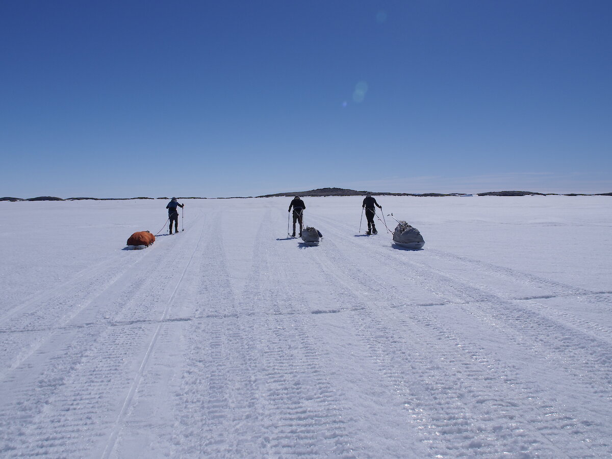
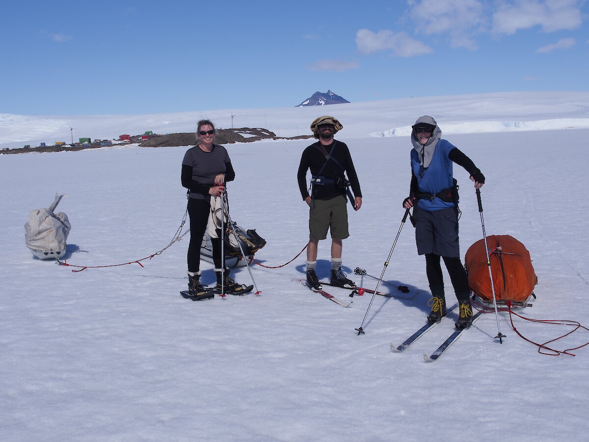
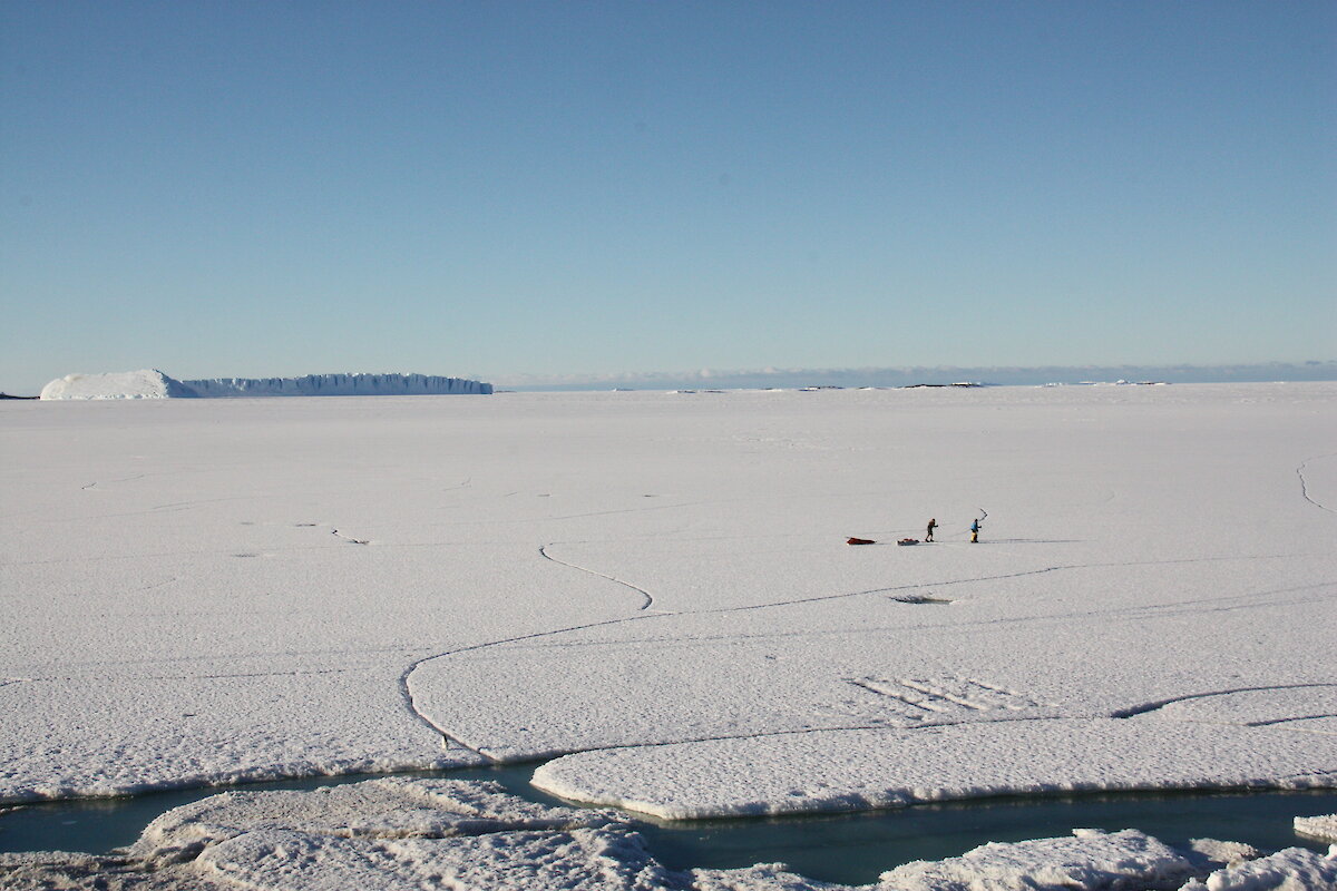
On the 28th December Helen and Julie, with the help of Leigh and Vicki, strapped on the skis and snow shoes, attached the sleds and took the rest of their gear out to Bechervaise Island. With the sea ice slowly degrading, they will remain at the island now until resupply to study the Adelie penguins and snow petrels.
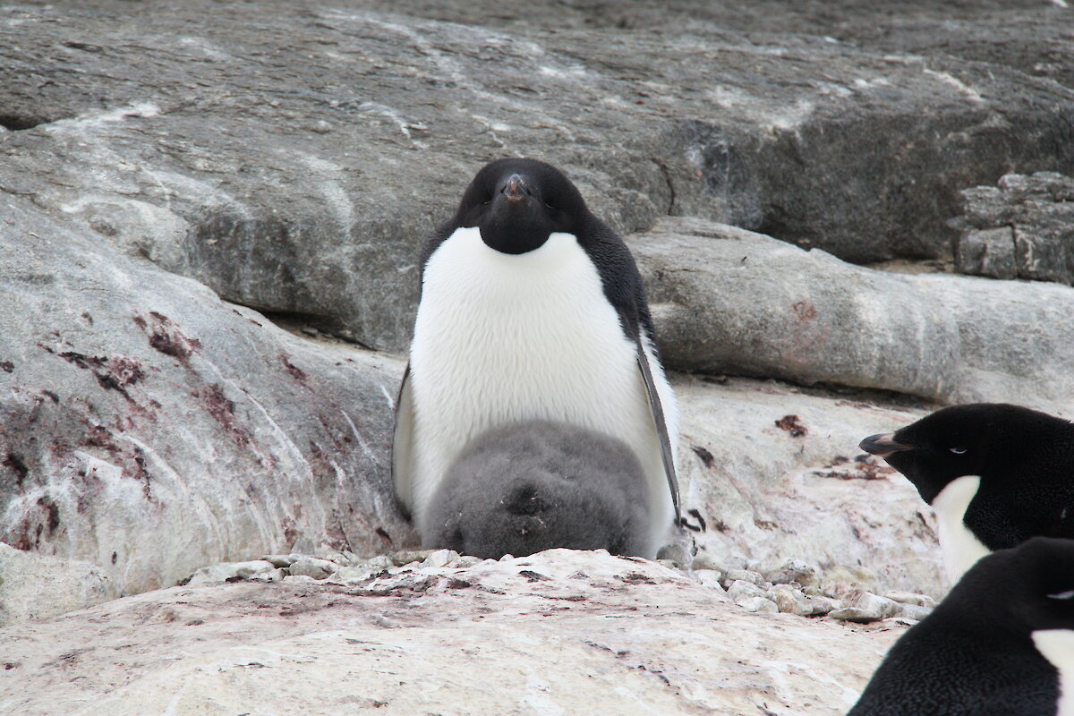
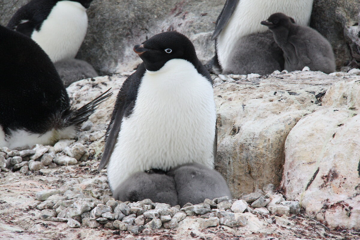
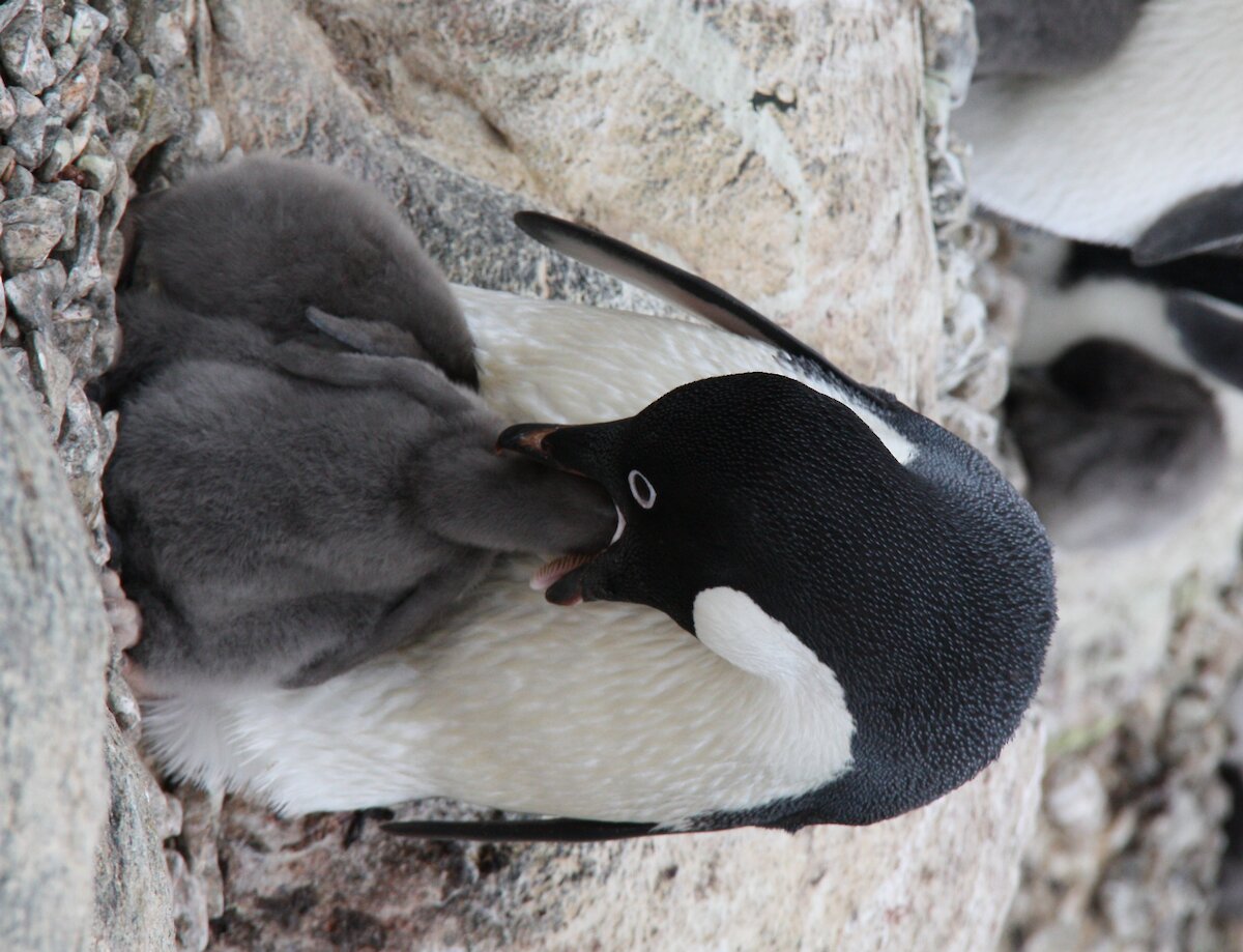
The island is alive with the sound of penguins. Calling, fighting, begging and of course the distinctive sound of penguins pooing. There were 1600 nests on the island this year and of these, 1200 are still active. However, not all of the nests have two chicks as the smaller chick is often not able to compete with a dominant sibling. Approximately 40% of nests with chicks have two chicks remaining, the rest have only a single chick which is usually extremely fat. It seems to be a good season so far for the birds with heavy adults returning from sea.
During incubation, the penguins were travelling up to 300km from the colony for up to 15 days, before returning to swap over with their partner. Once the chicks started to hatch, the foraging trips reduced to between one and three days, so they can return to feed their chicks. Helen and Julie have been tracking the birds using small GPS trackers (about the size of a matchbox) which are attached to the backs of the penguins. They have also been collecting lots of penguin scats from around the colony which will be analysed back in Hobart to identify the prey DNA in the scat samples. This allows them to investigate not only where the penguins are going, but what they are eating too.
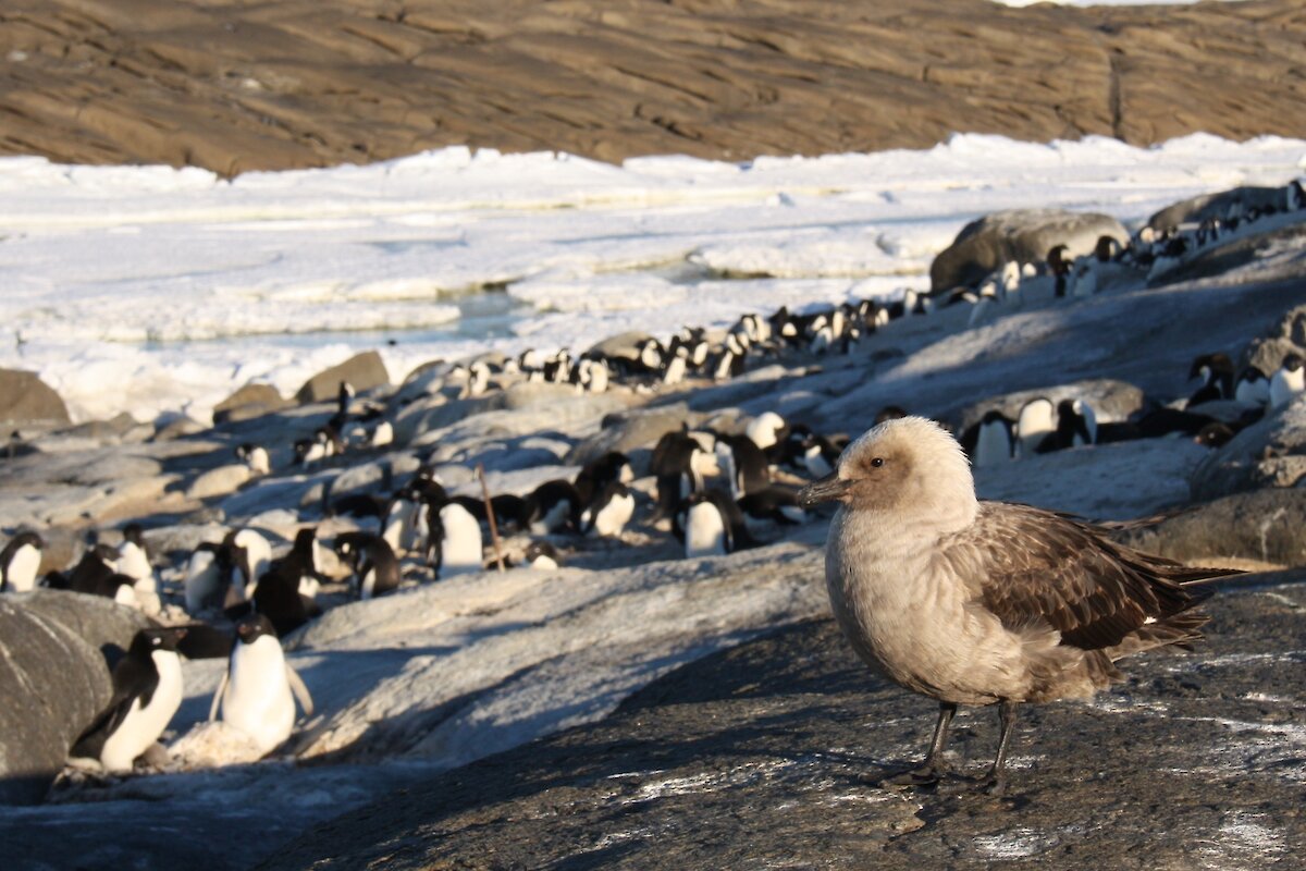
It is also a good year for the skuas. There are ten nests around the periphery of the penguin colony, with birds always at the ready to snatch an unsuspecting penguin chick off the nest. It is amazing to see how fast they can swoop in and get a snack, even with the parent present. The skua chicks have hatched, with a few even venturing out from under the parent, but with the strong winds, they aren’t out for long.
For the two biologists, the island is their office, lab, field site and home for five to six weeks. The camp is well set up and very comfortable. When the sun is shining and penguins are panting in the heat it is hard to believe this is Antarctica. But when the wind is blowing hard and it sounds like a freight train driving around the hut at 2am, you really know you are at Mawson!
Julie McInnes
The geology of Mawson Rock
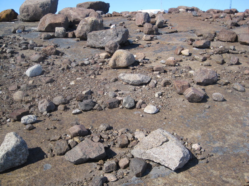
In its original state Mawson Rock is a moraine-mantled, ice-polished charnockite exposure. The only area undisturbed by station activities is generally to the west of the cosmic ray laboratory and bounded by the lower vehicle access route to the station.
Mawson charnockite also forms most of Mt Henderson, the Masson and David Ranges and most coastal exposures between Mawson and Ufs Island. It is dark brown and characteristically monotonous in nature, forming high peaks and sharp ridges of rock.
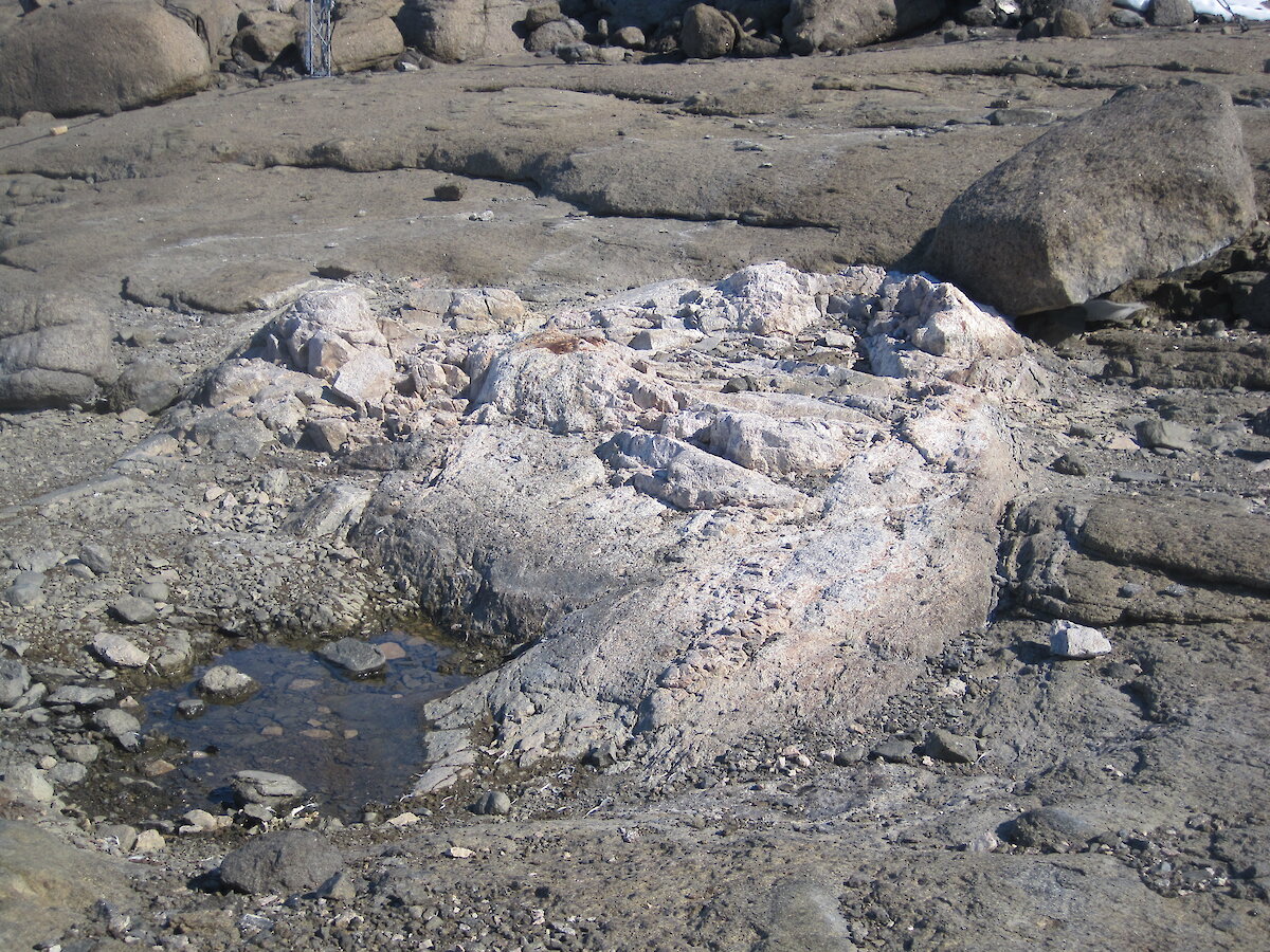
Charnock in charnockite is named after Job Charnock, a servant and administrator of the English East India Company, in whose tombstone the rock was identified. The eastern Gnats area of India was in a position now occupied by ocean immediately north of Mawson and the geology of this area has strong similarities with that of Mawson, including large charnockite bodies and small localities containing the relatively rare mineral sapphirine. A sapphirine-rich phase is exposed in a small area on East Arm. It occurs as a roughly circular, whitish outcrop of gneiss five to six metres in diameter, surrounded by a narrow depression, and is within 30m of the shoreline of East Bay.
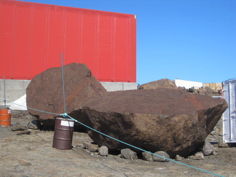
Within station limits, a large glacial erratic called the “Do not remove chocks” rock, west of the EVS, and another, “Stor Klippe” on the shore of the harbour, are significant in the station’s folklore. Another erratic is known as “RTA rock”. However, my favourite is an immense split rock north of the EVS on the blizz line to the trades workshop. John Bechervaise called it the “Johanna Stone” and described it as “a ponderous granite erratic, well rounded and about 10 feet tall, has at some remote and lonely time broken cleanly in two parts like a cut pear”.
Even in the fiercest of blizzards with no visibility and walking carefully holding the blizz line, I always feel safe knowing that under my feet is the smooth Mawson rock.
References:
Mawson Station. Management Plan. April 1993.
Blizzard and Fire. John Bechervaise. 1963.
Rocks around Mawson. A poster by Geoff Clarke, John Greenfield and Dan Dunkley. Sydney University 1994.
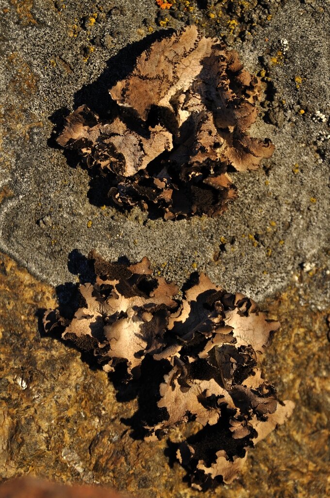
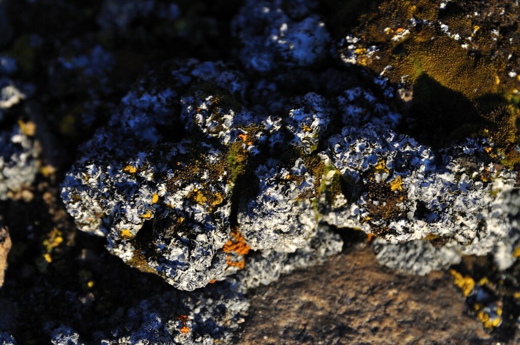
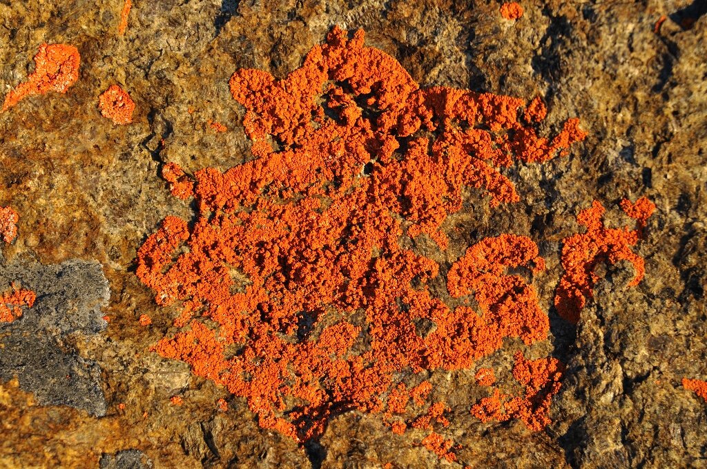
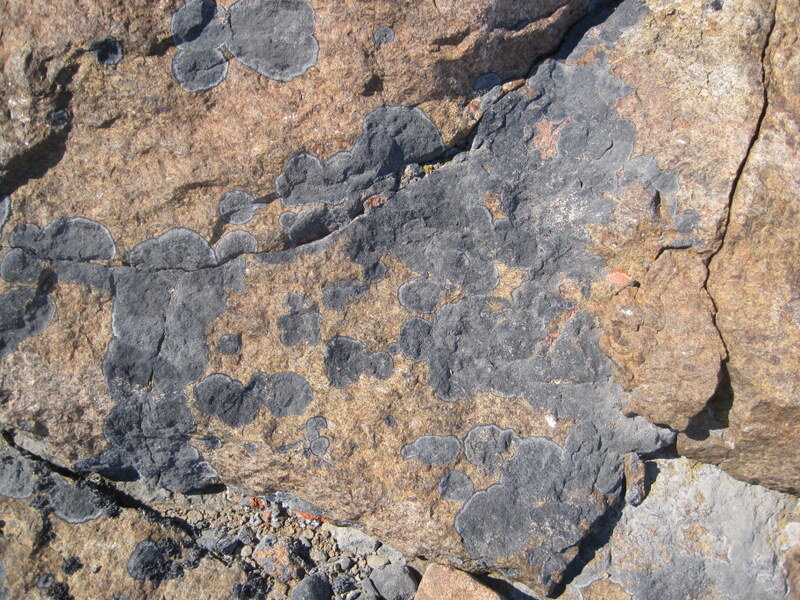
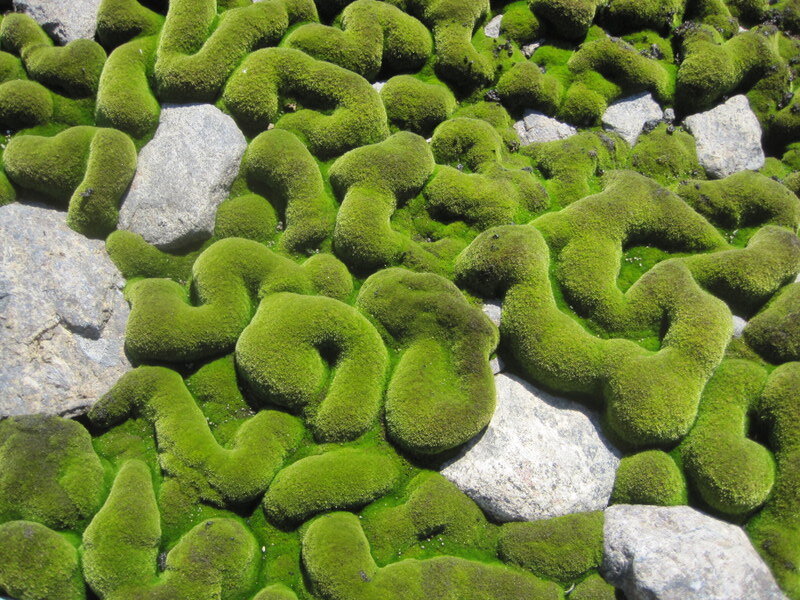
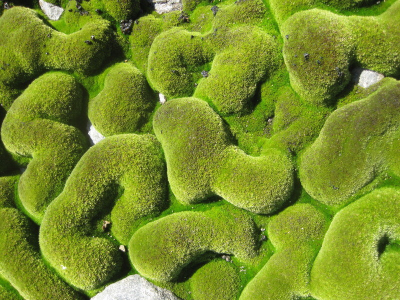
The vegetation of Mawson Rock
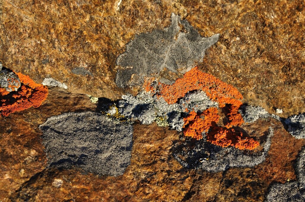
The vegetation of Mawson Rock is depauperate, with non-marine algae having a widespread distribution and a greater coverage than lichen and moss vegetation.
The lichens form on exposed rock and on closed patches with sheltered aspects. The bright orange lichen on the rock to the west of the living quarters is clearly visible from our second floor lounge.
Mosses are confined to gravels on northerly aspects receiving snow bank melt waters and a prominent gully west of the EVS currently has a heavy growth of moss.
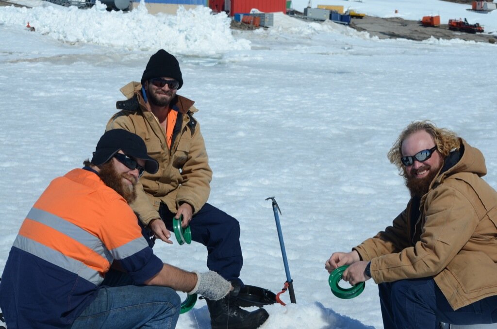
Marine environment in Horseshoe Harbour
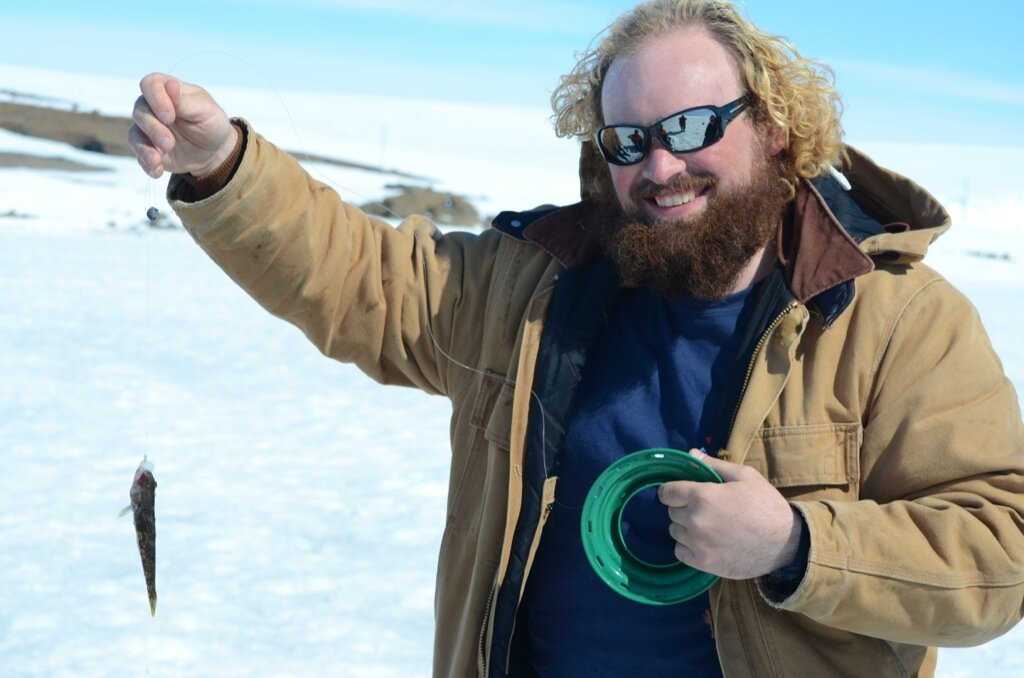
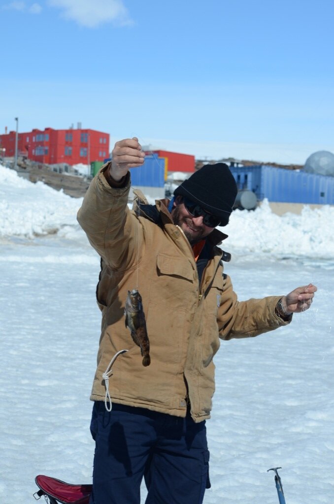
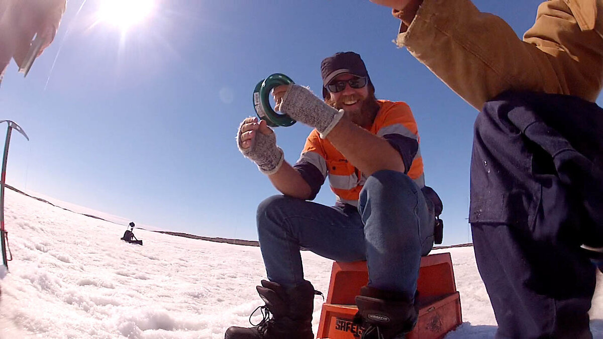
In late December and early January Anders, Jeremy and Leigh decided to make use of Permit AMLR 12–13-2795-Mawson which authorised them to harvest marine organisms of a specified kind for the purposes of recreation in accordance with AAO Project no. 2795, subject to certain conditions. After gaining access to the sea ice which was starting to become separated from the land by tide cracks in Horseshoe Harbour, they drilled through over 1.5m of sea ice and dropped their lines.
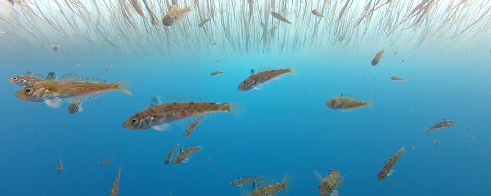
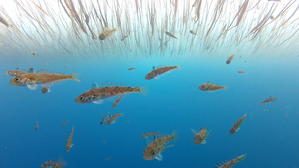
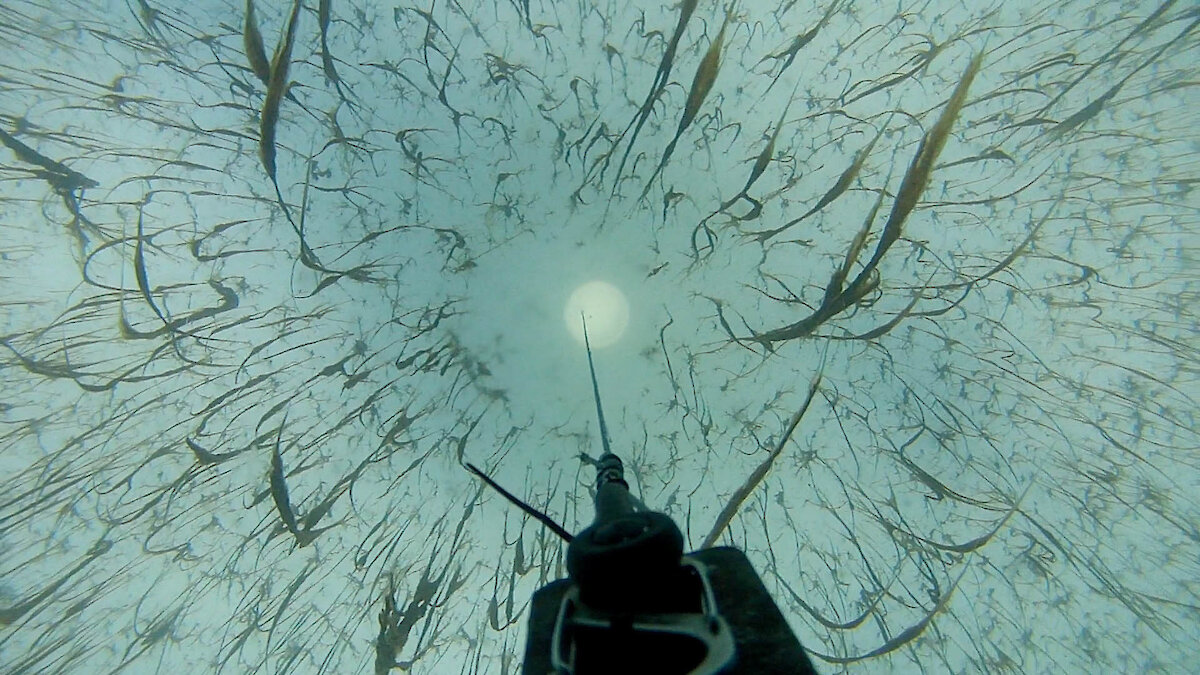
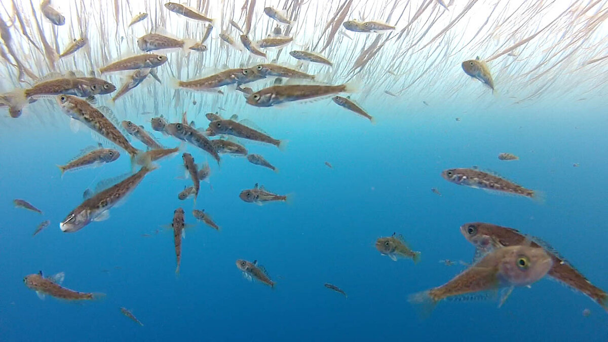
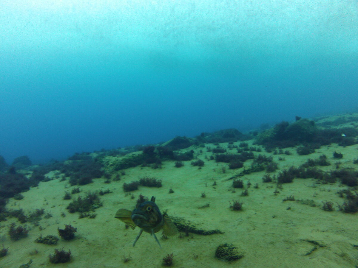
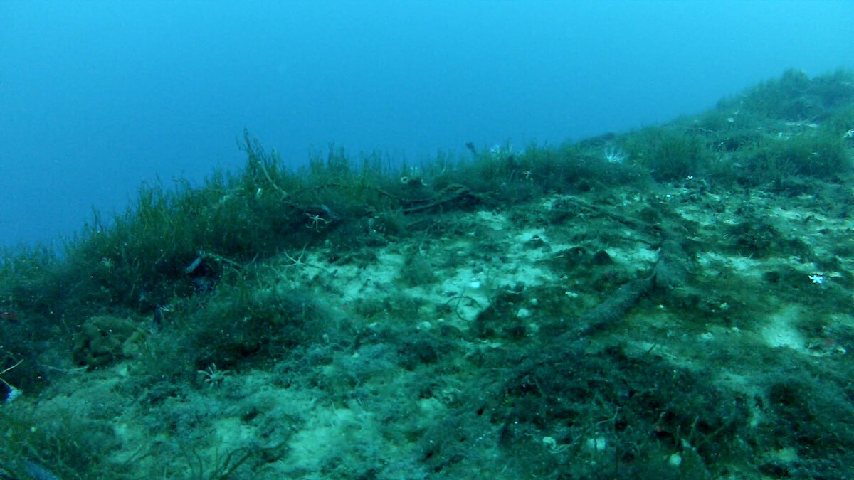
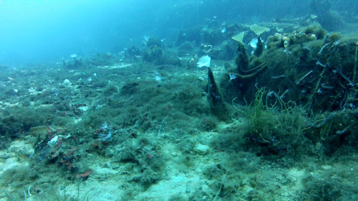
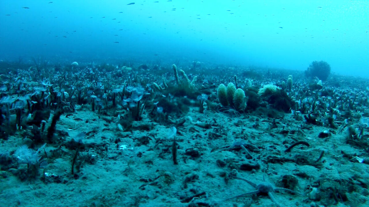
In total 15 fish were caught, all of which were released. Of course the guys would say they caught many more fish and that they were far bigger than any photo depicted. However, the three were more interested in photographing the marine environment than actually fishing. They fabricated a metal stand and then attached their GoPros with a wire cable to the surface. The method worked exceedingly well and they were able to get photos of starfish, sea spiders, tube worms and fish from 60m below. Also of interest was the “grass-like” growth on the under-surface of the sea ice.
If anyone reads this segment they may like to tell us what the “grass-like” growth is and identify the marine organisms photographed.