
Macquarie Island’s mountain wave clouds
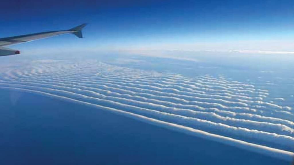
Living on Macquarie Island we get used to seeing long parallel clouds siting off the west coast that don’t seem to move no matter how windy it is. These stationary clouds are called Mountain Wave Clouds and are quite common here.
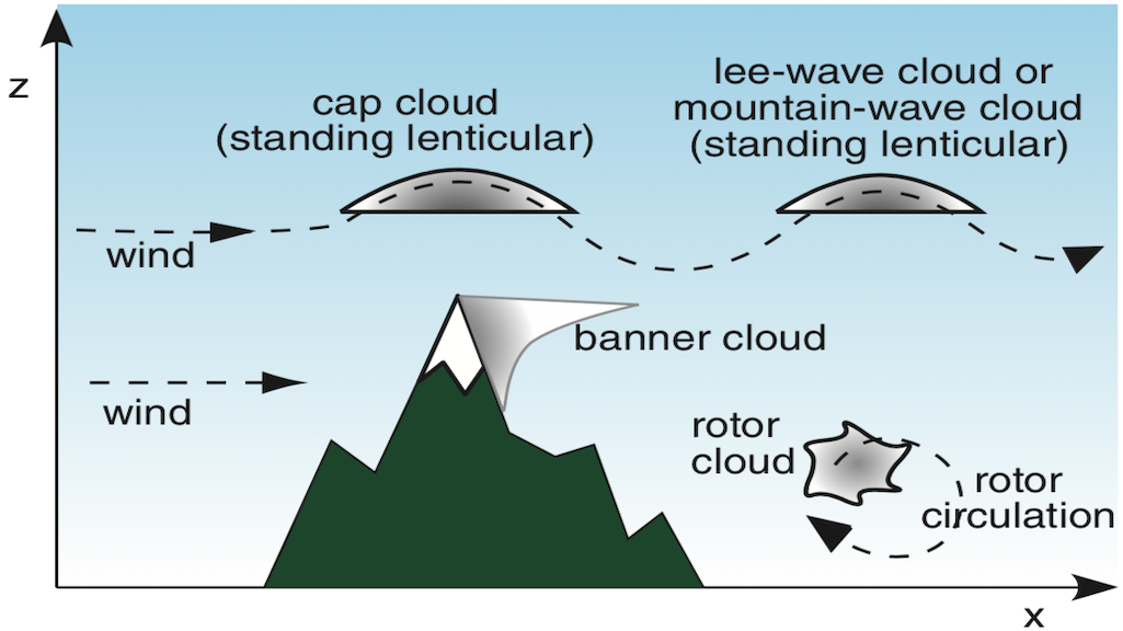
Mountain Wave Clouds form in the peaks of Mountain Waves. A Mountain Wave is an air current that oscillates up and down in a wave pattern as it flows down wind from a mountain. They are generated when strong winds flow over a mountain range that is close to perpendicular. As the air is forced up by the mountain it hits an atmospheric inversion which is higher than the peak of the mountain. Think of an atmospheric inversion as an invisible barrier which the air can’t ascend up through. So when the air hits the inversion it bounces off it and begins to descend back down again. As the air descends it is compressed because air pressure is higher at sea level. As the air is compressed it heats up just like a bike or car tyre heats up when you pump it up. When the air heats up it expands, becomes less dense and ascends until it bounces off the inversion again. If there is nothing downwind of the mountain to interfere with this cyclic pattern of air being deflected down by an inversion then floating back up due to it’s buoyancy then this can go for hundreds of kilometres. If you could see the air flow it would look like a wave of peaks and troughs.
If there is enough water vapor in the air and the temperature is cool enough near the peaks the air cools to it’s dew point temperature and the invisible water vapour condenses to form tiny water droplets and a cloud forms, a Mountain Wave Cloud. What you would see is a series of stationary, identical parallel clouds usually with curved tops where the peaks of the waves are. These clouds are called lenticular clouds or lens shaped clouds.
Macquarie Island is perfectly positioned for the formation of Mountain Wave Clouds because the predominant wind is strong and from the west and the island is roughly orientated north/south. There is nothing to interfere and break up the Mountain Waves for thousands of kilometres and at 55 degrees south and in the middle of the Southern Ocean it’s cold enough and there’s plenty of moisture in the air for cloud formation. At Macquarie Island they usually form in the lower troposphere and consist of stratocumulus so the most common type of Mountain Wave Cloud here is Stratocumulus Lenticularis.
So if you ever make it to Macquarie Island and you’re looking out to the west and see a series of long parallel clouds that seem to go forever over the horizon, well, they probably do and they probably go most the way to Aguirre Island in Chile… almost.