
Supporting science to better understand earthquakes and tsunamis
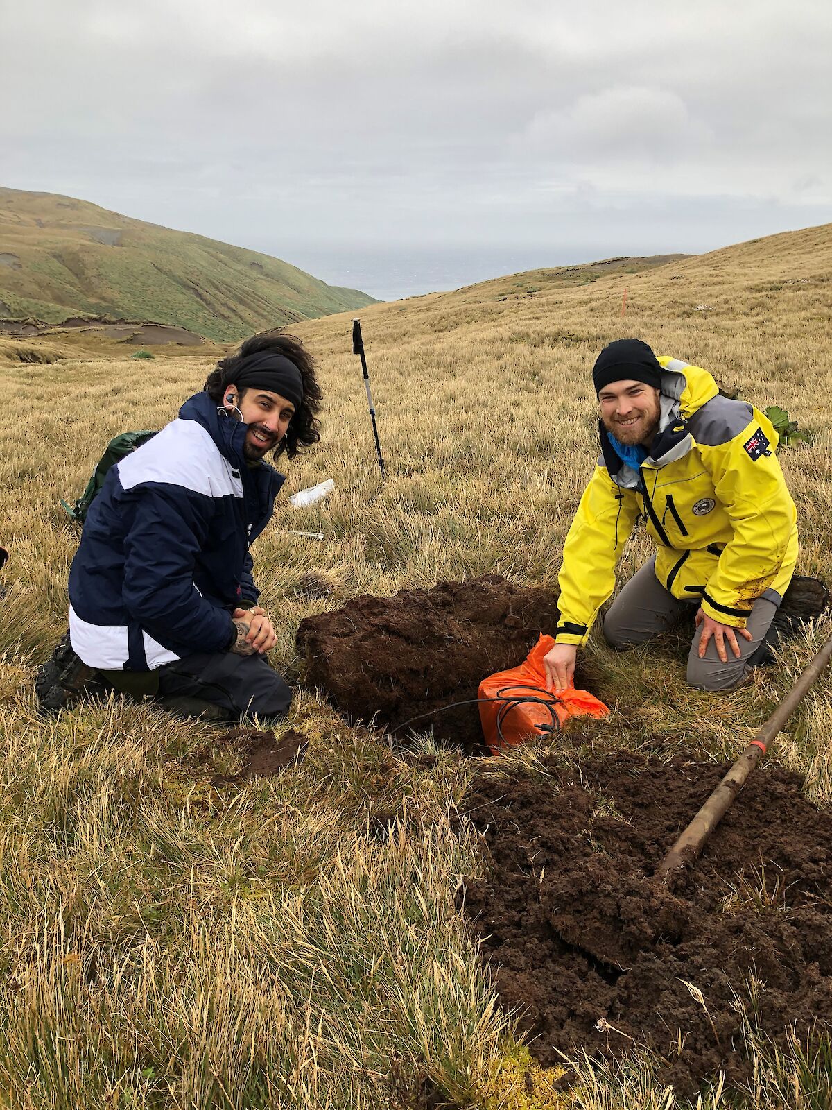
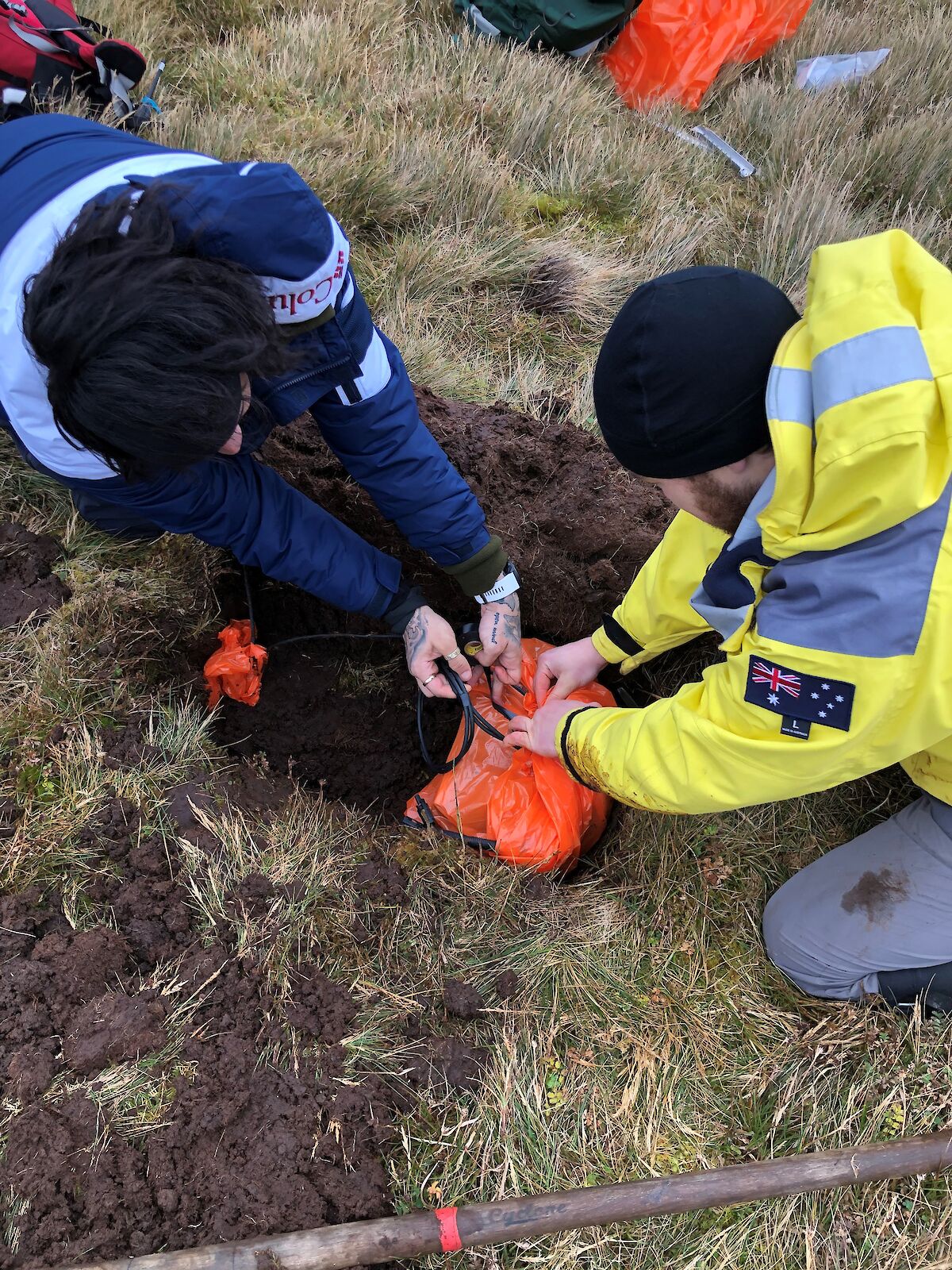
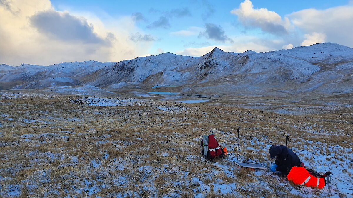
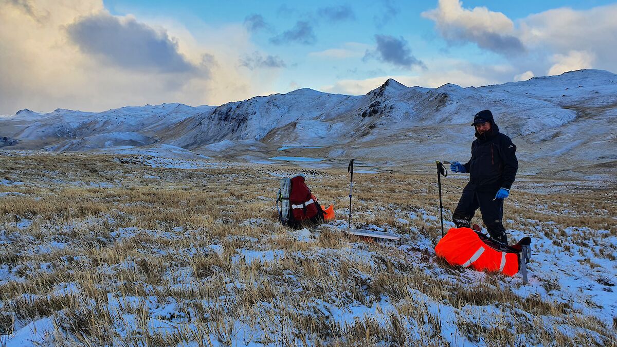
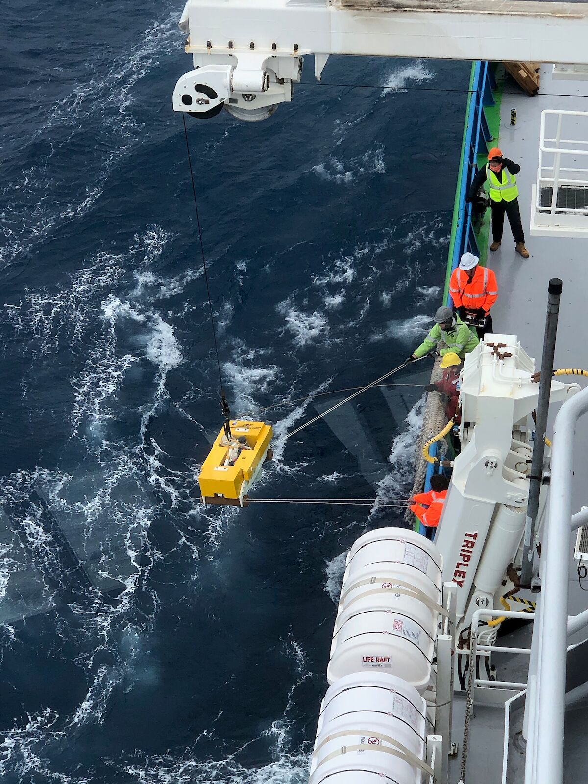
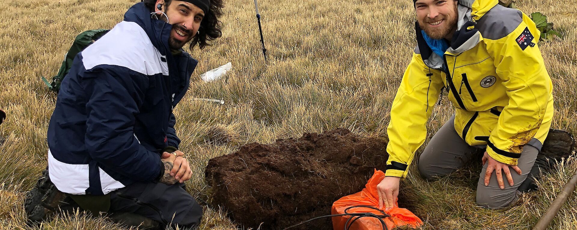
Since arriving on the island the team has been working on the installation of a number of earth-based seismometers to support a project being run by Geoscience Australia / Australian National University. The project is linked to work completed in late 2020 when a number of ocean bottom seismometers where deployed at sea around Macquarie Island. We're supporting the project by deploying the final seismometers in the array, this time based on land at Macquarie Island, to support the information being gathered in the oceans around us. What this actually means in practice is that we've had teams deploying to the field, carrying heavy stuff, digging holes and installling equipment.
The first two installations were pretty close to home and could be done as day trips. The remainder have required the pre-positioning of equipment half way down the island (load carried, sherpa style) followed by teams heading off on one or two night trips to then grab the equipment and install it. It's been great work and has created more opportunities for us to get out and continue our island explorations. We've got four installed so far, one to go and that will complete our part of the project. Our aim is to get the work completed by midwinter and celebrate accordingly.
For a bit more of the technical background on the project, Professor Hrvoje Tkalčić, Head of Geophysics, Research School of Earth Sciences at The Australian National University explains further.
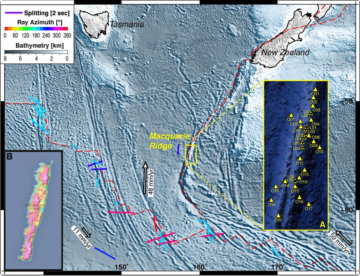
This project aims to advance understanding of the Australia-Pacific plate boundary (the Macquarie Ridge Complex or MRC) in the Southern Ocean. It will be the first study to elucidate the processes generating the world's largest submarine earthquakes not associated with active subduction, which may lead to understanding of how subduction initiates, the mechanism of earthquakes occurring at convergent margins, and more accurate estimates of earthquake and tsunami potential. This study will put Australia at the forefront of Earth Science research into the evolution of tectonic plates and has the potential to better inform hazard assessment efforts in the region, benefiting policy-makers and at–risk communities along the Australia coastline. 3D imaging of the central MRC and Macquarie Island will be of immediate benefit for understanding the tectonic evolution of the Australian plate and the mechanisms responsible for earthquake generation in the region. The latter will enhance monitoring of the earthquake belts around Australia and will provide more accurate estimates of tsunami potential; therefore the result will be relevant not only to the seismological research community, but also to national earthquake monitoring programs, such as those operated by Geoscience Australia and EQC/GNS New Zealand. The combination of study area, deployment geometry, and imaging techniques will yield the most complete seismic structural dataset available on Earth for evaluating processes controlling great strike-slip earthquakes in oceanic lithosphere.
From Derek and your friendly neighbourhood crew at Macca.