This week Stay Here triumphs in the relay; Horse shares his winning photos and we saw a plane!
Stay Here went there and back!
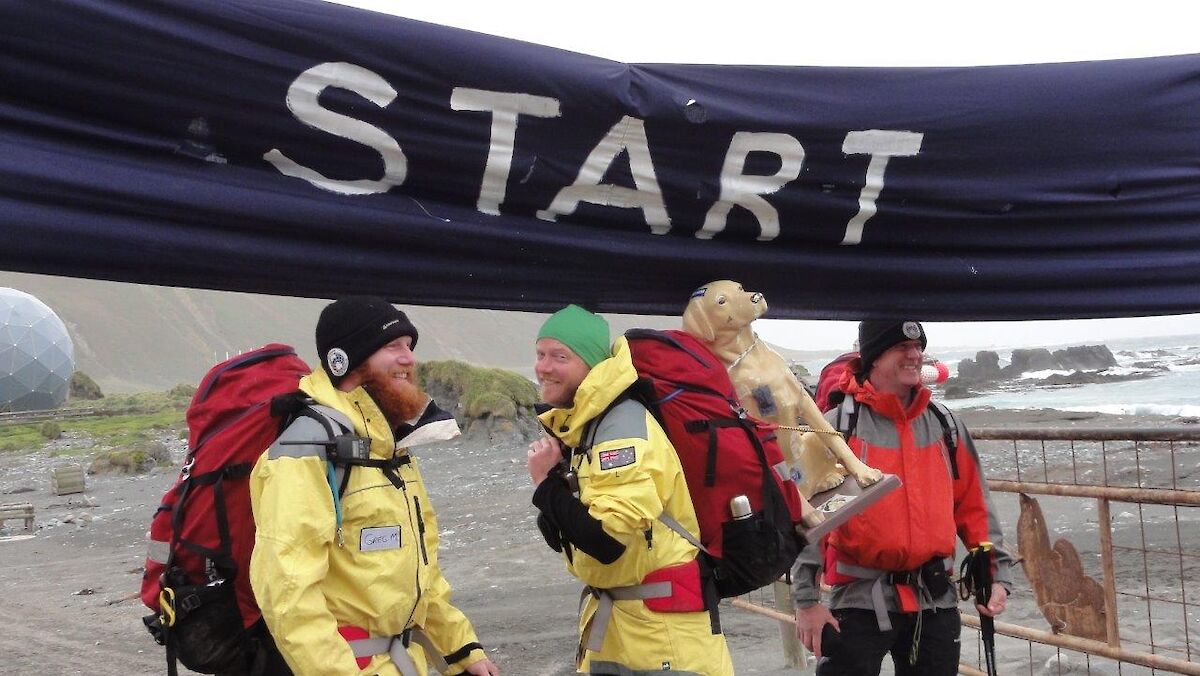
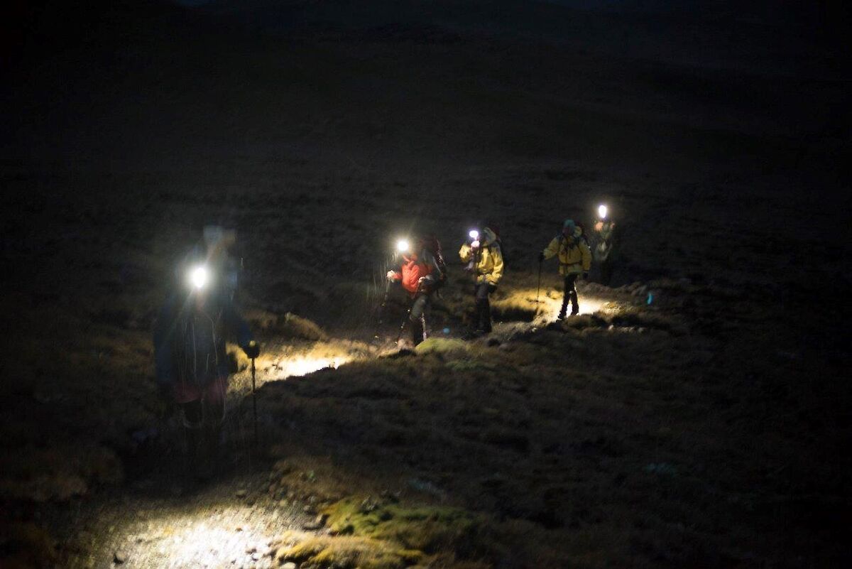
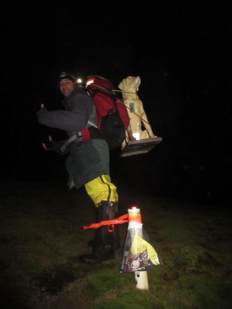
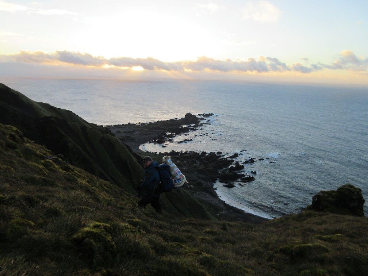
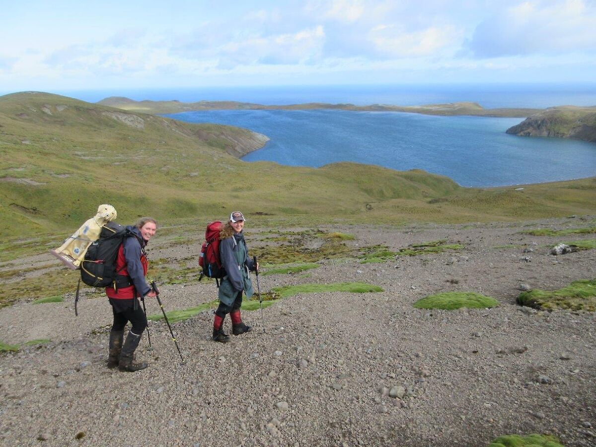
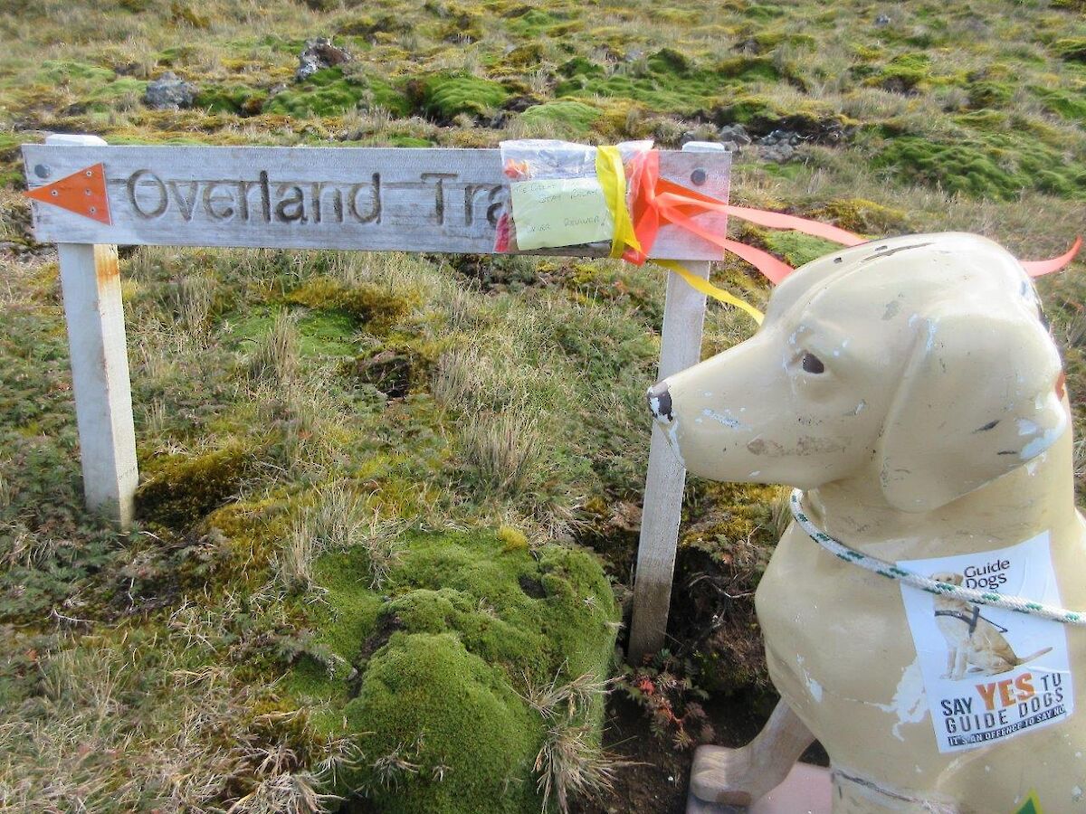
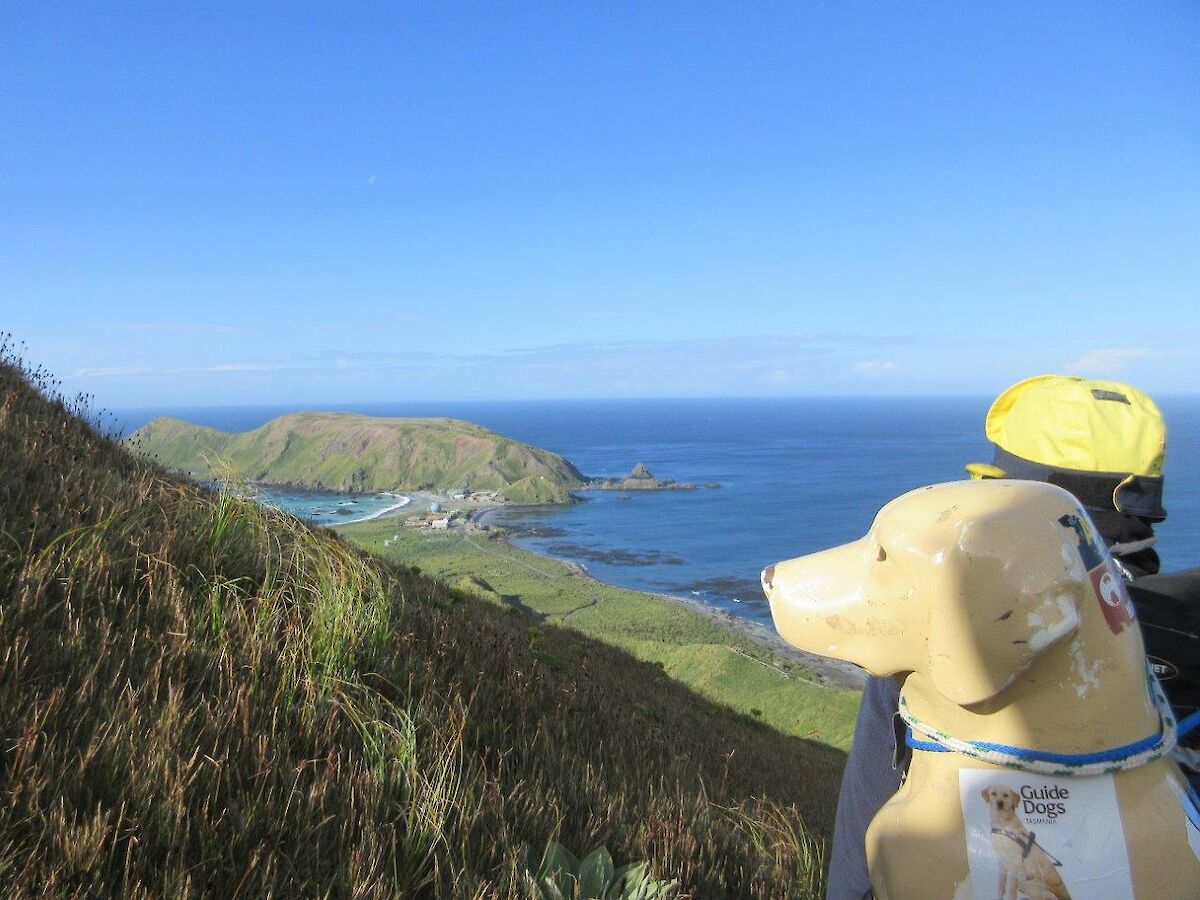
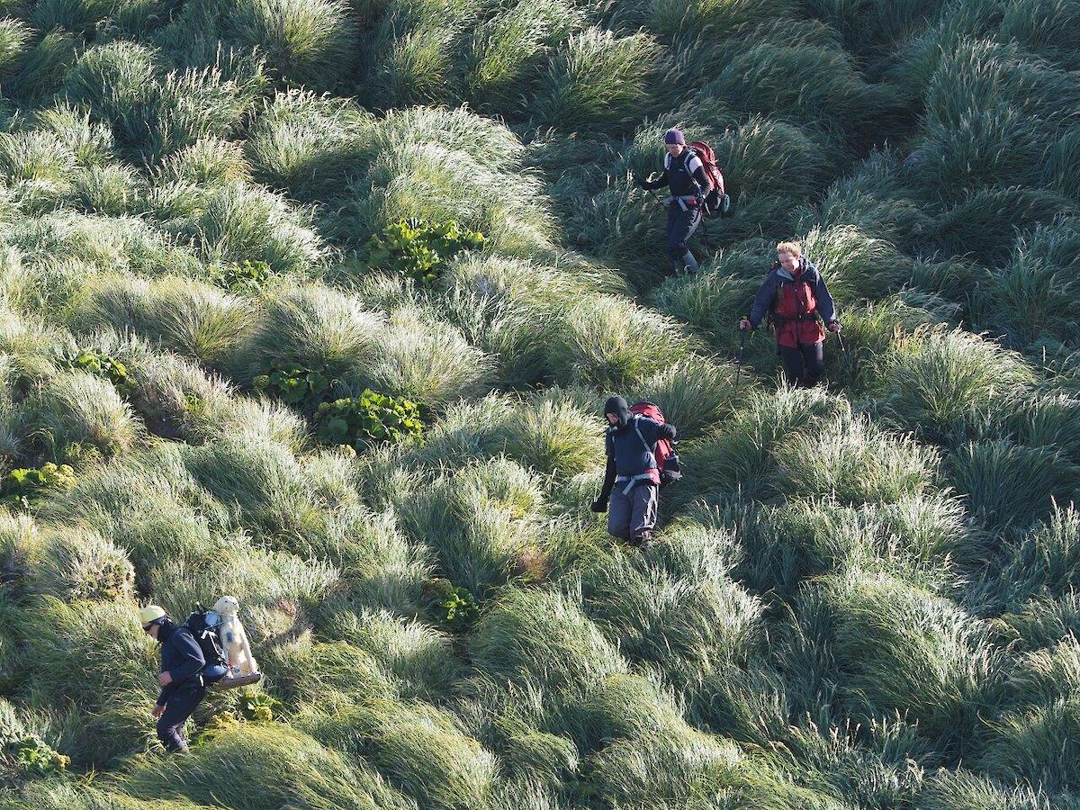
As mentioned last week, as part of the inter–station 10 kilometre challenge, Macquarie Islanders decided to take Stay Here for a walk down to Hurd Point and back in 24 hours. As this is a 75 kilometre round trip, it was done with teams of walkers with each group taking Stay a bit further along the track. (Stay travelled with her own camera and some notepaper so anything in quotation marks is from the notes she came back with.)
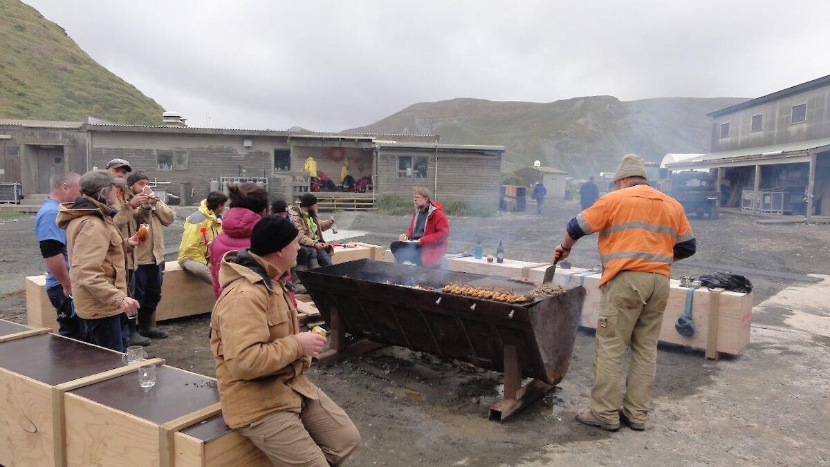
The first team, Alex, Greg M and Greg C left station at 6 p.m. after having been farewelled by those staying behind (we need to maintain a fire team on station at all times) with a BBQ dinner. They arrived at ‘four ways’ (where all four tracks meet) to meet the next team, Joe, Kim & George just after sunset.
'George and I lead the way as daylight faded for the day, from Brothers Track to Red River Kim did deliver and from thereon in rain Greg M for me was the man! Arriving to Green Gorge Tarn, the driver-reviver was a great surprise, and Ali and Chris welcomed all with tea and flags — divine. Good luck Stay, they will be cheering along the way.'
Green Gorge Hut is the only hut actually on the Overland Track and at approximately halfway down the island, made a perfect place for a tea stop and team changeover when they arrived at 10.40 p.m. Chris and Ali were waiting with the kettle on and after more photo opportunities, set off with Alex and Stay for the next leg.
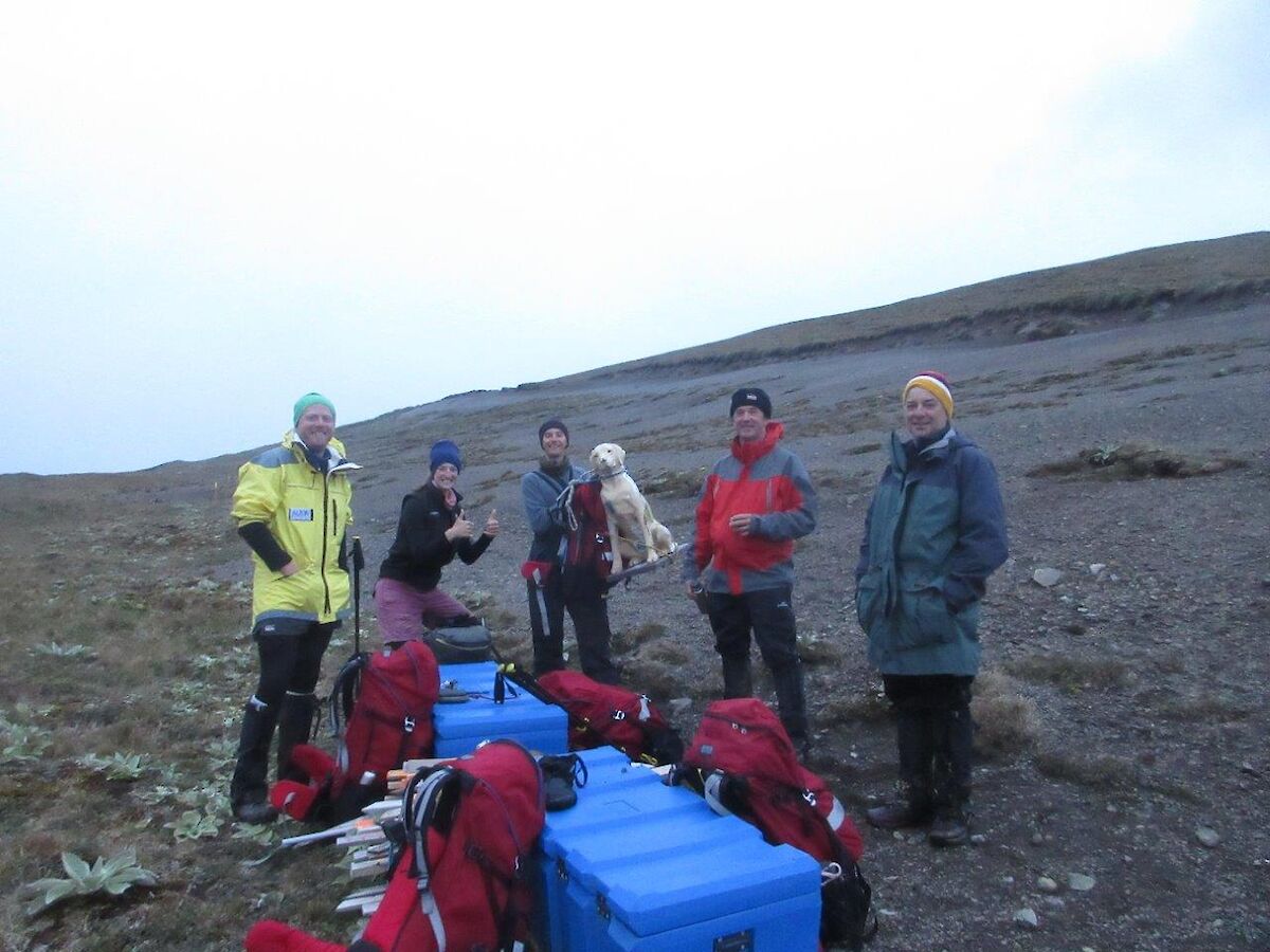
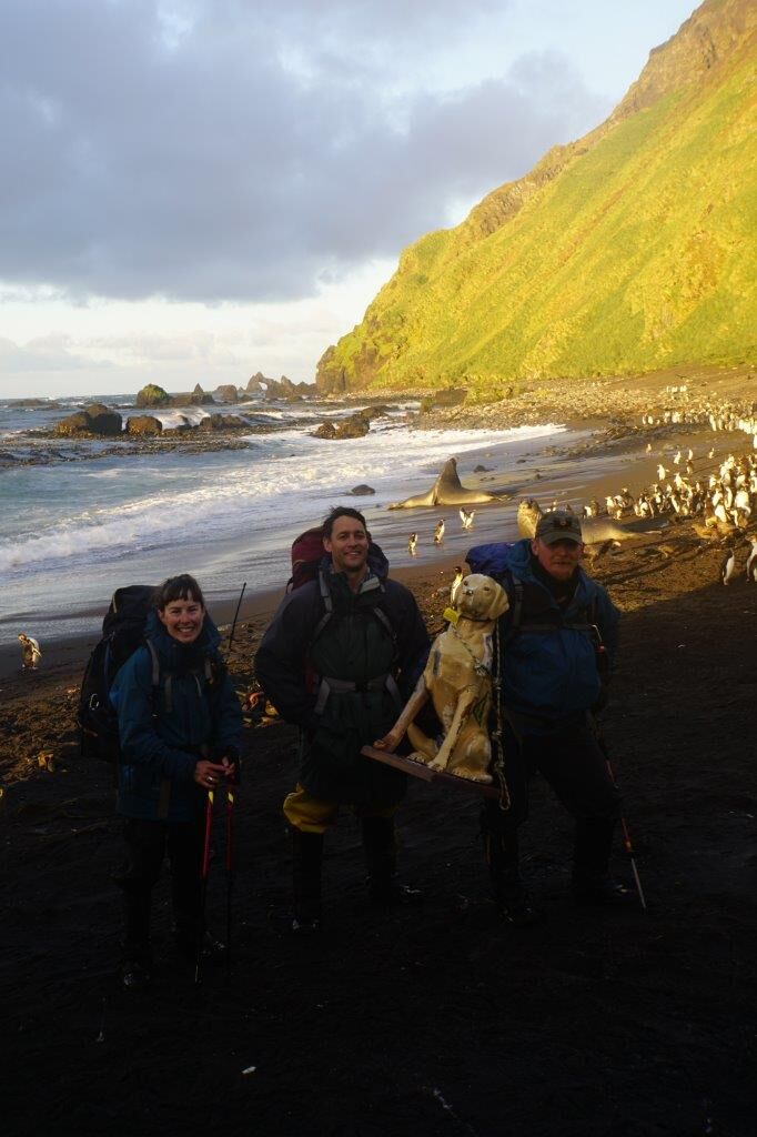
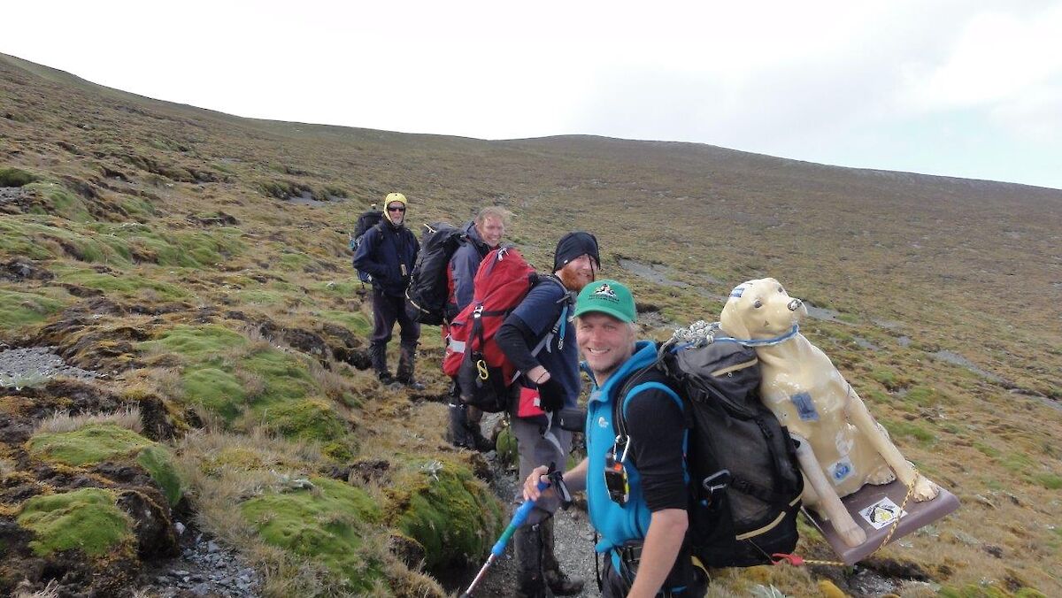
At Ratsak Junction at the unusual walking hour of 2.50 a.m., Ro and Kane joined the hike (after having to get up at 1.30 a.m. to hike out from Waterfall Bay Hut) and Ali and Alex peeled off to the hut to get some sleep. Daylight started to appear around 4.00 a.m. and the team were on the grassy down to Hurd Point just after 5.00 a.m.
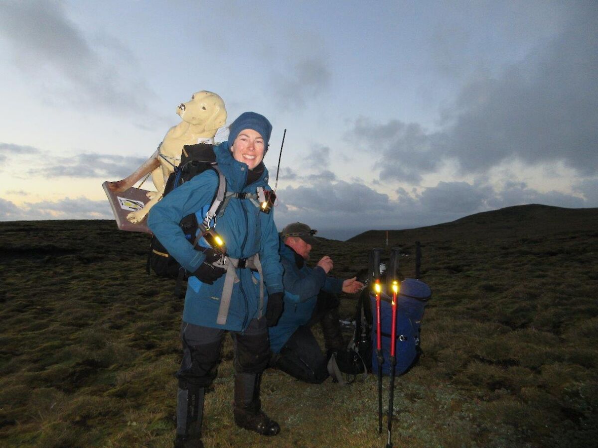
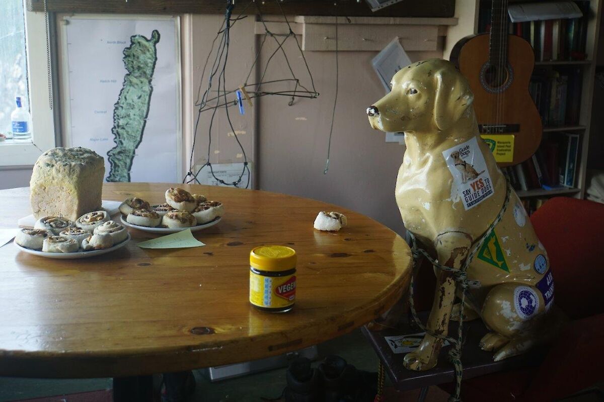
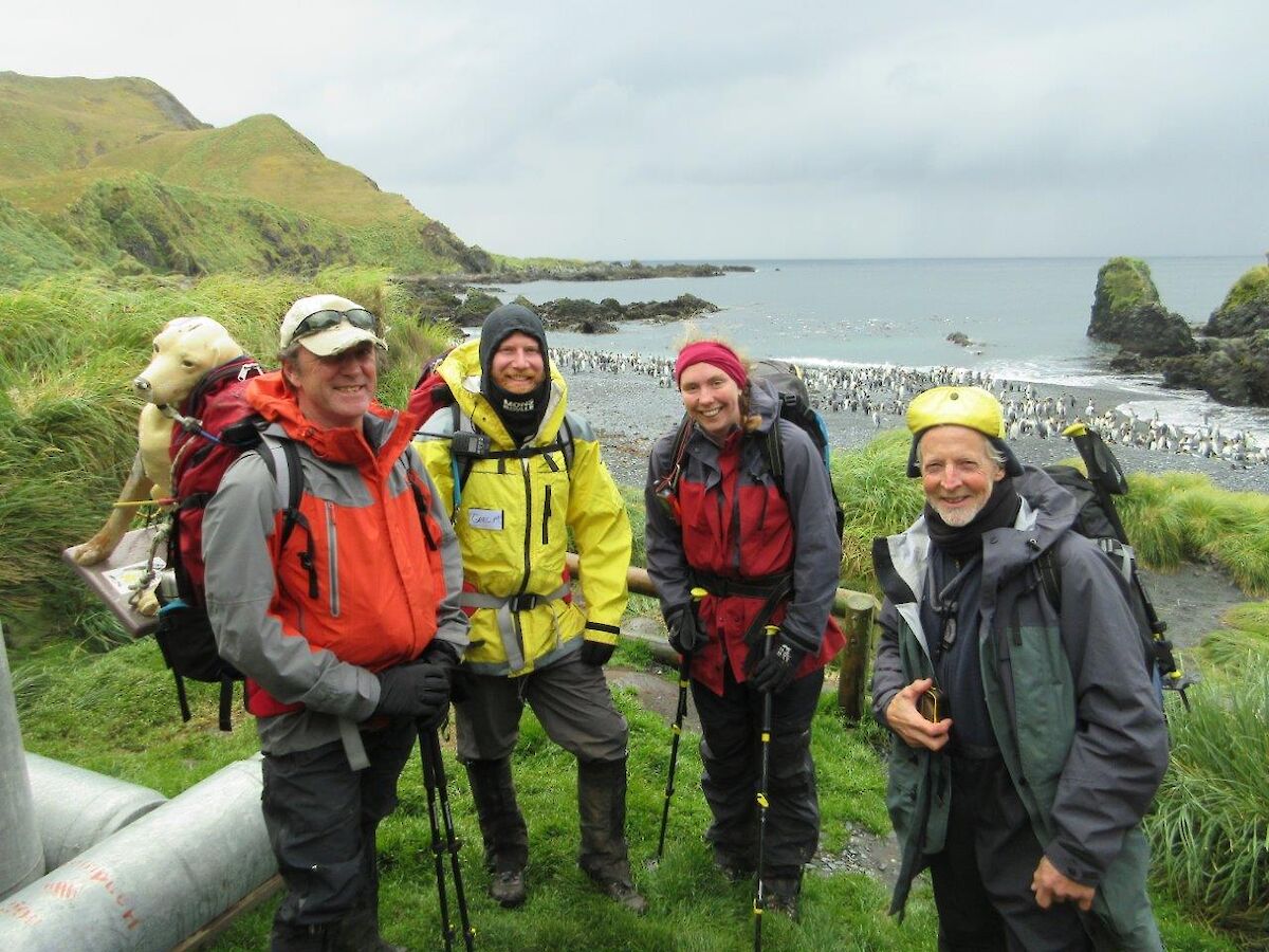
'Team Stay of Ro, Kane and Chris appeared at the top of the grassy bright and early at 5 a.m. Smiles all round. I had a short hut break with a cuppa, pumpkin bread and Vegemite and cheese scrolls before heading right back up the grassy. John took the first stretch, taking me up on the plateau and over Windy Ridge. I enjoyed an early morning wake-up shower, then beautiful sunshine. Penny took the next leg, carrying me onto Ratsak Junction where Ali was met with perfect timing.
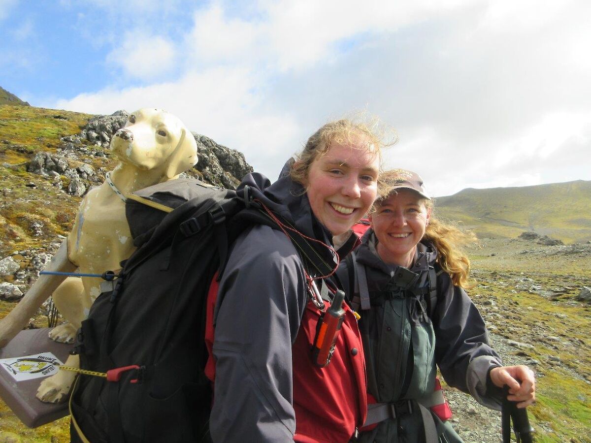
On past Major Lake, where despite Ali’s presence there was a view! Heading down to Green Gorge both Ali and John took another Stay carrying shift. Kim was met heading south along the track and provided energy biscuits. Arrived in Green Gorge in good time where the two Gregs had the kettle freshly boiled. Now onto the next legs!'
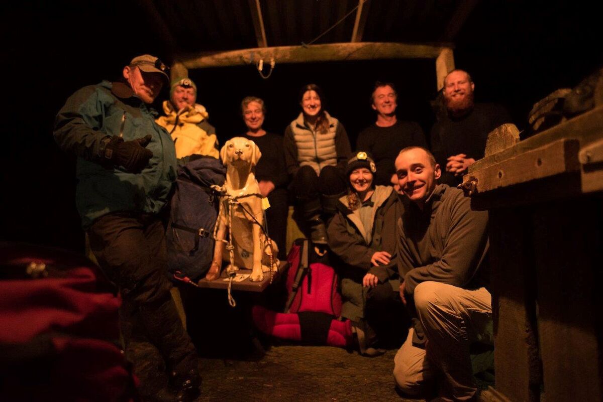
The two Gregs hit the track with John, Penny and Stay, and at four ways, Marcus and Cath joined the group for the final leg to the isthmus. They were all met at the lookout by Helen, Laura, Nat and Murray with more people gathered at the finish line. The finish line was crossed at 5.30 p.m. so return journey Macquarie Island station–Hurds Point–Macquarie Island station was completed within 24 hours!
As well as doing something that hasn’t been done here before (and yes, many would ask, ‘why would you?'), we have raised $2696.50 for Guide Dogs Tasmania so far, which adds to the feelgood factor for all.
Shoulder to Shoulder (S2S) photographic project
The Division was contacted by the Shoulder to Shoulder Project to see if anyone would like to submit images depicting life on a research station during a 24 hour period.
As part of the infrastructure group and summering at Macquarie Island, I submitted eight images with five being selected to be published in an upcoming book.
The Shoulder to Shoulder Project was conceived as a Millennium Project for the year 2000. However due to unforeseen circumstances the project had to be shelved mid–planning in 1999.
The concept was to record life events and preparations for New Year’s Eve, over a 24 hour period from midday 31 December to midday 01 January. Midday to midday being the shoulders of the new year hence the name Shoulder to Shoulder.
In 2015, the goal was achieved and the project executed with support from a West Australian (WA) online community of enthusiast photographers. The 2015–16 initial project was a small scale WA only testing exercise for this year’s much larger Australasia project.
The exercise was a resounding success with many of the initial participants preparing to re–shoot this year’s project.
This year the project had new partners with two Cancer research charities as beneficiaries of the sales of the resulting book. The images though the project is photo-journalistic in nature do not have to strictly meet this genre.
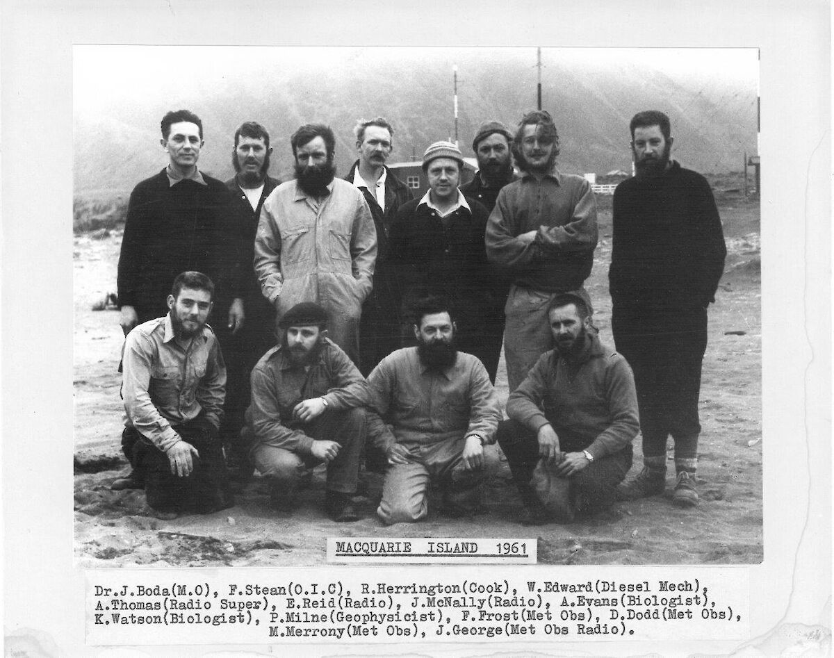
David (Horse) Barringhaus
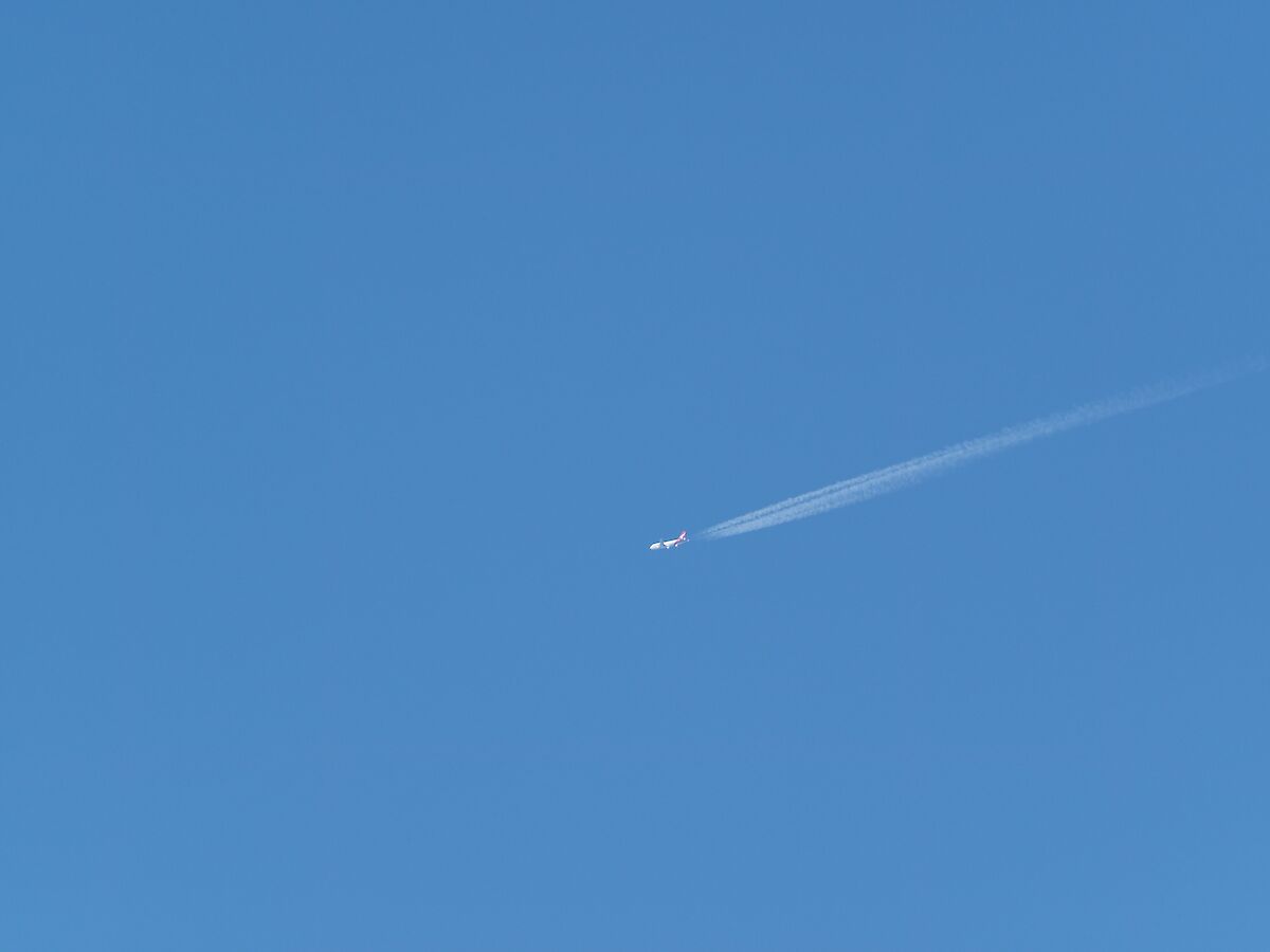
Qantas flyover
Look! Is it a bird? (A wandering albatross? A northern great petrel? A cape petrel?) No, it’s a plane!
Much excitement up and down the island on Sunday when Qantas flew directly overhead — no novelty at home, here it’s the first plane we've seen since arriving 10 months ago.
David Dodd (MI 1961) sent us an email the next day to say they had a lovely view of the island: “Macca came upon us rather quickly as there was a fortuitous break in the cloud at the last moment and at once we realised Macca was below us. We were quickly down the east coast at Bauer Bay heading south at 800km/hr, however we were able to look back to the isthmus and North Head and got great views of the plateau and lakes. In a matter of minutes we were over Hurd Point and heading for Bishop and Clerk islands where we were able to obtain some pictures. I last saw Macquarie Island in 1961 so it was a real trip down memory lane.”
The flight was retracing the path of the first Antarctic Charter flight in 1977 that went from Sydney to Macquarie Island, Commonwealth Bay and the Ross Sea.
Flashback
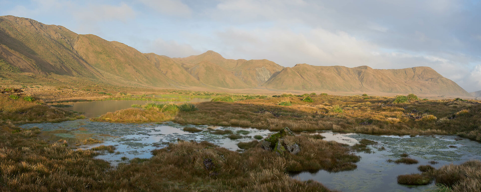
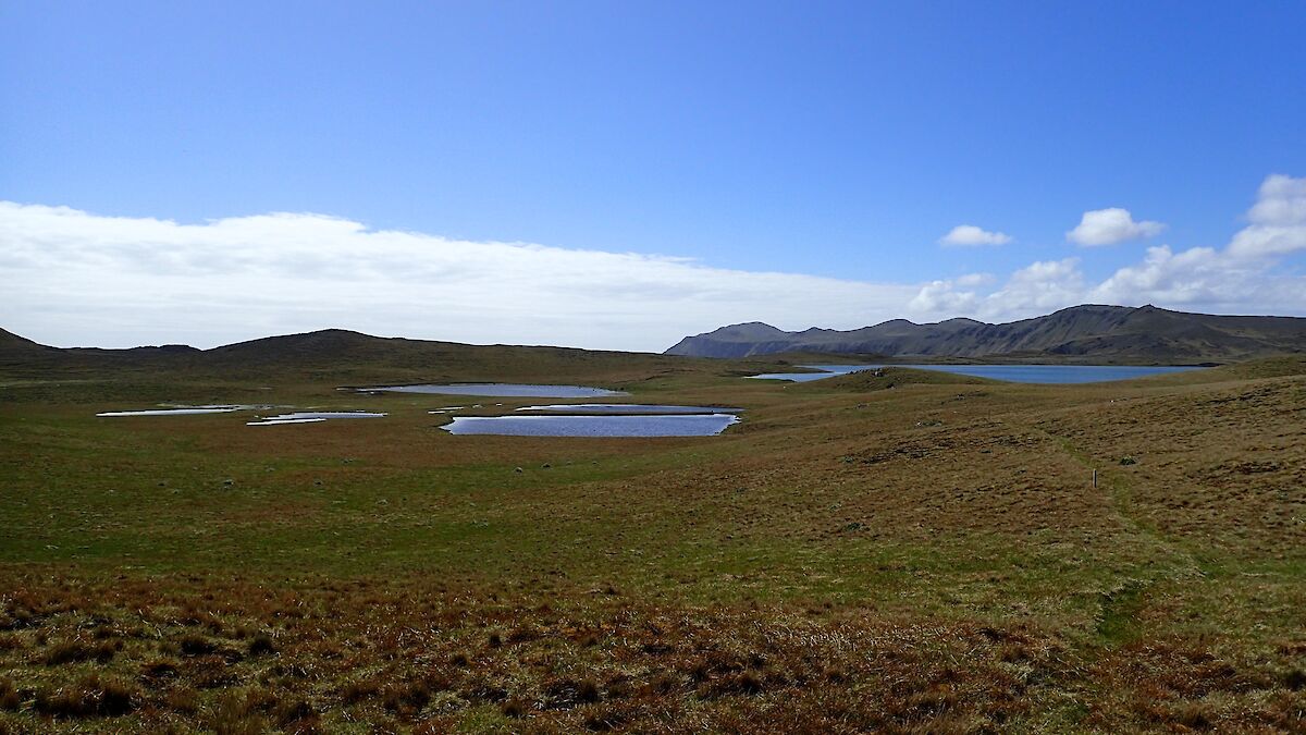
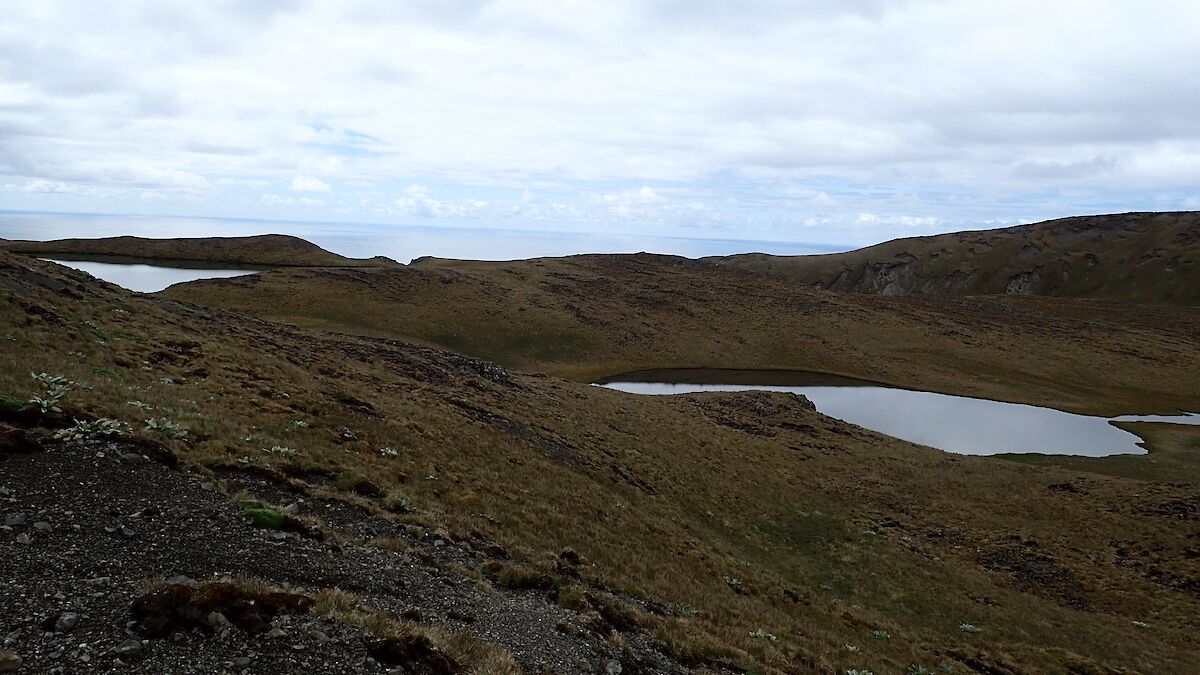
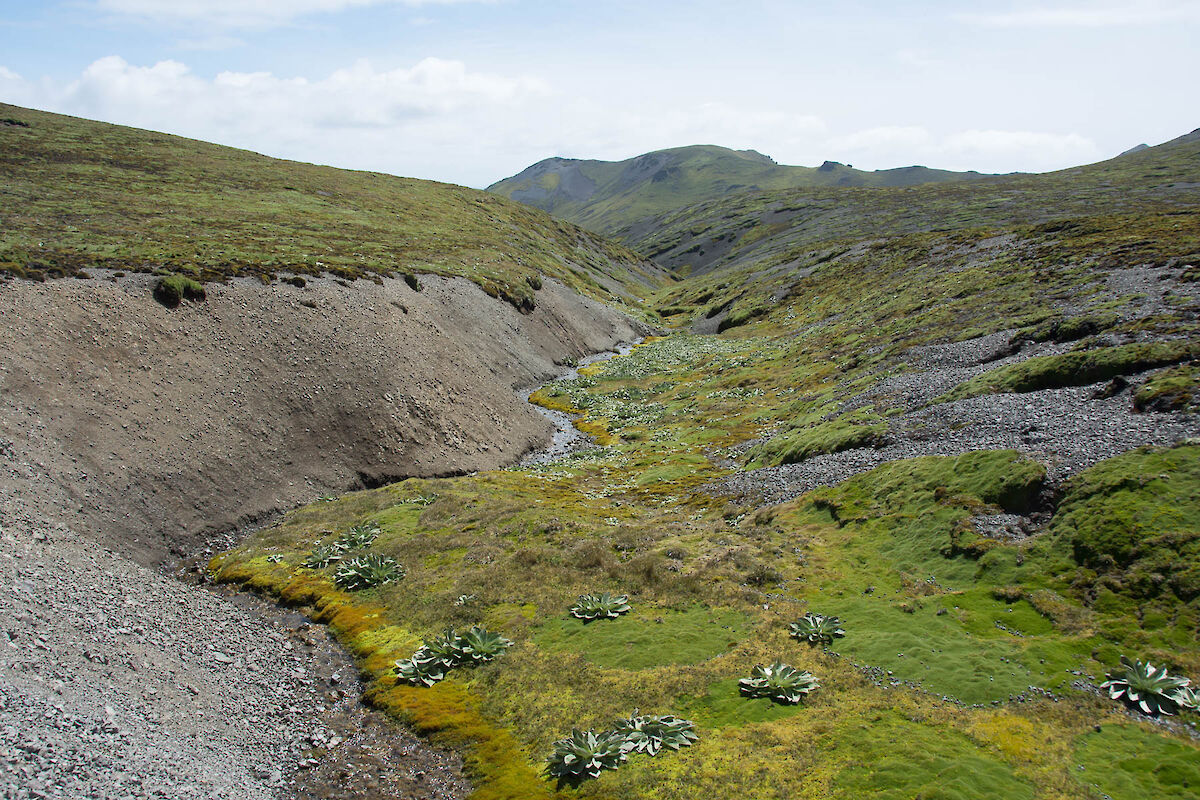
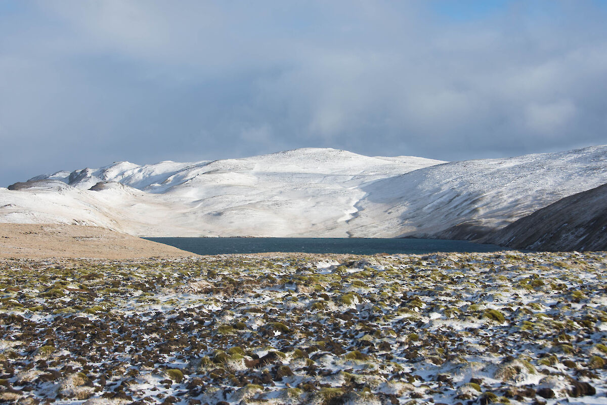
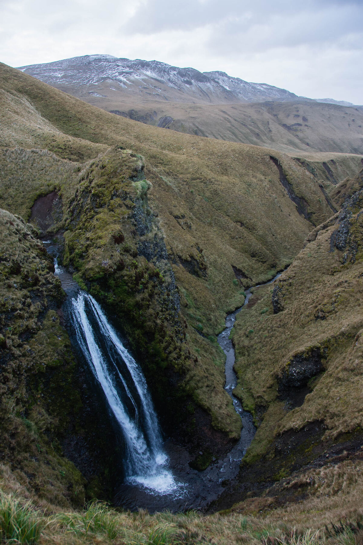
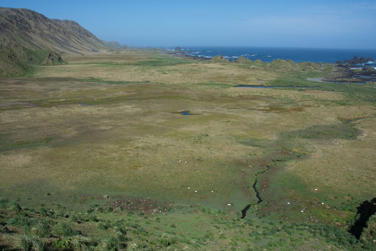
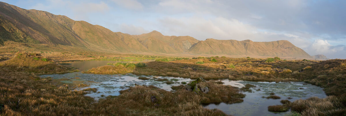
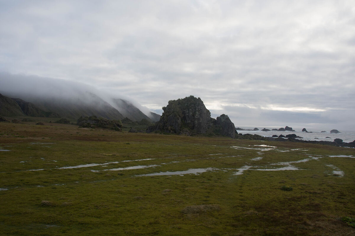
For somewhere where it seems to rain a lot of the time (and where we have, again, broken the annual rainfall record last year), one of the more intriguing aspects of Macquarie Island is the general lack of creeks and rivers.
There are 24 named lakes on the plateau and several named lagoons on the coastal margins. In addition to these, there are many unnamed, smaller water bodies around the island. Major Lake is the largest lake on the island at 0.5 sq km, whilst Prion Lake is the deepest to have been measured at 32 metres.
But some of these lakes lack inflowing or outflowing creeks. This appears to be due to the highly fractured nature of the bedrock or the way in which the bedrock dips or slants. This results in water percolating quickly through the rock, perhaps ultimately re-emerging on the shore platform which skirts parts of the island. These areas are exceedingly boggy.
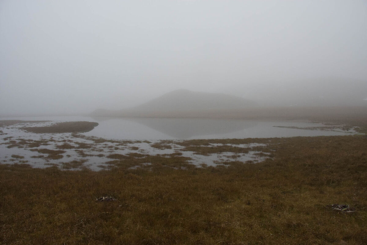
The bogs are composed of peat which have been reported to be up to six metres deep, and are thought to have formed over the last 5000 to 7000 years. Excellent examples occur at Handspike Point, on the north–eastern tip of the island. (The bog on the north-eastern side of the island is referred to as the “featherbed”.) This depth suggests either a very fast rate of organic accumulation or, more likely, a slow rate of decomposition in comparison to peats in other parts of the world. Rates are never constant, but on average it appears as if the lowload bogs on Macquarie have developed faster than many other peatland areas in the world.
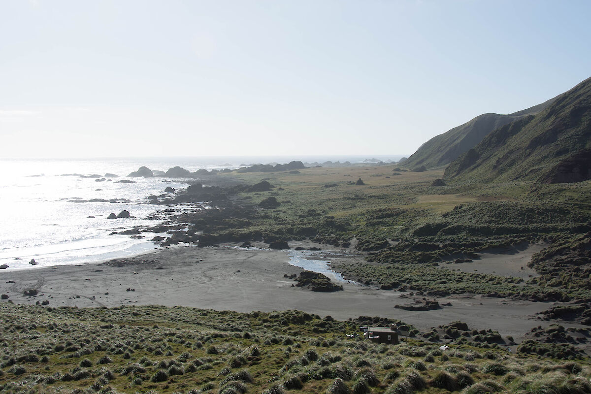
Peats are widespread on the island, on the slopes (where they seemingly defy all laws of gravity) as well as the flat areas. Known as blanket bogs, these form as a direct response to the wet, humid environment and low evaporation rates. In many locations no fine soil material exists because it has been washed or blown away, leaving extensive cobble and boulder-strewn areas, which could appear like glacial debris and may be part of the reason early geologists though the whole island had been glaciated.
So what does all that mean for the contemporary Macquarie Islander?
It means we have wet feet pretty much all the time out on the track!
All the knowledgeable bits for this article are taken from the TasPWS booklet: ‘A new arrival: the geological development of a young island’ by Michael Pemberton, Garry Davidson and Jennifer Burton & “Sub-Antarctic Wilderness” by Aleks Terauds & Fiona Stewart