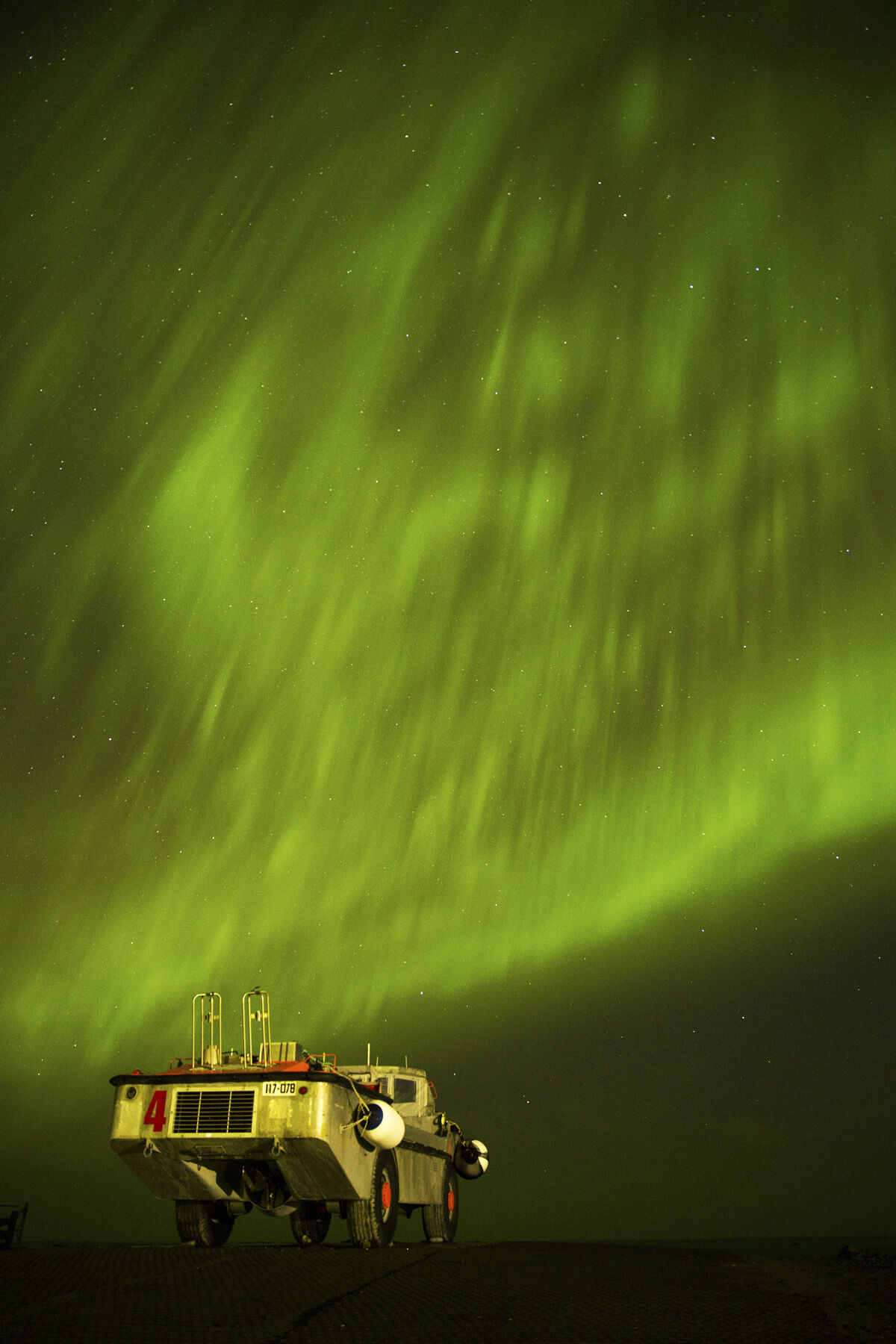
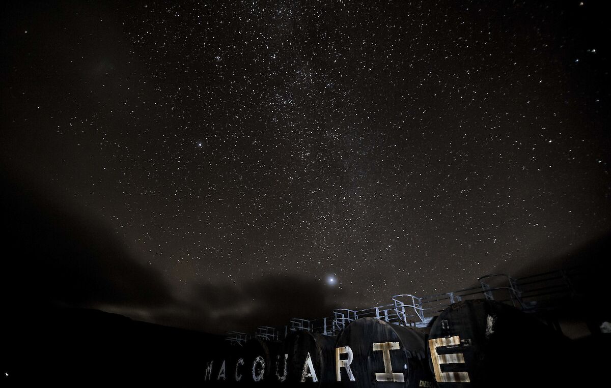
Some clear skies at Macca this week have kept expeditioners on their toes for photo opportunities, both day and night.
Macca station update
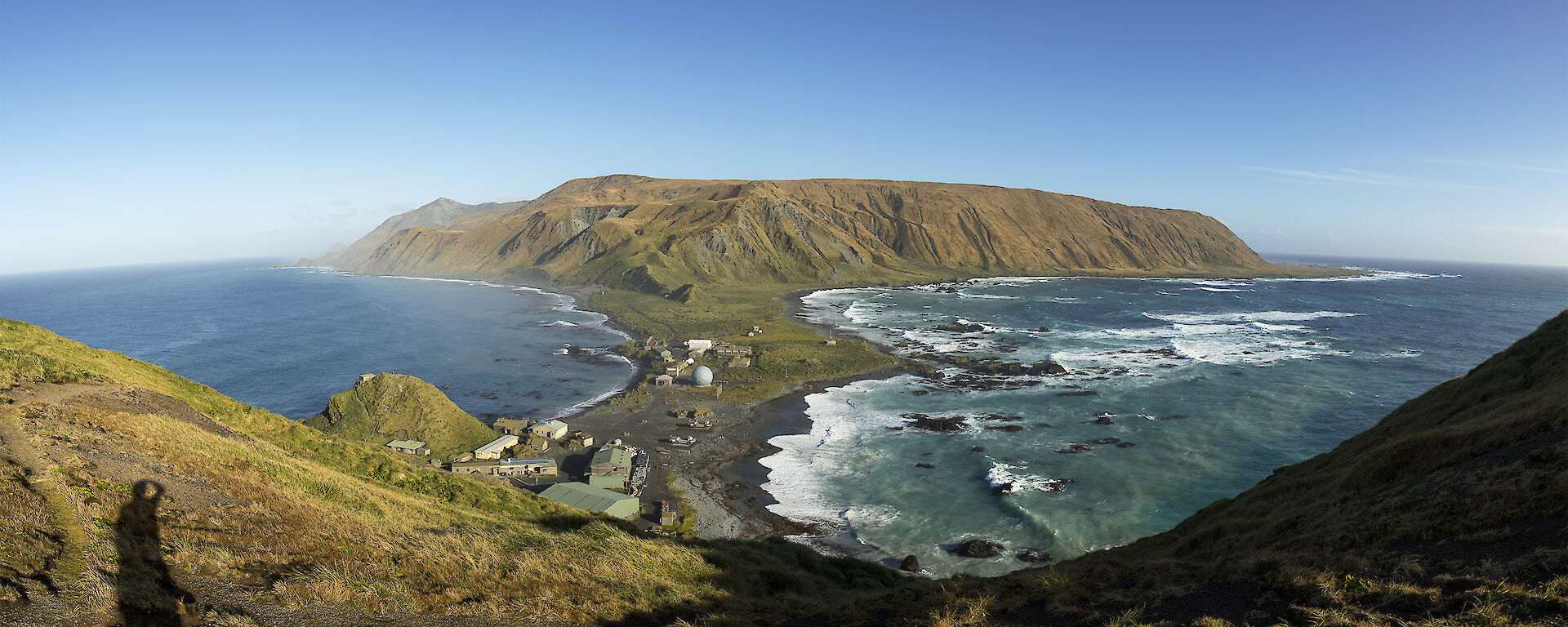
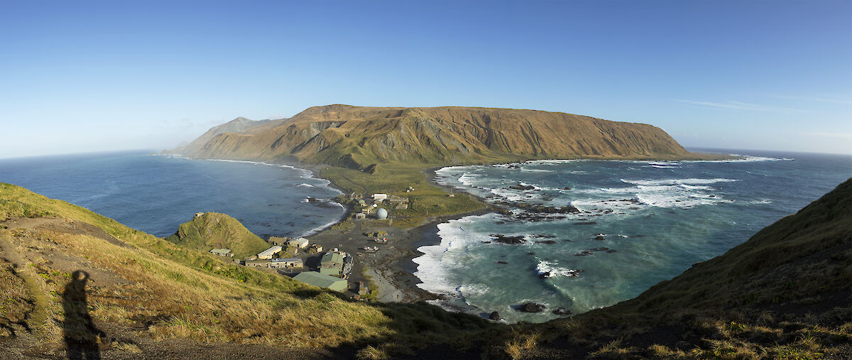
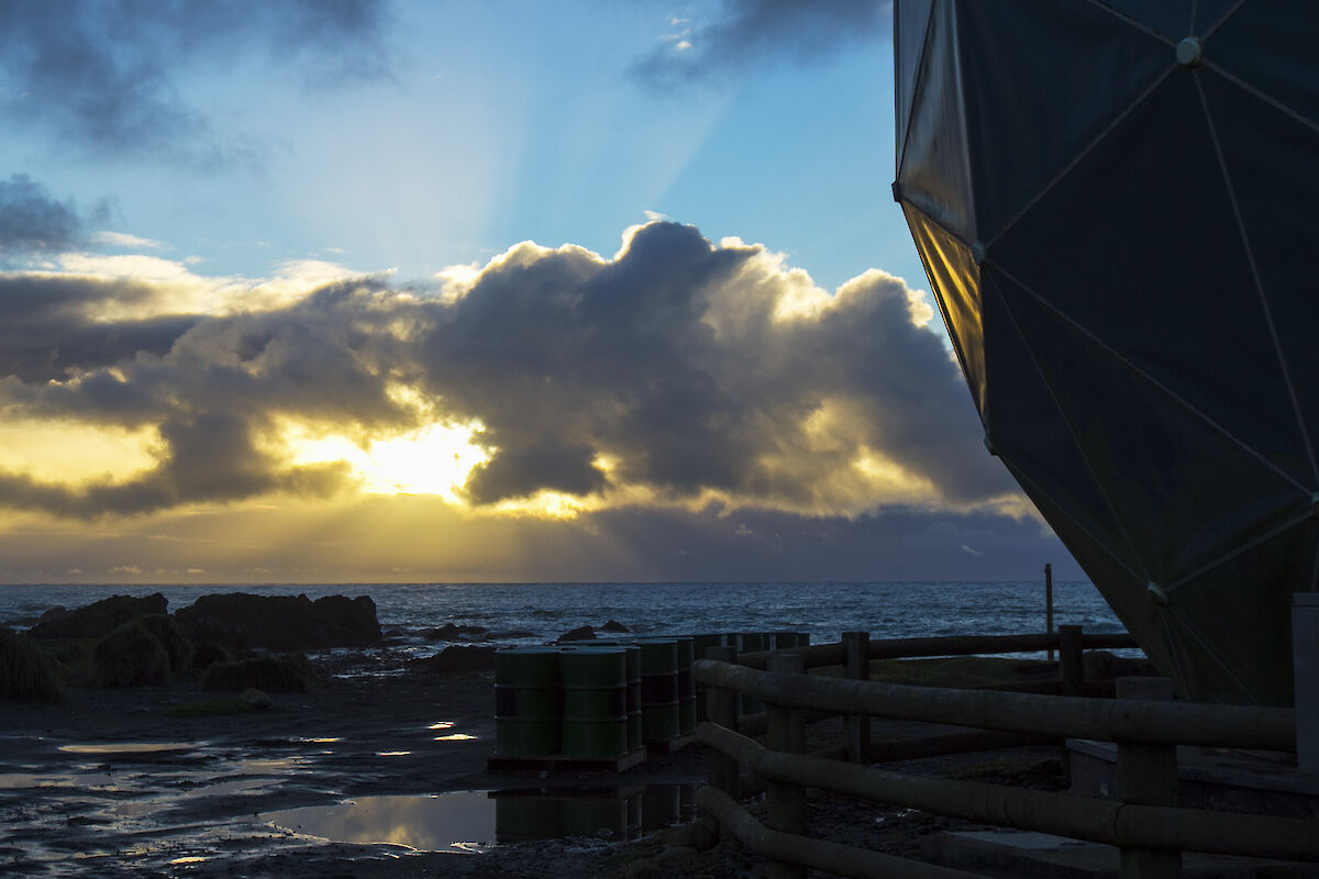
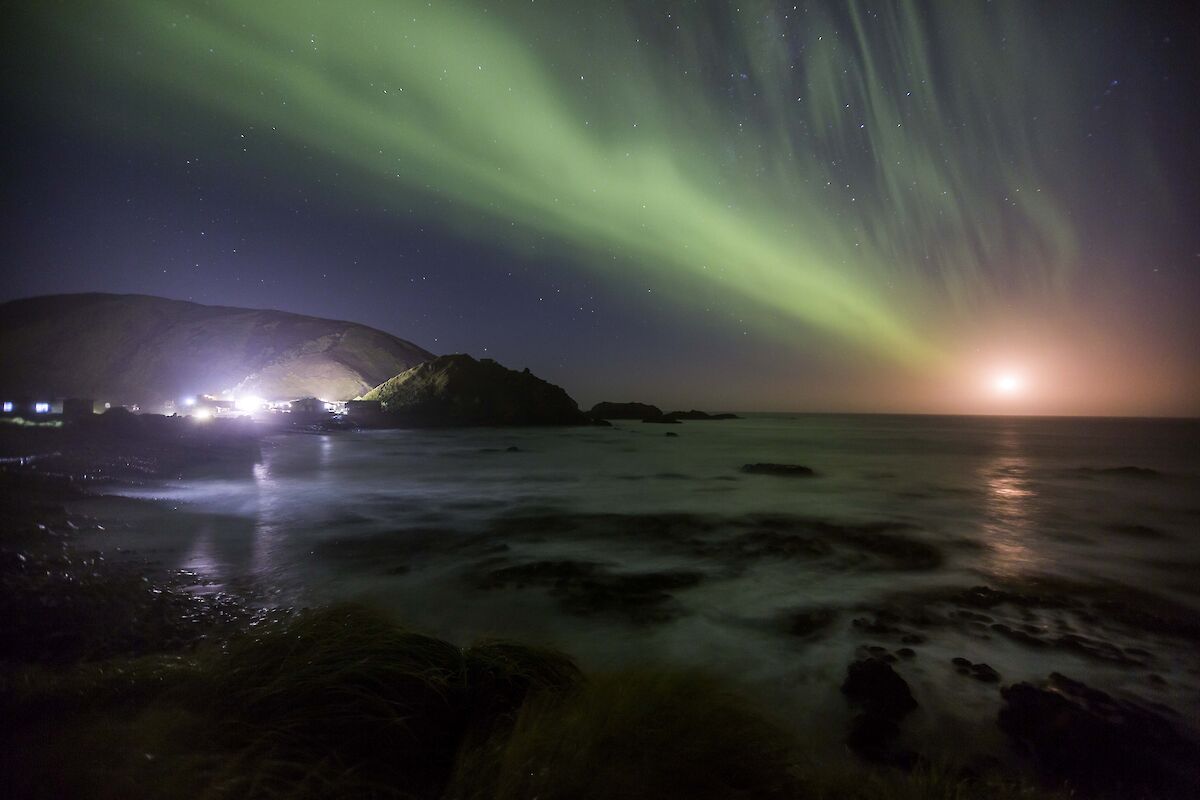
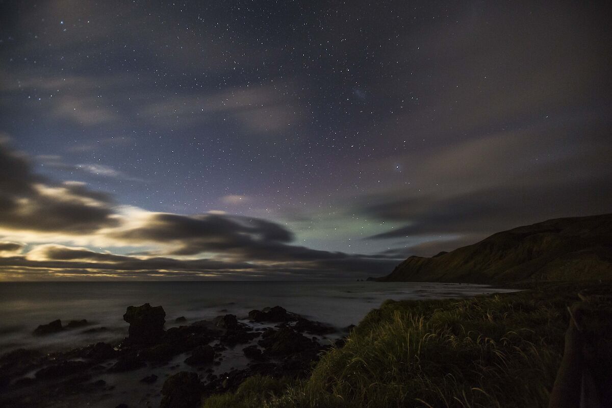
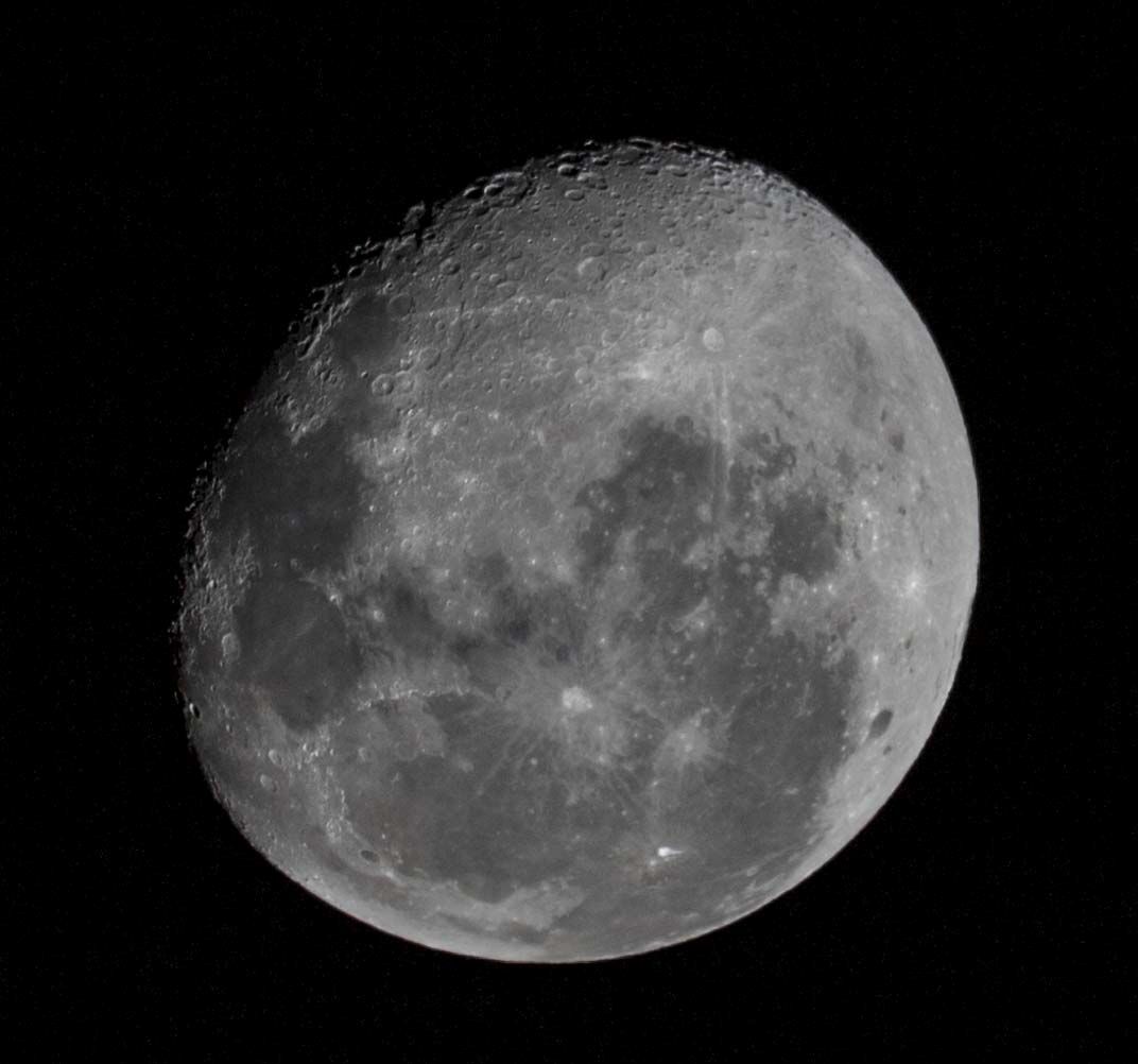
This week on Macca we had quite a number of fine days, allowing everyone to take advantage of the visibility and snap a few photos around the place. Aside from enjoying some sunshine and blue skies, the break in the clouds has also given us another fine opportunity to see some magnificent auroras over the past few nights. Many photography novices are now getting well set up, under the guidance of some seasoned pros, and are achieving some beautiful pictures.
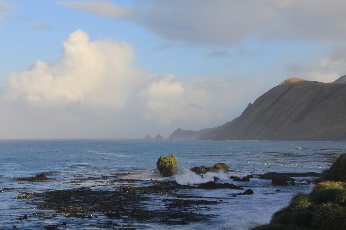
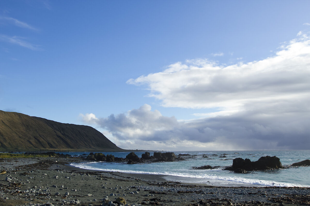
Larger easterly swells this week have also shown us another of Macca’s ‘moods’. With the usual prevailing swell being westerly, seeing the waves crash in from the east is a spectacular sight.
Field travel continued this week with Dan and Nick rounding out the last of the field familiarisation trips. Having had an exceptional orientation to the island terrain and conditions, the majority of expeditioners are now able to plan some recreational travel during time off.
The fire team conducted our first fire alarm muster drill this week, with all expeditioners assembling from their work places to the muster point in impressive time. Our on-call fire team kitted up complete with breathing apparatus gear in six minutes including the time spent to jog down the isthmus for many. It was a great effort by everyone on station, and effective demonstration of all of our pre-departure training paying off.
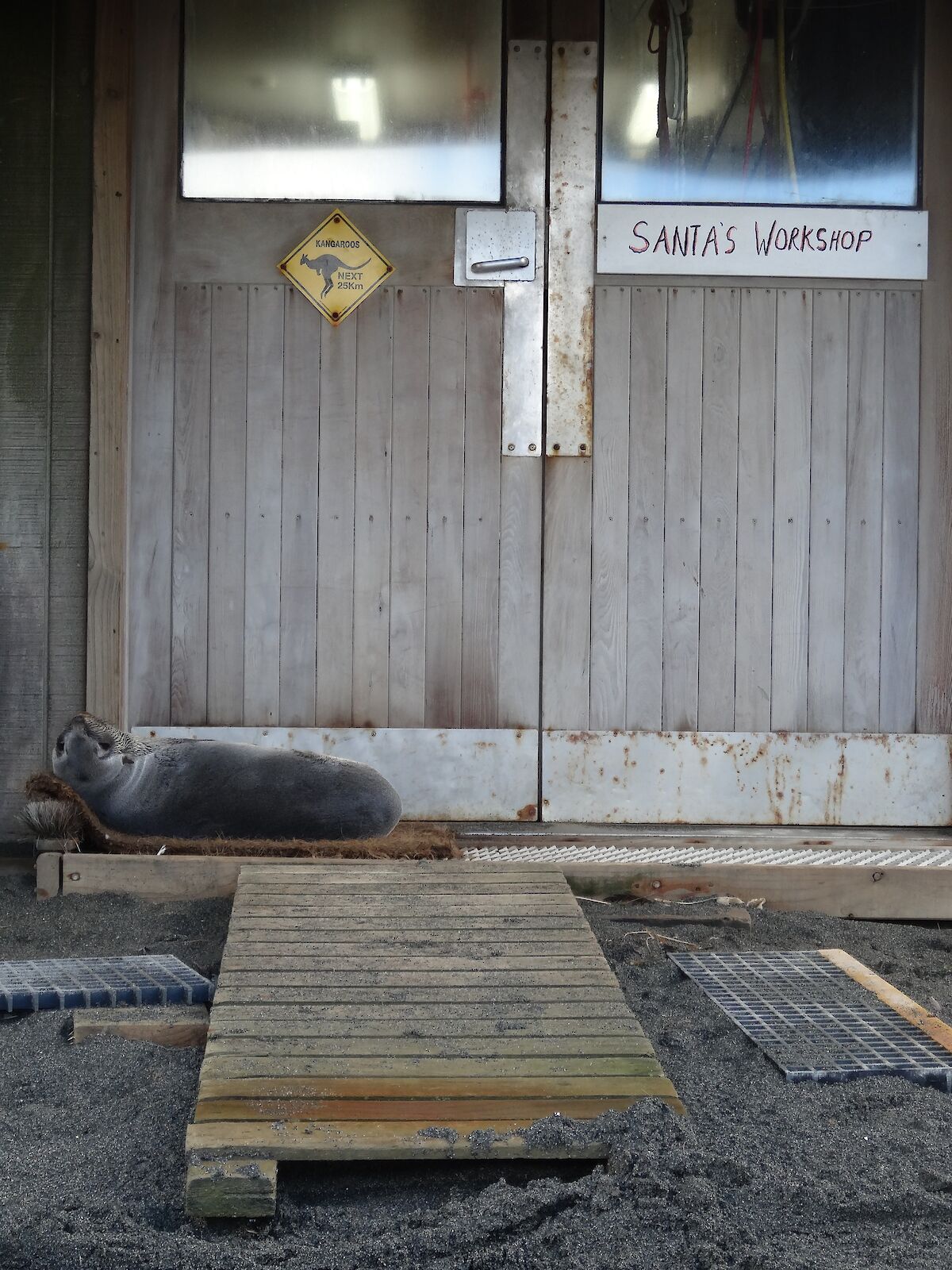
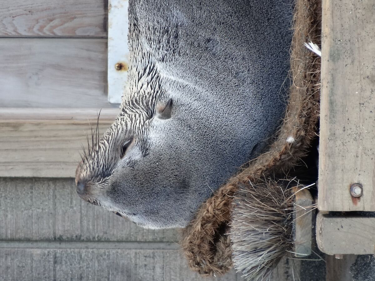
Finally a cheeky little visitor has been popping up on station this week. The small fur seal has taken to snuggling up on our doormats, or in the tussock beside entrances to various buildings. Whilst incredibly cute, it does make getting to work, or your accommodation, tricky.
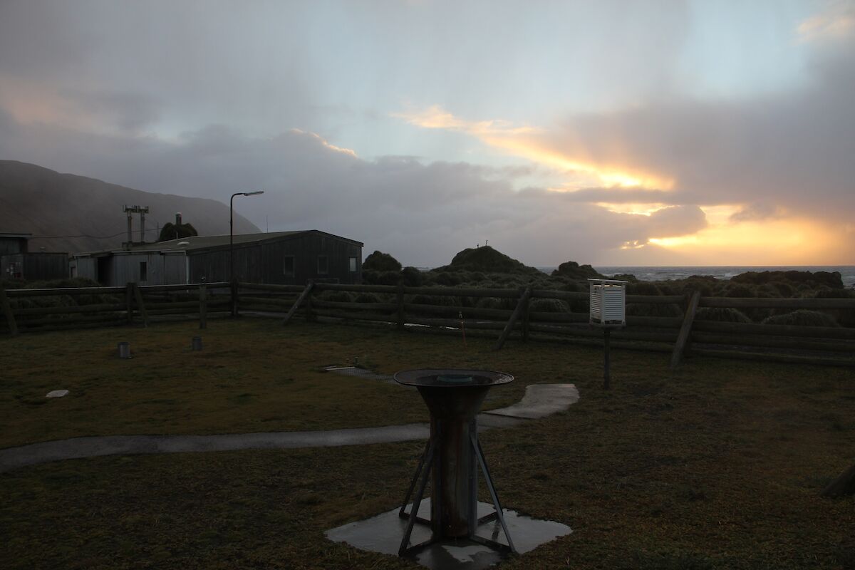
April weather summary
With April having drawn to a close, we have the opportunity to reflect on our first month of weather on the island.
The weather throughout April was a good introduction to what we should expect here for the upcoming year, with no new records being set.
We had a rather wet welcome to Macquarie Island this month with precipitation occurring every day, to a total of 95.2 mm.
Good Friday was our warmest day of the month, clocking in at a balmy 8.7°C. The coldest day of the entire month was experienced on our first Monday on station, the 13th, hitting a sub-zero temperature of −0.5°C.
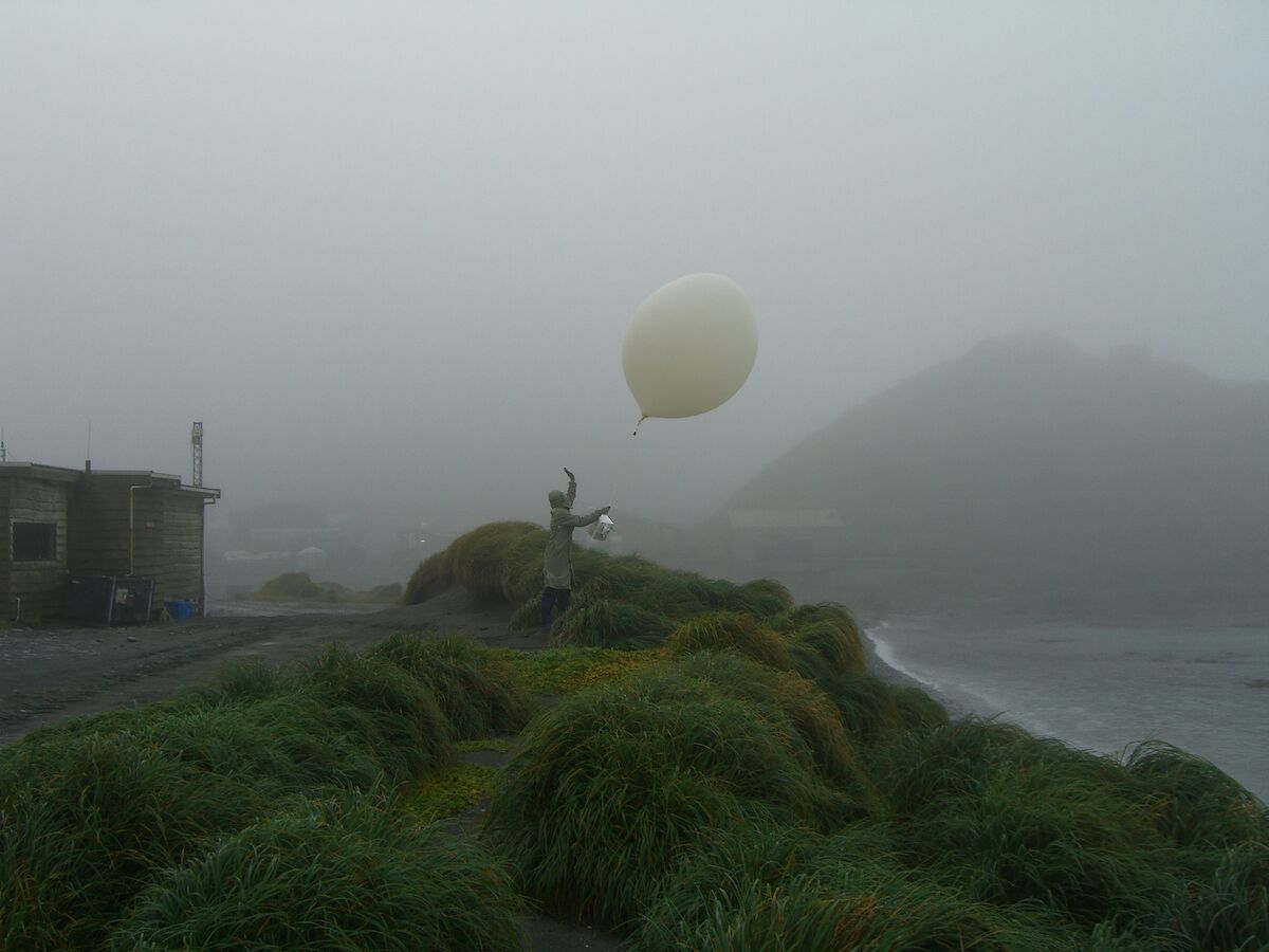
Overall our temperatures were just slightly below average, despite having an above average amount of sunshine. The clear skies that provided the increase in recorded sunshine also carried into the evenings, providing eight nights on which auroras were observed.
The windiest months of the year on Macca are the March/April and September/October period. This was well reflected with the first of the month seeing a 133 km/h gust and a monthly average sitting at a constant 41 km/h.
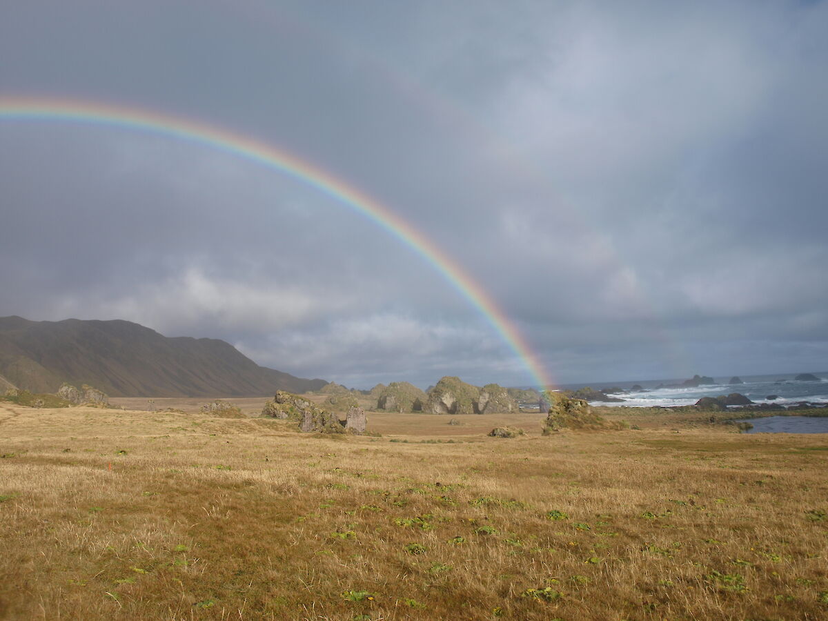
All in all, April’s weather summary is an accurate depiction of what everyone warns you Macquarie Island is: wet, windy, and cold. This didn’t stop our proactive photographers from getting out and capturing the weather photos seen below.
Dan Laban
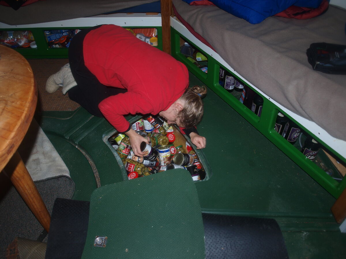
Tsunami response cache
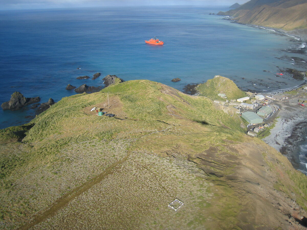
Macquarie Island was formed about 600,000 years ago by the uplift of rocks from deep within the earth, eventually exposing the tip of the Macquarie Ridge above the ocean’s surface. This tectonic activity results in this region being very seismically active, with tremors and earthquakes being recorded here on the island during most seasons. Our station is built on an isthmus, essentially a long sand bank, which can be inundated at its lowest point a few times a year in the event of high tides and large seas occurring concurrently.
The Australian Antarctic Division (AAD) recently requested modelling from Geoscience Australia on the vulnerability of Macquarie Island to tsunami, following an earthquake or tremor. The modelling suggested that the station is potentially vulnerable to inundation as a result of both near and far tsunami events. As a result, the Australian Antarctic Division is implementing appropriate tsunami mitigation measures for the station to help reduce the potential impact from this type of event should it occur.
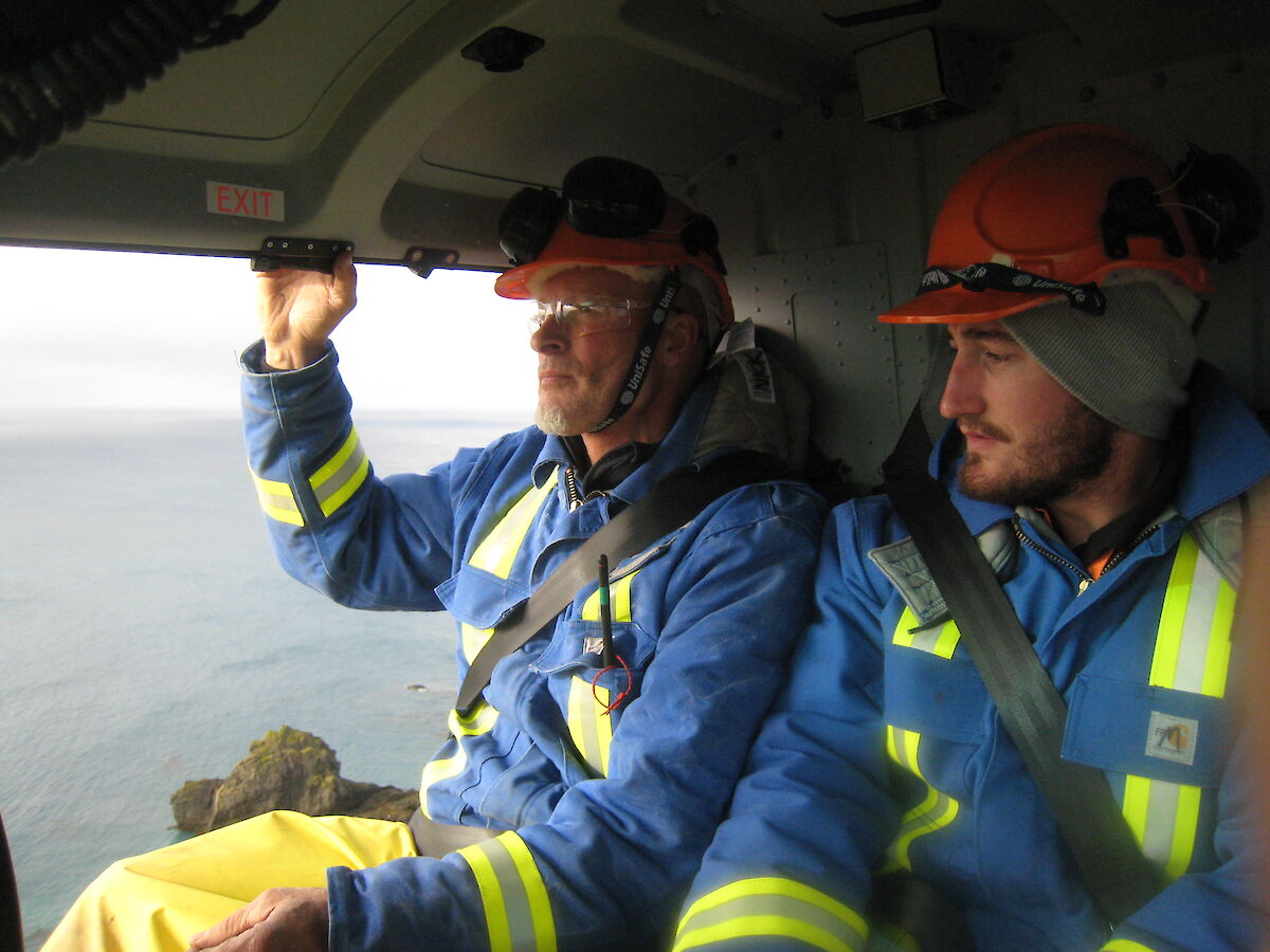
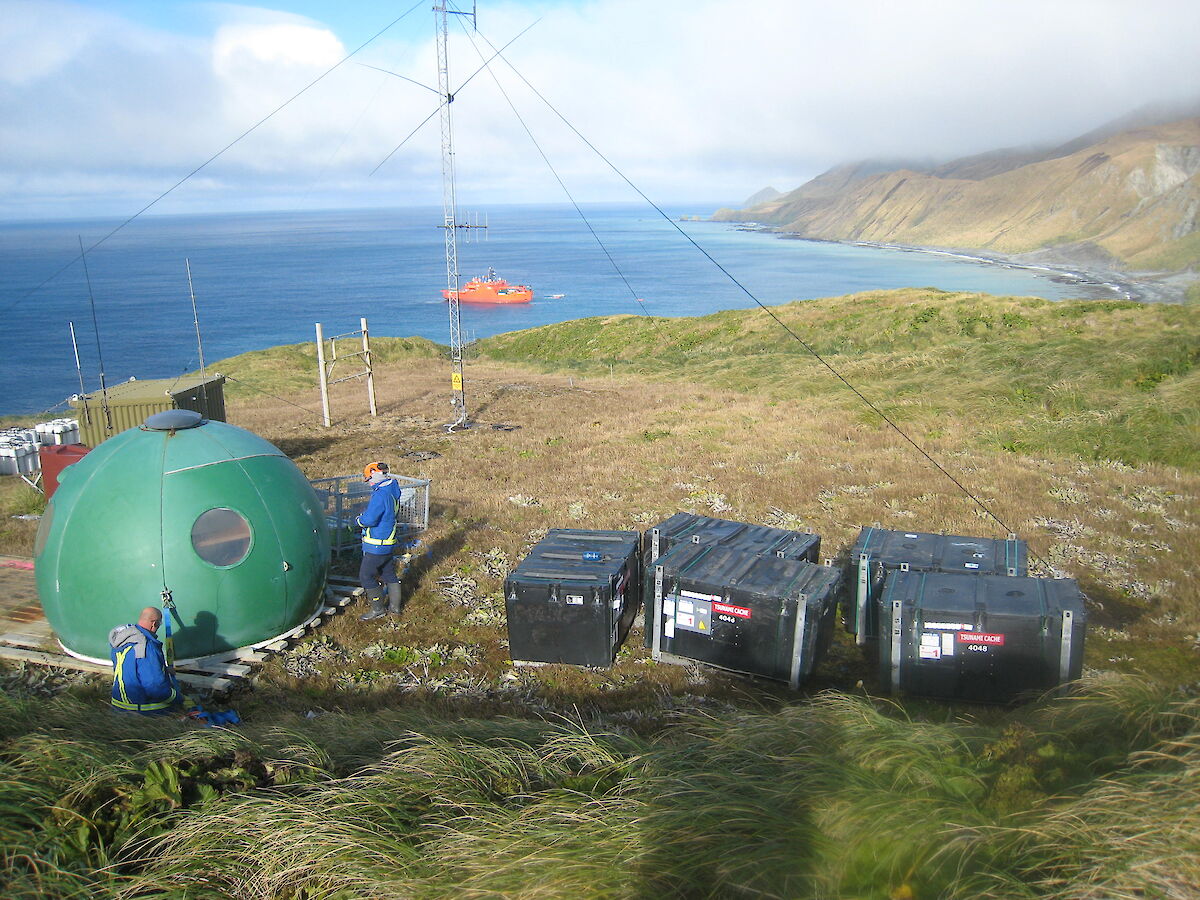
During the resupply activities in April, a new Tsunami shelter was installed upon Wireless Hill, as a replacement for the interim cache which was previously installed. The shelter was flown into position onto a pre-constructed platform using a helicopter, with a team of expeditioners on hand to anchor it into the ground.
The new shelter hut includes a cache of communications gear, clothing, and food to sustain the community until help arrives, should we be required to evacuate to the shelter. Due to the lack of sea ice around Macquarie Island, outside assistance can be provided year round by ship or by air drop.
The team on Macquarie Island have been partaking in awareness raising activities, and tsunami alarm testing. Periodic tsunami evacuation drills will also continue throughout the season.
Whilst there is no record of a tsunami event occurring on station in recent history, we are nonetheless well prepared to evacuate to higher ground upon receiving early warning via the AAD in Australia, or upon feeling significant tremors.
Out for a stroll
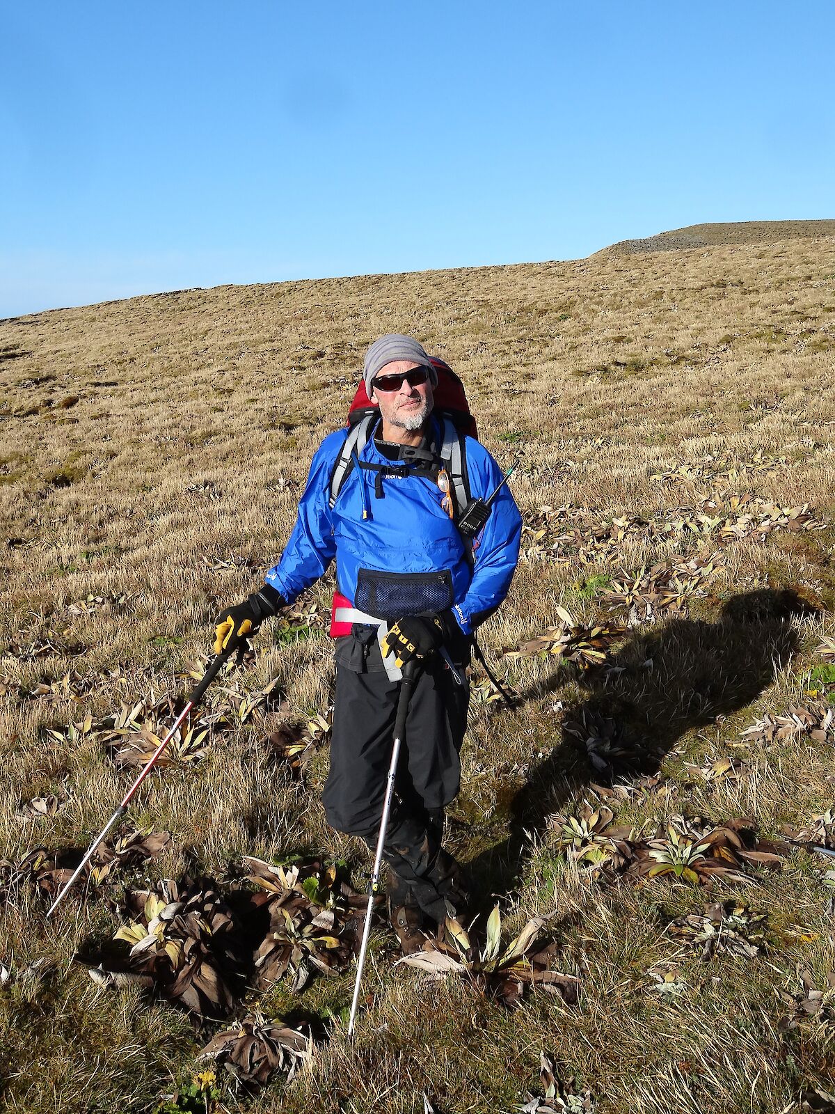
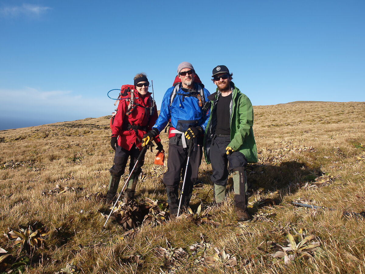
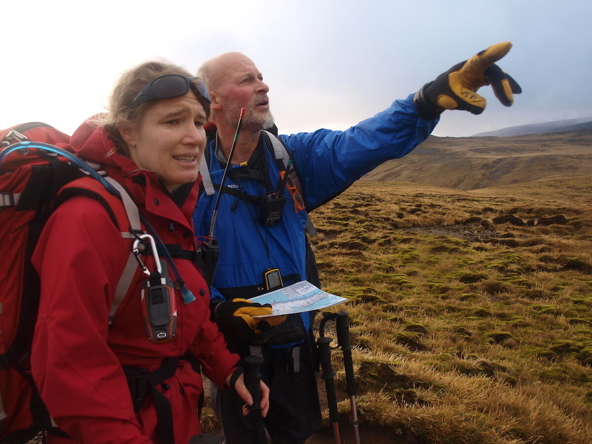
Thursday started like any other day: an excited knock on the door and a “Dan, are you decent?” Despite the varying opinions on what constitutes decency I decided to take the chance and answered in the affirmative. Nick and a very excited Anna burst through the door and informed me of a day of such sunlight and beauty that it had been decided that a much earlier start to our field trip would be the best way to make the most of the stellar weather while it lasted. So pants and pack were donned and off we went to ‘carpe the diem'.
I should take a moment and explain that this wasn’t your run of the mill field trip, but a field familiarisation trip. This is a big step in the process of being deemed fit for travelling and overnighting in the field.
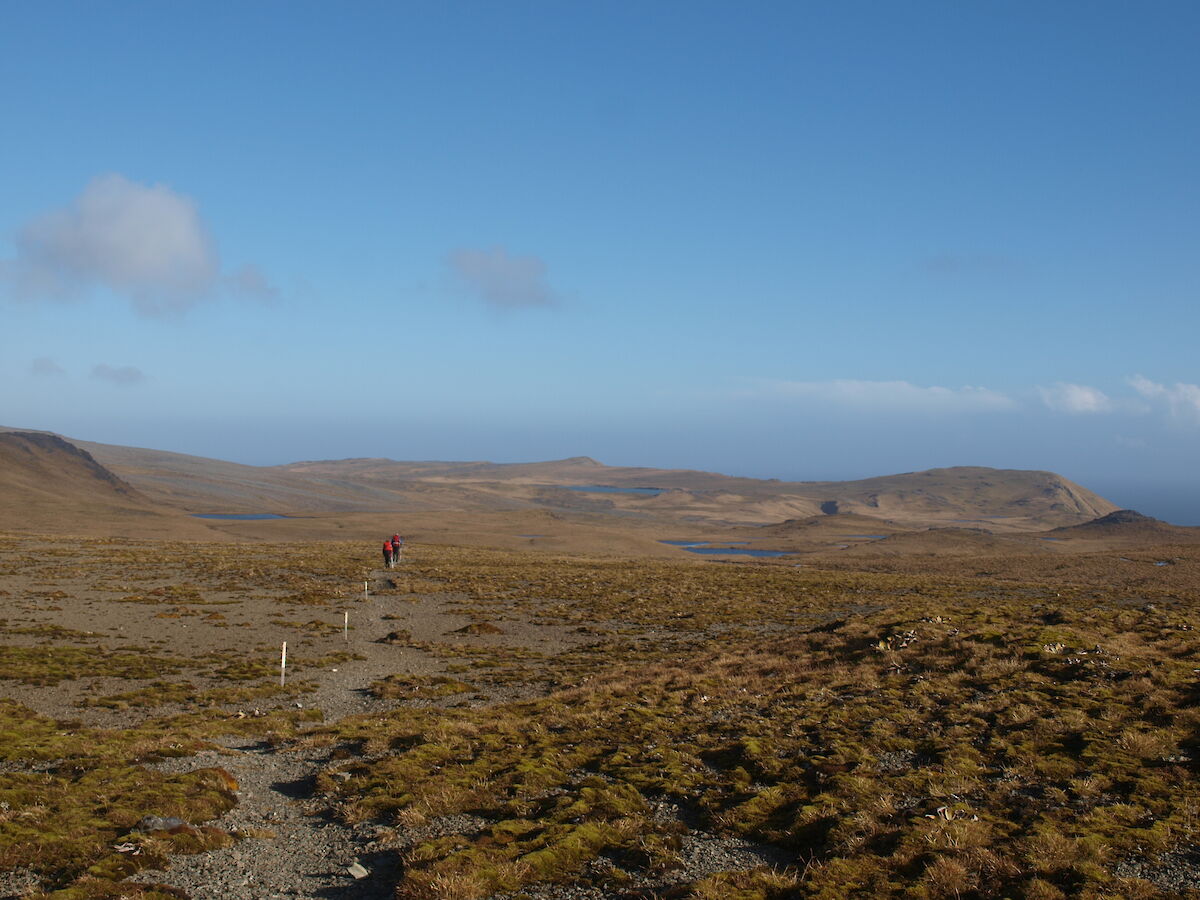
So the plan was to take a two night trip, staying first at Bauer Bay hut, then darting across to the west coast for a night at Brothers Point hut, before walking the coast back to station on Saturday. All the while our trusty park ranger and trip leader, Anna, would be showing us the do’s and don'ts of a field trip.
The path that ascends from station to the plateau is known as Doctors track, and winds through and up a very steep hill. We were rewarded for our efforts with a breathtaking view of the station, with the sun on our face and barely a breath of wind. The track soon flattened out and even started to descend as we followed the Island Lake track. We passed a number of smaller lakes, such as Emerald Lake (not nearly as green as you would expect). The track weaves an interesting path as it cuts across a spit right through the middle of Island Lake. The spit is constantly shifting and forming meaning it’s often a dice roll on where the best points to cross are, in order to minimise wet feet. Along the way Anna pointed out a number of research plots marked out for a variety of different projects, as well as some rare vegetation including a moss that has only a dozen known patches on the whole island.
We reached Bauer Bay in the afternoon light, and went through the motions of setting up the hut and wandering around the beach. Once things settled, Anna cooked up a fresh loaf of bread using a clever method of making the dough rise over a gas heater. We shared stories over a dinner of gnocchi and vegetables before retiring for the night.
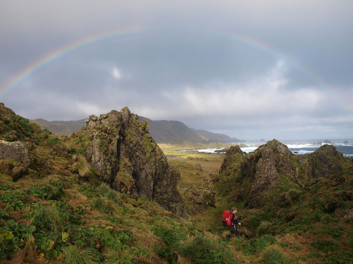
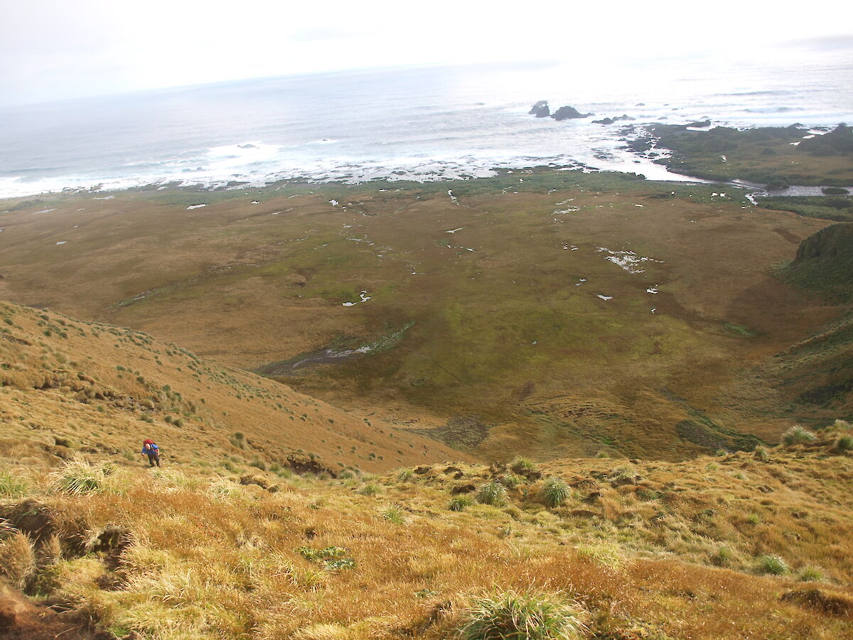
We departed the hut early Friday, following the coast across the southern featherbeds. The spongy nature of the featherbeds guarantee wet shoes very quickly. The featherbeds took us through an area known as the Labyrinth, a collection of green soaked rock formations that look like they could have been ancient ruins of millennia past. Our group hiked in silence, blown away by the overwhelming beauty of the area. We emerged into the sun on the other side, rainbows leading the way to the jump-up to the plateau. A jump-up sounds like a fun, easy route. It was not. A shear slope that, despite being barely eighty meters, took us what felt like an age and a day to reach the top. After a much needed breather we hiked inland to Prion Lake: a perfect mirror, completely undisturbed, reflecting the surrounding hillside. We took a break to appreciate yet another serene moment then headed off to soon connect up to the overland track and descend down the western side of the plateau to Brothers Point, where we retired for the night.
Saturday’s plans were for a lighter walk in which we would follow the coast around back to station, avoiding the exhausting hike back up and down the plateau. We meandered up the beach giving the mammoth sized elephant seals a wide birth while appreciating a large king penguin colony containing a number of crèches of baby chicks. Despite our perfect track record with the weather so far, it seemed the ocean wasn’t as kind. Massive easterly swells were pushing up the coast completely cutting off the path around the heads and back to station. We radioed station to inform them of our predicament and that we would be back tracking a little to Sandy Bay where we would head inland and back onto the plateau. After so many experiences and ten-fold more steps we marched tiredly back to station. The way down Doctors track is substantially more pleasant than the hike up, and we were greeted at the bottom by Marion and Lionel who were out for an afternoon walk.
All in all, it was everything you could hope for in a trip. We learned lots, were challenged, saw some amazing wildlife and landscapes, and got to share it all with some amazing people. I couldn’t think of a better way to finish up the week.