
Something close to the heart that draws me back!
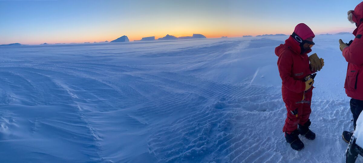
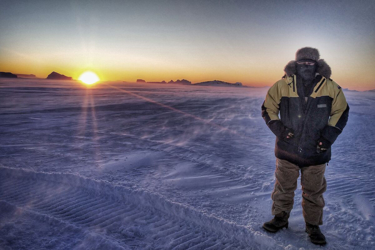
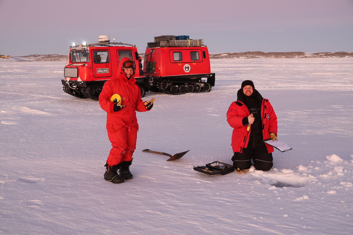
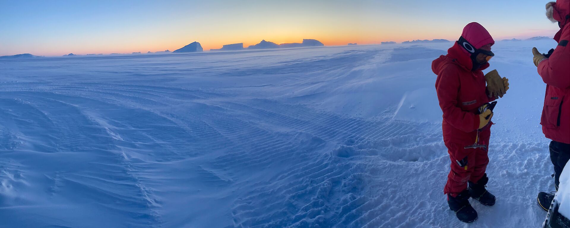
On our voyage south it all started with the opportunity to be involved in sea ice monitoring on, for most of us, the month-long voyage of V1 that brought us here. We were given insight into the program with an in-depth passionate talk from Petra Heil, sea ice scientist at the Antarctic Division theatrette prior to departure. Once here, we have been able to assist Tom P, our science support engineer in the weekly sea ice monitoring schedule.
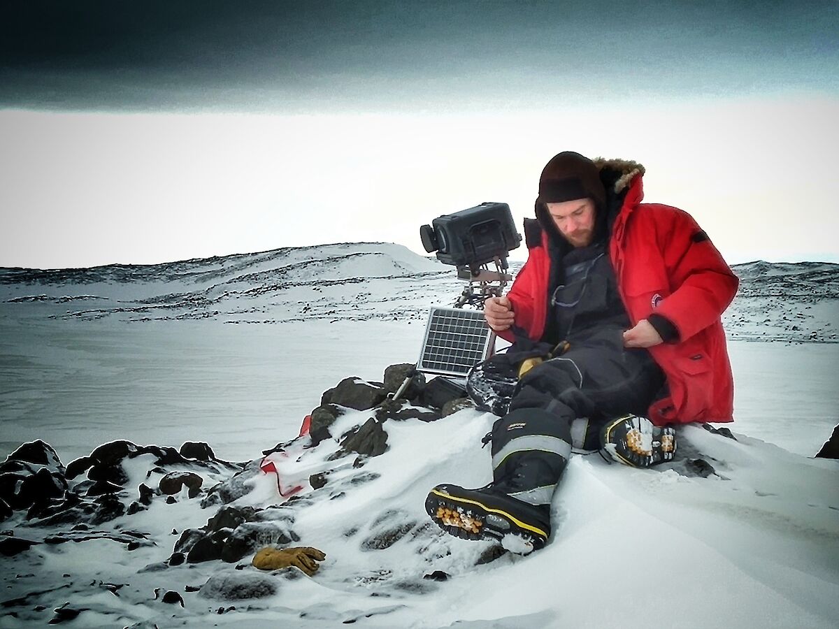
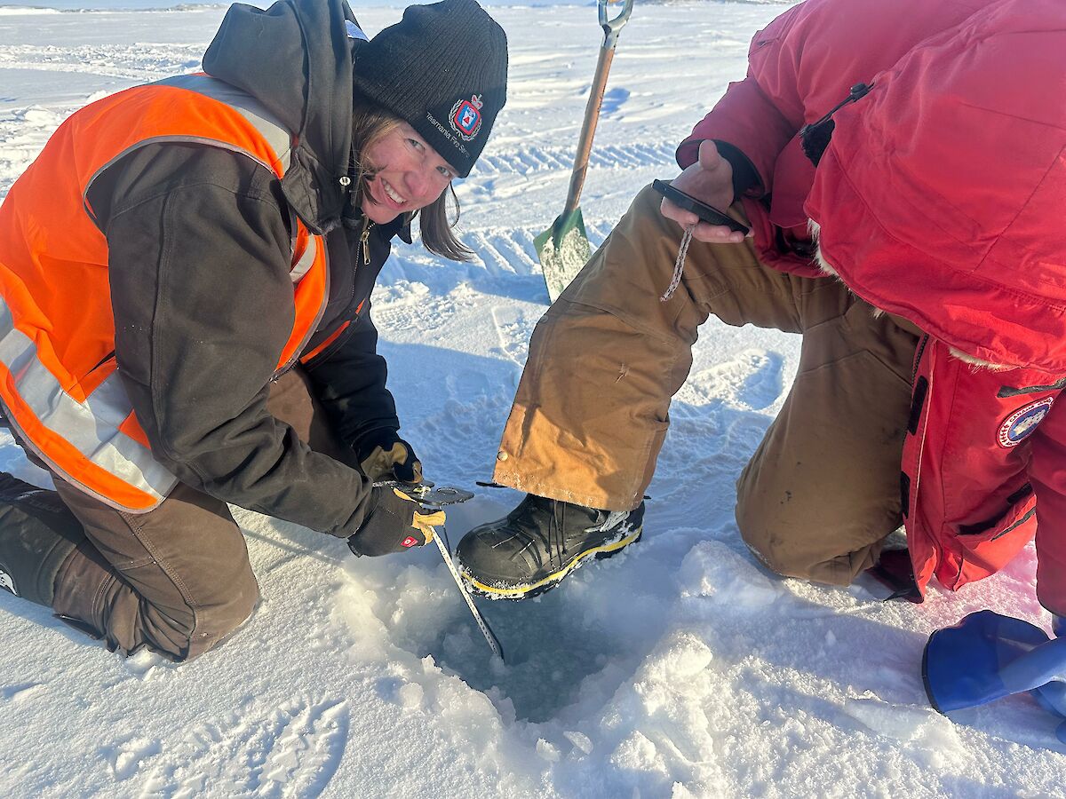
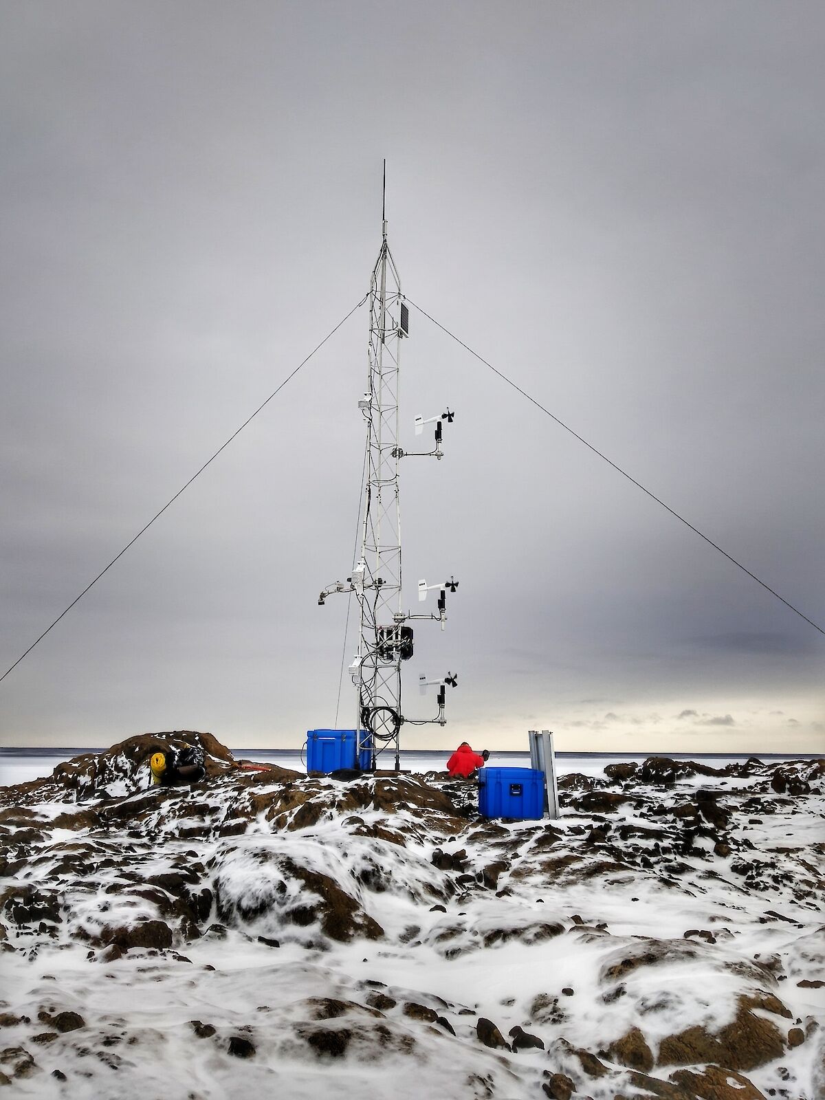
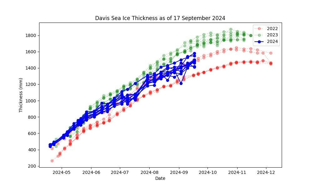
Weekly measurements of the sea ice in the local bay of Davis are carried out. This involves drilling down through the ice and taking measurements of the depth of the ice, the distance of the water within the hole to the sea-ice surface, and the depth of snow on top of the ice.
Recent records:
Davis Sea Ice Summary – 17 September 2024
Max Thickness this week – 1580 mm
Min Thickness this week – 1410 mm
Average Thickness this week – 1488 mm
Last year's average for the same week – 1705 mm
The year before average for the same week – 1369 mm
Last week’s average – 1452 mm
Currently the ice is 217 mm thinner than this time last year and 119 mm thicker than this time the year before. The ice grew on average by 36 mm compared to last week. Another measurement carried out is that of snow accumulation on the sea ice. A 10m square grid is pegged out and measurements are taken at every metre within the grid.
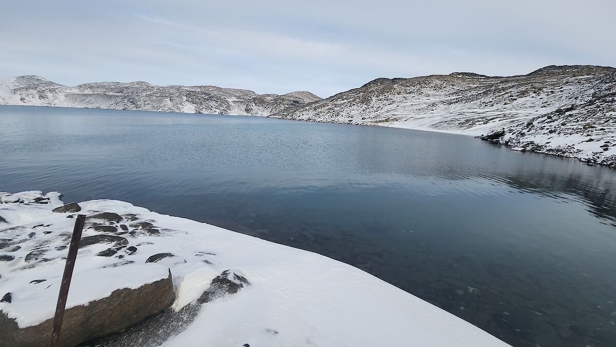
Deep lake measurements, mentioned in an earlier Icy News, are measured once a month. Measurements of temperature and depth are taken. This hypersaline lake contains approximately 270 grams of salt per litre (45 teaspoons). Normal seawater contains approx. 35 grams per litre. At −11.5°C it is so salty it still doesn’t freeze.The unique lake sits at 50 metres below sea level and is 36 metres deep. By the way, the Dead Sea is the deepest lake below sea level in the world at 430.5 m. Lake Eyre is the lowest point in Australia at 15m below sea level. Since 1977, measurements of the water level have taken place and monitoring the water temperature began in 2016.
Recent records:
Deep Lake obs for 14th September, 2024:
Depth: 1.35
Water: −16
Cloud: 7/8
Air: −15
Wind: 8 kt Gusting 20 kt
Expeditioners: Tom Paynter, Peter Rizzo, Russ Sturzaker, Dave Scott
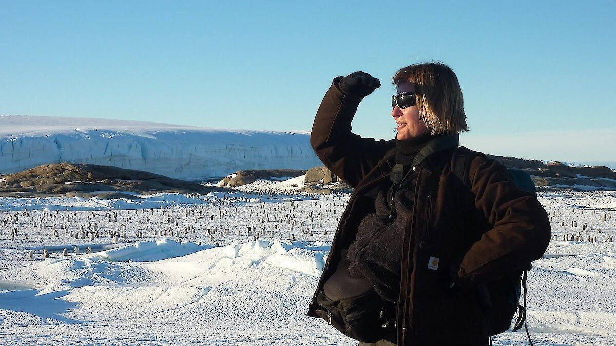
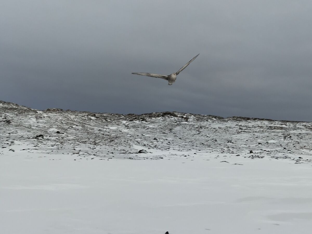
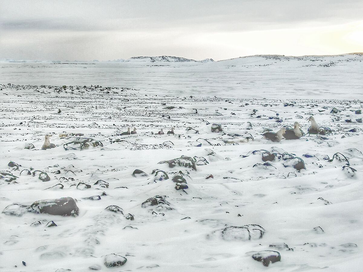
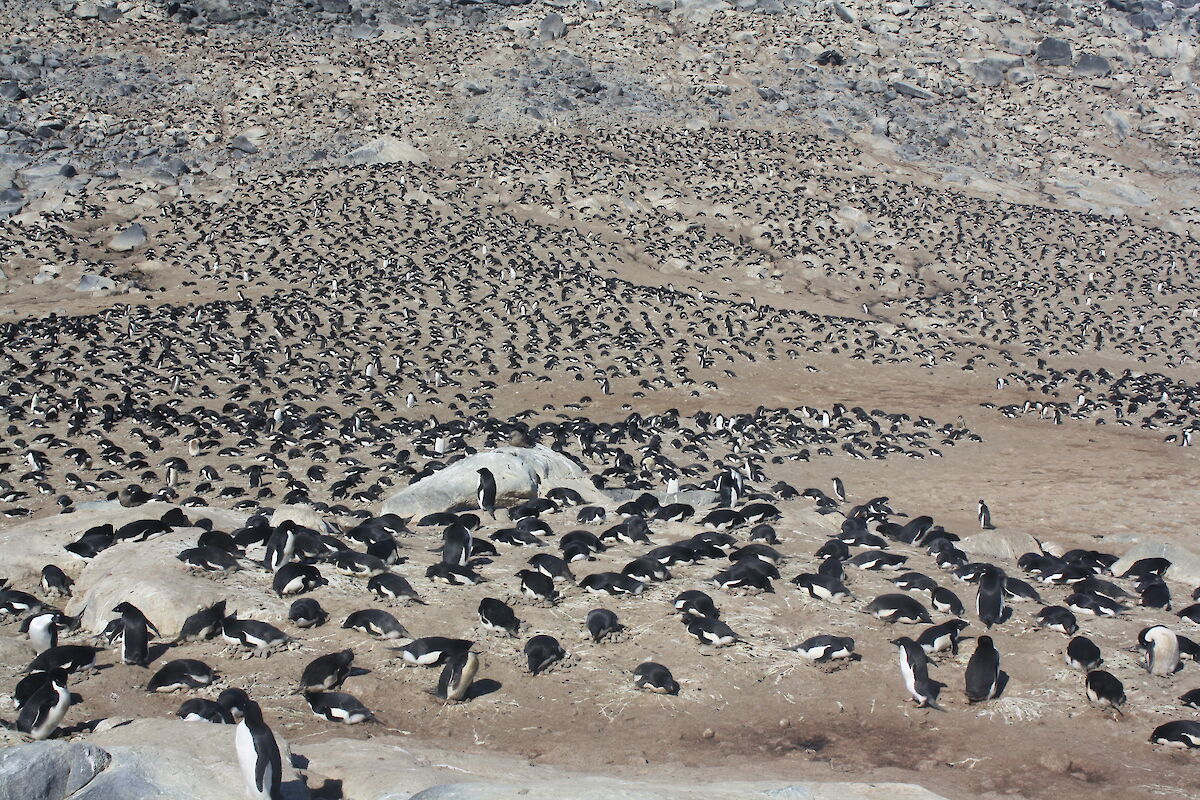
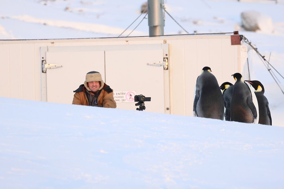
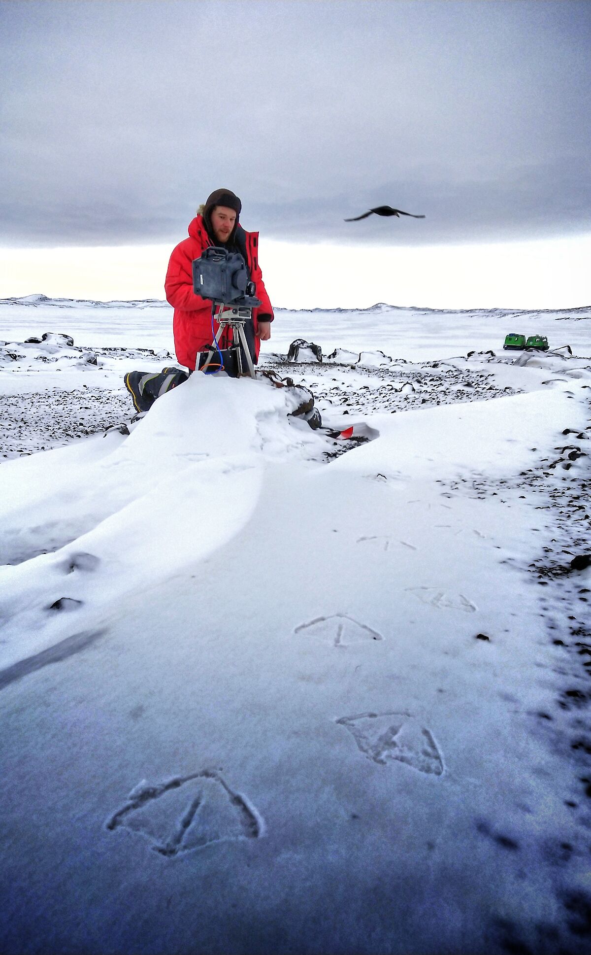
Finally, there are several islands that have cameras installed to monitor the known breeding areas of a variety of birds. Birds that breed in these locations of the Davis region include Adelie penguins, southern giant petrels, snow petrels, cape petrels and Wilson's storm petrels. Some of the islands are classified as Antarctic Special Protected Areas (ASPAs). These areas require permit access for a maximum of two people for camera maintenance and downloading of images. These images are then forwarded to Dr. Barbara Wienecke AAM, senior research scientist and seabird ecologist.
One such island is Hawker Island, approximately six kilometres to the south-west of Davis research station. This island was recently visited in August for camera maintenance. It was a delight to find eight pairs of southern giant petrels at the sight. To note, the sea ice edge was only approximately a kilometre away, providing plenty of food close by despite the lack of ground-based food (like Adelie penguin chicks) which they prey on over the summer months.
In 1994/95 I first met Barbara Wienecke during the summer at Mawson. She had wintered in ‘94, a lot of it out at the Auster emperor penguin colony, east of Mawson, studying the penguins, and I experienced my first winter in ‘95. It was during this time the seed was sewn for me, taking any opportunity to listen to the fascinating stories and information that Barbara passed on. Her passion and enthusiasm were infectious as was her happy bright spirit.
Opportunities became available for us all to assist in the program of monitoring the emperor penguins of Auster colony. Merely sewing some new wind sock-shaped canvas bags to replace old worn, soiled, split ones, that hold and nurture the bird whilst careful measurements are made, was a special way for me to contribute in some way, back on station. Later in the year I was delighted to participate in a 10-day trip to Fold Island colony, west of Mawson. We monitored the movement of birds from the colony and watched where they were travelling to access food, either a tide crack or sea ice edge. Travelling by Hägglunds, five of us camped in polar pyramids, sitting out a two-day blizzard and then with the contrast of stunningly magical weather, we set up weigh points and manually counted the emperor penguin movements from the colony.
The following summer I had the opportunity to stay at Mawson, rather than return to Australia. Three of us were deployed via helicopter to Ufs Island to an Adelie penguin colony. Three penguins were carefully selected. We were to measure and weigh them and investigate their diet. We took it in turn to bivvy out overnight at the colony to keep watch for the returning birds. Once sighted, we would radio the other two camped on the other side of the island who would spring to life bringing all necessary scientific needs to carry out our careful analysis. After seven or so days, the trackers were removed, and we left the birds to their peaceful environment once again.
It has been a delight to play a small but significant part in helping monitor the wildlife, under the wise direction of Barbara Wienecke and careful enthusiastic expertise of Tom P here this year. How far we have come with technology in being able to monitor wildlife with the advancement of digital photography and memory cards!
Davis station does not have an emperor penguin colony close by, the closest being at Amanda Bay some 80 kilometres away to the southwest. Despite this, we have been fortunate to sight these majestic birds on occasions around the Davis region.
The history of the naming of Amanda Bay dates back to August 1957 when a surveying party observed an astro fix at Larseman Hills. During the return flight to Davis Station the area was photographed and named Amanda Bay after the newly-born daughter of RAAF Squadron Leader Peter Clemence who piloted the aircraft at the time. Prior to this in the 1954/55 astral summer the Australian National Antarctic Expedition (ANARE) on the vessel Kista Dan, explored the waters of Prydz Bay and the first landing in the area was made on Lichen Island by a sledging party led by Dr. Phillip Law on the 5th of February 1955.
Amanda Bay was declared an ASPA in 2008 and cameras were installed to monitor the colony in 2011. Prior to this installation, a yearly traverse would set out from Davis across the plateau to visit Amanda Bay and take an annual photograph for a bird count. The first traverse was in 1986 where Antarctic expeditioners visited the colony and continued to occupy the first hut at Law Base which had been established the previous summer.
For those interested in a paper written by Barbara in 2009, it discusses the colony numbers at that time.
The following paper discusses the 12 confirmed emperor penguins colonies in the Australian Antarctic Territory, with the last located in ‘94.
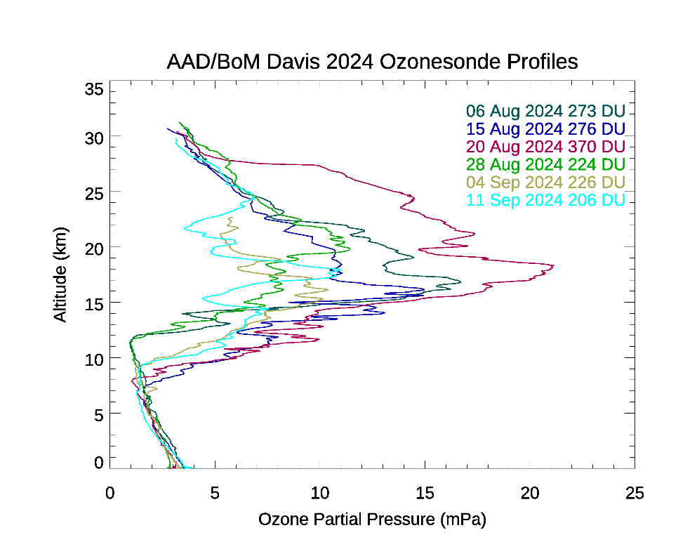
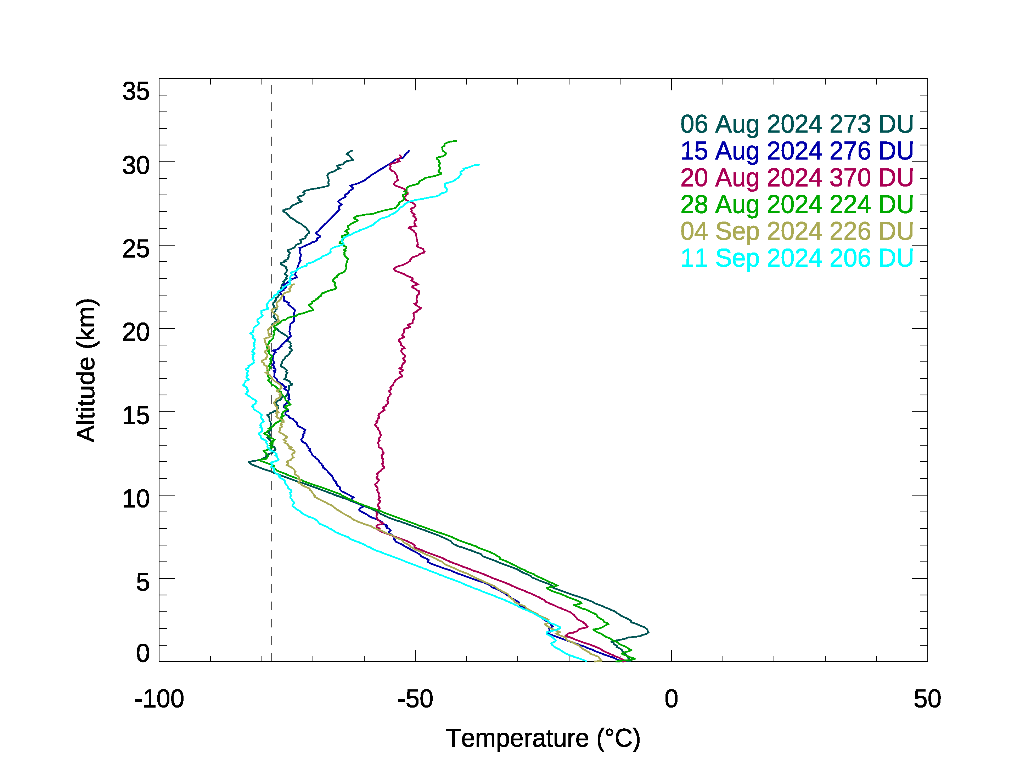
Last but by no means least is the ozone monitoring program. As a member of the Bureau of Meteorology team here again this year, we undertake a weekly monitoring program of the ozone layer using a radiosonde, which is carried under one of our larger weather balloons. On average, this reaches heights of approximately 32 km before it can’t expand any further due to the decreasing pressure and the balloon ruptures and descends. During the ascent and descent, the ozonesonde measures the amount of ozone within the atmosphere it is passing through.This information is then sent to our specialist in Melbourne for analysis where they can look at the changes in ozone from one week to the next and temperatures also recorded throughout the flight through the stratosphere.
Earlier in July and August it was found that the temperatures in the stratosphere were a lot warmer than the average for that time of the year. September however, is showing the temperatures recorded to be more in the average range for this time of the year. The ozone hole that forms over the south pole during the winter months each year, has moved and warped as is does through the winter season. Now with spring and the return of the sun, we see the level of ozone trending downward as the polar vortex containing the air with depleted ozone begins to spread out from the pole as the vortex slows it’s rotation and the air from within the vortex is released.