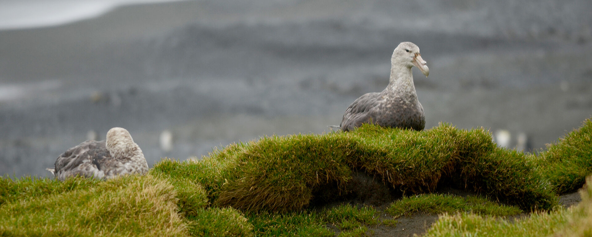
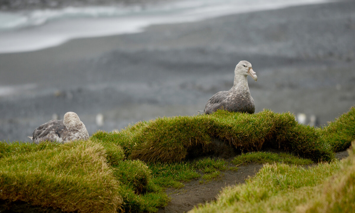
Southern giant petrels at Gadgets GullyPhoto: Cris Howard
This week at Macquarie Island: 12 April 2013
Chris, the TASPWS Ranger, gives us a heads up on the Macca bird count. We also conduct vital search and rescue plus firefighting training. The MIPEP team report on their weekly walking.
A ranger’s diary — bird count project
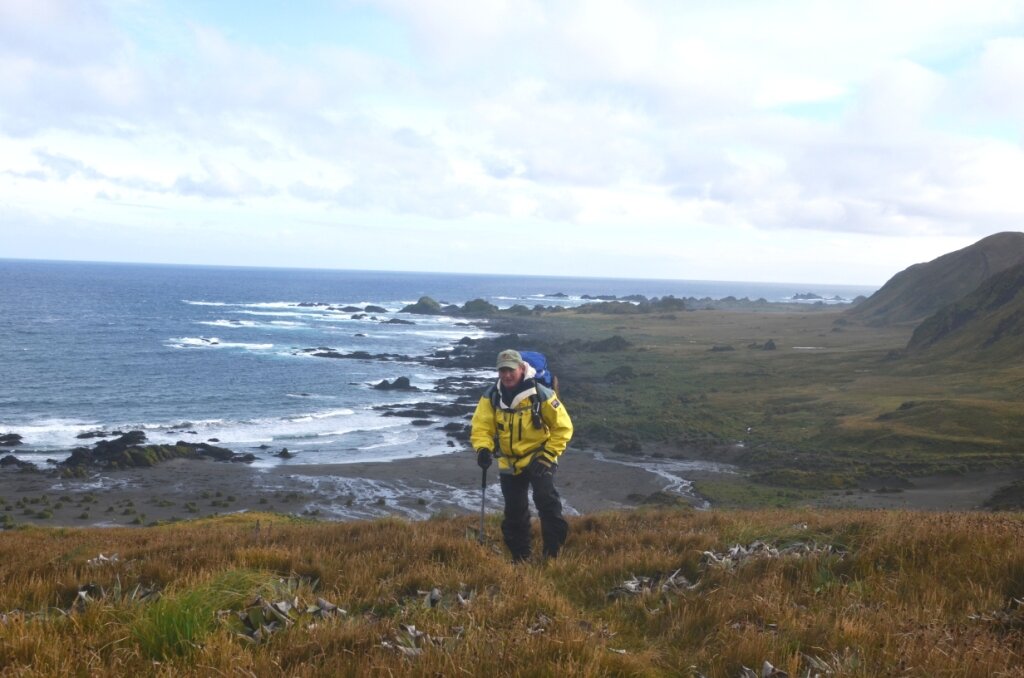
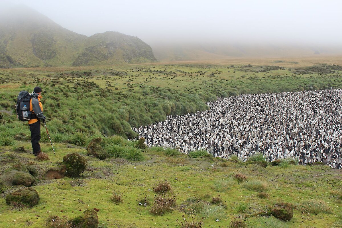
One thing about a ranger’s life on Macquarie Island is that no two days are the same. One day you could be picking up rubbish on a beach on the remote west coast and the next day you could conducting a bird survey somewhere else on the island. One thing in common with both tasks however is the amount of walking involved.
The Bauer Bay cleanup undertaken last week involved a short round trip of about 14 kms. I will walk approximately 35 kms to undertake the monthly bird census around the northern half of the Macquarie island. Next week, I’m off down-island to check the status of the majestic wandering albatross chicks that hatched recently. I’ll cover approx 85 kms on that task — right to the bottom end of the island and back.
The aim of the monthly bird count project is to record the number of birds seen along a given section of the island. A number of different species including: southern giant petrels, northern giant petrels, antarctic terns, Macquarie Island cormorants, kelp gulls, skuas and ducks are counted. Information collected will be passed on to scientists and analysed to determine population trends over recent times.
Seabirds are known to travel vast distances, although some, such as the Macquarie Island cormorant, are known only to this location. As I travel around I also make observations and take notes on general conditions and that of some of the penguins.
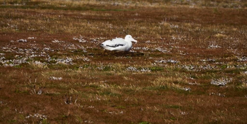
On this last trip I was very privileged to come across a nesting wandering albatross. I carefully withdrew to a safe distance and photographed this bird with a zoom lens. Special measures will be put in place to ensure there is no further disturbance to these critically endangered species.
Chicks of both the northern and southern giant petrels will be nearing maturity soon. The data collected over these surveys will help scientists to understand just how successful, or otherwise, the last seasons breeding was.
Juvenile kelp gulls, now fully fledged, are still very distinctive flying over head in their mottled feathers. Some of the antarctic terns seen on this last trip are in breeding plumage with striking red legs and beaks. Macquarie Island cormorants occupy commanding positions on rock stacks along the foreshore. They are very certain to pick a site that is not exposed to the direct wave action of the ocean.
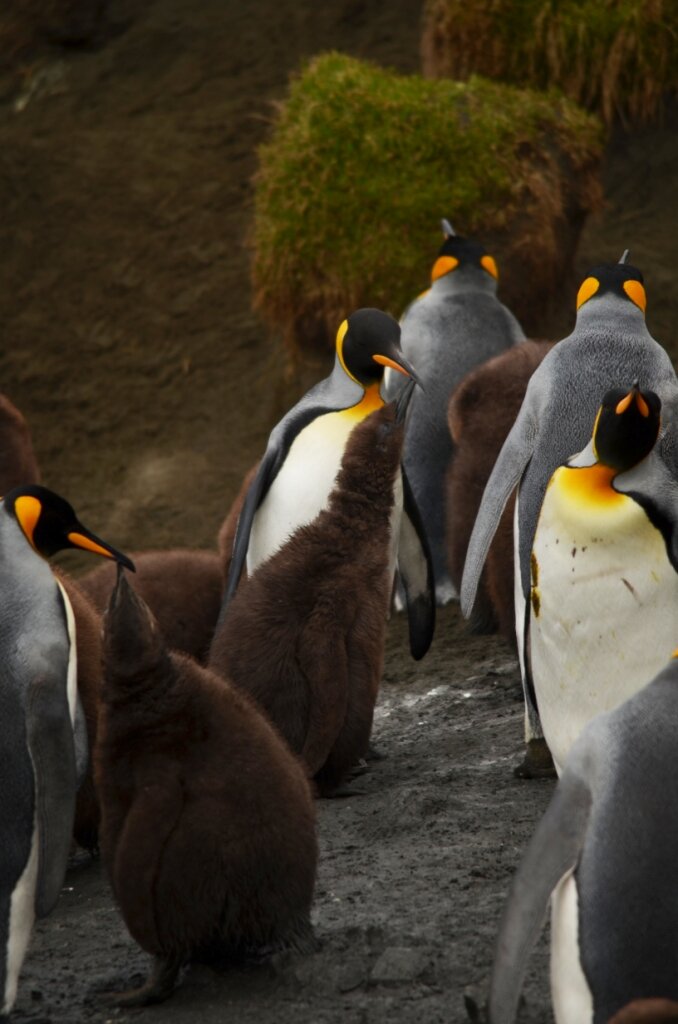
There is always something to be seen at the king penguin colonies. The older of this season’s chicks, in their beautiful chocolate coloured soft down feathers, are all gathering in large crèches getting ready for winter.
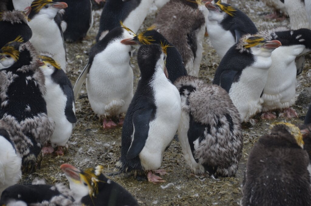
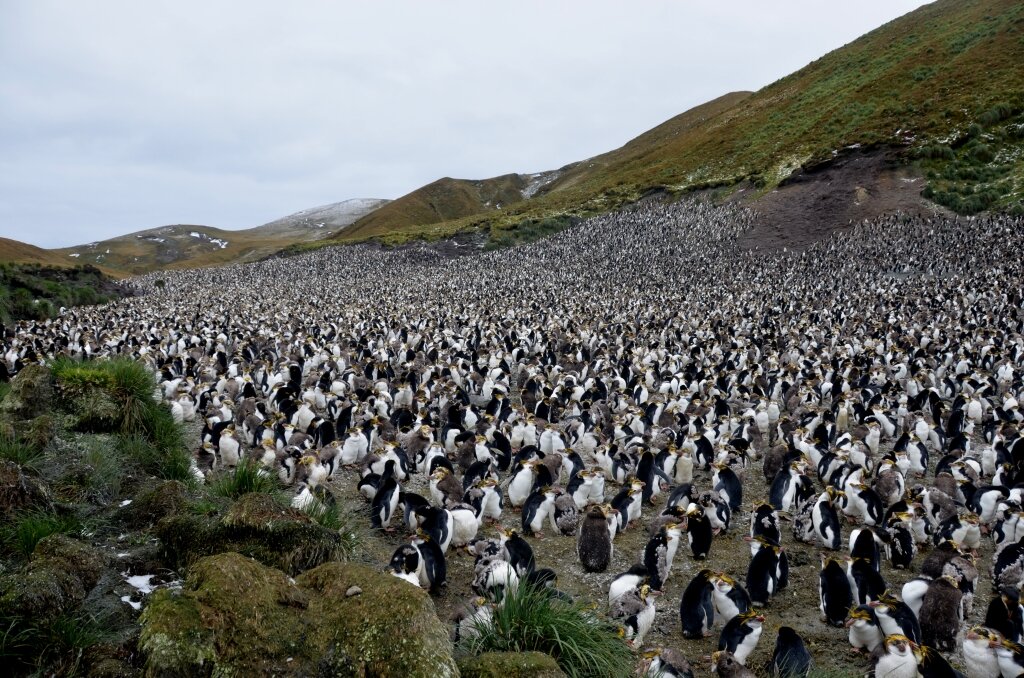
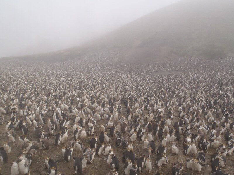
The royal penguins have almost finished moulting last season’s feathers. As you walk down wind of a colony, one thing you can’t help but notice is the amount of small feathers blowing on the wind — just like light snow.
Skuas are now starting to depart the island for warmer parts with the onset of winter. Giant petrel chicks are now starting to fledge. The adults hang voraciously around penguin rookeries waiting for the stragglers to fall behind The ’Law of the Claw’ applies here if you’re a slow penguin.
Chris Howard, Chief Ranger TASPWS
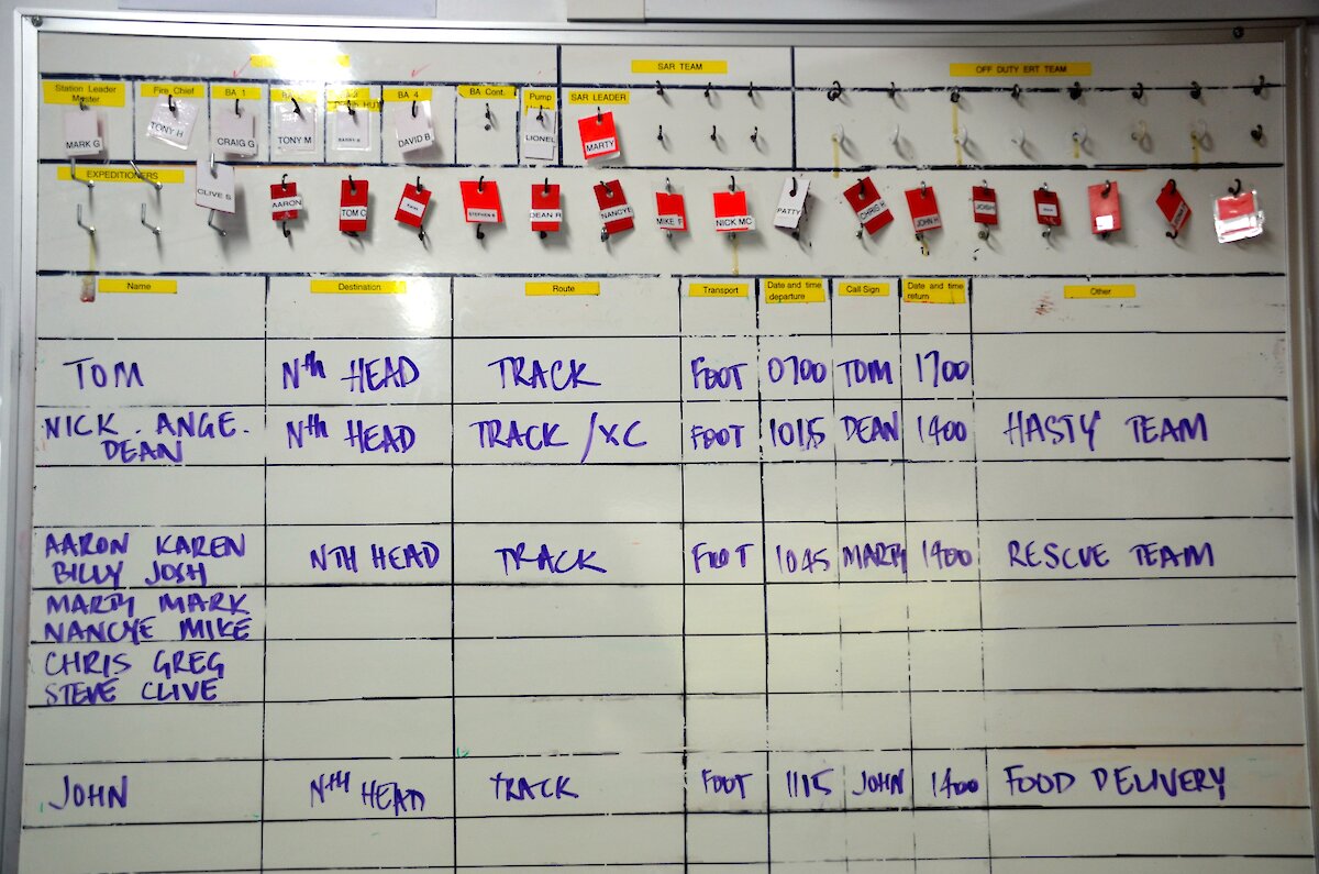
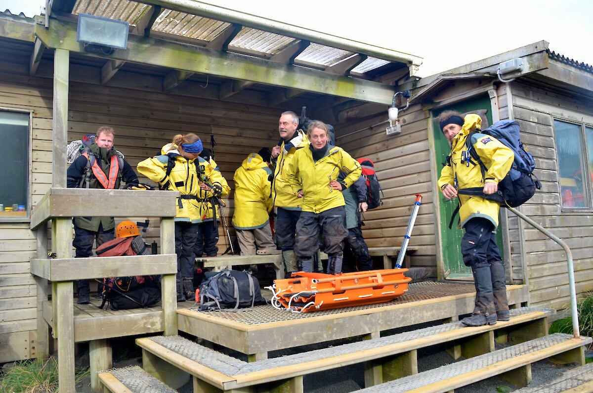
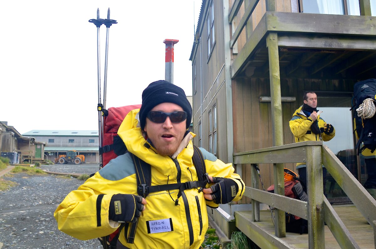
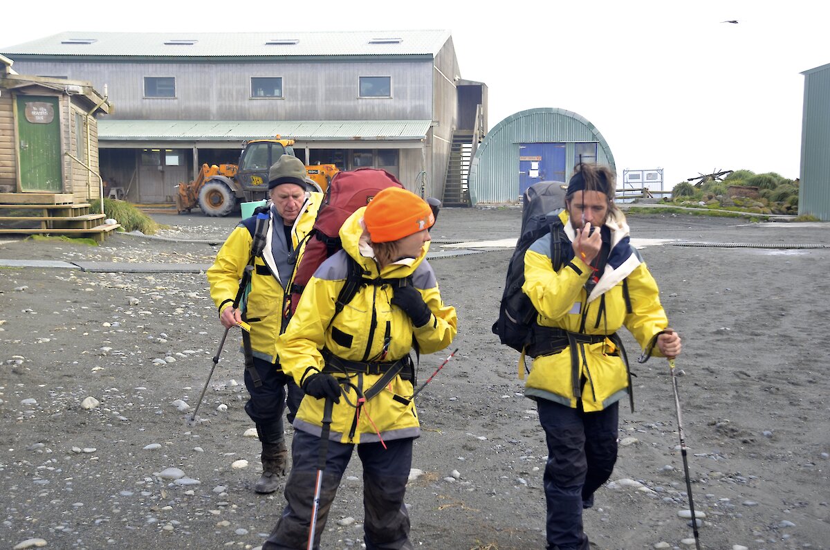
SAR excercise a success
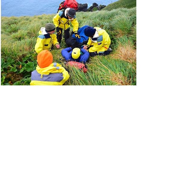
Last week we conducted a field SAR exercise involving everyone on the island. It set up to respond to Tom, one of the MIPEP hunters, who had ‘badly injured his knee’ while working amongst the tussock and cabbage on North Head. Tom, pretending, couldn’t put any weight on his leg so was unable to walk. He was otherwise in good health. He called VJM for assistance, describing his situation and pinpointing his location with GPS coordinates.
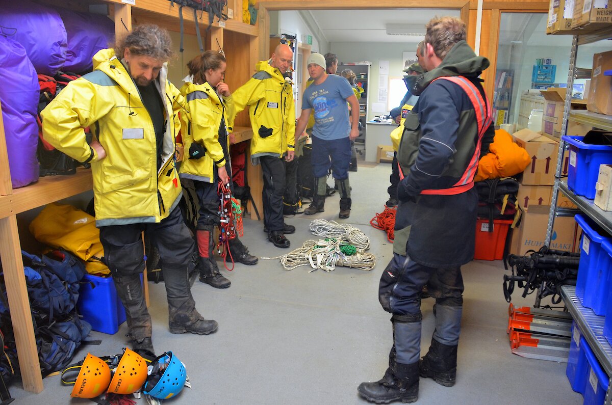
We sounded the fire/SAR alarm to muster everyone on station, then informed them of Tom’s situation. People were allocated to different teams for the response (hasty, rescue, comms, fire and medical) before being briefed and then heading off to prepare for their tasks.
Tony H and Patty worked the radio and incident log in communications, while the rescuers geared up the hasty team of Dean, Angela and Nick so they could get going to locate Tom, stabilise his injury and help protect him from the environment.
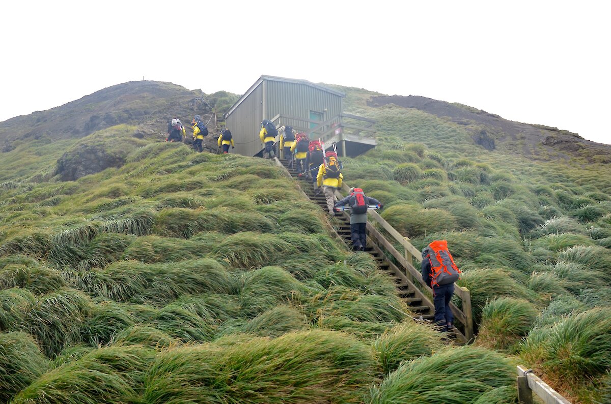
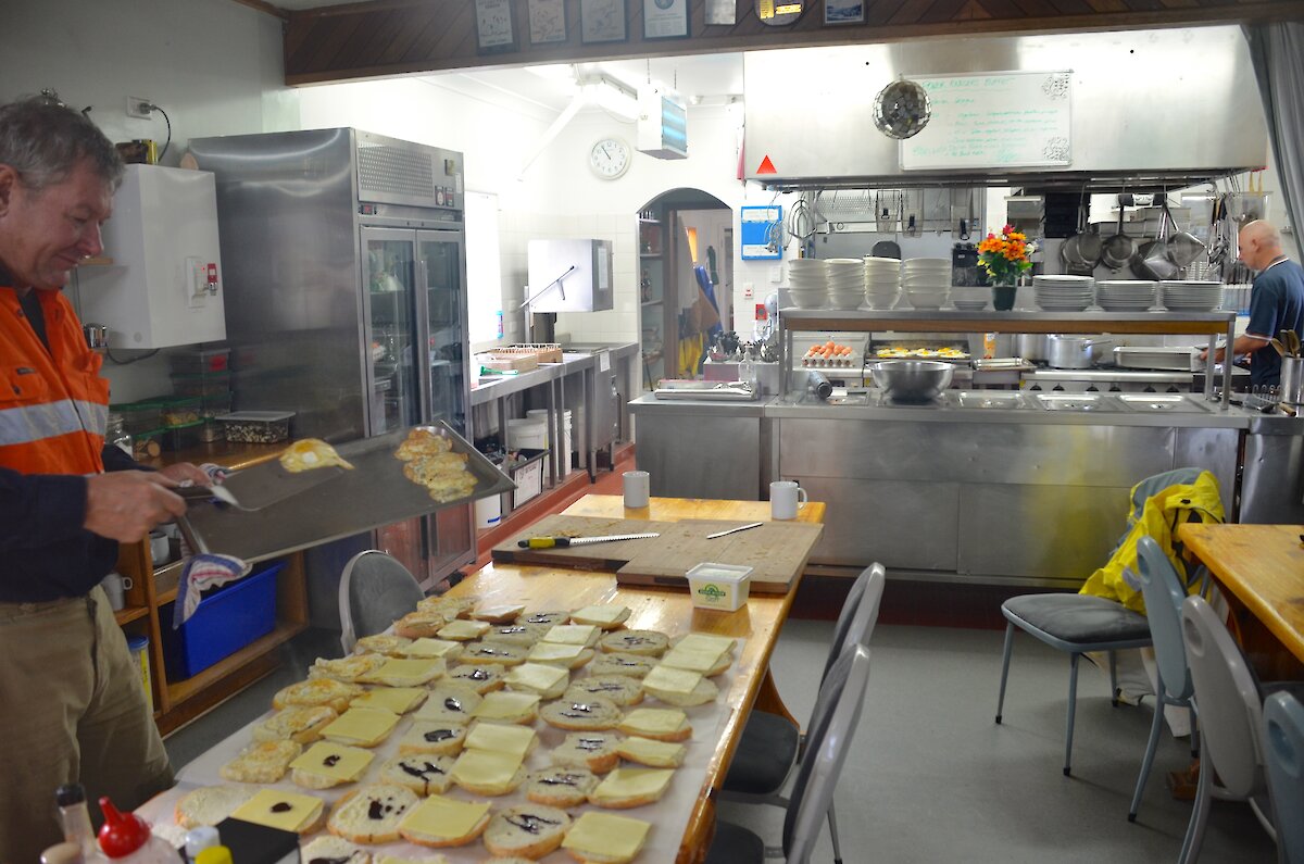
Not long after, the main rescue team of 10, plus Dr Clive, departed station for North Head with stretcher gear and enough equipment to build a rope system to get Tom in the stretcher and down the slopes north of the station. John followed up close behind with warm food for the rescuers, prepared by Chef Tony and others on the medical/fire teams.
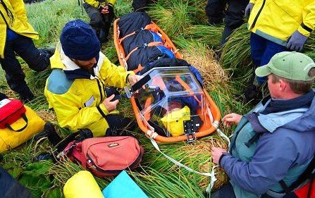
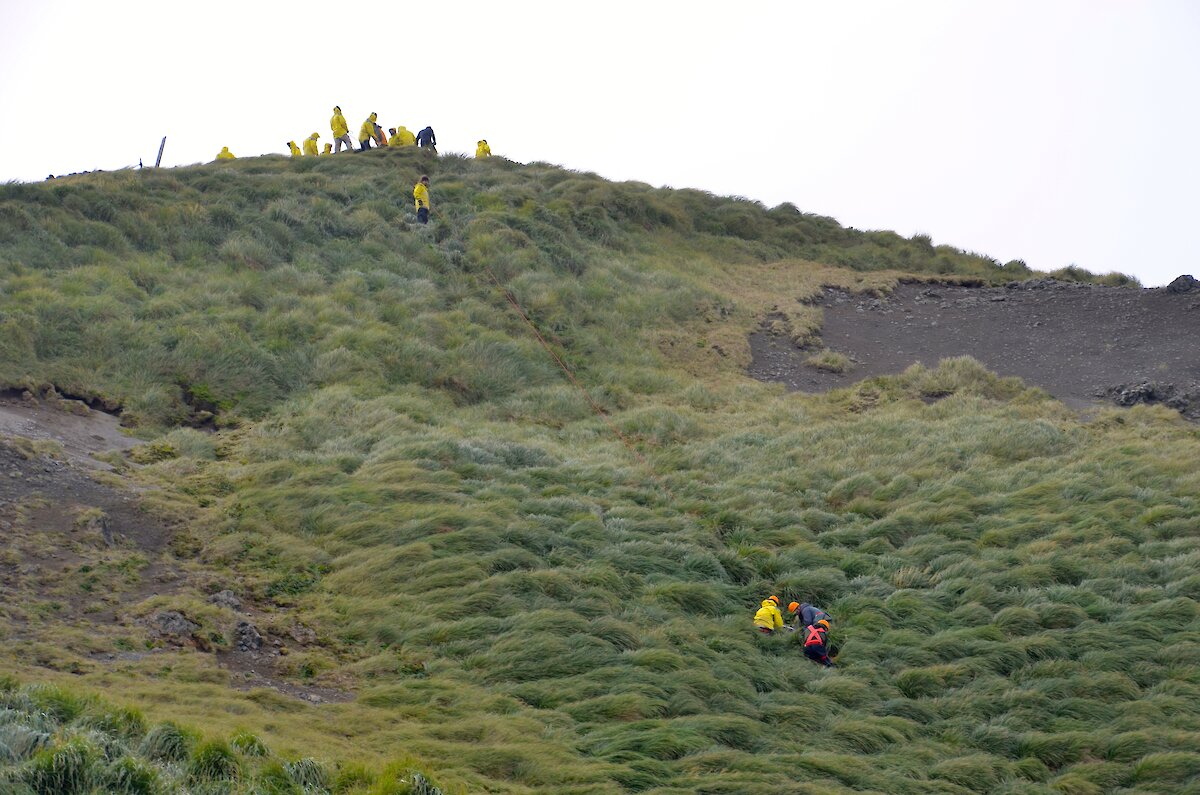
Dr Clive assessed Tom at the scene before the ‘victim’ was secured in the stretcher for the carry and lowered back to the station. A dozen or so people worked to carry the stretcher along the track and over some difficult terrain to the site chosen for the slope lower.
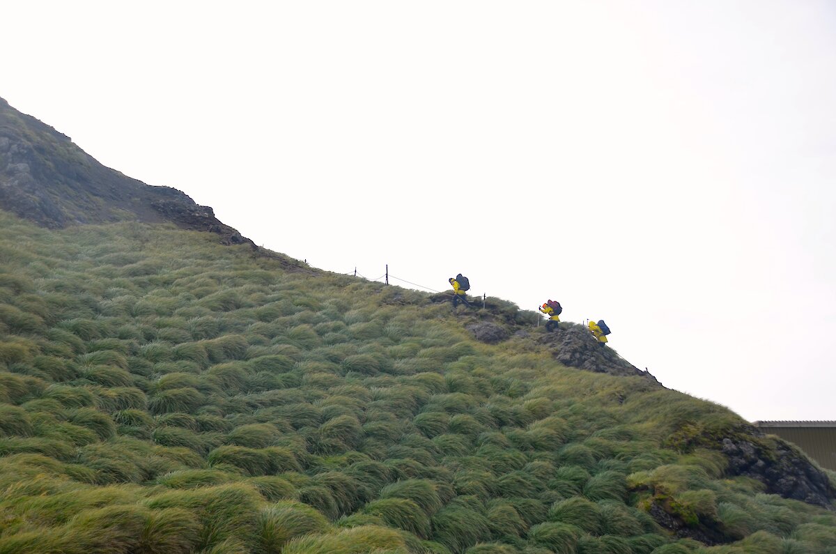
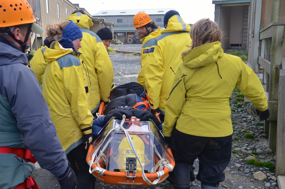
Anchors were set up, stretcher attendants were readied and secured to the stretcher and the team began lowering Tom down the steep, waist-high, tussock grass slope toward the Garden Cove end of the station. Once at the bottom, the team manoeuvred the stretcher through the tussock, onto the station and over to the surgery.
It was a successful exercise and an important reminder of the work required to retrieve an injured person from the field on a hilly, Southern Ocean island with no vehicle transport.
A new team out in the field — a word from Dave
Field training is one of the essential parts of being an AAD expeditioner. After all, it is the first time that we set foot off station to explore our new home.
Craig (BOM), David (BSS/DSL), Tony (comms) and Marty (field training officer or FTO) set out on one of only two means of transport on the island — size 10, 9, 8 and 7&1/2, brands varied but the results were the same. Place one in front of the other, make sure that the fuel was correct for the job. In this case it was three cupcakes, two coffees, one ham and cheese toasty and two sultanas.
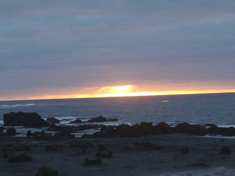
Day one: mild conditions prevailed light winds and almost clear skies, our first encounter with the real Macca come near Lake Scoble when the nice level track turned into the boot-sucking, pole-sinking mud that was to be the norm rather than the unexpected on this trip. Bauer Bay hut, nestled back from the beach on the west coast of the island, was on this day remarkably calm with skies almost clear enough to get a sunset.
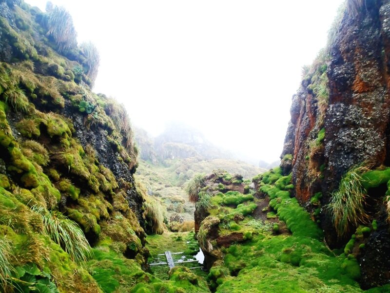
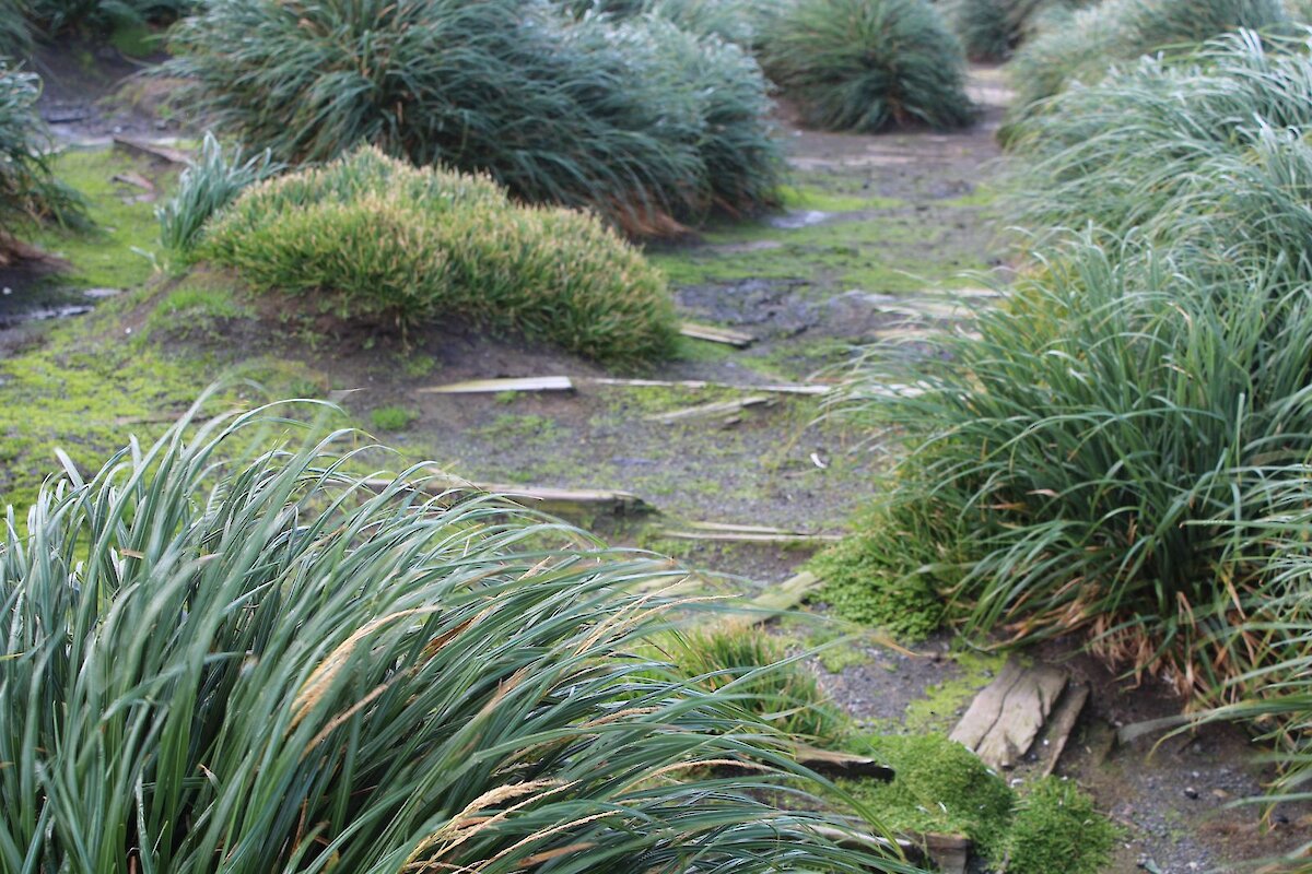
Day two: we were greeted by mist and low cloud, much more like the Macca that we have been told about. We were able to head along the Aurora Cave track that had just been opened to expeditioners now that the giant petrels had finished nesting, a great walk with our first experience of feather beds — like walking on two mattresses that have been filled with water and then covered with nice green plant life giving it the look of solid ground, ready for that moment in lack of concentration while you gaze at the scenery to suck your boot off or devour your leg up to the thigh. So many things to talk about on that day’s walk, it will have to wait for another day. for that moment in lack of concentration while you gaze at the scenery to suck your boot off or devour your leg up to the thigh. So many things to talk about on that day's walk, it will have to wait for another day.
Day three: we were now on the east coast at Brothers Point hut, the closest hut to station and the starting point for the walk along the eastern beaches back home. Lots of wildlife, ocean views and lots of talk about dangers, procedures and history of the area from our walking Macca encyclopedia Marty as we sauntered, staggered and stumbled our way through the ever-changing terrain amongst the wildlife that makes Macca the special place it is.
Tony’s field excursion
Here at Macca (Macquarie Island) a good day is one that has little wind, no snow and temperatures above five degrees Celsius. Travel on the island can be difficult and not without discomfort in the form of cold and wet.
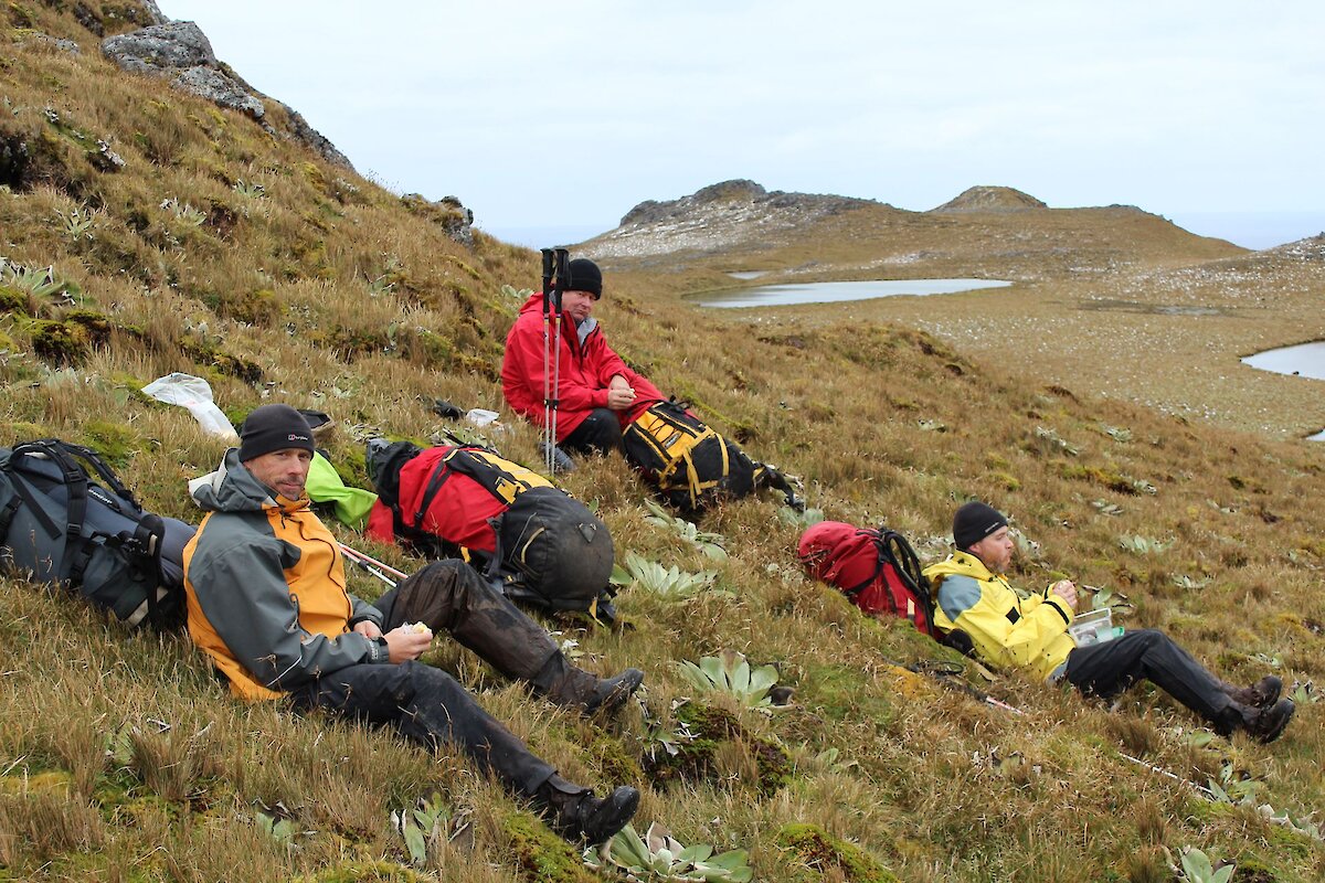
To assist in preparing all personnel on the island for travel, both for work and recreation, each person undergoes training by an experienced field training officer. Our group had it all, Marty (FTO), snow the day before, a mild wind (mild for here at least) and even the sun made an appearance or two. Then there was us three keen students - David, Craig & myself (Tony).
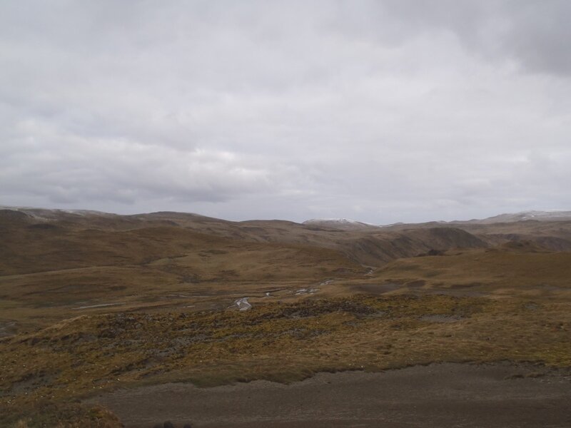
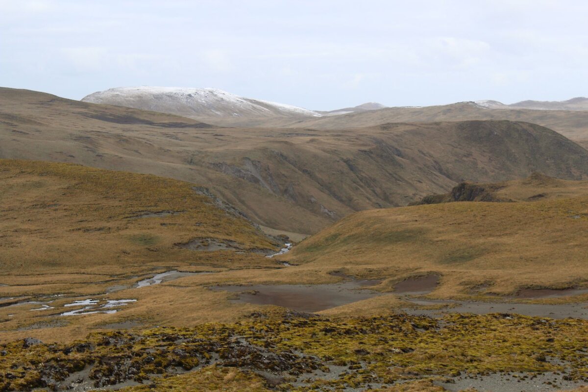
The island is mostly a plateau ranging from about 200 to 300 meters above sea level and falling very steeply to sea level around the coast. Once on the plateau the going was not as expected. Instead of firm ground underfoot, the ground was saturated with either puddles or mud pools which could and did easily fill your boots. With a high rainfall, little sunlight and a deep layer of moss and other vegetation the ground stays saturated even high up on sloping ground where one would normally expect to encounter firm ground.
High up on the plateau we followed the island Lake Track past Scoble Lake while along the route Marty imparted his knowledge about the various aspects of island travel. We stopped for lunch on the sheltered side of a small hill to keep out of the bitter southwest wind. The panoramic view enhanced by the light dusting of snow from the day before made this the best lunch room ever.
After a short break we were on our way again checking the map and verifying directions to points of interest on the way. The landscape was varied with some firm ground and rock under foot, but the norm still wet and boggy.
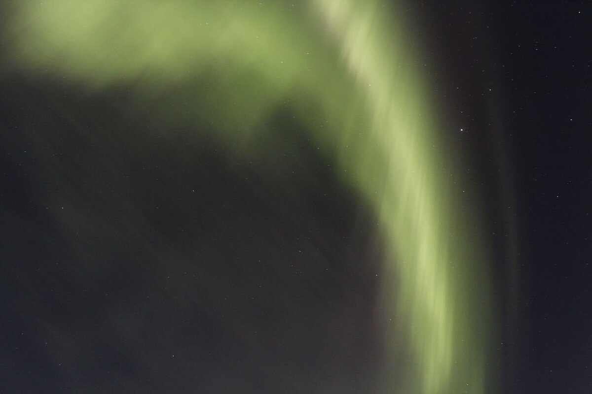
Nearing the day’s end, we dropped down off the plateau on to the beach at Bauer Bay to find our shelter - a small but well provisioned wooden hut with all the comforts of home. That evening gave us a striking display of aurora Australis — green formations dancing in the sky. We captured a few photographs but some taken by others that night from the station were stunning.
Day two dawned and so did another revelation, that the boggy ground we were concerned about yesterday was of no significance compared to walking on the featherbed. I don’t know why but they call the path a track. You walk on moss and grass that is super-saturated, such that the ground is like walking on a giant waterlogged sponge. The catch is that ‘the sponge’ is not continuous, it has gaps and weak points in it where your legs and feet disappear. Water pours into your boots and the suction holds you fast until you compose yourself enough to regain your footing above the surface again only to blunder into the next hole to the amusement of the others.
While wet, the landscape yet again was both different and spectacular. The royal penguin colony contained thousands of penguins looking cute and smelling foul! Penguins were all the way up the plateau.
Brothers Point hut (on the east coast) eventually emerged from the mist, looking rather like a flying saucer. This hut, being built of fibreglass, reverberated in the wind much more then Bauer Bay Hut which lies on the windy west coast. More information pertaining to hut living was given, a substantial meal followed by the all important radio ‘sked’ at 1900.
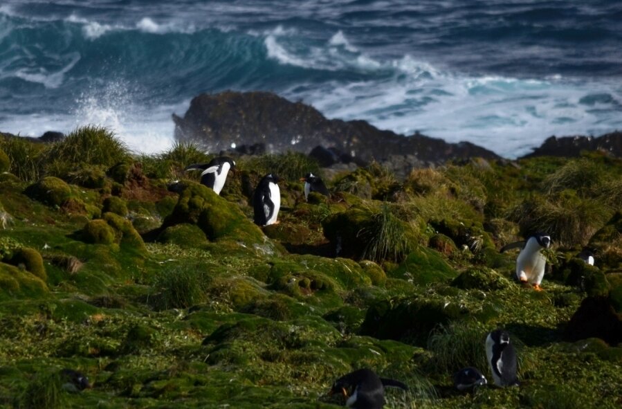
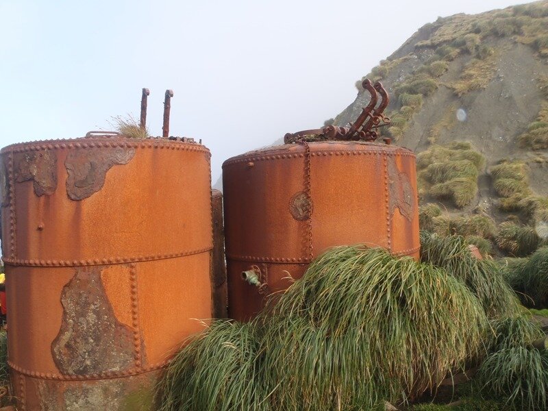
Our last day of the trip dawned as another typical day — wet cold and misty. We headed off up the coast to encounter yet more penguins: royal, king, and gentoo. The rock hopper penguin lives in more difficult terrain is not as easy to find. We passed the remains of a hut built by sealers who turned their trade to penguins when the seals dropped in number. By this time we were enjoying a pleasant day, the sun was shining.
Before we reached the station we encountered a strong wind and had to don our goggles for protection from the wind-blown sand. Finally the station was in sight as was a well earned shower and laundry facilities.
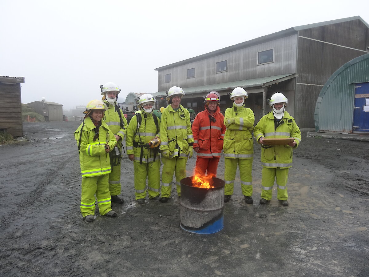
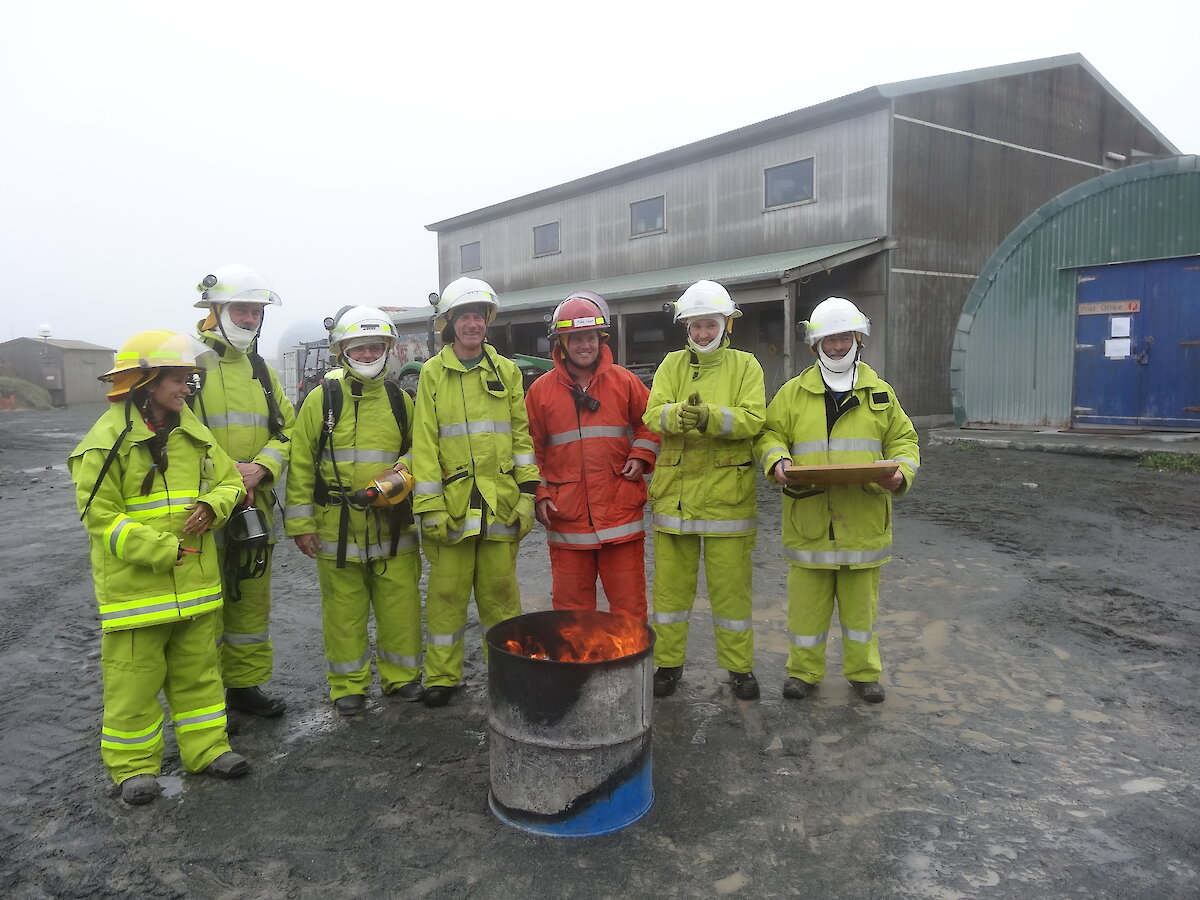
Calling on the fire team
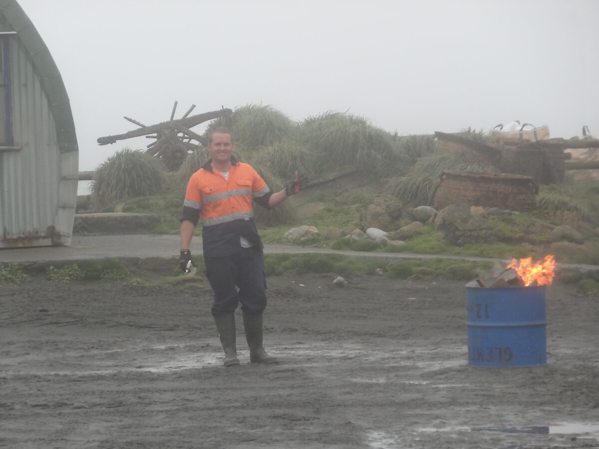
On Friday the 5th of April the sirens sounded and we were alerted to a suspicious fire in the Macquarie Islands base courtyard! Who lit the fire is still unknown, but speculations are flying.
Our fire team comprised of Josh as fire chief, John, Lionel, Aaron, Barry, Greg and Patty, were stopped in their tracks and thrown into action! Luckily that same morning there had been training for some. The team gathered at the fire hut and proceeded to get dressed in the appropriate gear and moved expeditiously to their positions awaiting further instructions. All protocols were followed and Macquarie Island was ‘saved'! Further investigations are continuing to establish who the culprit is and there are two characters in question.
Suspect 1: The Fire chief himself - some say that most pyromaniacs involve themselves with fire teams.
Suspect 2: Macquarie Island’s one and only leader. Some say they spotted him looking in the mirror in the costume room impersonating the fire chief and looking for clothes similar to that worn by the fire chief.
If any of you out there have any information, we ask you come forward.