
Three for Lee
Three for Lee
A Wise Old Owl (in the form of a bearded Field Training Officer, and with a hair bun – no judgement) once told me that they live their Antarctic station life following a daily idiom that even Confucius would be proud of. It goes something like this; “When on station do something for yourself, something for your team and then something for the community’’. That Wise Old Owl should know as he’s been frequenting seasons on the frozen continent since the late eighties…
Anyway, that ‘Wise Old Owl’s’ three-tiered personal code resonated with me, and I try to do just that – it just seems sensible.
And so, in typical FTO fashion (as the appointed ‘jolly master’, ‘jolly meister’, ‘master of the jolly’ or whatever title is thrown around daily) and with an enthusiasm to be out in the Antarctic mountains, the ‘do something for yourself’ part effortlessly morphed into the goal of climbing the three highest peaks of the nearby mountain ranges – collectively named the Framnes Mountains. I appropriately named this little venture as ‘Three for Lee’ - in a symbolic and yet unmistakably selfish way. Of course, I somehow managed to validate this self-interest by inviting other expeditioners into the mix - clearly satisfying that Wise Old Owls rhetoric of ‘doing something for the team and the community’. See what I did there? Yep, you’re welcome…
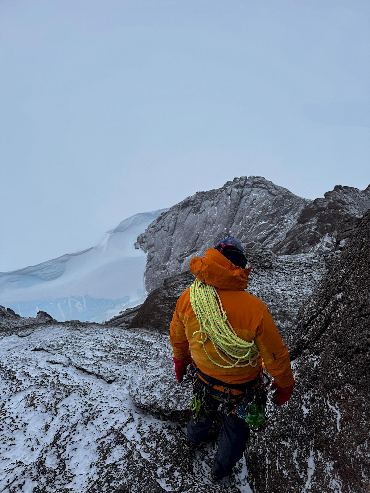
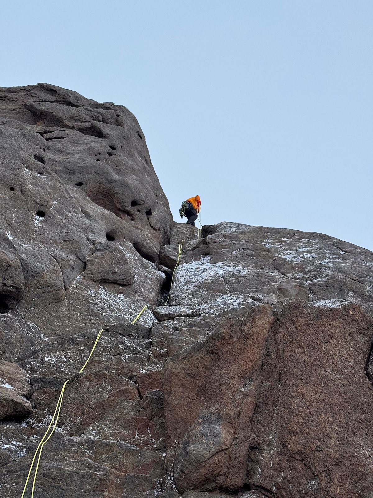
Some of the mountain peaks here are merely walk-ups - which is to say they require nothing more than two feet and a heartbeat. Others, are simply scrambling which require a common-sense approach plus two feet and a heartbeat (the jury is still out on the former). While others require some multi-pitch climbing skills and experience.
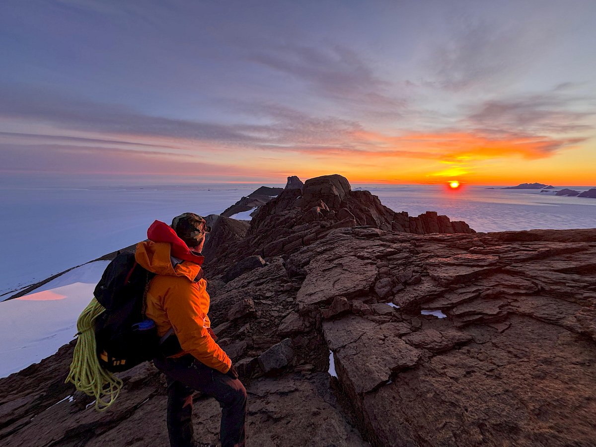
Geographically, there are three accessible mountain ranges close to Mawson Station. To the east is Goldsworthy Ridge (basically a range). The highest peak there is Mount Henderson (lovingly referred to as ‘Hendo’ of course). At best it’s a low-grade scramble. But it is charmingly exposed. The unobstructed katabatic winds generally come from the south-east travelling hundreds of kilometres – until they hit Hendo of course. As such, it pays to have the right conditions otherwise it can get a wee bit blowy. The Hendo summit commands magnificent views from the coast to the interior. At only a cheeky little 951 metres in height - it is possibly the most popular peak to bag for the locals. But, while it is a pleasant climb, it is no walk in the park at -25 degrees Celsius, 15 knot winds, a light snow cover and three hours of daylight to complete. With numerous false starts due to weather - well done to Tom, Mitch and Di in seeing it through! Box ticked.
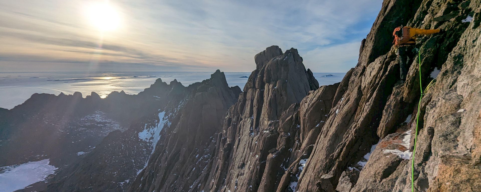
In the centre is the Masson Range. This range extends for around 20 kilometres and is orientated vertically from north to south. It is divided up into the North, Central and Southern Masson's.
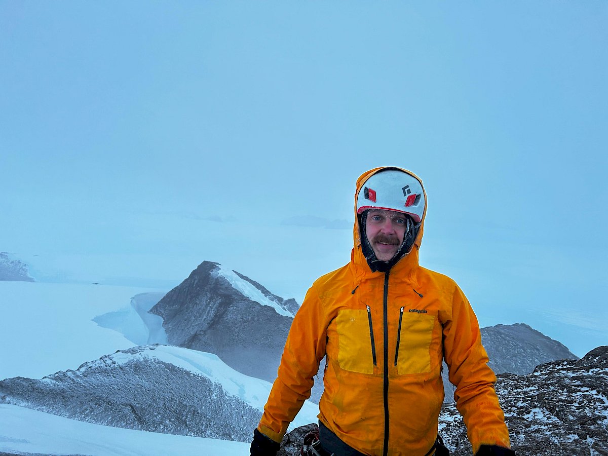
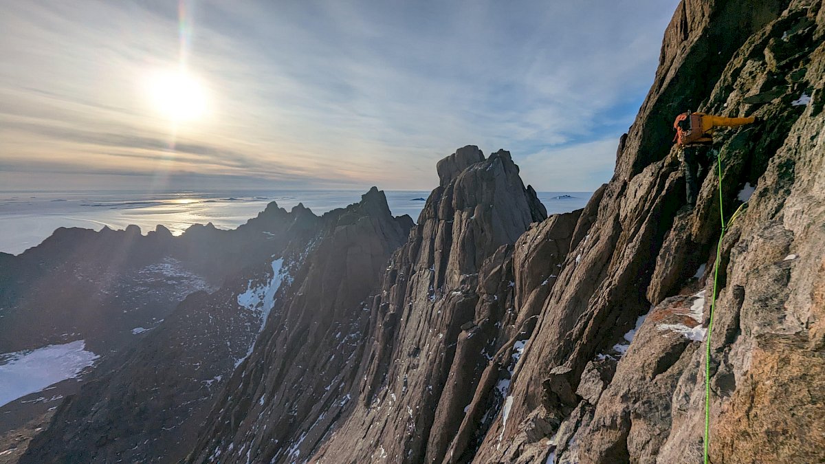
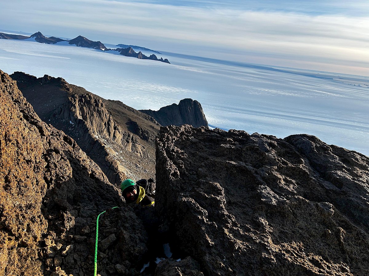
Mount Ward is located within the North Masson Range and is the highest at 976 metres. It’s a six-pitch beauty! The approach and climb is on the western face, and therefore relatively protected from the weather. A magnificently exposed climb full of traverses, scrambles, climbs, rappels and requiring a little bit of funky footwork. Views from the top are remarkable. There is even a small vintage tobacco tin which expeditioners sign upon summiting, and that dates back to 1958! The most recent entry into the tin, except for ours, dates back to 2017. Box ticked – well done Bela!
Moving next to the Central Masson’s, which are unfortunately unreachable due to crevassing along the designated route – but there is one peak there that has caught my attention. Shhhh…
Along to the south, it stands to reason is the South Masson Range. There is a peak known as SM-4 standing at 1004 metres. Allegedly, it is unclimbed and therefore unnamed (except for its South Masson peak four designation, hence SM-4). I think that needs to be changed! Watch this space…
However, the next range which parallels the Masson Range to the west is the David Range. A 13-kilometre string of nunatak peaks within the Station Operating Area (the ‘SOA’). Fun fact - this range does extend outside of the SOA which means any access demands paperwork and authorisation - a six-month work in progress. News update – seven months now. Mount Hordern at a height of 1444 metres is to be found there. It is on the cards - but not until it gets signed off.
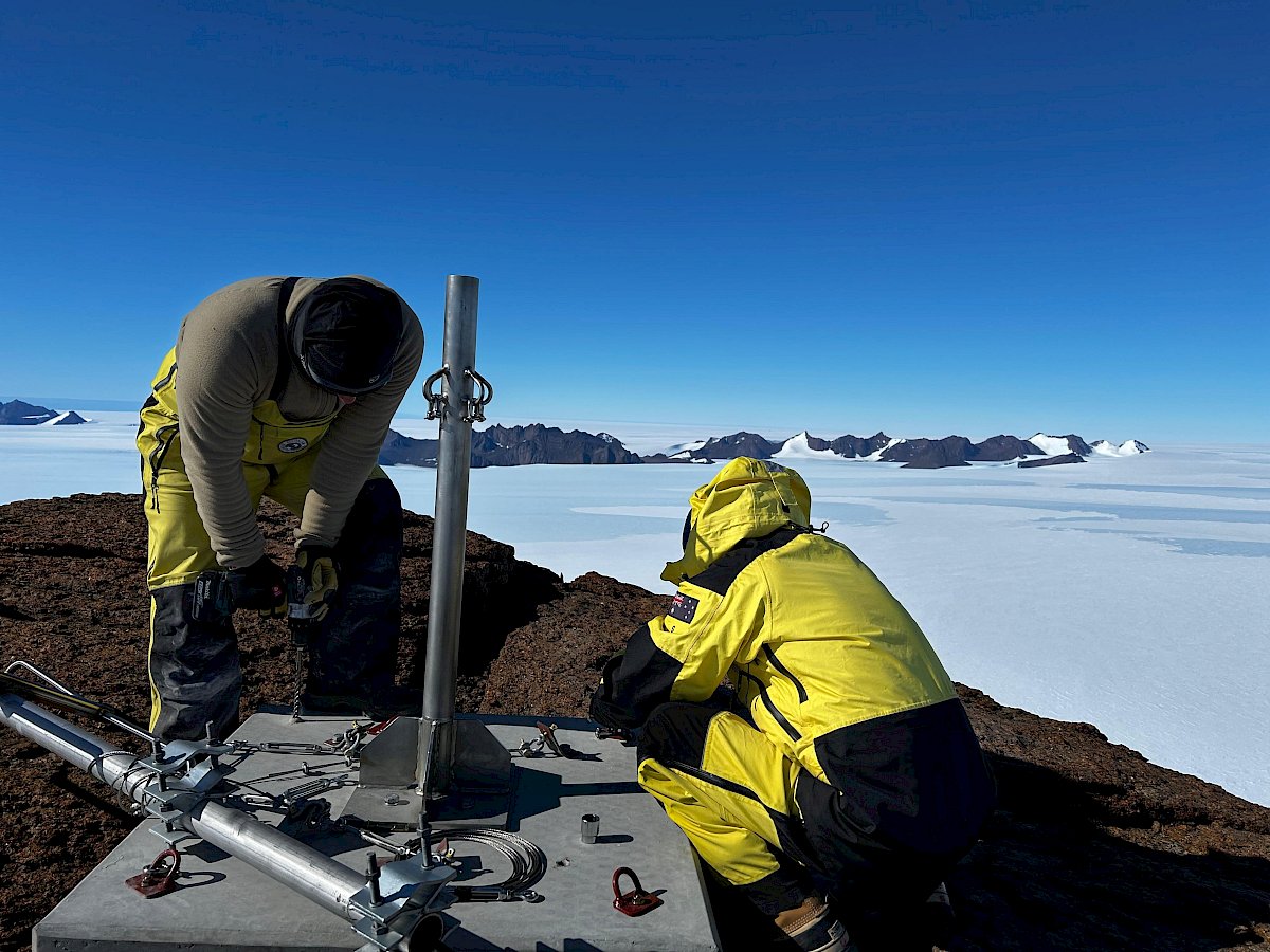
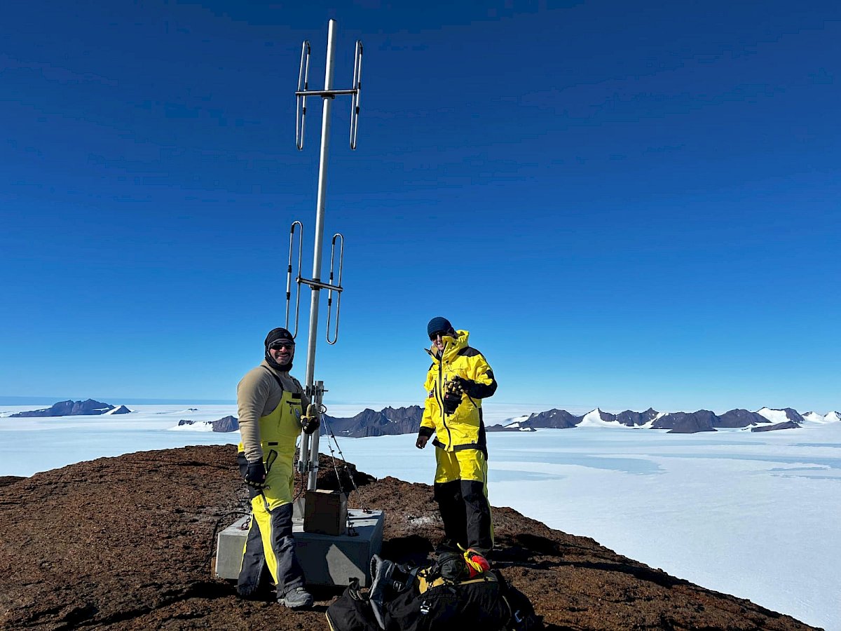
But I digress, back to the SOA: there is a string of pleasant walk-up peaks. They offer everything you expect of an Antarctic mountain summit. One of which is Mount Parsons at a jaunty little 1060 metres. There is a communications mast upon the summit which was about a good an excuse as any to get up there on a ‘repair mission’. A very basic ascent on pea gravel, and a great team effort from the mountain goats Lockie and Danny! Box ticked.
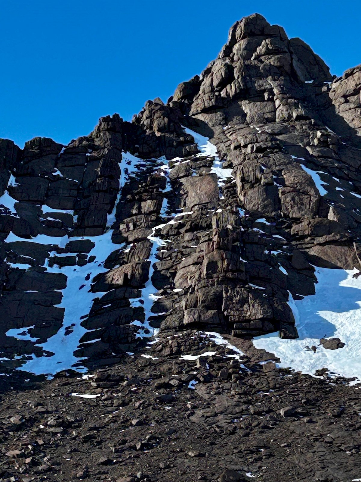
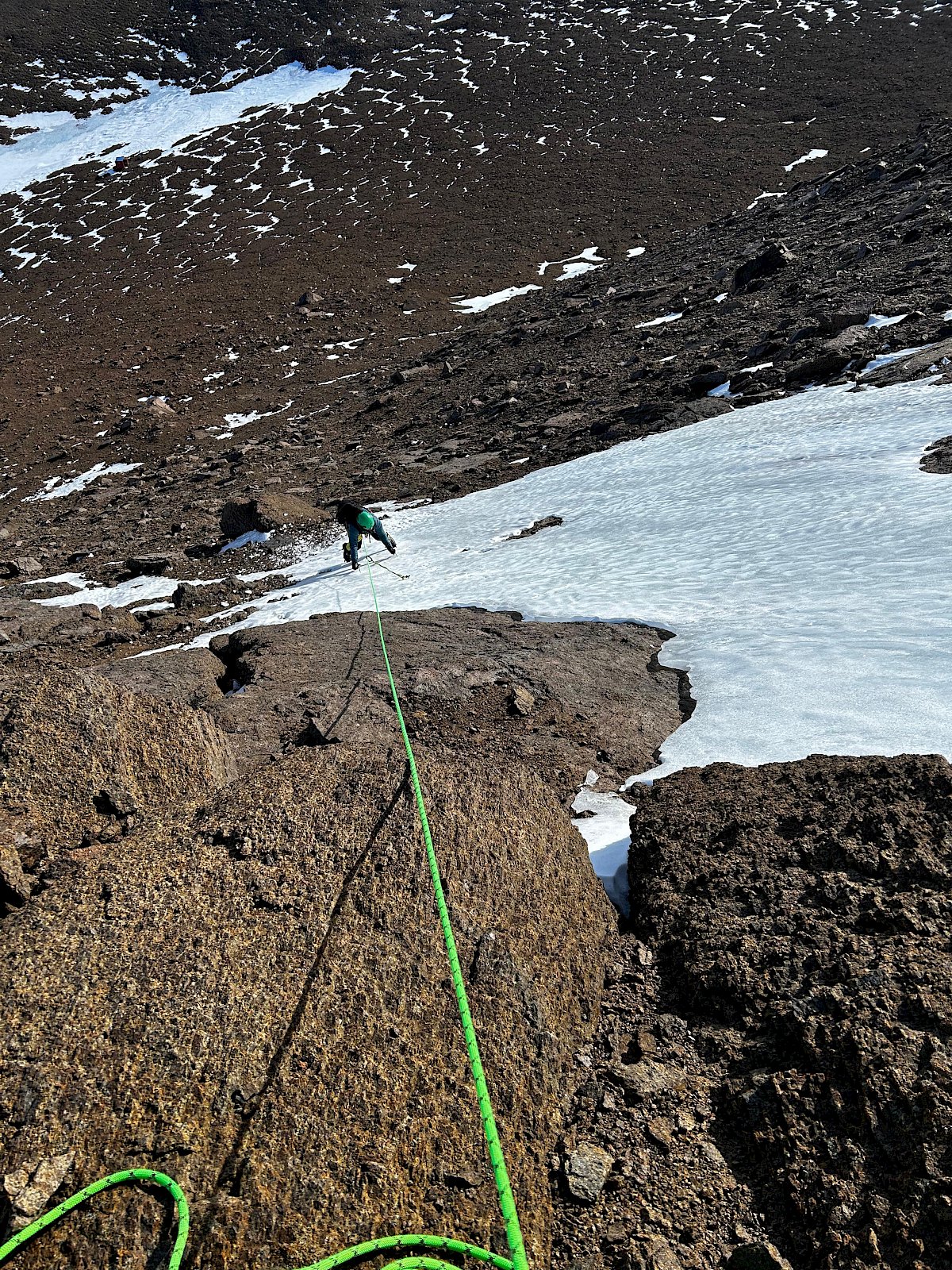
Fang Peak is another straightforward ascent within the David Range fittingly named after its resemblance to a dog tooth (abstractly – well sort of…). Topping out at 1032 metres, it is certainly not the highest there. The most common summit approach is a walk-up along an exposed ridge with a sprinkling of scrambling nearer the ‘pointy end’. However, Bela and I decided a west face ascent on mixed rock and ice would put the ‘dog tooth’ to bed. Nothing to report there, except my poor ice climbing technique and sore calves for the next week! Box ticked.
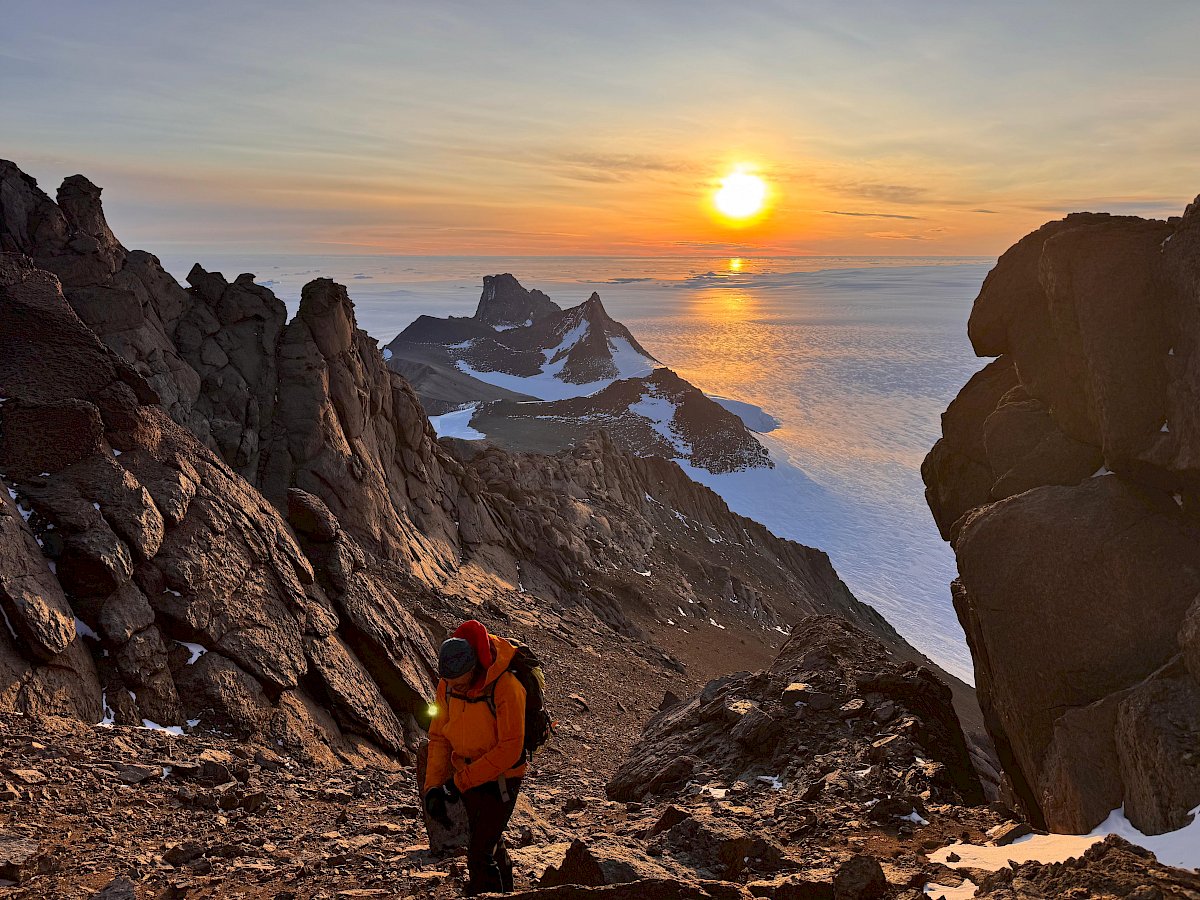
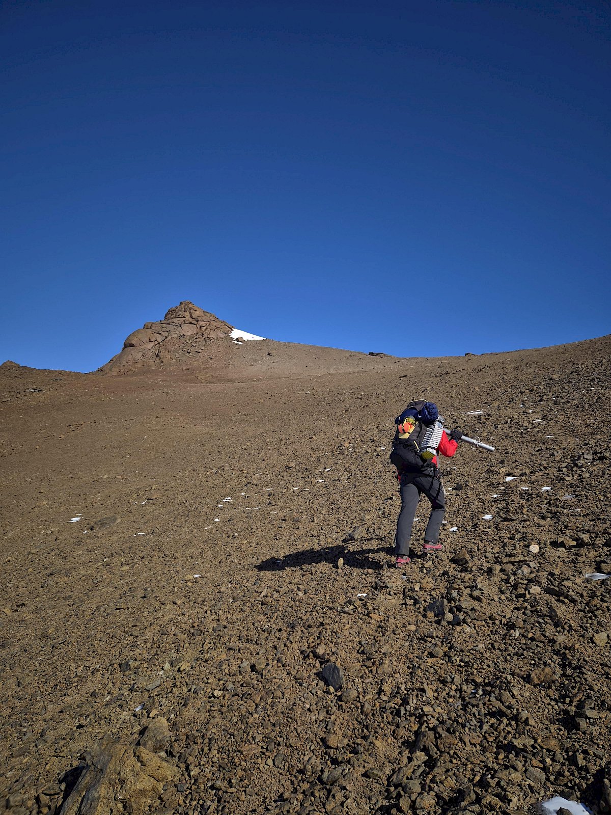
But, its Mount Elliot tipping the height scale of 1237 metres as the accessible brute of the David Range. A magnificent walk-up along an exposed narrow ridge into a nice col and up on through to the summit. A bit of snow here, a bit of ice there, more pea gravel and an enjoyable little scramble at the end. Again, amazing views from the top and well worth the effort. Box ticked!
Next on the cards is Mount Hordern…for the community of course…
Lee Warner - SFTO Mawson