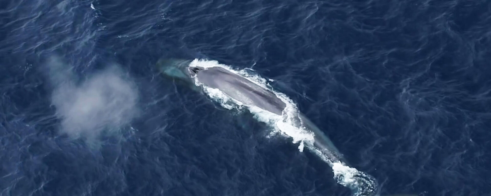

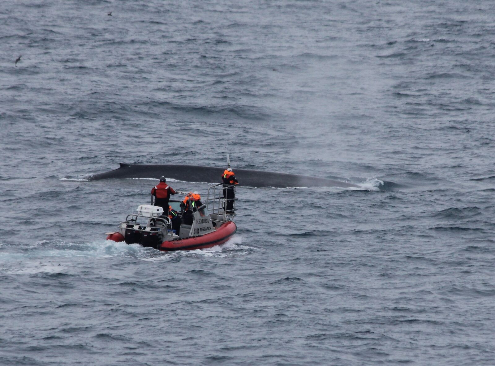
Ten years ago Dr Virginia Andrews-Goff was riding the bowsprit of a six metre boat, as a 30 metre, 120 tonne Antarctic blue whale surfaced alongside.
That day in the Southern Ocean, she became the first and so far, the only person, to deploy satellite tags on two of these critically endangered and rarely-sighted giants.
At the time her success added weight to a case in the United Nations International Court of Justice, demonstrating that scientific research on whales could be conducted without killing them.
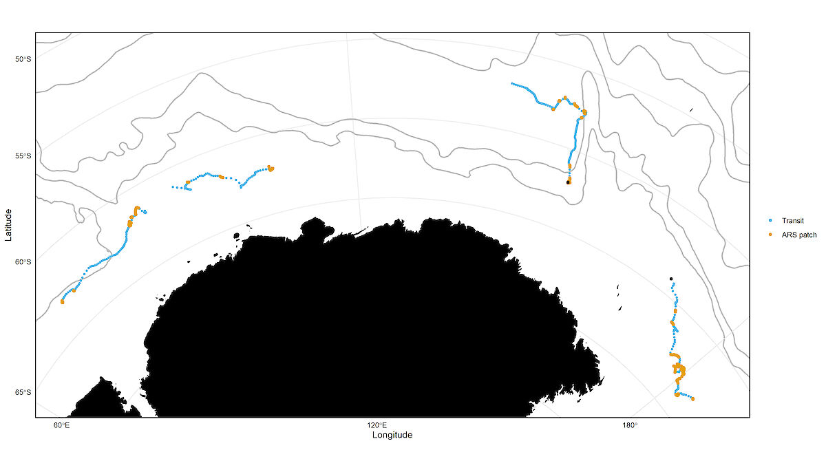
Dr Andrews-Goff and her colleagues at the Australian Antarctic Division have now published the two satellite tracks generated by that 2013 work, in the open access Biodiversity Data Journal.
The tracks give an insight into the animals’ movement and behaviour on their feeding grounds, and illustrate the significant logistical challenges needed to successfully locate, tag and track Antarctic blue whales.
“This is a unique data set that was incredibly challenging to get, and unfortunately, for 10 years no-one has been able to generate more data,” Dr Andrews-Goff said.
“We know very little about the movement and distribution of Antarctic blue whales, where they migrate, where they forage and breed, and we don’t understand the threats they might face as they recover from whaling.”
Part of the issue is that the animals are incredibly difficult to find. Commercial whaling in the 1960s and ‘70s killed about 290,000 Antarctic blue whales, accounting for 90% of the population. By the late 1990s, the world’s population of Antarctic blue whales was estimated at 2280 animals.
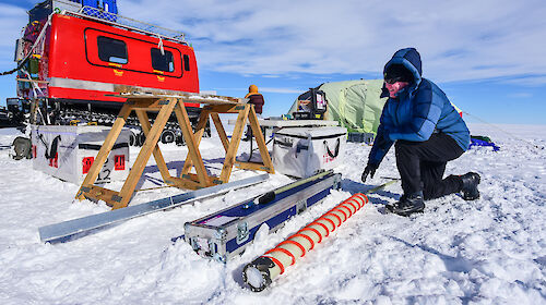
Back in 2013, the research team used novel acoustic tracking techniques to detect blue whale calls and hone in on their location from up to 1000 kilometres away. Once the whales were in sight (in two separate locations), an expert crew manoeuvred close to their fast-moving targets.
The satellite tags showed that the whales travelled 1,390 kilometres in 13 days and 5,550 kilometres in 74 days, with an average distance of more than 100 kilometres per day.
“The two whales did entirely different things, but what became obvious is that these animals can travel really quickly,” Dr Andrews-Goff said.
“If you consider how far and fast these animals moved, protecting the broader population against potential threats will be tricky because they could potentially circumnavigate Antarctica within a single feeding season.”
Since the tracks were obtained, new analytical methods have added some behavioural context to the data.
Two movement rates were observed – a faster ‘in transit’ speed averaging 4.2 km/h and a slower speed of 2.5 km/h, thought to correspond with searching or foraging.
“It looks like the whales might hang around in one area to feed and then move quickly to another area and hang around there for another feed,” Dr Andrews-Goff said.
“There may be certain areas that are better feeding grounds than others. From a management perspective, it would be good to understand what is it that makes these areas important?”
Even at a sample size of two, Dr Andrews-Goff said the satellite tracks will assist the International Whaling Commission’s management of Antarctic blue whales, by providing initial insights into blue whale foraging ecology, habitat preferences, distribution, movement rates and feeding. These will inform an in-depth assessment of Antarctic blue whales due to begin in 2024.