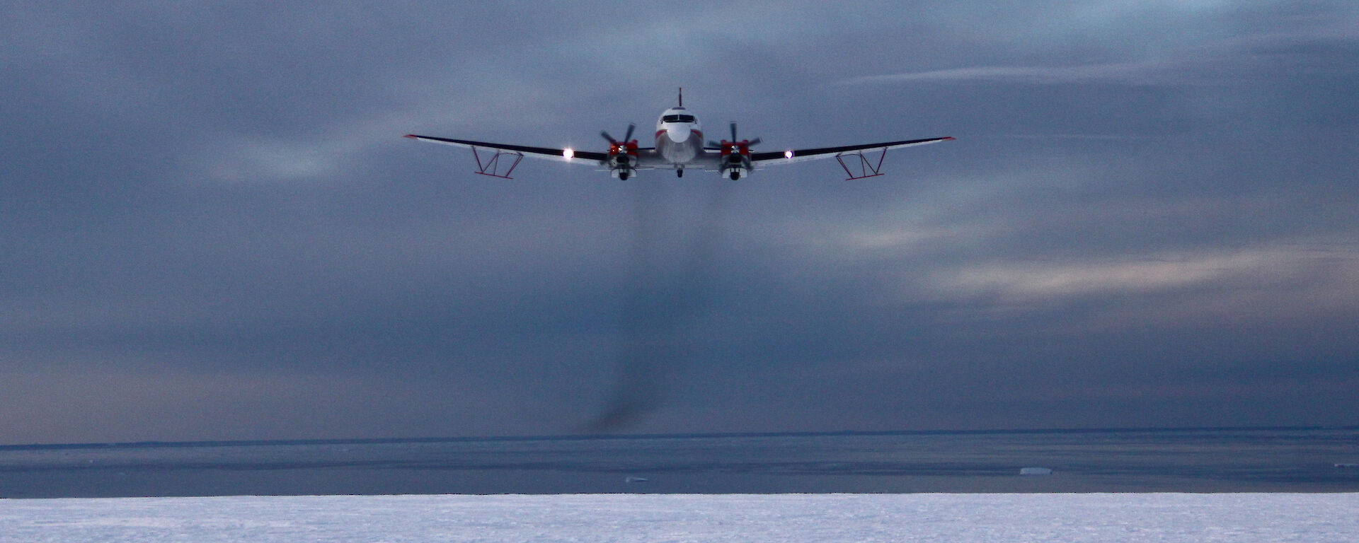
Basler conducting ICECAP survey flights in 2009.Photo: Jamin Greenbaum
The ICECAP-EAGLE has flown
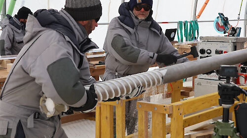
Few people would enjoy the experience of removing an aircraft door mid-flight.
But for Australian Antarctic Program (AAP) scientists surveying the Antarctic ice cap and its coastal fringes, removing the door of their World War II-era Basler aircraft, to deploy oceanographic instruments, is just part of the ‘fun’.
AAP glaciologists, Dr Lenneke Jong and Dr Jason Roberts, are part of the long-running ICECAP project (Investigating the Cryospheric Evolution of the Central Antarctic Plate) – an international effort to study the stability of the Antarctic ice sheet and the associated consequences for global sea-level rise.
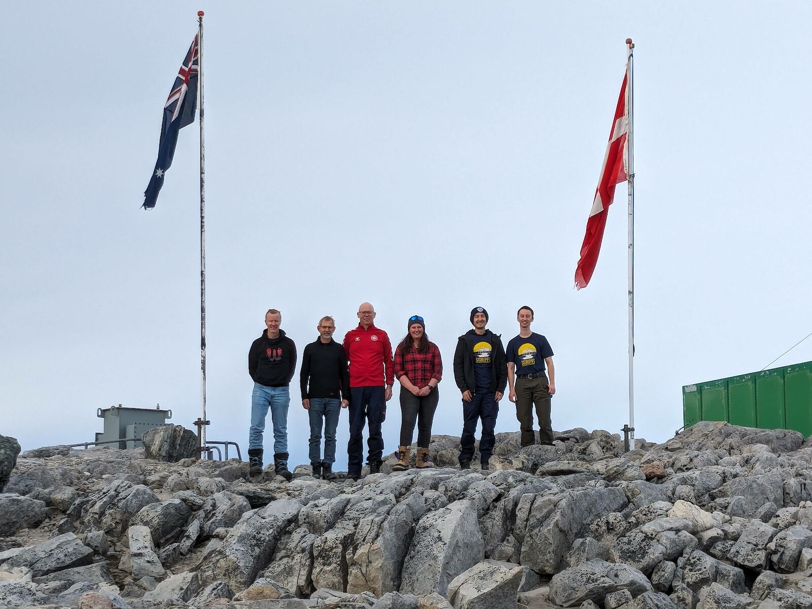
The ICECAP-EAGLE team at Casey this seaso, includes Australian scientists Dr Jason Roberts (left) and Dr Lenneke Jong (fourth from left), Prof. Jørgen Dall and Dr Anders Kush from Technical University of Denmark, and Dr Tyler Pelle and Briar Conger from the Scripps Institution of Oceanography, University of California.Photo: Anders Kusk
This summer the pair, together with two Danish and two American counterparts, are flying geophysical surveys between Casey and the Shackleton Ice Shelf, and at the French/Italian station, Concordia, to study the ice sheet and bedrock below.
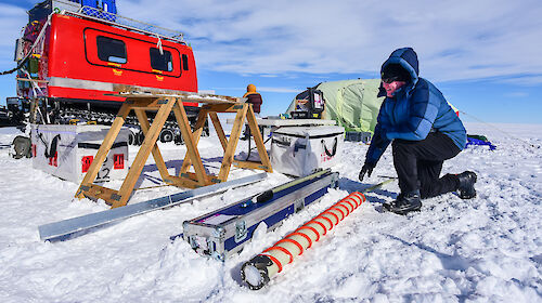
They will also deploy up to 85 oceanographic instruments near the front of the Shackleton Ice Shelf, but with a modification to the traditional ‘door-off’ procedure.
Ice sheet stability
ICECAP’s aerial surveys and instrument deployments aim to gather information to improve modelling of ice sheet dynamics, and our understanding of the role of the Antarctic ice sheet in global climate and sea level rise.
About 2200 billion tonnes of snow accumulates on the Antarctic continent each year, which is equivalent to about six millimetres of global sea level. This ice gain is offset by ice loss, as it flows from the interior to the coast, where it melts and calves off as icebergs.
“The structure and composition of the bedrock beneath the ice affects the path and speed of ice flow,” Dr Roberts said.
“So we want to know where there are mountain ranges, basins or flat plains under the ice and what type of rocks are under there. For example, are they ‘hot’, naturally radioactive rocks that can lubricate the movement of the ice sheet by contributing to the formation of liquid water at its base?”
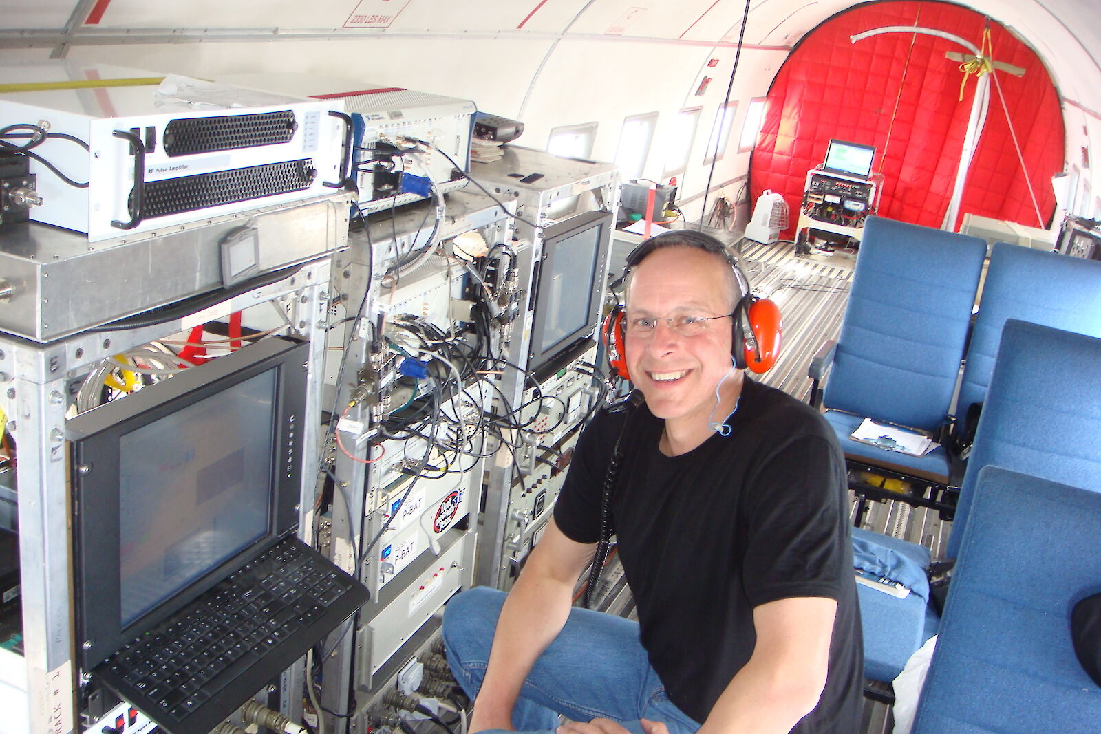
To find out, the team conducts geophysical surveys in a venerable Basler BT-67 (a modernised DC3), bristling with instruments and sensors, including an ice-penetrating radar, laser altimeter, camera, gravimeter and magnetometer.
These instruments measure the thickness, internal structure and surface elevation of the ice, the presence of liquid water, and bedrock depth, structure and composition.
So far the international effort has mapped more than 700,000 kilometres of survey lines, and contributed to more than 3500 publications, including more than 100 that informed the Intergovernmental Panel on Climate Change reports.
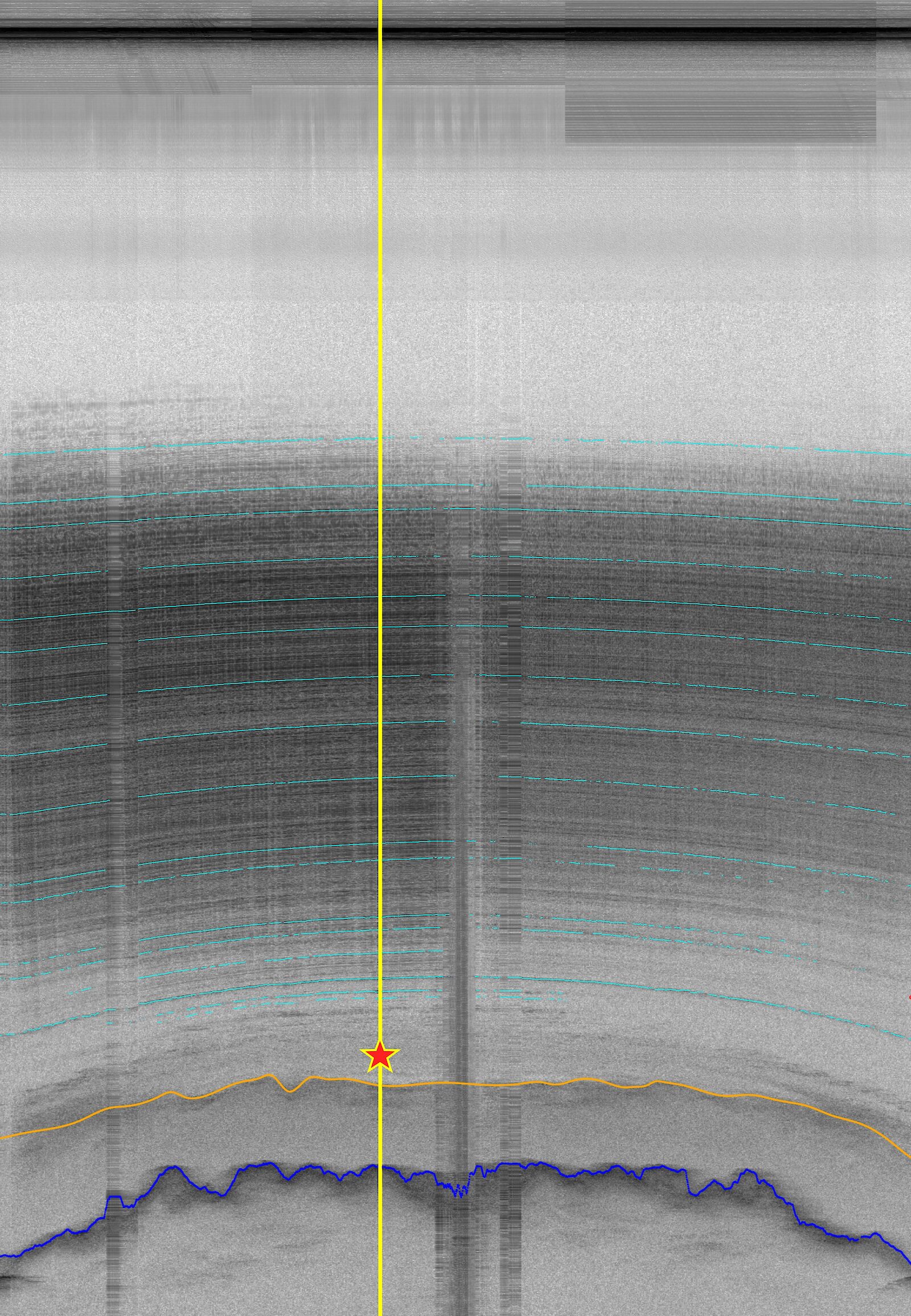
ICECAP has also helped identify the location of ice more than one million years old (Australia’s Million Year Ice Core Project drilling site) at Little Dome C, about 1200 km from Casey (see radargram image).
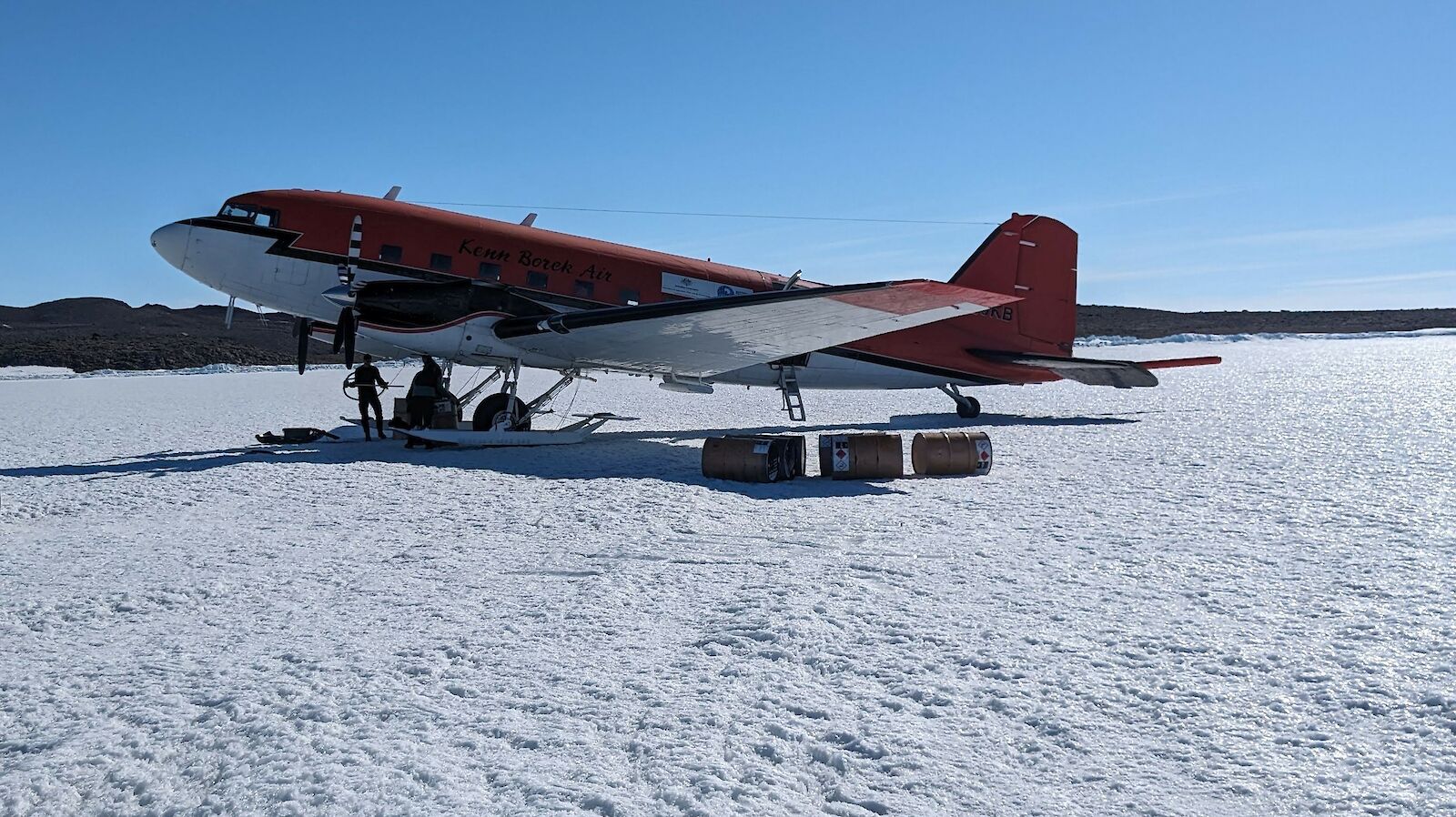
The 1940s-era Basler refuelling at Bunger Hills near the Denman Glacier.Photo: Anders Kusk
Fragile fringe
The ICECAP project recently added ‘EAGLE’ to its title – ‘East Antarctic Grounding Line Experiment’ – heralding an expansion of its interests into the stability of fringing ice shelves and glaciers.
“On the coastal fringe, we’re looking at ocean temperatures near glaciers and ice shelves that are experiencing rapid melting from a warming ocean, such as the Totten and Denman glaciers,” Dr Jong said.
“So we’re deploying instruments to measure water temperature, currents, and the sea floor structure beneath the ice, to better understand how far warm water can penetrate beneath the ice.”
Which is where the aircraft’s ‘open door policy’ comes in.
“In past seasons we’ve had to remove the door to deploy these instruments, as we fly over the drop zone, and ensure everything is strapped down against the freezing wind, and that people are double harnessed to the aircraft,” Dr Jong said.
“But this season we’ll have a small chute to deploy them from, which should make things more comfortable and less frantic.”
ICECAP-EAGLE flights are surveying the Shackleton Ice Shelf this season, and deploying oceanographic instruments at its front.Photo: Lenneke Jong
Flight plan
From Casey it takes about 2.5 hours to fly to the Shackleton Ice Shelf, roughly 600 km west. Another hour is used to survey parts of the 33,800 square kilometre shelf, and deploy oceanographic instruments at its front and within the adjacent sea ice zone. The aircraft can then refuel at the Bunger Hills – the site of a major scientific campaign studying the Denman Glacier – before returning to Casey.
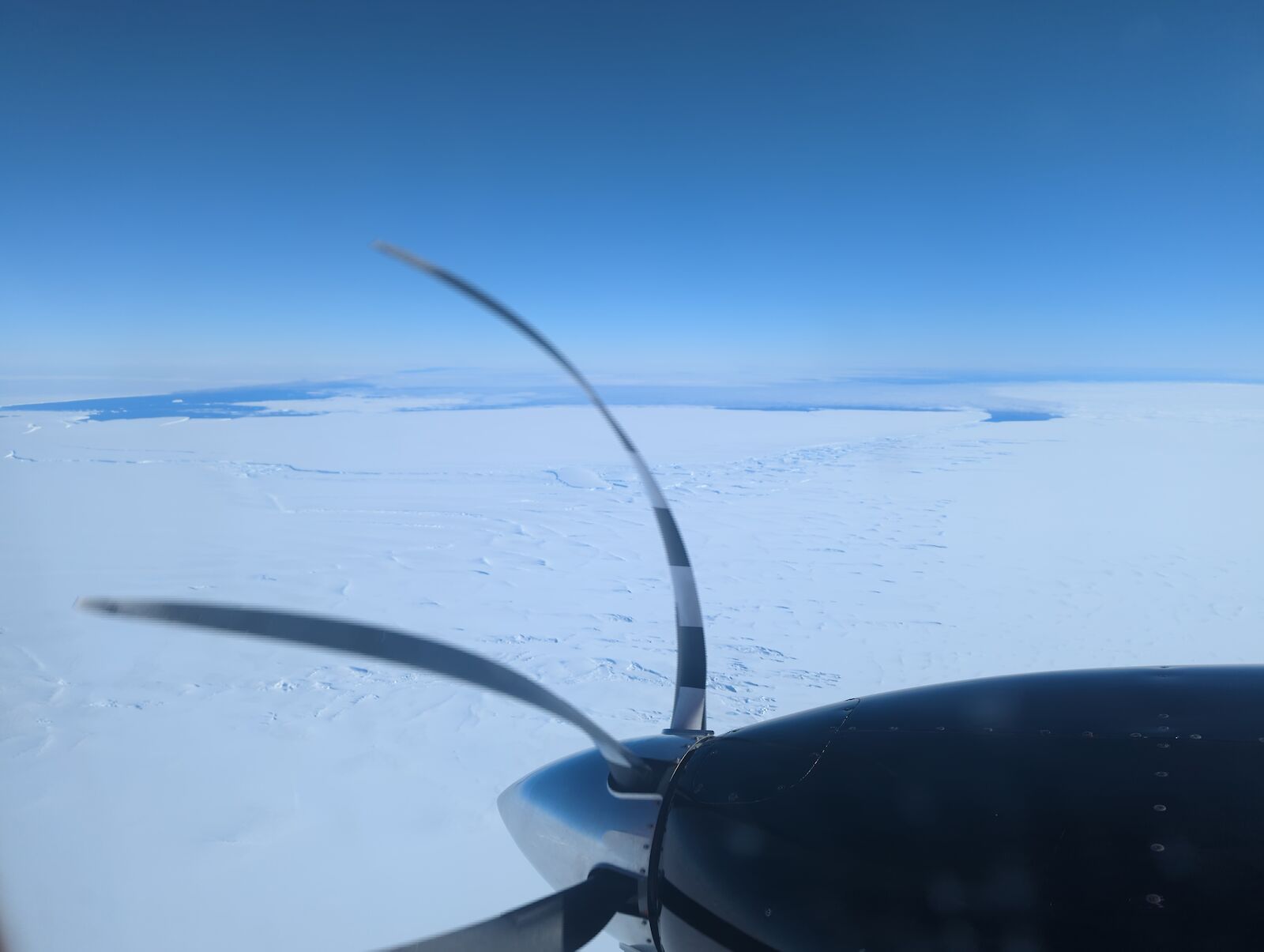
During the flight, the on-board instruments continuously collect data as the Basler flies about 2000 feet (600 metres) above the ice or ocean. Up to four of the team are on board, ensuring the instruments are working correctly, and troubleshooting when they’re not.
Everything is based on a flight plan, led by Dr Jong, using the latest satellite data to identify instrument deployment locations and areas of interest for study.
“We map out the route, often in a grid pattern, with a series of waypoints, and know how long segments should take in case conditions change in-flight,” she said
“During the flight we’re in almost constant communication with the pilots. We ask them to fly very straight lines, so it’s manual flying for them the whole day.
“For one of the surveys we’ve planned, they’ll fly a ‘race track’, 50 kilometres up and 50 kilometres back again, 10 to 15 times, so we’re not going to be popular that day.”
Flying in the old Basler is a highlight for the pair.
“It’s certainly not QANTAS. You bring your own thermos. But I love it,” Dr Jong said. “Especially flying over the glaciers, where you really can appreciate the fact that they are rivers of ice.”
“The Basler is a thing of beauty, just even sitting on the ground,” Dr Roberts said. “It’s very reminiscent of 1940s adventure movies.”
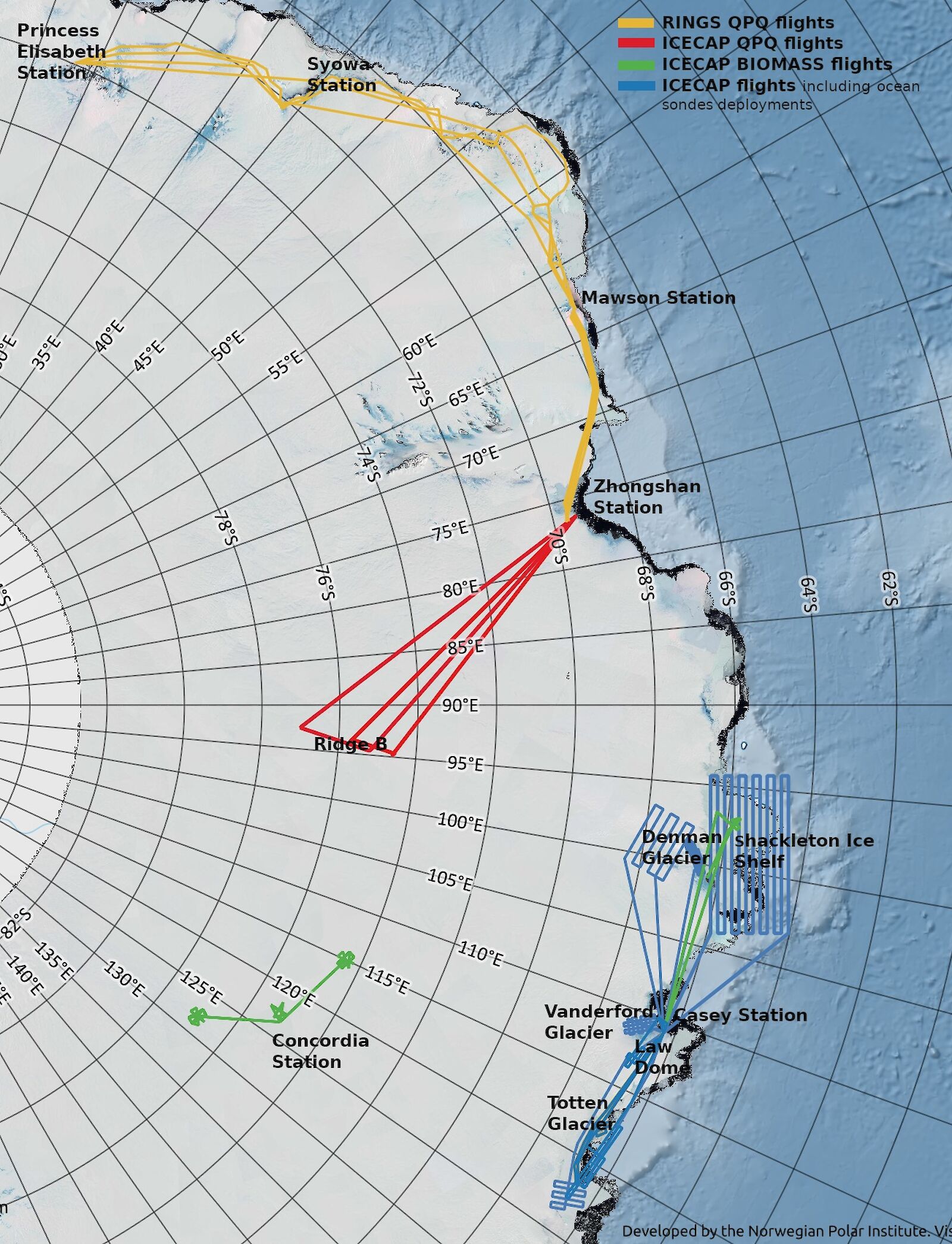
This map shows the planned geophysical survey flights for the ICECAP-EAGLE project. Australia will conduct flights at Concordia (green line) and between Casey and the Denman Glacier and Shackleton Ice Shelf (blue lines). Other countries will undertake flights elsewhere in East Antarctica (red and yellow lines).Photo: AAD
Data mining
Once a survey flight is complete, the team members who were not flying that day do some quality control on the downloaded data.
“We look at the radargrams to see the structure of the bedrock and layers in the ice, and camera images to look at surface features,” Dr Roberts said.
“If there’s something exciting in the data that we want to investigate further, we can use it to adjust our flight plan for the next day.”
The data is so precious that there are multiple backups and pathways to get it out of Antarctica.
“You would not believe how paranoid we are about getting the data back safely,” Dr Jong said.
“We have several copies on hard drives and they each leave Antarctica a different way, just to be sure.”
An example of a radargram showing layers in the ice sheet and bedrock at the base (dark blue line). This image shows the drilling location for ice estimated to be more than 1 million years old (yellow line and star). Light blue lines are ice layers that have been assigned an age.Photo: Jason Roberts
Space mission
This season the two Danish scientists in the team, Professor Jørgen Dall and Dr Anders Kusk from the Technical University of Denmark, are testing and calibrating a new radar system for the European Space Agency (ESA).
The radar will be part of the ESA’s Earth Explorer Biomass satellite, which will measure Earth’s forest biomass. According to ESA, forest biomass can be used as a proxy for stored carbon. The data it collects will help understand fluxes in carbon – through land-use change, forest degradation and forest regrowth – and the role of forests in the carbon cycle.
The radar will be calibrated on survey flights near Concordia, high on the Antarctic plateau, and at several locations on the Shackleton Ice Shelf.
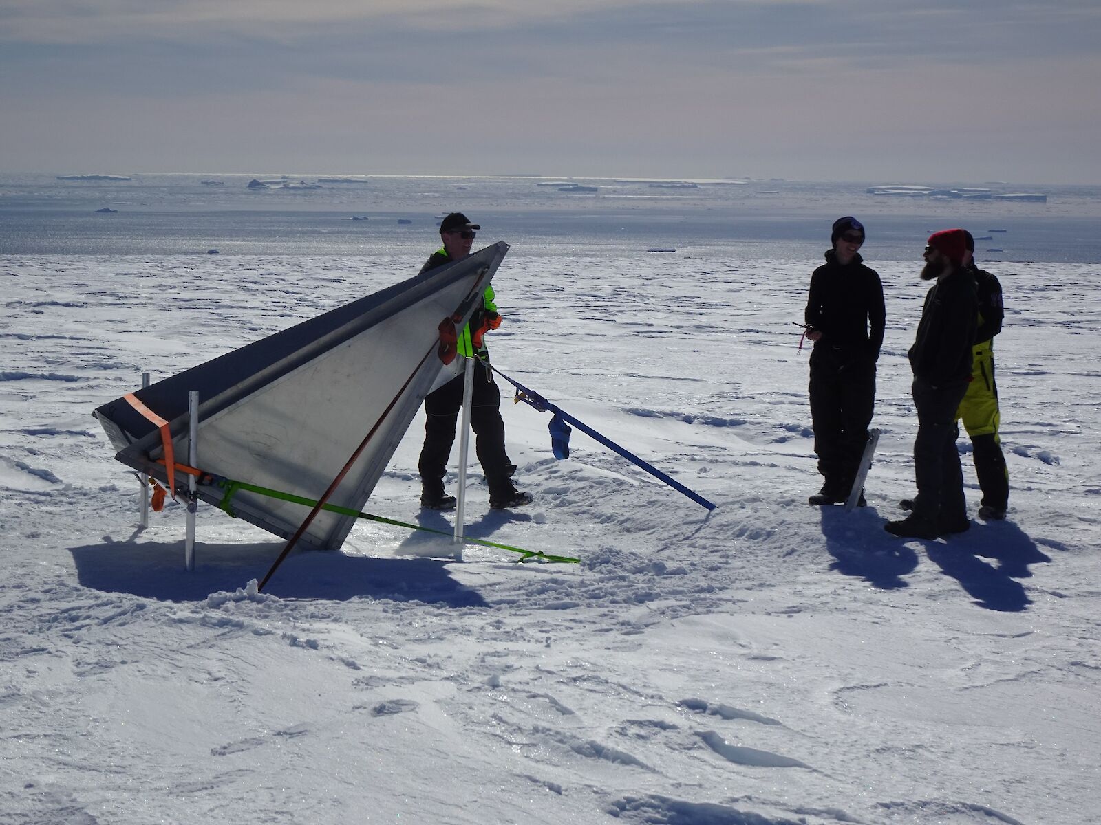
This reflector is a calibration point for the Danish radar system. It is fixed at a specific angle to reflect all the radar signal that hits it. As a result, it appears as a very bright point in the data when the aircraft flies over it.Photo: Jorgen Dall
International effort
The Casey-based team hope to complete up to 10 survey flights this season.
Other countries, including China and the US, will also conduct surveys across parts of East Antarctica, continuing to build on 15 years of work.
The international effort extends to instruments being used on the Basler.
“The radar belongs to Denmark, the gravimeter is on loan from Germany, the magnetometer belongs to the University of Texas, and some equipment has been provided by Japan,” Dr Roberts said.
“It’s a real United Nations effort!”
The Basler kitted out with instruments during a previous flying season.Photo: Jamin Greenbaum