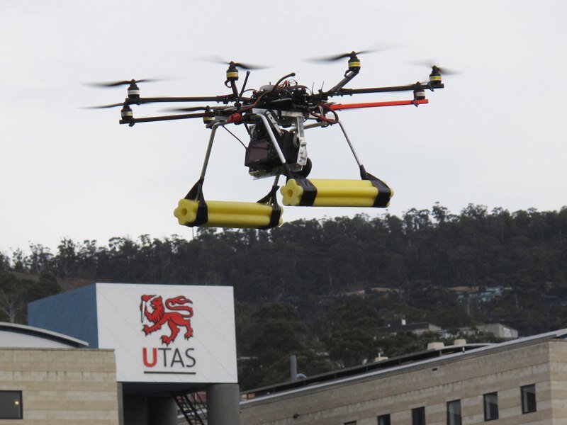

A new high-tech remote controlled helicopter, the ‘OktoKopter’, will map fragile coastal moss beds in Antarctica this summer.
In scenes reminiscent of a James Bond movie, the eight rotor helicopter, equipped with cameras and sensors will sweep the Antarctic skies.
But this unmanned aerial vehicle, developed by University of Tasmania researchers Arko Lucieer and Darren Turner, in collaboration with the Australian Antarctic Division, will have science rather than world domination in its sights.
The remote controlled machine, about 20 times smaller than a real helicopter, will use remote sensing techniques to monitor the impact of changes in temperature, wind speed and UV-B radiation on moss beds at Casey station.
Project leader, Dr Lucieer said the OktoKopter was built in Germany but adapted by the Tasmanian team for the Antarctic project.
“The OktoKopter is equipped with visible colour, near-infrared and thermal-infrared cameras as well as an autopilot system that allows it to fly to pre-programmed GPS waypoints,” Dr Lucieer said.
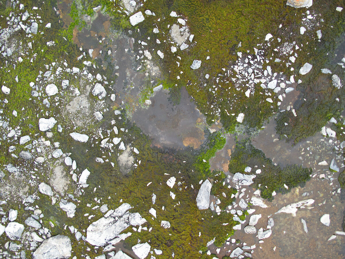
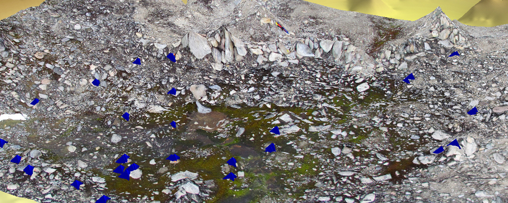
“This will allow us to produce a detailed digital elevation model of the terrain and collect ultra-high resolution imagery down to a resolution of one centimetre.”
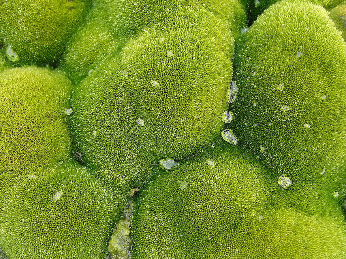
A recent collaborative research project at Casey station has found a distinct die-back of the moss beds, with large patches of dead brown vegetation appearing throughout the area.
“The OktoKopter will help us to determine which terrain is supporting the healthy moss and which areas are dying off,” Antarctic Division Botanist, Dana Bergstrom said.
“The significance of moss is that it can serve as an indicator of climate change as it grows very slowly, preserving a climate record along its shoots. The Antarctic moss beds are essentially miniature versions of old-growth forests in Australia.
“So if we can accurately date these mosses and also map their extent it means we will be able to see what has happened with the climate in the past decades and predict how it may change into the future,” she said.
This is the second year of the project; last summer Dr Lucieer used a standard remote controlled helicopter for the remote sensing work, but after issues with stability and accuracy he started using the OktoKopter system for his remote sensing research.
Dr Lucieer will use the OktoKopter in Antarctica in February next year.
Collaborative partners include the Australian Antarctic Division, Australian National University, Wollongong University and the University of Tasmania.