
The ability to detect changes in Antarctic ‘fast ice’ (stationary sea ice attached to the continent or grounded icebergs) could provide scientists with a useful indicator of climate change in Antarctica and insights into what drives the extent and variability of fast ice.
As well as the physical impacts of fast ice on glaciological processes, changes in fast ice will also have biological impacts, including on the extent and distribution of sea ice algae, which provides food for krill, and for emperor penguins, which need to traverse fast ice to move between their breeding and feeding grounds. But assessing changes in fast ice is no easy task, as PhD student, Alex Fraser, discovered.
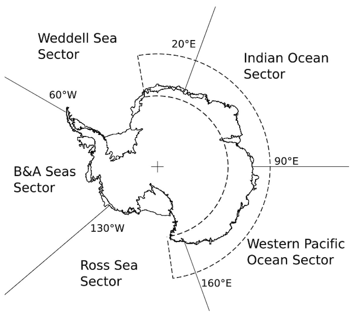
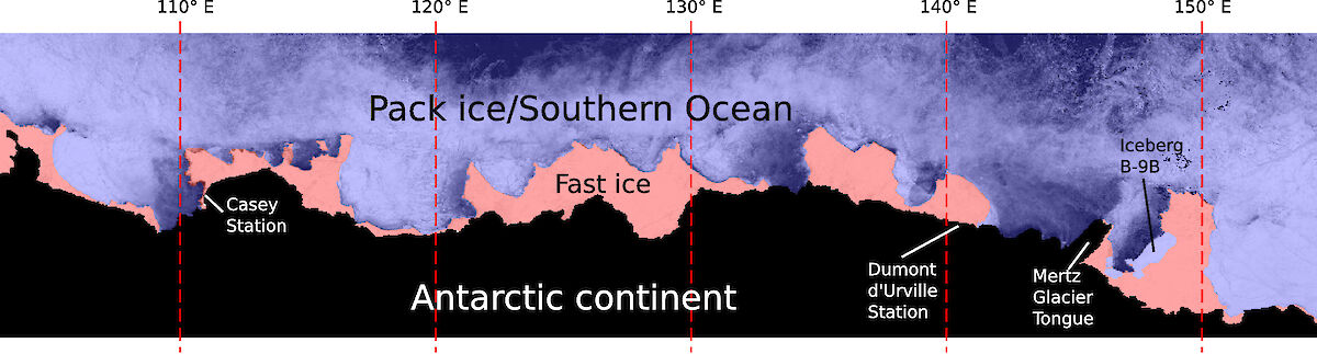
For the past three years Alex, through the Institute for Marine and Antarctic Studies and the Antarctic Climate and Ecosystems Cooperative Research Centre (ACE CRC), has developed a method for using NASA’s MODIS (MODerate resolution Imaging Spectroradiometer) satellite images to map the distribution of fast ice in East Antarctica – from 10°W to 172°E – between 2000 and 2008.
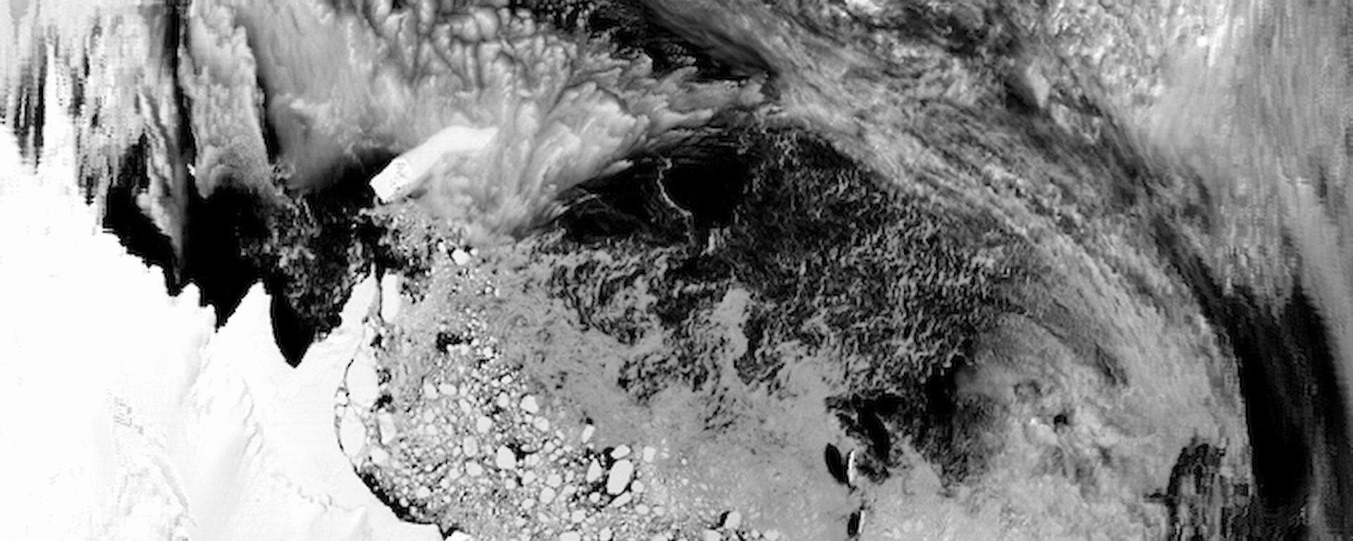
As the Antarctic coast and sea ice zone are notorious for attracting high cloud cover, most of Alex’s 150 000 MODIS images were affected by cloud, which obscured 93% of each image on average. To overcome this problem Alex wrote a program that allowed him to merge images over a 20-day period and extract only the cloud-free data from each image. AMSR-E (Advanced Microwave Scanning Radiometer – EOS) satellite images of the sea ice zone were also used to enhance the distinction between pack ice (freely floating ice) and fast ice.
The end result was a series of 159 composite images over the nine year period, which allowed Alex to clearly separate fast ice from pack ice.
'By analysing the composite images I could separate the pack ice, which moves, from the fast ice, which doesn’t. This dataset is the first of its kind anywhere in the world, and it enables us to study detailed changes in the extent of fast ice for the first time,' he says.
Alex found a significant increase in fast ice extent over the past nine years in an area known as the ‘Indian Ocean Sector’ (from 20°E to 90°E). Further east, however, in the ‘Western Pacific Ocean Sector’ (between 90°E and 160°E), there was no significant change in fast ice. Further work is needed to establish a conclusive trend in fast ice extent.
'We really need a longer record than nine years to say whether there is a definite trend one way or another,' Alex says.
'There are satellite images going back to the 1970s which could provide this information.'
This work will fall on the shoulders of a future scientist, however, as Alex prepares to move on to a post-doctoral position with the ACE CRC, where he will use remote sensing techniques (such as satellite altimetry) to look at glaciological processes of the Antarctic ice sheet.
A.D Fraser, R.A. Massom and K.J. Michael. A method for compositing Polar MODIS satellite images to remove cloud cover for landfast sea-ice detection. IEEE Transactions on Geoscience and Remote Sensing, Vol 47, No. 9, 2009.