
Global climate research and sea ice modelling and forecasting are set to benefit as a result of a major Australian-led initiative to validate sea ice datasets from NASA’s Advanced Microwave Scanning Radiometer-EOS (AMSR-E) sensor.
Important information on Antarctic sea ice distribution and properties is routinely and remotely collected using satellites. Satellite passive microwave remote sensing is a key polar research tool because it
- has systematic, daily near-global coverage
- penetrates cloud cover and polar darkness
- discriminates sea ice from open ocean
Work carried out during ARISE (Antarctic Remote Ice Sensing Experiment) has enabled the first-ever detailed validation of this key dataset, which dates back to 1978. This is crucial to global climate research, and specifically
- sea ice concentration
- snow thickness on sea ice
- ice temperature
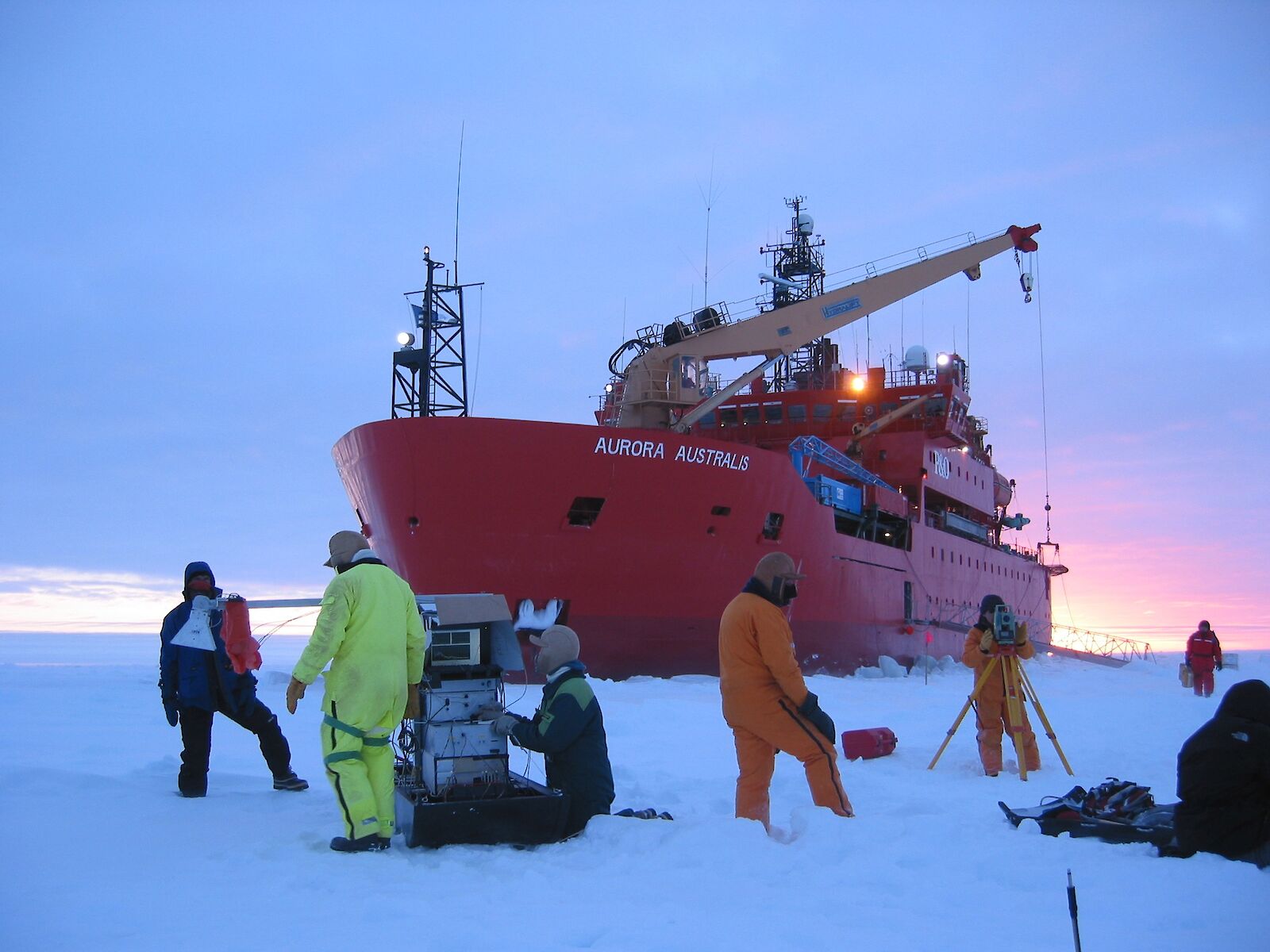
The work was conducted by scientists from Australia, the USA, Germany, Belgium, Japan and China, in close association with NASA and JAXA (Japan Aerospace Exploration Agency), between September and October 2003. The Aurora Australis visited the sea-ice zone to north-west of Casey (64–65.5ºS, 112–119ºE).
The effective use of data collected from satellite passive remote sensing requires knowledge of its accuracy. We achieved this by comparing AMSR-E data with collected at the same time that sea ice and snow cover information was collected during ARISE.
The main challenge was to acquire data over an area wide enough to be representative of the satellite pixels (tens of kilometres), but over periods short enough to counteract the effects of changes over time. This was achieved using a range of measurements to characterize ice and snow conditions over local to regional scales, including:
- detailed ship- and helicopter-based in situ measurements
- satellite-tracked drifting buoys
- helicopter-borne digital aerial photography and thermal infrared radiometry
- higher resolution satellite data
What we found
Ice concentrations
A reasonably close agreement between satellite- and aerial-photo-derived ice concentrations (i.e. 96.5±2.5% versus 94.3%) is found under cold conditions with a dry snow cover.
Ice temperature
Satellite ice temperature agrees with in situ surface measurements to approximately 0.5°C.
Snow thickness
The snow thickness, however, is a significant underestimate compared to in situ measurements weighted by the percentage of thin ice (and open water) present.
For the case study analysed, the underestimate was 46% for the overall average, but 23% compared to smooth-ice measurements alone.
The consistency of the spatial pattern suggests that the observed difference may be an offset (at least under freezing conditions).
Related links
Massom R.A., Worby A., Lytle V., et al (2006). ARISE (Antarctic Remote Ice Sensing Experiment) in the East 2003: Validation of satellite-derived sea-ice data products. Annals of Glaciology 44: 288–296.