“We wanted a design that was unpowered, required minimal installation, that would be visible to the most number of satellites, and that could accommodate any orbit of these satellites,” Dr Fedrigo said.
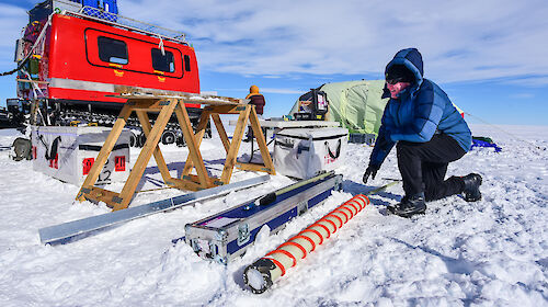
The tophat reflectors are shaped like their namesake, with a wide ‘apron’ or brim, and 1.5 metre-high crown.
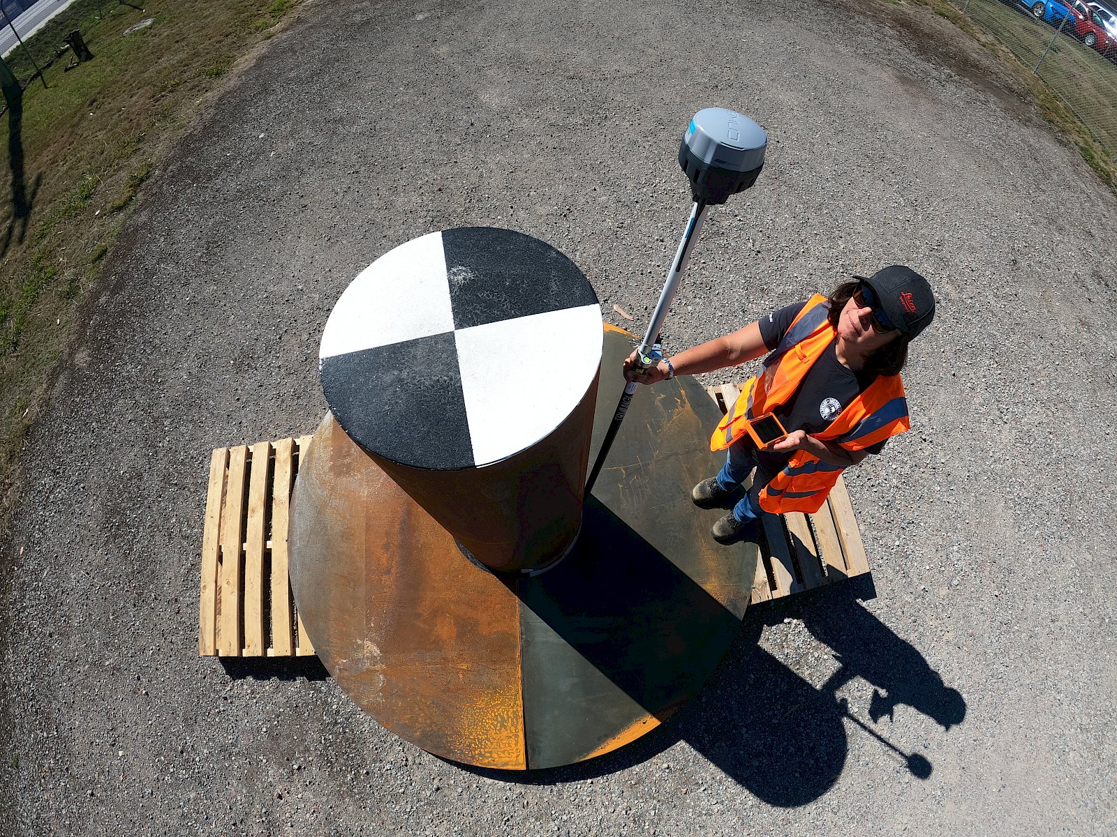
At the top of the crown is a painted checkerboard design, which produces a pattern in images taken by optical satellites.
The reflectors’ construction in corrosion-resistant stainless steel also provides a target for ‘synthetic aperture radar’ (SAR) satellites. These send out microwave pulses that bounce off objects, creating radar images of the earth’s surface, even when it is dark or cloudy.
“The microwave energy from the SAR satellite bounces off the large centre column of the reflector, towards the apron, and then back to the satellite,” Dr Fedrigo said.
“This creates a bright signal response in the image which we can use to mark the exact coordinates of the satellite, to a position on the ground.
“The checkerboard works in the same way except that we look for the pattern in the image and assign the GPS coordinates to the centre of it.”
Dr Fedrigo said that SAR imagery is used by the Australian Antarctic Division to assess glacier volume, detect crevasses, and observe wildlife during the winter months when optical imagery isn’t available. It can also be used to look at changes in landscape elevation, possibly due to erosion, landslides, and volcanic or tectonic activity.
“The installation of these tophat reflectors on Heard Island will allow us to accurately align radar imagery each time it is captured, despite the regular cloud cover,” Dr Fedrigo said.
Dr Garthwaite said it is common to use ground reflectors to accurately align radar imagery.
“But what is quite innovative here is having a target that can be seen in both radar and optical images and from satellites that fly in lots of different orbital directions,” he said.
The reflectors will provide an important feature in remote sensing imagery, for the Antarctic Division and for anyone wanting to monitor the island.
The 750 kg reflectors will be filled with concrete and positioned near existing survey markers on the island, away from wildlife that may like to “cozy up” to them.
All activities will be implemented in accordance with existing and pending environmental permits.
Dr Fedrigo and Dr Garthwaite worked closely with four space companies from the United States, Finland and Canada, and also the German space agency, DLR, to test prototype reflectors and confirm a final design.
“The companies worked with us to ensure our prototype was visible in a broad range of satellite imagery, and that the final design was fit for purpose before we deploy them,” Dr Fedrigo said