
A Remotely Operated Vehicle travelling two metres beneath ice floes in East Antarctica could provide a rapid way of determining where sea ice algae prefer to grow, and the effect of this distribution, if any, on krill.
The Remotely Operated Vehicle or ROV, which is tethered to the surface by a 400 metre-long cable, played a key role in the recent Sea Ice Physics and Ecosystem eXperiment-II (SIPEX-II) voyage.
Voyage Chief Scientist, Dr Klaus Meiners, from the Australian Antarctic Division and the Antarctic Climate and Ecosystems Cooperative Research Centre, said the main job of the ROV was to measure the amount and distribution of sea ice algae under the ice using a smart light sensor called a ‘hyperspectral radiometer’.
‘This instrument measures the different wavelengths of sunlight penetrating the ice, some of which are absorbed by sea ice algae for photosynthesis,’ Dr Meiners says.
‘By measuring the reduction in the blue and green wavelengths of light beneath the ice, we can estimate how much algae there is.’
Sea ice algae live within and attached to the bottom of the sea ice and are an essential food source for Antarctic krill, which in turn provide food for larger animals such as penguins, seals and whales. Climate models predict that sea ice in Antarctica will have declined by 25% in extent and 35% in volume at the end of the century. So understanding the distribution of sea ice algae now, and the effect of sea ice thickness and snow thickness on its biomass, will enable more accurate assessments of the impact of climate change on this keystone species and the rest of the Antarctic marine ecosystem.
‘The traditional method of studying sea ice algae is to take ice cores and then measure the photosynthetic pigment used by algae — chlorophyll — as a proxy for how much algae there is,’ Dr Meiners says.
‘But since the 1980s about 1500 sea ice cores have been taken around Antarctica, each with a diameter of only 10cm. So that’s less than a football field of data in an area that extends to 18 million km2 in winter.
‘The hyperspectral radiometer on the ROV can take a measurement every 10 seconds, so in a single day we can collect more information than everyone has collected in 30 years.’
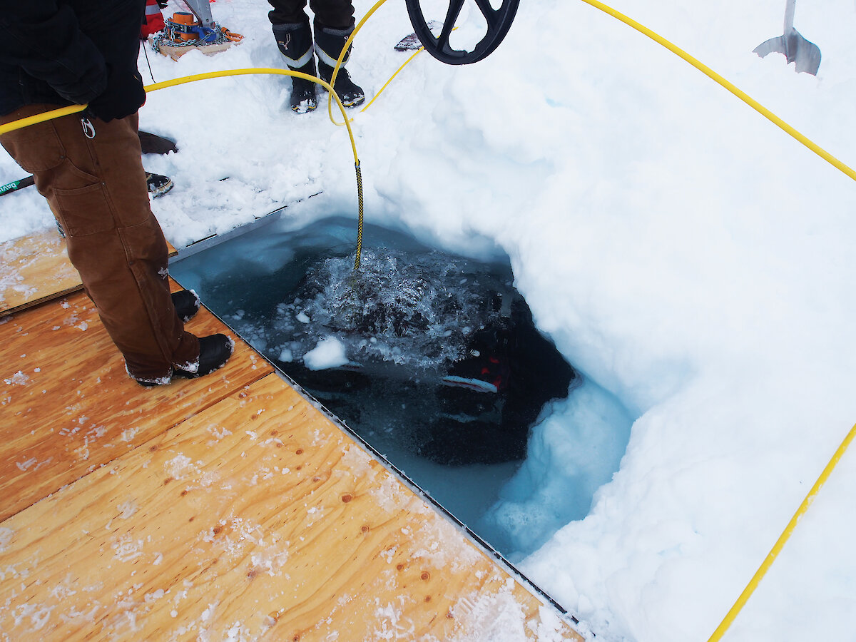
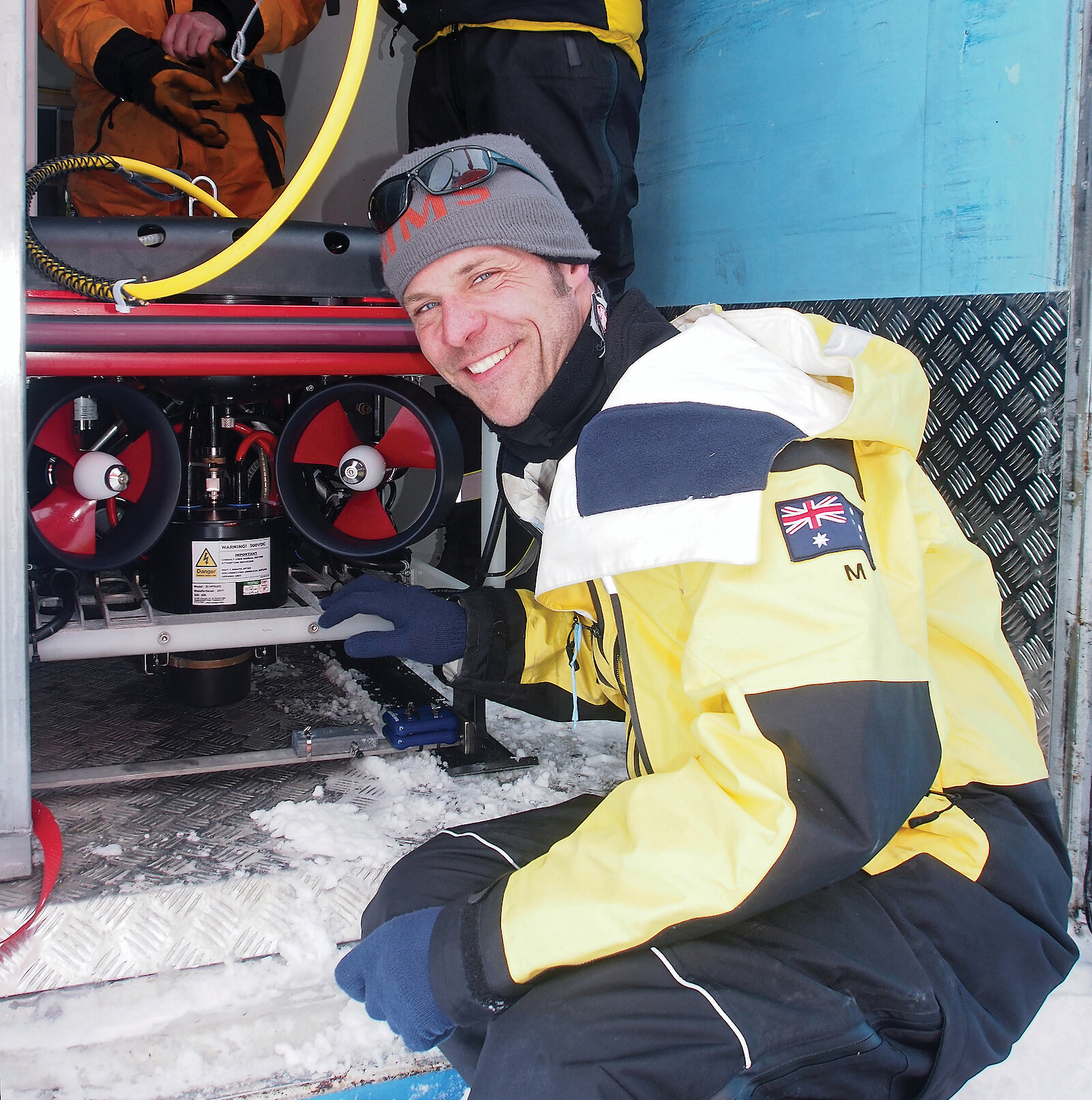
The SIPEX-II voyage was the first opportunity for the Australian Antarctic program to use the ROV in the harsh Antarctic environment. The vehicle was instrumented with various sensors and tested months before departure by Antarctic Division’s Science Technical Support team and the instrument workshop. A big part of the voyage was then dedicated to getting the vehicle, its navigation system, and associated procedures around deploying it under the ice, right.
The team had to first drill a suitable hole in the ice using an industrial sized drill bit on a back-hoe, before winching the 80kg ROV into the hole. Engineers then used a joystick to operate the vehicle, from a heated container next to the hole, and monitored its progress via a link to four high definition stereo vision cameras installed on the ROV.
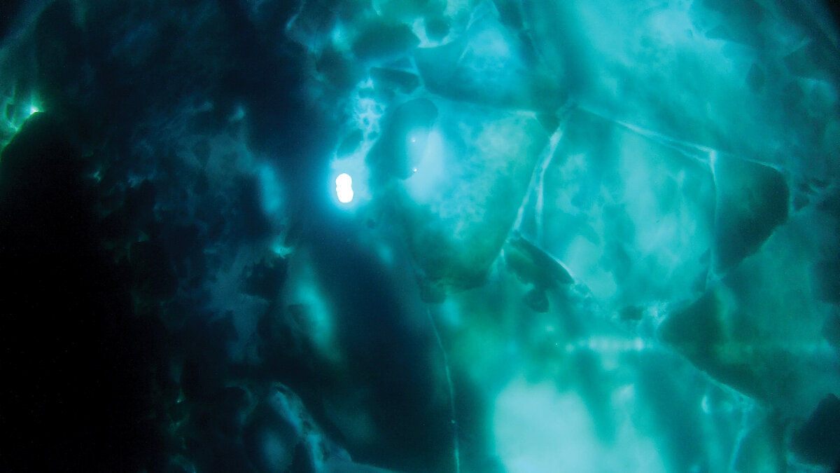
‘It was amazing how rugged the subsurface of the ice was. It looked pretty wild, like a badly eroded mountain range. We had a lot of snags under icicles which was pretty stressful, but the ROV has a little grabber which we used to pull the tether free,’ Dr Meiners says.
‘We saw a lot of beautiful jellyfish and Antarctic krill, as well as patchy areas of algae, but we need to analyse our images and link our hyperspectral data to surface measurements to get a proper estimate of the amount of sea ice algae.’
As well as hyperspectral data the ROV was also able to collect information on sea ice thickness using a sonar and pressure sensor.
‘The pressure sensor tells us how deep we are and the sonar gives us the distance from the ROV to the subsurface. The difference between these measurements gives us an estimate of the ice thickness,’ Dr Meiners says.
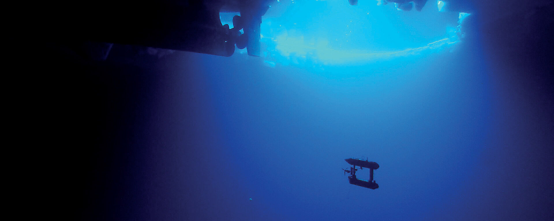
This thickness data will be compared with similar measurements made from a deeper-diving Autonomous Underwater Vehicle or AUV, which operated at about 20m below the ice.
‘The ROV project links with many other projects on the voyage operating underneath, on and above the ice,’ Dr Meiners said.
‘As well as the AUV work, we will link with measurements of snow thickness collected by laser scanners on the ice surface and from a helicopter. When we link this data together we’ll get a three-dimensional map of the ice. Using this we’ll be able to see whether sea ice algae distribution correlates with ice thickness and if this affects krill distribution as well.’
The ROV and other teams will spend the coming months linking their different data sets to build the ice thickness and algae biomass distribution maps.
‘These are big questions that you can’t answer on one voyage, but you understand more each time,’ Dr Meiners says.
‘We’ve proven that the ROV, the AUV, and other technologies work in Antarctica, and these technologies will allow us to improve the speed and scale at which we can collect data in the future.’
WENDY PYPER
Australian Antarctic Division