
This year all Australian Antarctic Science projects are being finalised under our old science strategy, before new projects, approved under the new Australian Antarctic Strategic Plan, begin in mid-2012. Most projects reviewed in this magazine last year (Australian Antarctic Magazine 19: 16–20, 2010) will be continuing, and a snapshot of some of these follows.
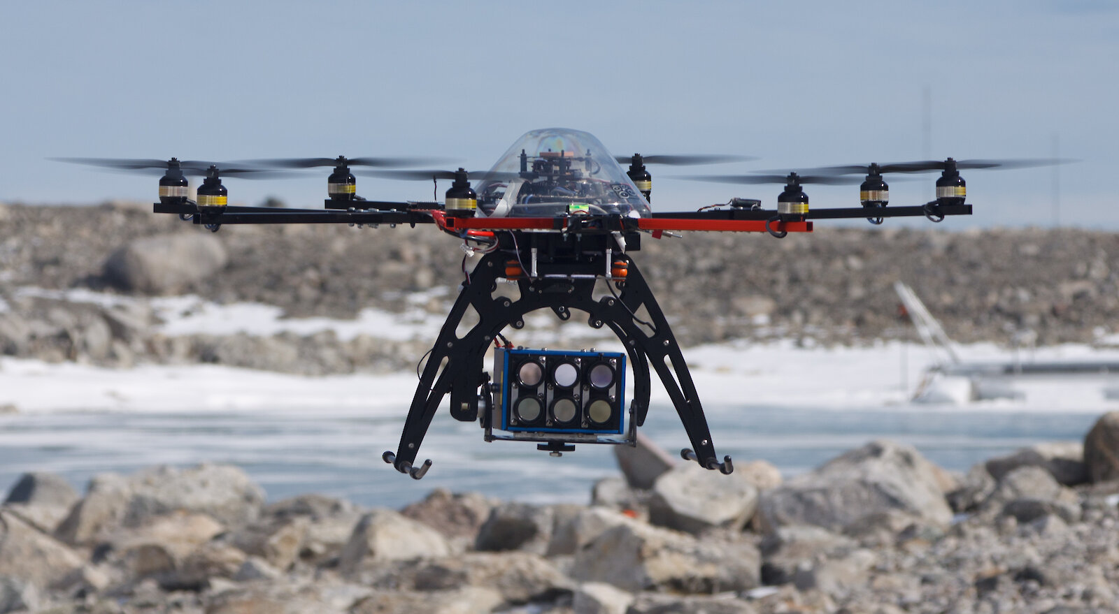
Moss bed monitoring. After a successful 2010–11 season photographing moss beds at three sites in the Casey region, the ‘OktoKopter’ unmanned aerial vehicle (Australian Antarctic Magazine 19: 1–3, 2010) will return to Antarctica to photograph moss beds in Antarctic Specially Protected Area 136 on the Clark Peninsula. The OktoKopter carries a high resolution digital camera, a six-band multispectral camera (this detects light reflectance in six wavelength regions, which identifies moss species and health), and a thermal camera to map moss temperature. The data is helping to build a picture of moss health and distribution. To improve the quality and type of data collected on Antarctic mosses, scientists have acquired a new hyperspectral camera (which detects hundreds of spectral bands). This season the camera will be mounted on a tripod to photograph 10m2 moss plots. In 2012–13 it will be mounted into a new plane-based unmanned aerial vehicle, after Tasmania-based trials during 2012.
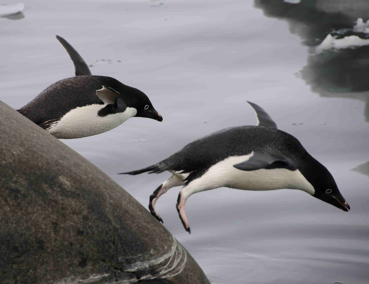
Seabird monitoring and research. A long-term monitoring program of Adélie penguins is conducted on Béchervaise Island near Mawson station each summer to provide information required by the Commission for the Conservation of Antarctic Marine Living Resources (CCAMLR) for the sustainable management of the krill fishery. Work this season will also include monitoring the breeding success of snow petrels.
Research to understand the summer and winter foraging patterns of seabirds across East Antarctica will continue with satellite, GPS and geo-locator tags being attached to penguin and petrel species at Mawson, Davis and Casey stations. Tracking work at Davis will include attaching miniaturised cameras and accelerometers to Adélie penguins to obtain a view of the prey field and determine when they are foraging. The work is part of a joint research project with Japanese researchers through a Japanese Research Fellowship.
Developing water quality guidelines for Antarctica and in-house culturing facilities for marine invertebrates. This project looks at the effects of common contaminants, including fuels and metals, and their interactions with environmental variables, such as salinity and temperature, on a range of Antarctic organisms. From this research, risk assessment techniques and environmental guidelines for the protection and remediation of contaminated sites will be developed.
During this year’s short field season at Casey, scientists will collect a range of nearshore marine invertebrates to bring back to the newly built Marine Research Facility at the Antarctic Division’s headquarters in Kingston (Tasmania). Over the coming years scientists will optimize methods for the successful culturing of invertebrates in this facility. This will enable year-round experimentation with Antarctic and subantarctic organisms and reduce reliance on on-site research in Antarctica.
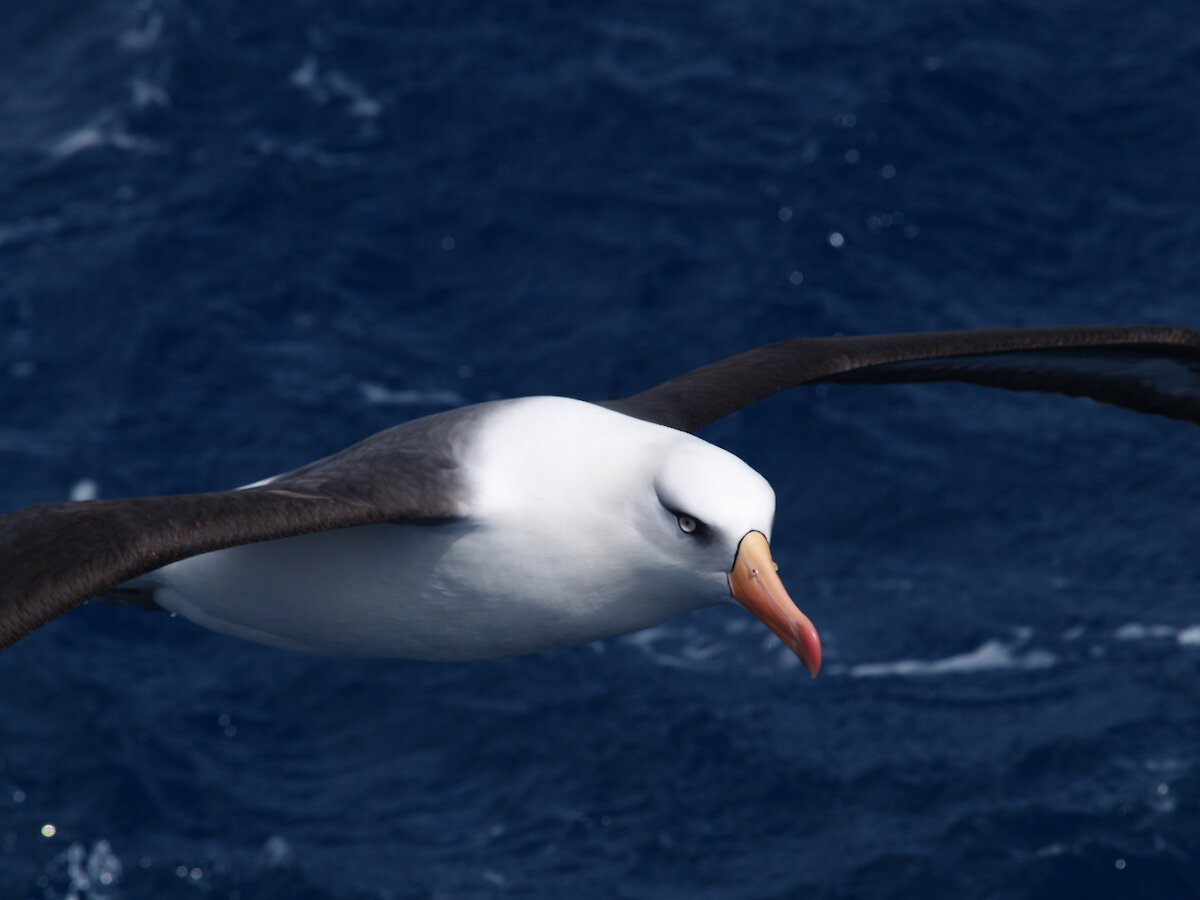
Ongoing projects on Macquarie Island include developing low risk, low cost on-site remediation techniques to clean up fuel spills; investigating the status and trends of recovering fur seal populations; monitoring albatross and petrel populations; and looking at how subantarctic organisms and ecosystems respond to change caused by global warming, feral animals and weedy plant species.
A number of marine science projects will continue this season including the Antarctic Climate and Ecosystems Cooperative Research Centre study on ocean acidification, caused by increasing amounts of carbon dioxide being absorbed by the ocean. This phenomenon is affecting the ability of some organisms to form shells or structures made of calcium carbonate. Scientists will collect samples of pteropods (marine snails) and foraminifera (single-celled shell forming organisms) in waters between Australia and Antarctica, to establish a baseline record of shelled zooplankton distribution in the Southern Ocean. This record will be used for future comparative studies of the impacts of ocean acidification in this region.
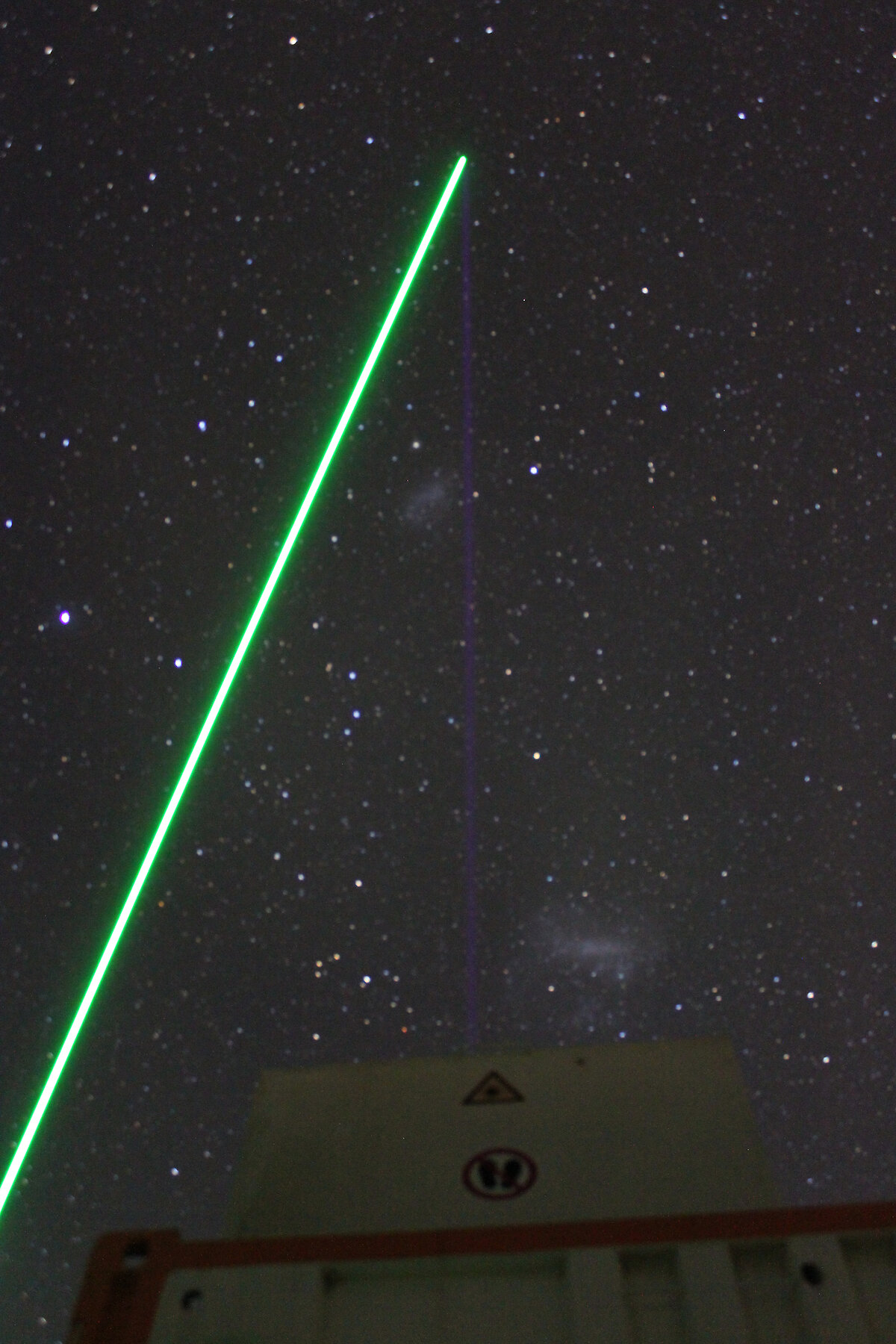
Atmospheric studies. At Davis, two ‘light detection and ranging’ (LIDAR) instruments, in combination with three radars (operating at 2, 33 and 55 MHz), will continue gathering information on ice-aerosol cloud formation in the mesosphere (85km altitude) near the edge of space. In the Arctic, these ice clouds are occurring more frequently and over a greater area than in the past. These changes are hypothesised to be linked to climate change. To determine whether similar ice cloud changes are occurring over Antarctica, the Australian LIDAR will operate in tandem with an iron LIDAR owned by the Leibniz Institute for Atmospheric Physics, which was located to Davis last summer.
The iron LIDAR has successfully measured the first complete year of temperature between 80 and 96km above Davis, where mesosphere ice-aerosols exist. A second year of observations will allow investigation of inter-seasonal variations and enable otherwise stealthy atmospheric processes to be revealed — since small changes in temperature have a large effect on the ice-aerosol layer. Previously, only twice daily satellite temperature measurements within a range of 500km of Davis were available. New adaptive optics on the iron LIDAR may also allow measurement of meteor dust particles, which are thought to be the nucleation site for mesosphere ice-aerosol cloud formation. The findings from the Australian-German collaboration will be incorporated in international climate simulations and atmospheric models.
The Davis LIDARs will also be used to study the optical properties of fine aerosol particles in the 5–30km altitude range in the troposphere and stratosphere, to better understand their effect on climate, and their effect on processes occurring with ozone depletion and its long term recovery.
Census results published
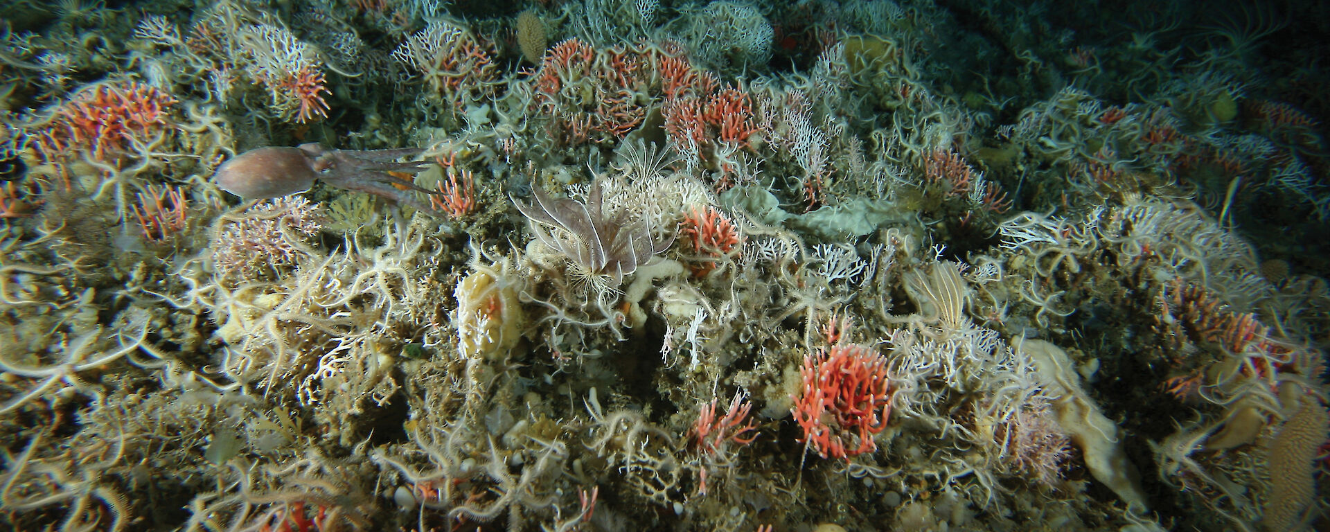
A special volume of the journal Polar Science was published in August, featuring research from the Collaborative East Antarctic Marine Census (CEAMARC) voyages — part of Australia’s contribution to the International Polar Year (2007–09). The special volume comprises 18 papers describing the purpose and achievements of CEAMARC to date: the hydrography and sea ice conditions of the survey area and distribution patterns of plankton, krill and fish; food web interactions and feeding strategies based on diet, lipid and stable isotope analysis; and a report on the DNA barcoding of bottom-living fish and communities.
The CEAMARC voyages used three ships from Australia, France and Japan to survey the region between Dumont d'Urville and the Mertz Glacier. The voyages aimed to study all organisms in all habitats. Microbes, zooplankton, krill, mid-water fish and bottom-living fish and invertebrate communities were targeted. Sampling occurred throughout most of the water column and on the sea floor of the continental shelf and slope to 2000m. Detailed studies of the oceanography, sea ice conditions and sea floor morphology and sediment composition were also conducted, to help explain the distribution of organisms.
More results are expected as the analysis of samples and data continues. For more information see Polar Science Volume 5, Issue 2, pages 75–312, and Australian Antarctic Magazine 18: 13–18, 2010.
Graham Hosie
CEAMARC leader