
Polar regions are experiencing rapid and severe climatic shifts with major changes in temperature, wind speed and UV-B radiation already observed in Antarctica. As climatic records only extend back 50 years, we urgently need new proxies to determine if coastal climate has changed over the past century.
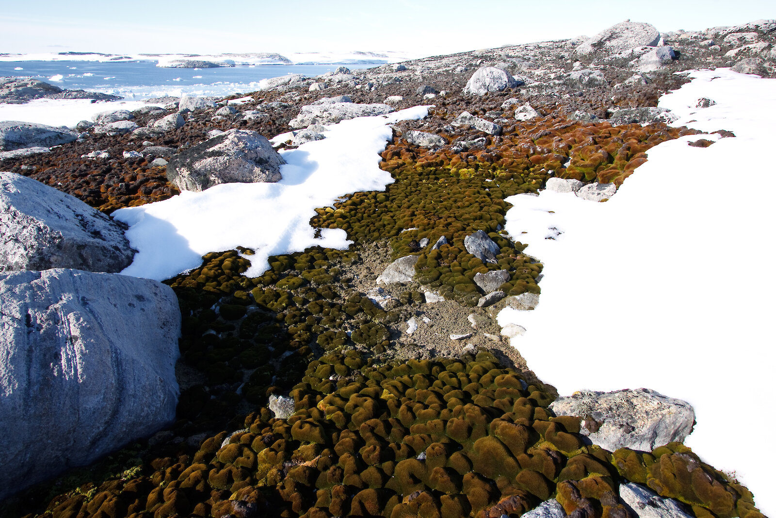
In a manner similar to trees, old-growth mosses preserve a climate record along their shoots. The Windmill Islands region near Casey has the most extensive and well-developed moss beds in Eastern Antarctica. Our ability to accurately date these mosses and map their extent in sufficient spatial detail means that, for the first time, mosses can be used as sentinels to provide crucial information on how the Antarctic coastal climate has changed over past centuries and how biota has responded to these changes.
In the first year of our project, ‘Spatial analysis of changing terrestrial ecosystems in the Windmill Islands and the sub-Antarctic’, and the first field season at Casey in 2010, we found that the spatial scale of the moss beds (tens of square metres) makes satellite imagery unsuitable for mapping their extent in sufficient detail. However, recent developments in the use of unmanned aerial vehicles (UAVs) for remote sensing applications provide exciting new opportunities for ultra-high resolution mapping and monitoring of the environment.
In 2009, we developed a new UAV consisting of an electric remote-controlled helicopter capable of carrying three different cameras for cost-effective, efficient, and ultra-high resolution (less than 5cm pixel size) mapping of terrestrial vegetation in the Windmill Islands. We managed to collect spatial data for four different moss sites: Antarctic Specially Protected Area (ASPA) 135, the Red Shed, Robinson Ridge, and ASPA136. During our UAV tests at Casey in 2010 we also demonstrated that the UAV is ideal for capturing photographs of the station buildings and environment — providing a quick and easy way to collect spatial information for management purposes.
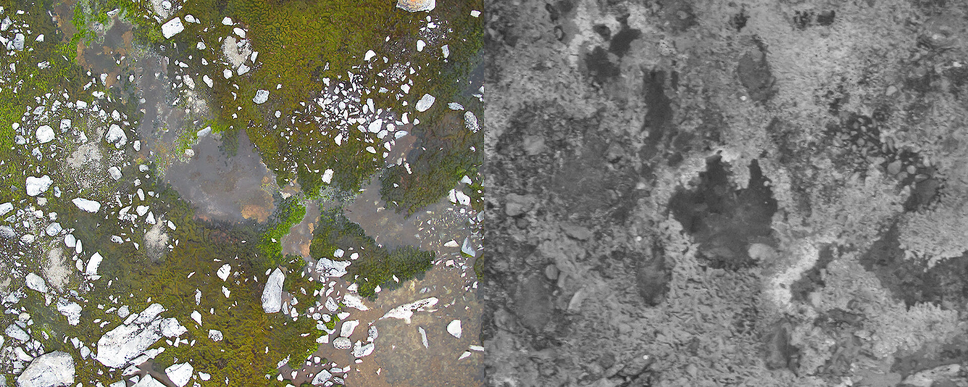
Two detailed UAV photographs of the same 6m x 4m area showing a visible photograph on the left and a near infra-red (NIR) photo on the right. The NIR photo shows healthy moss as bright (light) pixels. (Photos: Arko Lucieer)
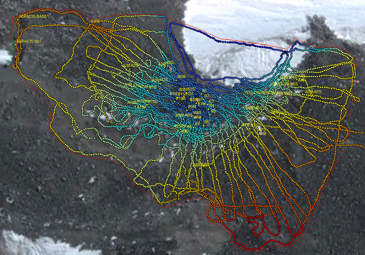
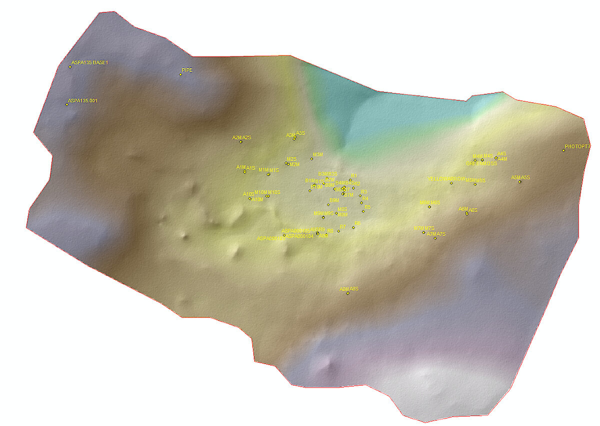
The location of moss communities is largely driven by water availability and is restricted to moist environments that receive water during the summer snow melt. Topographic factors such as micro-topography (e.g. boulders and rocks), water drainage, upstream catchment, slope and solar irradiance play a key role in moss occurrence and health. We collected data on the moss bed topography using accurate GPS receivers to capture some of these important environmental factors. From these GPS transects we managed to create digital elevation models (DEMs), but we found that the subtle variation in the terrain (micro-topography) was insufficiently captured in the GPS data.
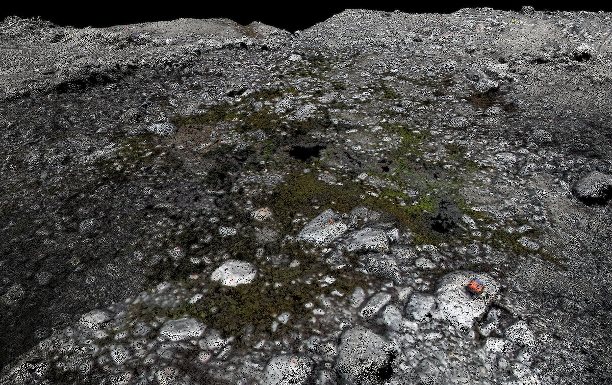
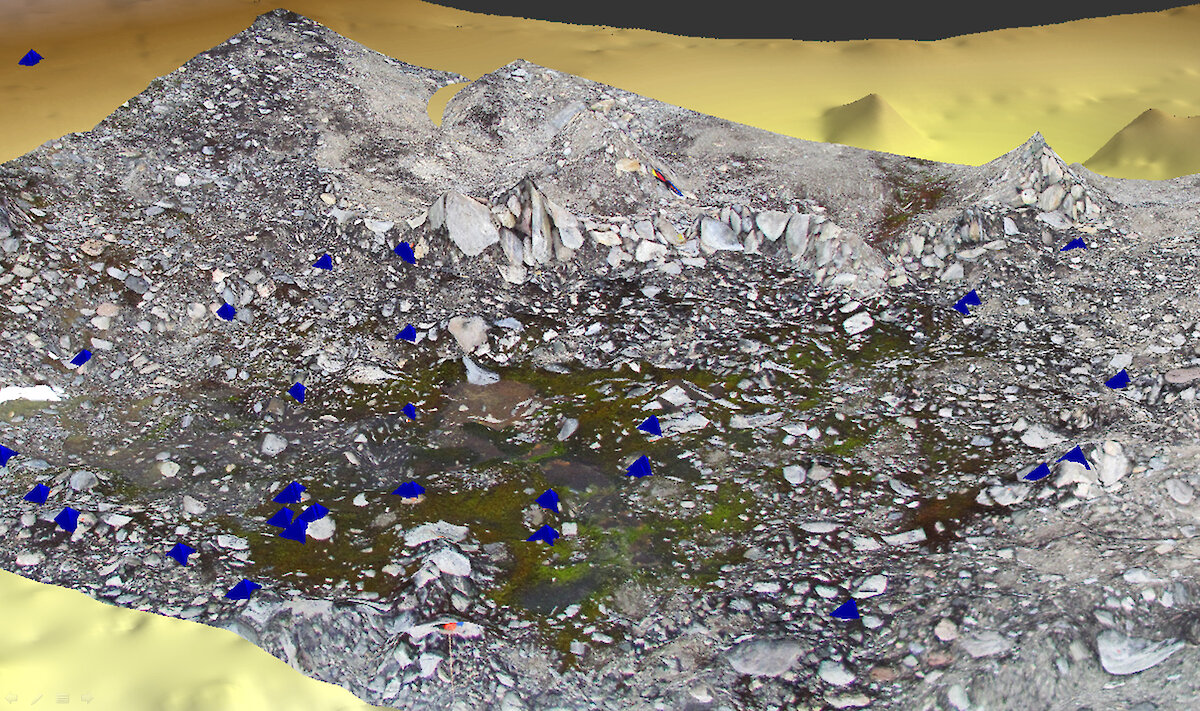
Accurate and detailed information on the micro-topography is of crucial importance for moss bed mapping and monitoring as it drives water availability and local temperature. To address this issue we adopted an exciting new technique developed in the field of computer vision. With this technique we can extract very detailed ‘3-D point clouds’ of the terrain by overlapping UAV photographs, allowing us to capture the micro-topography in an extremely detailed spatial dataset (see image at right).
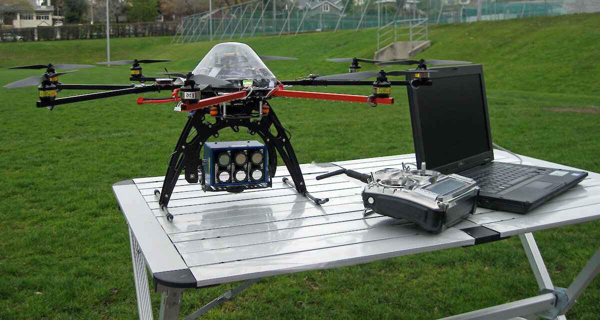
More recently we purchased and developed a new UAV called the ‘OktoKopter’. This multi-rotor helicopter is a much more stable platform than the UAV we developed in 2009. The OktoKopter allows us to take sharper photos with a full-size digital SLR camera and a stabilised camera platform. The Oktokopter also has an autopilot that allows autonomous navigation to GPS waypoints, enabling more efficient coverage of the moss beds. In 2011 we plan to use the OktoKopter to map the Casey moss beds in greater detail than before. The OktoKopter will carry three new sensors: a high-resolution digital camera (DSLR), a six-band multispectral camera (allowing us to detect moss species and their health), and a thermal camera for mapping the moss temperature. This exciting new equipment and the science behind it will provide us with state-of-the-art datasets that will teach us more about these special Antarctic sentinels.
ARKO LUCIEER1, SHARON ROBINSON2 and DANA BERGSTROM3
1University of Tasmania, 2University of Wollongong, 3Australian Antarctic Division