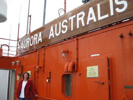
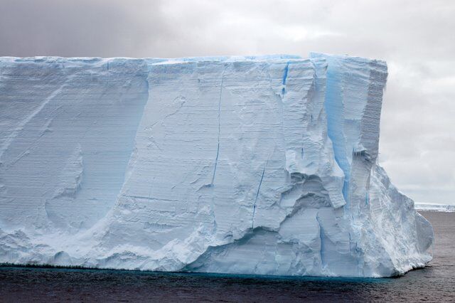
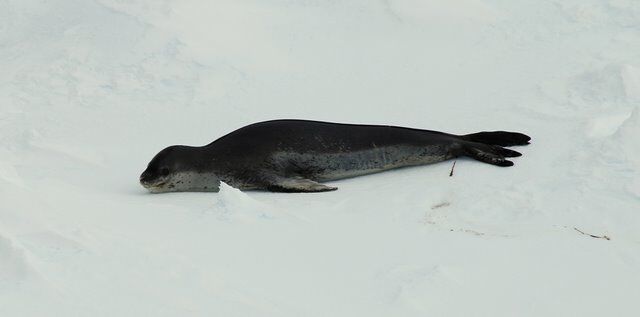
Between December 2009 and January 2010 Australian Antarctic Magazine Editor, Wendy Pyper, joined marine scientists aboard the Aurora Australis for a seven-week research and resupply voyage. Her diary provides a glimpse into some of the scientific work that was conducted. You can also read more stories about the research in Australian Antarctic Magazine 18, 2010.

Week 1 (7–13 December)

Departure

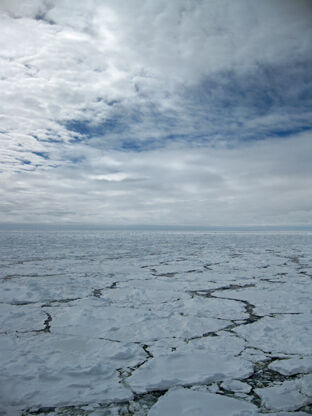
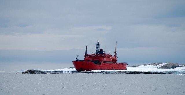
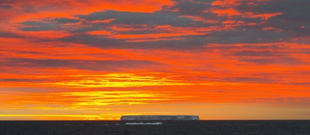
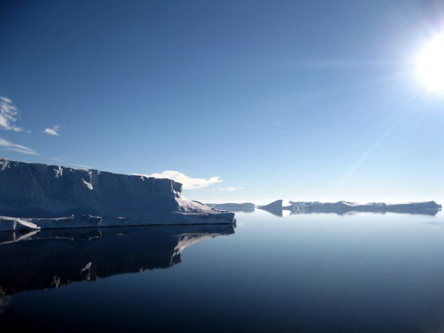
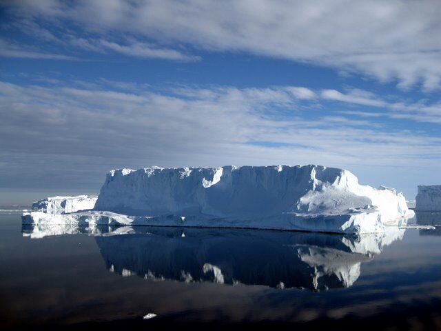
The Australian Antarctic Division’s first marine science voyage of the season started auspiciously with an orange sunset and calm seas providing a welcome backdrop for our departure on the evening of Monday 7 December. After two thunderous bellows from the ship’s horn, which saw those standing too close almost fall over the side, we inched away from Hobart’s Macquarie Wharf 3 and pointed the bow towards the Southern Ocean.

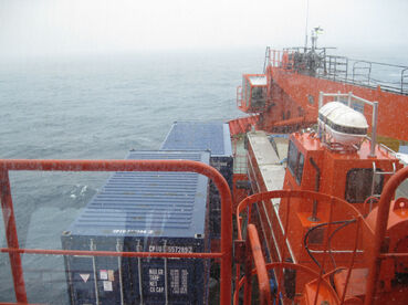
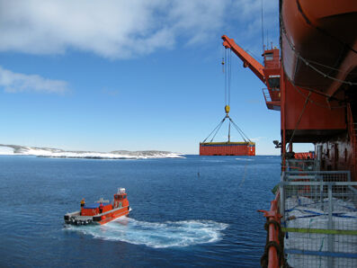
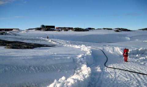
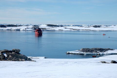
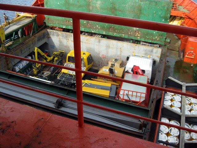
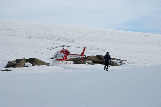
Throughout the day of departure, we were briefed on ship and polar safety and our environmental responsibilities. This continued on board the Aurora Australis with briefings from Captain Scott Laughlin, and Voyage Leader Doug Thost, and included a tour of the ship and lifeboats. Each lifeboat is fully enclosed and can accommodate up to 78 people in their claustrophobic embrace. With everyone belted tightly to their seats, the lifeboat is guaranteed to right itself in rough seas. It was a relief to step back onto the ship’s helideck, which is currently a puzzle of cargo destined for Casey and Davis stations. It’s one of the largest loads in the crew’s memory, and the ship had a definite list to the port side (left) on departure.

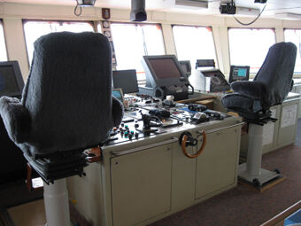
Next stop on the tour was the nerve and navigation centre of the ship — the bridge. From here there is a 180 degree view of the Southern Ocean. A strip of red carpet around the console of knobs, buttons and dials, designates the crew’s work zone, while blue carpet marks where sightseers can go.

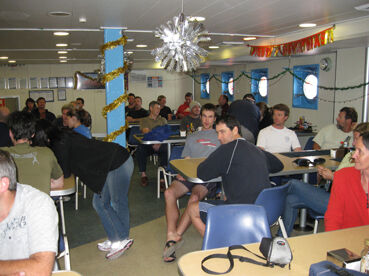
Navigating around the ship does not come so easily, with a confusing maze of stairs, corridors and doors. But we were given a useful guide to the different levels of the ship: A is for the top deck, B is for bridge, C marks the crew’s living quarters, D is the deck we sleep on, E is for eating at the mess and F is for fun — in the gym.

Back on D deck, my cabin-mate (a marine biologist) and I, set about making our beds and packing away our gear. The cabin sleeps three, but even with two people it is a squeeze to fit everything in. All the cupboard doors and desk drawers have locks on them, and there are straps and bungy cords everywhere to secure things in the inevitable rough seas. Our first night is a calm introduction to the Southern Ocean and we go to sleep to the soothing rumble of the engines.

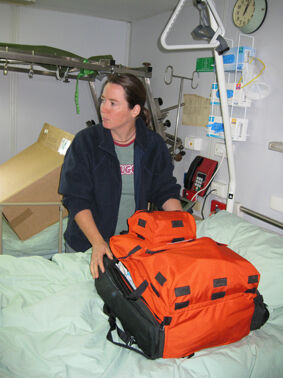
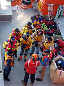
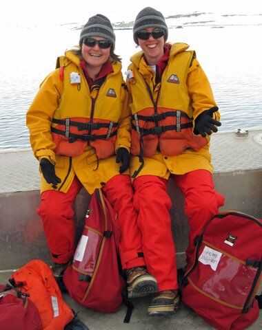
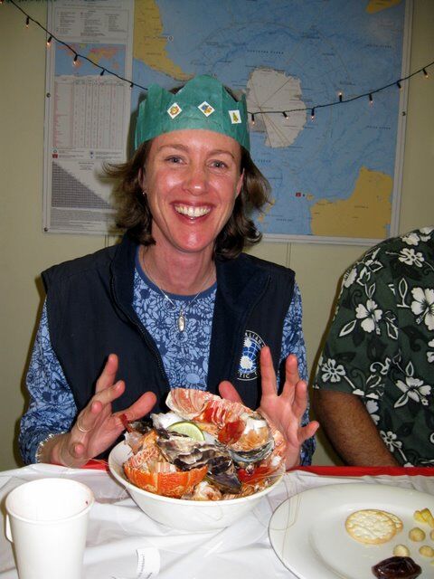
The next morning my cabin mate and I are struggling to find our sea-legs. I’m well enough to explore the ship a little and try to eat something, but mostly I just have to lie down. I’m forced out of bed at 11 am for the first safety drill (‘muster’) of the trip. We have to don our Antarctic clothing — a one piece freezer suit over thermal wear, beanie, gloves and muck-lucks (sheep-skin lined boots) — with a life jacket over the top. Our names are called and then we all troop back indoors to resume our prior activities.

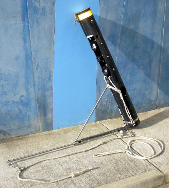
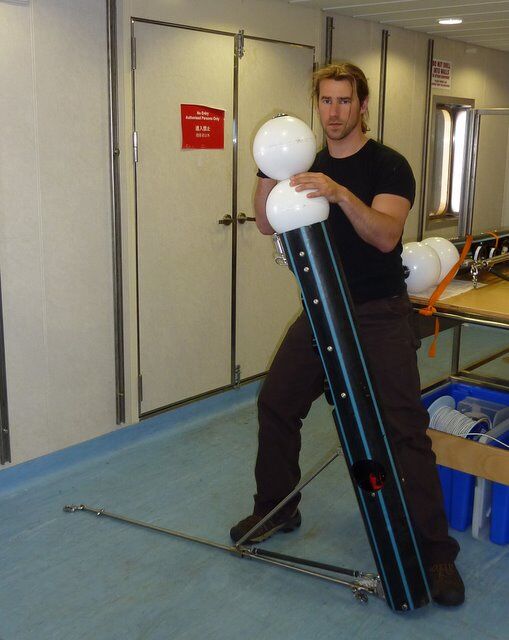
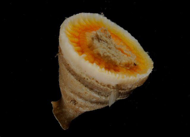
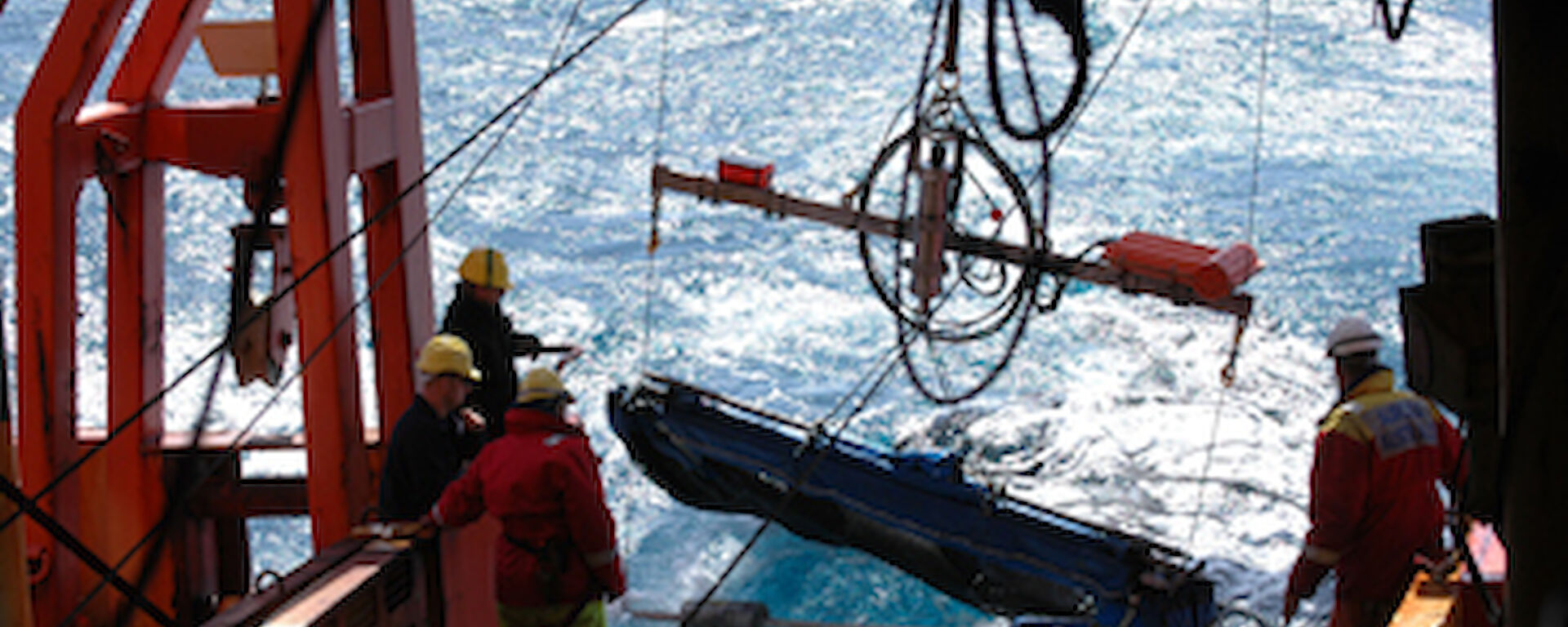
Rectangular Mid-Water Trawls

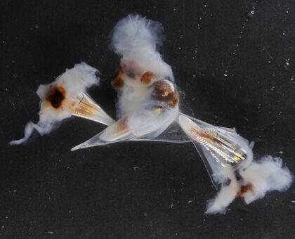
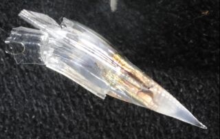
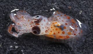
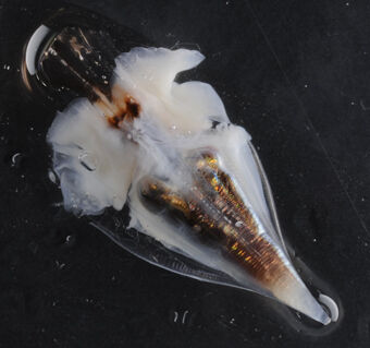
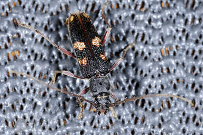
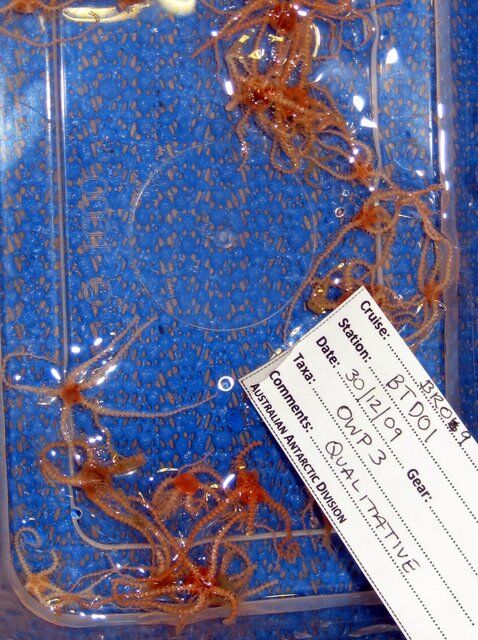
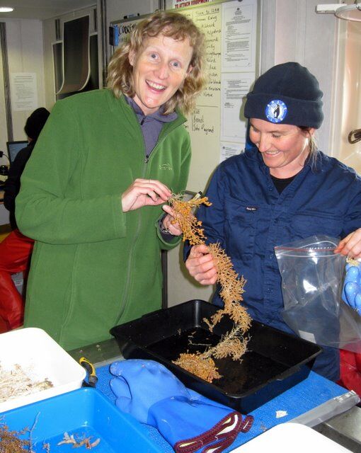
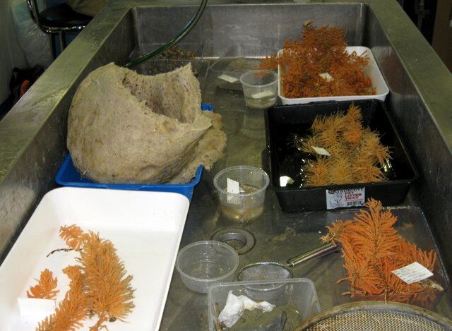
The first marine science project began on the second day of the voyage, Tuesday 8 December. A team of scientists from the Antarctic Climate and Ecosystems Cooperative Research Centre (ACE CRC), University of Tasmania and Australian National University (Team Acid) are researching the effects of ocean acidification on tiny marine snails, known as pteropods, and planktonic, single-celled, shell-forming organisms called foraminifera. The role of these organisms in the food web is not know, but they do act as indicators of change in the ecosystem which could have profound implications for commercial fish species, seals and whales.

About 40% of man-made carbon dioxide is absorbed by the ocean and forms a weak acid when it mixes with water. This acid affects the ability of pteropods and foraminifera to form shells, resulting in thinner, lighter, pitted or etched shells. As colder water absorbs more carbon dioxide than warmer water, the effects of ocean acidification will be seen first in the Southern Ocean. According to Dr John Baxter, a government scientific advisor from Scottish Natural Heritage who has joined Team Acid on the ship, ocean acidity has increased by 30% (a pH change of 0.1) since the beginning of the Industrial Revolution and is already affecting shell-forming marine organisms. Observed effects include thinner shells, fewer pteropods in areas where they were previously common, and an increase in gelatinous organisms such as jellyfish and salps.

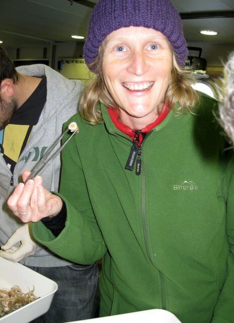
ACE CRC biologist, Dr Donna Roberts, says the team is undertaking the first study of the effects of ocean acidification on pteropods and foraminifera in their natural environment. “We want to establish a baseline of the health of these organisms in the ocean now, so that they can detect changes in the future,” Dr Roberts said.

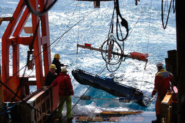
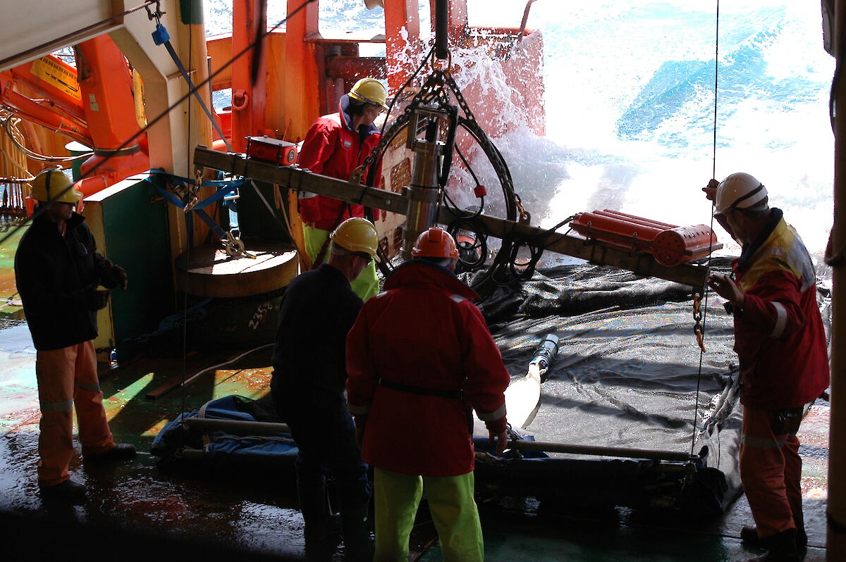
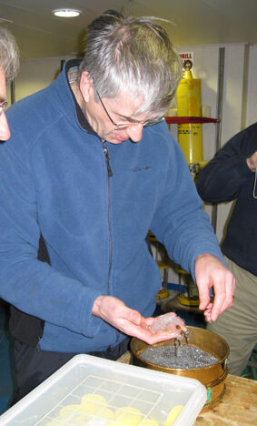
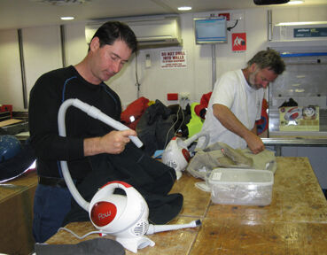
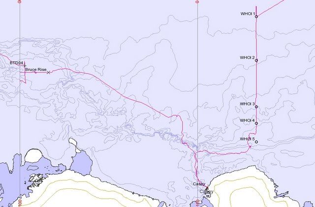
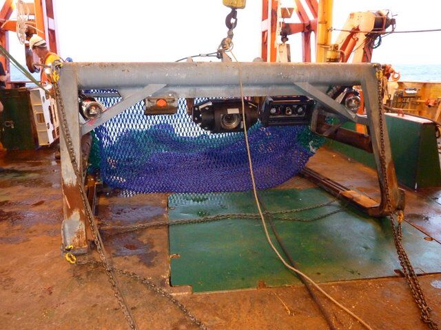
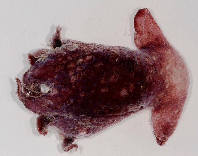
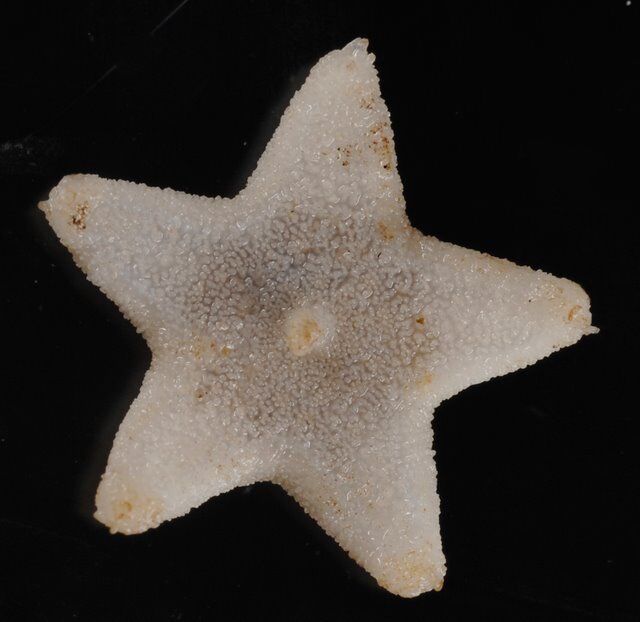
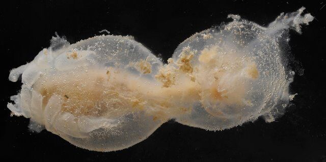
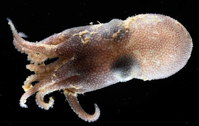
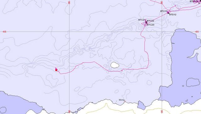
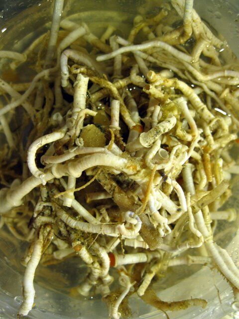
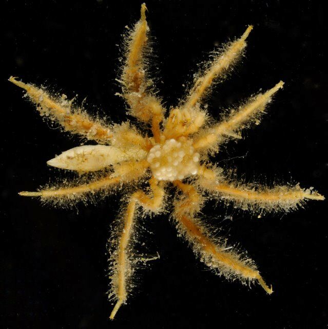
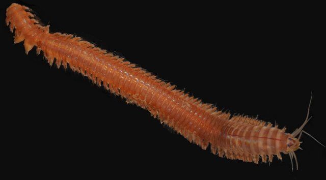
To do this the team are deploying a pair of rectangular mesh nets (rectangular midwater trawl — RMT) from 47 to 54 degrees south, along a line from Hobart to Casey. The team is hoping to catch larger pteropods with the 4mm mesh net, but the main species they are looking for is the tiny (0.5-1mm) Limacina helicina antarctica, which will be caught in the 150 micron mesh net. The microscopic foraminifera will also be sieved from the water brought up in the trawl and preserved for later analysis.

Week 1 (7–13 December)

Another ‘bucket of snot'

Team Acid is investigating the impacts of ocean acidification on microscopic marine organisms in the Southern Ocean. The researchers are conducting seven rectangular midwater trawls; three in subantarctic waters (45–49 degrees south), two in polar waters (54–56 degrees south) and one in the narrow channel of water where the subantarctic and polar frontal waters meet (51 degrees south). They expect to see a change in the shell weight, size and species of pteropods as we move further south into the colder and more acidic water.

On the trawl deck the ship’s crew winch the two RMTs into the heaving seas. Each net has a ‘cod end’ attached to it, which are cylindrical canisters to contain the sample. The nets remain closed until they reach the required depth — between 20 and 100m below the surface — at which time the team can remotely open the net to collect the sample. This particular depth is chosen as it is the region where scientists think the pteropods construct their shells.

Up in a control room above the trawl deck, the team hover around a pair of monitors displaying information about the temperature, depth, salinity and biomass as the nets descend. This information is relayed from a 'CTD' (conductivity, temperature, depth) instrument attached to the nets, and the ship's acoustic echo-sounders, which can detect organisms in the water, such as swarms of krill or phytoplankton. When an area of high biomass is reached, dots and blobs appear on the screen and the nets are opened up.

Fifteen minutes after deployment, the RMTs are retrieved. Team Acid move into the lab and begin bucketing and sieving through the samples. Both cod ends contain a glutinous mass of salps — ‘another bucket of snot’ as one crew member describes it — but this third subantarctic sample also yields some surprises; a tiny squid, a large selection of amphipods and some translucent predatory worms called chaetognaths. One of the biologists has set up a sophisticated macro photography system in the lab and he takes the opportunity to practice using it while the samples are still fresh.

Jellyfish ocean

Three more trawls that cross into Antarctic waters fail to catch any more pteropods, and the numbers of other organisms, including salps, is also dwindling. ACE CRC biologist, Dr Donna Roberts, says the absence of creatures from the trawls around the sub-Antarctic boundary, is probably due to the unstable ocean temperature, where the upwelling of warm and cold water mix. The huge abundance of salps and other gelatinous creatures in the earlier trawls is typical of these waters, some theories suggest an increase in salps is occurring creating a ‘jellyfish ocean'.

At the seventh RMT site at 54 degrees south, Team Acid hit the jackpot. One large pteropod of the Clio genus and six small Clio shells are captured. Dr Roberts wears a huge grin as she preserves the impressive specimens in ethanol.

Team member Alex Pentony Vran, an engineer from the Australian National University, has been recruited to Team Acid to examine the mechanical properties of pteropod shells and provide definitive evidence that they are becoming more fragile. Previous work has focussed on changes in shell weight and the use of optical microscopy to examine shell thickness. In contrast, Alex will take the shells captured on this trip, apply force to them with an extremely fine diamond-tipped probe, and measure their response. This will allow him to put a figure on how strong or weak the shells are.

Week 1 (7–13 December)

A trip to the doctor’s surgery

A few days into the voyage I take a trip up to the doctor’s surgery to see how things operate there. Dr Cath Deacon has a wealth of field experience under her belt, with numerous Antarctic trips and work in war-torn countries for Medicine sans Frontiers. But as the only doctor on ship, she has put out a call for volunteers with some first aid training to assist in the event of an emergency.

A group of about six expeditioners with wilderness first aid training or senior first aid gather in the surgery. The most important part of Dr Cath’s first response kit is the big red ‘Thomas bag’ which contains all the drugs she may need, bandages, syringes, needles, and equipment for catheterising and establishing an airway or an intravenous site. Nearby is a stretcher and oxygen concentrator that administers about 40% oxygen. One wall of the surgery is lined with cabinets full of books and equipment, while the other wall contains colour-coded drawers, filled with bandages and medicines.

Dr Cath takes us through the use of the portable defibrillator and CPR (cardiopulmonary resuscitation). We practice CPR on a dummy and refresh rusty first aid skills — 100 compressions per minute, 2 breaths every 30 compressions. Dr Cath says silently singing the Bee Gees’ tune ‘Stayin Alive’ will help keep us on 100 beats per minute.

The surgery is also equipped with an anaesthetic machine, ventilator, X-ray machine and of course, the surgical table. A few sea-faring expeditioners have gone under the knife in years past, including one who needed an appendectomy just last year. Appendicitis is one of the most common reasons for surgery in Antarctica and all doctors travelling with the Australian Antarctic program have their appendix removed. Fortunately, expeditioners don't need to go through the procedure, but I leave the surgery confident that if I need one, I'll be in good hands.

First iceberg

At 57 degrees south we encounter our first iceberg. It’s Saturday morning, 12 December, and the bridge is swarming with first timers wanting a glimpse of the ice. Old hands say don’t waste your time on the first iceberg as they'll only get better, but what newbie can resist snapping every angle of the icy-blue monsters. Our first iceberg is 200m long and looks like it’s been floating around for a while with its smooth, cake-icing surface slowly sagging into the sea. Regular sightings of bergs continue throughout the day, but we're still at least a day away from the sea ice.

Endless ocean

Time seems to expand in the Southern Ocean. We've been at sea six days now but it feels like 12. I visit the bridge on Sunday morning, 13 December, and scan the horizon. Apart from a few icebergs yesterday, there has been nothing but undulating grey water stretching from one end of my world to another. A flock of about 20 small seabirds (prions) keep pace with the bow of the ship, cavorting effortlessly over the waves. I wonder where they came from, where they're going to, and how something so small and seemingly fragile can survive in this vast, watery desert.

It’s not a desert though. As the recent trawls have demonstrated, life teems just below the surface. The phytoplankton and zooplankton that we have been sampling makes up the bulk of the world’s biomass and sustains life on earth. Without it we wouldn’t have oxygen to breathe, or food to eat.

In the afternoon a snow shower develops and deposits large, fat flakes on the deck. It's 0.4 degrees Celsius outside. We can almost smell the start of the pack ice.

Last night, as we crossed 60 degrees south, the first timers amongst us were required to pay homage to King Neptune. It was an entertaining, if somewhat sticky ceremony that left all in need of a shower. An odd aroma of chocolate mousse and salmon hung in the air for some time after. The day has been fairly quiet with many people taking the time to rest before the next big science project kicks off tomorrow. This will see five very large and very expensive current moorings deployed in the sea ice zone over a period of 48 hours.

Week 2 (14–20 December)

Team America

Three technicians, Jeff Pietro, Daniel Bogorff and Brian Hogue, from the Woods Hole Oceanographic Institute (WHOI) based at Cape Cod on the east coast of the United States, have joined the marine science voyage to deploy five moorings — very long lengths of wire cable with instruments and buoys attached. WHOI is the largest non-profit, marine education institution in the world and is famous for its deep-sea submersible, Alvin, used to discover the wreck of the Titanic.

Jeff, Daniel and Brian, aka ‘Team America,' have an enormous job ahead of them over the next 48 hours. A good complement of the ship’s officers and crew will also be engaged in the work to manoeuvre the ship into the right spot and get all the equipment safely assembled and off the trawl deck into the Southern Ocean. It’s a dangerous operation with a lot of heavy equipment, winches, hooks, chains and ropes in cold and slippery conditions.

The idea is to deploy the five moorings at different depths along a line running from 62–65 degrees south (and 113 degrees east), into the Mertz Glacier polynya. Here instruments attached to the moorings will spend two years measuring ocean properties, in particular current speed, conductivity (salinity) and temperature at different depths.

The work is part of a collaboration involving WHOI, CSIRO and others to measure the outflow of dense (cold and salty) Antarctic Bottom Water produced in the polynya. Recent work in the region by CSIRO has found that dense water near the sea floor is becoming fresher (less salty and less dense). This may be because of increased precipitation, a decrease in sea ice formation (sea ice formation increases the saltiness of water beneath the ice), or increased glacial melt in Antarctica. It’s hoped the five moorings will help scientists determine the actual cause.

Each mooring is a different length — 4220m, 3520m, 2520m, 1520m, and 1020m — and various instruments are attached along the wire to correspond to parts of the sub-polar gyre the scientists want to study. The moorings are anchored to the sea floor by about 2 tonnes of steel, and the cable and instruments are suspended in a straight line above using a series of small floats every 500m and one large, yellow buoyant sphere at the top. The whole package sits almost 500m below the ocean surface, lending it the name ‘sub-surface mooring'.

Among the many gizmos attached to each mooring cable is a McLane Moored Profiler (or MMP). This robot is programmed to move up and down its section of cable measuring current speed, temperature, conductivity and depth. In two years it will profile over 1 million metres of water.

Each mooring also has a number of stationary Vector Averaging Current Meters (VACM) — the workhorses of physical oceanography — which measure current speed and direction, temperature, and pressure. Every 30 minutes, these instruments record an average of their measurements over that time. Two moorings also have Acoustic Doppler Current Profilers (ADCP) which sit on the top buoy and profile the top 500m of water.

Mooring deployment

After days of calm seas the swell picks up for the first mooring deployment. Jeff, Daniel and Brian have been waiting a year for this moment and fortunately conditions are still deemed safe for work to begin. Over six hours, Team America and the crew painstakingly assemble the first mooring in 500m sections, beginning with the big yellow buoy at the top. Four kilometres of cable is gradually winched out, instruments and smaller buoys are attached, and the 500m sections are lowered into the ocean. The ship moves slowly towards the final mooring position trailing a string of yellow buoys behind it. Once in place, the two tonne anchor is attached to the final section of cable and the whole lot is released. The anchor will sink to the spot scientists have selected to study, dragging the entire mooring down with it in a nice, straight line.

Over the next two days Team America and the crew repeat this procedure and successfully deploy all five moorings. In the sea ice zone the order of assembly is reversed, with the anchor going in first at the designated spot, and the top buoy last.

In two years time the team will return to collect the moorings which each have an ‘acoustic release’ at their base. An acoustic code will unlock the moorings from their anchors and the buoys will bring each mooring to the surface, where they can be winched back to the ship.

Week 2 (14–20 December)

Into the pack ice

We woke to the most incredible sight on Tuesday morning. Pack ice stretching from one horizon to the next, punctuated by a metropolis of sky-scraper icebergs. I couldn’t get out of bed fast enough.

According to the day’s ice conditions report, we're moving through small first year floes. The sea temperature is −1.7 degrees Celcius and the air is almost as cold. The ship moves easily through the large white pancakes with their crisp, meringue surfaces. Sharp cracks appear near the edges of each pancake as we pass and large blocks calve off and bounce in the blue water, before exposing their slushy undersides, brown with sea ice algae.

A crabeater seal and a nervous-looking Adélie penguin appear, sharing a single floe. Even with a 200mm telephoto lens they're still too far away and I envy the few people here with larger lenses. White snow petrels and brown and white cape petrels fly laps around the ship, these small, agile seabirds easily disappear as they dodge and weave amongst the ice floes. Later I spot an emperor penguin and manage to capture it on camera.

Aliens on board

Since our departure we've apprehended a number of hitch-hikers on board — a spider, two moths, two flies, a longicorn beetle and a mosquito. As the ship’s Voyage Environment Officer, it’s my job to preserve each humanely killed ‘alien’ and record the details of its find using the ship’s ‘Alien Invertebrate Kit'. Soft-bodied organisms such as spiders are preserved in 70% ethanol, while the insects are placed in a jar with desiccant and cotton wool, to protect their delicate legs. These will be returned to Australia for identification. Capturing these potential Antarctic invaders is important because if they did become established at our stations, they could cause extreme environmental damage, and eradication is often very costly. The information recorded also helps us improve our quarantine procedures before departing Australia.

Another important part of preparing to disembark in Antarctica is to ensure any gear used in Australia — especially boots, backpacks, camera bags, tripod feet and outer-wear — is free of seeds, soil, insects and other organic material. For most of Thursday expeditioners and crew were busy vacuuming clothes and bags and scrubbing shoes with a sterilising solution. Boot cleaning will be repeated between Casey and Davis to ensure there is no cross-contamination between Antarctic sites.

Iceberg watch

We sighted some large icebergs throughout Wednesday and Thursday, particularly as we negotiated an iceberg graveyard called Peterson Bank, east of Casey. This is an area of shallow water where icebergs become grounded until they melt enough to roll over or lift off the sea floor.

Since our first iceberg sighting four days ago, volunteers have been conducting an ‘iceberg watch'. This is part of a long term program to record changes in the number and size of icebergs over time. The Australian Antarctic program has collected a huge dataset since 1977, spanning the region between Casey, Davis and Mawson (50–150 degrees east) and north towards Australia.

Once every three hours, two people go to the bridge to look for icebergs within six nautical miles of the ship. When they spot one, they use the radar to approximate its distance and a sextant to get the degrees of angle between one end of the berg and the other. Plugging the distance and degrees into a conversion table allows them to determine the length of the iceberg. The icebergs are separated into six size classes, from a minimum of 25–100m to more than 3200m, and the number of icebergs in each class is recorded. Anything less than 25m is considered a ‘bergy bit', and only a sample of the visible icebergs is measured, rather than every single one.

Since entering Peterson Bank we've passed at least 126 icebergs, most between 200–800m in size and a few in the 1600–3200m class. They're an incredible and beautiful sight, but it’s my first iceberg that has been etched into my memory.

Week 2 (14–20 December)

Camp Quality

On every voyage, expeditioners and crew find ways to raise money for Camp Quality, a charity for children with cancer. On Thursday night an auction was held. Among the quality items up for grabs were a Woods Hole Oceanographic Institute t-shirt, a garden hose, a 30 minute shoulder massage, a copy of an extreme skiing video, some stunning rope work by one of the crew, a screw driver set and the only packet of Doritos (corn chips) on ship.

The stakes were raised with the sale of a colour field guide of the benthic invertebrates of Heard and McDonald Islands, signed by the authors, for $350. You can tell this is a marine science ship! This was soon exceeded by a large, rare print copy of the ship’s fire escape plan for $565. As bidders were swept along by our Voyage Leader’s sales banter, over $2885 was raised for the charity.

Casey at last

Twelve days after leaving Hobart, we arrive at Casey two days ahead of schedule. A few people stayed up all night to witness the event and were treated to a spectacular pink ‘sunset’ over the icebergs at about 3 am. At this time of year the sun barley dips below the horizon before rising again, so it never gets dark.

There was tense excitement on the bridge for many hours before our arrival as we negotiated thick sea ice. The need to deploy the Woods Hole ocean moorings at defined depths and longitude has meant an unusual and not usually recommended approach to the station, through the iceberg graveyard at Peterson Bank. While this has provided us with exceptional sightseeing opportunities, it’s been difficult for those ‘driving’ the ship to find ‘leads’ (gaps) in the sea ice that will allow the ship to pass. Usually the winds and currents push the sea ice up against the grounded icebergs, causing it to pile up so thickly that even the 8000 tonne icebreaker can’t get through.

Luckily the weather has been particularly calm and warm this week and with the help of a Casey-based C212 aircraft, which buzzed the ship a few times, we found one lead that led directly to open water in front of the station. After some painstaking manoeuvring that saw our progress drop to about one nautical mile an hour, we were finally clear of the ice and steaming towards Casey.

Goodbye Casey winterers

I wake on Friday to a view of the station from my porthole. Up on the bridge I watch as a ‘raft’ of curious Adélie penguins porpoise their way across the bay to inspect the giant, orange intruder in their midst. A group of them sunbake on a nearby ice floe and later, I watch them line up in an orderly fashion and dive off, one by one, and disappear into the freezing water.

We begin preparations to move some cargo and people ashore almost immediately. The station is currently filled to capacity, so some people will come aboard the ship while our 10 Casey winterers will go ashore. After almost four months of preparation and training in Hobart, the team are itching to get on station and start work.

The barge and crane operators are kept busy moving shipping containers from ship to shore for most of the day and then at 5 pm the winterers’ moment arrives. The crane lowers their gear in a net onto the barge and then, donning Antarctic clothing and life jackets, the winterers step aboard and motor across the bay to their home for the next 13 months.

A roster is drawn up for the rest of us, with some people going ashore during the week to help in the kitchen, and others rostered to monitor the fuel line when we start pumping the 700 000 litres of fuel we've bought for the station. It will be my turn to go ashore on Sunday.

Week 3 (21–27 December)

Slushy for a day

It’s Sunday morning 20 December and I’m up early preparing for my first step on the Antarctic continent. Along with three others, I’m on ‘slushy duty’ in the Casey kitchen. We’re told to put on our Antarctic survival gear — thermals, polar fleece, wind-proof jacket and pants, warm boots and socks, beanie and gloves and of course, sunscreen. At 7:30 we put on life jackets and, encumbered by so much clothing, waddle to the port-side exit where a wooden rope ladder swings a few metres above the barge. Willing myself not to fumble or trip, I descend safely and then we’re off.

A few Adélie penguins greet us at the Casey wharf and then we walk up a gravel track towards the station, stopping every five metres to take photos. My first impression is surprise at the large outcrops of what look, to my non-geologist eyes, like pink granite boulders — perfect snow petrel habitat. Later in the day we discover that in fact many pairs of snow and storm petrels make their nests in rock crevices around the station and are the source of much distant chattering and squawking.

As we arrive at the colourful Legoland of shipping containers that house the services and residents of Casey, I’m struck by the ski-village feel of the place. A few people trudge up and down the snow-covered paths, a network of pipes snake between buildings, a Hägglunds rumbles past and old building materials, stacked on scaffolding, sit partially buried in snow. Inside the ‘red shed’ — the main accommodation and eating area — clothing and boots fight for space in the small atrium allocated for outer-wear. Another door opens into the heart of the building, where people go about their business in socks and t-shirts. A small reading area is illuminated by large, picture windows with a view to Newcomb Bay, a few people are playing darts, and some upbeat music emanates from our next stop — the kitchen.

Four of us have been assigned slushy duty today and within minutes we’re up to our armpits in washing up and food preparation. Two of my colleagues from head office are working as slushies for a few weeks and introduce us to the chefs, ‘Rocket’ and Steve, and start assigning duties. My first task is to make up two 5 litre buckets of milk and some juice (the station uses only powdered milk and concentrates of fruit juice and soft drink to reduce packaging waste). Next I slice year-old potatoes for the night’s roast and then, foolishly, I volunteer to bone some trout.

Steve presents me with a large tray of the cooked fish and demonstrates the boning technique; chop off the head and tail, remove the skin, gently open the fish to expose the spine and, with a little care, lift the spine and a million tiny rib bones off the flesh. Easy. After the first five or so fish I start to get some kind of technique happening, although it’s not exactly how Steve showed me. I worry about the expeditioners who will eat this fish in a terrine on Christmas day and hope they don’t choke. It’s slow going but at fish number 15 I start to feel a sense of achievement as I remove increasingly large pieces of flesh from the bone. As the last fish goes under the knife I look forward to a rest. My clothes and hands are covered in fish oil and fish bits and my back aches from hunching over looking for bones. Steve brings out two more trays of fish.

Some time later I have a chance to walk to Reeve’s Hill, overlooking Newcomb Bay, where the ship is anchored. A large cross on the granite slope serves as a memorial to Deputy Station Leader, Geoff Reeve, who died of exposure on 6 August 1979 after becoming lost in a blizzard. It’s a stark reminder of where we are. As we gaze across the mirrored surface of the bay, it’s hard to believe this oasis of calm can disappear in a howling whiteout for days.

Back in the kitchen I vacuum seal some freshly prepared meals for expeditioners in the field. The chefs do a fantastic job creating nutritiously balanced and tasty meals every day, especially as the supply of fresh food dwindles. It’s been about 13 months since the last resupply and everyone is keen for the fresh food containers to be unloaded from the ship. In the meantime, tinned and frozen supplies and station-made bread, keep stomachs full.

After snatching a meal it’s time to wash up, sweep and mop floors, repackage all the left-overs, which will be transformed into something completely different for tomorrow’s lunch, and wipe down tables. I’m impressed by the people who do this tiring and endless job every day for weeks or months, and by the chefs who patiently supervise people like me and turn out huge quantities and varieties of food for breakfast, morning tea, lunch, dinner … and field trips. Perhaps my desk job isn’t so bad after all.

Refuelling and resupply

On Monday, day four at Casey, we begin pumping fuel between the ship and the two ‘fuel farms’ at Casey. According to our Voyage Leader, Doug, about 1.5km of fuel hose is deployed from the ship, across the water, to a point on the shore and then to the station’s fuel tanks. Once pumping starts it doesn’t stop, and constant vigilance is needed to monitor the hose for any leaks and protect it from ice moving into Newcomb Bay. Teams of people in small inflatable rubber boats (IRBs) patrol up and down the line in four hour shifts throughout the night, nudging bergy bits away from the hose, while others monitor tank levels on shore. At 40 000 litres of fuel per hour, the transfer takes about 17 hours.

With the refuelling complete the resupply team turns to the enormous task of unloading all the cargo for Casey and the Wilkins Runway. First priority is an 18 tonne sled for Wilkins, which has to be moved before we can access all the other important stuff, like the fresh food containers. To do this some large floating platforms called Uniflotes are assembled first. We have five of these 5.2m x 2.4m platforms lashed together, each capable of supporting eight tonnes, and which are manoeuvred by the barge or another work boat called the ‘Pagadroma’ (the scientific name for snow petrel). Once the Uniflotes are in place, the ship’s crane lifts the sled over the side of the ship and lowers it onto the Uniflote.

With the top deck clear of the sled, the next layer of cargo — in the ‘tween’ deck (between the upper and lower decks) — can be accessed. Two refrigerated shipping containers of fresh food finally make their way to Casey, followed by a snow melter, a snow groomer and a tracked vehicle for Wilkins, a Toyota HiLux, and containers filled with equipment relating to ‘infrastructure', ‘plumbing', ‘telecommunications', ‘science', ‘mechanical’ and intriguingly, ‘mixed groups'.

Once the majority of cargo has been removed, various containers required for Davis (our next stop) and our next marine science project will be reshuffled to more suitable locations, and space made for cargo being ‘returned to Australia’ from Casey.

Week 3 (21–27 December)

On Thursday, Christmas Eve, I’m lucky enough to get a boat trip out to an Adélie penguin breeding colony on Shirley Island, just off Casey. The incoming and outgoing Casey station leaders have arranged for a visiting ABC television crew from the science show, Catalyst, to get some video footage of the penguins and there’s room for me in the boat.

We zip ourselves into ‘Mustang’ suits designed to keep us warm out on the water and meet our skipper at the Casey wharf. After a briefing about what to do if we fall in, and how to move about the inflatable rubber boat (IRB), we tumble in alongside television cameras, tripods and boxes of survival gear and chocolate.

We spend some time cruising slowly past ice cliffs fringed with long icicle daggers, and icebergs with deep cracks that radiate blue light. We spot two Weddell seals sleeping on the sea ice. Then, as we set course for Shirley Island, our boat is escorted by a group of porpoising penguins.

As we beach the boat on a rocky outcrop of the island and clamber ashore, small groups of penguins hurry to greet us and then stand, uncertainly, a few metres away. They crane their necks and ogle us with their white-rimmed eyes, chattering and waving their wings as they shuffle back and forth.

At the top of the rocky outcrop is a fantastic view of thousands of penguins clustered in small nesting groups, dotted along the ridges and slopes of the island. A faint waft of guano travels on the breeze along with the sound of some 8000 squabbling adults and the occasional ‘peep’ from a chick.

We approach one group slowly and quietly and sit and watch for about 30 minutes. A chick appears; a tiny ball of grey fluff under its mother’s belly. Its head wobbles above its pencil-thin neck as it demands food then, sated, it rests for a few moments before trying again. Some male penguins wander up and down the slope carrying rocks in their beaks and presenting them to their nest mates. Each time, they have to run the gauntlet of other nesting penguins and are pecked and chastised for their trouble.

A few skuas circle the colonies. They're like vultures looking for opportunities to snatch eggs or young chicks from under distracted parents. One lands beside our colony and silently menaces an adult which stands up, its hackles raised and its eyes glued to the skua. Graham, our guide, says the skuas often work in pairs, with one distracting the penguin from the front while the other darts in underneath. We leave the colony quietly, taking care not to give the skua the opportunity it seeks.

The Catalyst team is pleased with the day’s efforts and the cameraman leaves with a satisfied grin on his face.

Back at the station we reflect on the day’s adventure with fellow expeditioners over a hot meal and think how fortunate we have been to have glimpsed life in an Antarctic Adélie penguin colony.

Christmas Day

It’s Christmas morning and I’m still buzzing from the excitement of my penguin encounter. It doesn’t really feel like Christmas as we are so distanced from home and family and so focused on completing the station resupply. But the satellite phone runs hot all day with people calling home and a few Santa hats appear. A package arrives at the ship from Casey for me and I open it to find gifts from my family — books, puzzles and chocolate — thoughtful distractions for a seven week voyage.

After lunch the tables in the ship’s mess are beautifully decorated for Christmas dinner and a menu of the buffet to come is posted on the notice board — summer berry fruit punch, an assortment of cold meats, lobster, prawns and oysters, poached salmon, antipasto, a variety of salads, a cheese platter and a selection of deserts including Christmas pudding, sticky date pudding, trifle and pavlova. If that’s not enough, rum balls, biscotti and shortbread cookies will surely fill the gaps.

The cargo operations finish in the early afternoon. At 5pm the ship’s anchor is lifted and we set ‘sail’ with three blasts from the horn. A handful of people, including two expeditioners who are returning to Australia after 13 months at Casey, set off flares at the stern of the ship as we wave goodbye to the new expeditioners on shore.

At dinner we toast absent friends and family and exchange ‘secret Santa’ presents. Later, I go up to the bridge and spend an hour photographing hundreds of enormous icebergs as we retrace our passage through Peterson Bank — the iceberg graveyard. It is certainly a Christmas night to remember.

Week 3 (21–27 December)

Within hours of leaving Peterson Bank our progress is stymied by thick sea ice. We're some 222 nautical miles from our target destination, Bruce Rise, where the next marine science project will begin, and we've travelled four nautical miles in 24 hours. We're currently drifting with the ice floes and, as a result, heading in the wrong direction. Mid-morning on Sunday a CASA aircraft flies out from Casey to try to identify suitable leads in the ice.

While we wait, a lone killer whale surfaces in the small pool of open water surrounding the ship. I’m not fast enough to witness its 20 second appearance, but in the aftermath a group of Adélie penguins leap from the water and spend the next hour peering over the ice edge and trying to decide what to do next. They move as a group, occasionally stopping to squabble, running and jumping over lumps of ice, sometimes sliding on their bellies when they get left behind. Then one heads off boldly in another direction, throwing the rest into confusion.

'Fishing’ at Bruce Rise

Leaving the penguins to their deliberations I head off to a marine science briefing. Principal Research Scientist, Dr Andrew Constable, and on-the-ground project manager, Graeme Ewing, explain that once we reach Bruce Rise we will spend about 10 days documenting the sea-floor ('benthic') habitat and communities of organisms ('benthos') in the region, and the effect of bottom-fishing gear (trawl and longline) on these communities. The aim is to assess the vulnerability of, and risks to, habitats in the Australian Exclusive Economic Zone, from trawl and longline gear.

To do this a sophisticated and robust set of still and video cameras has been designed by Australian Antarctic Division research technicians to attach to the fishing gear and automatically switch on at the required depth. As the gear moves along the sea floor, powerful LED lights, attached to the cameras, illuminate the area and provide a clear view of the habitat and the action.

The cameras were successfully trialled around Heard Island and McDonald Islands in 2004 and off the Antarctic coast in 2007, providing the first footage of the interaction of bottom fishing gear with the benthos.

The work was part of a collaborative project between the Antarctic Division and the two licensed toothfish operators in Australian waters, Austral Fisheries and Petuna Sealord. These two operators have played an important role in facilitating research to underpin sustainable fishing and conservation measures set by the Commission for the Conservation of Antarctic Marine Living Resources (CCAMLR).

This new project at Bruce Rise extends the research into an unexplored and high latitude part of the Southern Ocean, in a region of interest to toothfish fishers. It is the first collaborative project between the Australian Antarctic Division, the Australian Fisheries Management Authority, the Fisheries Research and Development Corporation and the Australian fishing industry that aims to provide CCAMLR with information and precautionary approaches to assist conservation and sustainable fishery management in the region.

While the cameras will capture fishing gear impacts and help scientists to map the types of habitats present, a team of biologists will rotate on 12 hour shifts to identify and preserve all the invertebrate creatures (animals without a spine) hauled up in samples from the deep; between 800 and 1500m below. Many of the biologists have been studying their ‘Field Identification Guide to Heard Island and McDonald Islands Benthic Invertebrates’ in preparation for this task and posters of the species we're likely to see have been pinned to the walls of the ‘wet lab', where the samples will be sorted.

The biological samples will give scientists an insight into the types of benthic habitats in the area, their extent and their association with physical features such as seamounts, abyssal plains or canyons. This information will be used by CCAMLR to predict the location of habitats vulnerable to bottom fishing and to manage these areas in a precautionary way.

Week 4 (28 December — 3 January)

Zig-zagging to Bruce Rise

For two days we have been slowly zig-zagging our way through unyielding sea ice towards Bruce Rise, located north-west of Casey at approximately 63 25 S, 102 27 E. After our enforced rest on Sunday while we waited for the CASA ice reconnaissance flight, we picked up the pace on Monday and made about 2.3 nautical miles in eight hours at an average speed of less than one nautical mile per hour. The flight confirmed that the ice conditions eased about five nautical miles ahead, so we pressed on and were rewarded on Monday night with open water punctuated by looser pack ice.

Trawl trialling

It’s now Tuesday, 29 December, and the benthic invertebrate team begin trialling the beam trawl camera system to iron out any glitches before the serious sampling starts. The beam trawl is a one-tonne, steel, A-frame ‘sled', about 1.5m high and 2m wide, which supports a trawl net. Beam trawls are used mostly for research purposes, although they are used by some fishers in Europe to catch bottom-dwelling species.

The video and still cameras are mounted in ‘crash frames’ at the top of the trawl sled and the whole set-up is winched out over the stern of the ship. The still camera takes high resolution digital images of the sea floor every 10 seconds, while the video takes continuous, low resolution black and white footage.

The longline-mounted video camera, in comparison, is housed inside a narrow length of poly-pipe with two buoys at one end. The pipe is attached to the longline, which is essentially a thick piece of rope about the diameter of a 10 cent coin that sometimes contains lead threads to help the line sink faster and sit firmly on the sea floor. On commercial vessels, hooks are attached to this line by small lengths of rope called ‘snoods’ and the complete set-up is shot out of a narrow window at the stern of the ship.

The benthic team is using their camera on an experimental ‘demersal’ longline. On commercial fishing boats, demersal longlines drop down to the sea floor and then run along the bottom for up to 10km, catching toothfish. Our longline has no hooks and is only 1–2km long.

Once the longline camera reaches the required depth, a clever release system allows a long, steel arm and bracket to fall away from one end of the housing and, with the help of the two buoys, keeps the camera propped upright on the sea floor. Here it can see what happens to about five metres of line in front of it.

One of the cameras’ creators, Antarctic Division research technician Robbie Kilpatrick, said both the trawl and longline cameras have been designed for easy use by the fishing industry. They are now robust and automated enough that they will shortly be deployed on commercial fishing boats by scientific observers — who monitor the quantity of catch and the types of species caught. The cameras will allow fishing vessels to see the habitat they are working in, and move on from an area if it contains species deemed ‘vulnerable’ to bottom fishing by the Commission for the Conservation of Antarctic Marine Living Resources (CCAMLR).

The benthic team isn’t aiming to catch anything today so the trawl net is removed for all but one beam trawl tests. When the net is reattached, a few worms and brittle stars are inadvertently captured and these provide the first good quality specimens for the biologists to examine. A small team gets to work identifying, cataloguing, preserving and photographing the creatures and generally trialling the wet lab set-up and procedures.

The first picture of the sea floor is also captured by the beam trawl camera, and reveals a consistently flat and muddy ‘paddock’ with no immediately apparent benthic communities.

Up on the bridge another part of the team is running the ship’s acoustic echosounders to better define the bathymetry (depth) of the area and identify any interesting features, such as trenches or canyon heads, for us to sample. The cameras can operate to about 2000m, but for these tests a depth of between 500 and 1500m is desired. So far the Bruce Rise has proved to be very deep (1400m) compared to the nearby shelf areas around Antarctica (600m) and the search for a suitable sample site continues.

Week 4 (28 December — 3 January)

A full day of beam trawl camera operations on Wednesday fails to find any of the biodiverse benthic habitats scientists expected, other than a rock which, being the only bump around, has attracted a crowd of invertebrates. A curious underwater ‘UFO’ (later identified as a jellyfish) also pops into frame.

Principal Research Scientist, Dr Andrew Constable, said the Bruce Rise habitat is not as scientists imagined.

“It is a relatively muddy bank, with animals like sea cucumbers and worms that are equipped to feed in muddy environments,” he said. “But there are places with lots of small stones and larger ‘drop stones’ scattered around.”

There are other noteworthy sightings, however. One is the discovery of a plastic bottle on the sea floor; another is the presence of numerous long, straight and uniformly sized furrows in the sediment, which some of the scientists think may be marks from longlines.

While scientists favour the longline explanation, expeditioners are now tossing around other ideas about what the marks could be — a hoon on a motorbike during the last glacial maximum is one suggestion; animal tracks is another.

In the meantime a beam trawl is deployed with the net attached and almost 2 tonnes of rock, gravel and sediment is hauled on to the trawl deck. About 200kg of this material is sub-sampled by the biologists for ‘creepy-crawlies', but only 120g of biological material is ultimately recovered. From this and the earlier sample though, some 85 species of benthic invertebrates are photographed and catalogued. Among them are sea urchins, brittle stars, tube worms, shrimp, star fish, sea spiders, a dumbo octopus, a dumpling octopus and an unidentified jelly-like creature.

The scientists now have a good feel for the habitat of the western end of Bruce Rise and decide to head for a new location, the Knox Coast shelf break off the Shackleton Ice Shelf, which is expected to have a range of geographic features and habitats of scientific interest.

Running for a good cause

Life on ship takes on a strange ‘ground-hog-day’ timelessness. With people on 12 hour shifts and 24 hour daylight, the only way to really mark the passage of time (besides a watch) is mealtimes, which never vary: Breakfast 7.30–8.30; Lunch 11.30–12.30; Dinner 5.30–6.30. Many of my former breakfast companions now drift about looking bleary-eyed, eating breakfast at dinner and dinner at breakfast. There are queues for the coffee plunger.

Ship-wide social activities, including New Year’s Eve celebrations, are on hold until we finish the benthic trawl project. So reading, eating, watching movies, eating, talking to fellow travellers, eating, sleeping … and eating, are the most reliable distractions. But there is one other.

In the second week of our voyage a triathlon was organised where teams or individuals could compete in running, rowing and/or cycling legs, with prizes for the fastest and most improved. The idea was to raise funds for Camp Quality, but it’s also a great way to burn off recreational kilojoules.

I’m the runner in my team which means running 4km on the treadmill in the gym as fast as I can. My team’s rower has to row 3km; harder than it looks apparently, and our cyclist has to ride 10km on the reclining bike. I later discover that both the rowing machine and the bike can be set for minimum loads, making it easier to go faster. I have no such advantage.

As someone who prefers walking over running, it takes a lot of energy just to mentally prepare for the relentless knee-jarring, tendon-straining effort. Every morning I wake up and assess the state of my legs and whether they're up to another attempt at my goal — to break the 20 minute barrier. Most competitors did this in the first week of the event, but in my current form I figure a stunning, last minute ‘where did she come from?' moment, may have to do. Today I ran it in 21:50; seven minutes faster than my first attempt, so I think I'm in with a chance.

Week 4 (28 December — 3 January)

We reach our new sampling destination on Friday night (1 January 2010!) after a day steaming past immense icebergs and one nervous moment where the ship had to backtrack or risk getting stuck in consolidated pack ice.

A sweep of the sea floor with the camera revealed a more diverse range of terrain and habitats than the Bruce Rise and subsequent trawls provide a biological bonanza for the scientists to sort. Among the treasures are hydrocorals, brittle stars, sea stars, worms, icefish, tripod fish, octopus, shrimp, krill, sponges, sea urchins and giant sea spiders up to 25cm in diameter.

I help sort some of the first tubs brought into the wet lab, picking out different species with forceps and putting them into individual containers filled with sea water for the biologists to classify, weigh and photograph. A large amount of dead coral is brought in, but there is still life clinging to it, including ascidians (sea squirts) and small crustaceans called amphipods and isopods (sea slaters).

I discover that krill have external gills, while the gills of shrimp and prawns are enclosed by their carapace (shell). I also learn that sea spiders, or pycnogonids, are particularly large in Antarctica, possibly because of the absence of predators like crabs. They walk along the sea floor on stilt-like legs, scavenging or preying on sponges, worms, cnidarians (corals, jellyfish) and bryozoans (sea mosses). Under the microscope I notice they have some particularly sharp looking pincers.

Exclamations of surprise and delight fill the lab as scientists discover species they're particularly interested in. A few spectators wander in and ask if we've caught anything for tonight’s dinner. Another wag pins some poetry to the wet lab wall: ‘Rhyme of the Ancient Marinator: Yeah slimy things did walk with legs upon the slimy sea … which, after a light basting with soy and lime and 10 min on a hot grill, crisp up beautifully and taste a treat.' Despite the light-hearted banter, everyone here appreciates the importance of this work, and every creature caught is treated with the wonder and respect it deserves.

Our route to the sampling locations has been anything but straightforward. With so much ice to negotiate, the ship’s track looks like an upended bowl of spaghetti. Part of the problem too is the relatively uncharted nature of the area and the need to find suitable terrain at the right depth. At one point we encountered the edge of a shallow shelf, which dropped vertically down from 400m to 1300m.

Week 5 (4–10 January)

By Monday morning (4 January), we've completed 18 tows since the beam trawl sampling began and catalogued and photographed 366 species. Scientists on the midnight to midday shift just gone, sorted through five trawls from depths of 500, 750 and 900m — all relatively small but still productive. We're now moving to another site on the margin of Tessler Bank, near the Shackleton Ice Shelf, where an old Russian map suggests we will find canyons and other interesting terrain to sample.

Among the scientists working on the midnight to midday shift is coral biologist Dr Karen Miller. Karen works in the Environmental Protection and Change program of the Australian Antarctic Division and the Institute of Marine and Antarctic Studies at the University of Tasmania. Her research focus is on deep water corals (growing at depths greater than 200m) and she has spent many years in New Zealand and Tasmania studying them.

Karen is investigating the ‘connectedness’ of populations of corals on small and large scales — that is, how closely related one population or individual is to another — using DNA sequence analysis and other genetic techniques. She also has a number of PhD students who are looking at the connectedness of other invertebrates, including amphipods and sea urchins.

Karen’s team is studying invertebrates with different reproductive strategies. Corals, for example, disperse their spawn into the ocean currents, so geographically distant populations are more likely to be related. Some sea urchins, in contrast, keep their young in brood pouches on their bodies, so they're more likely to be related to their immediate neighbours rather than a population several metres or kilometres away.

'By studying some key species with different reproductive strategies, we'll be able to see how much their life history influences their dispersal, versus how much other factors, such as ocean currents, influence it,' Karen said.

During the benthic trawling Karen and her students have been collecting samples of corals, sea urchins and amphipods for genetic analysis. Karen will compare her coral samples with those collected on other research trips near Dumont D'Urville and the Ross Sea. These sample sites span an area of about 4000km adjacent to east Antarctica. Karen explains that while it seems reasonable to assume that all species in Antarctica are connected, because the Antarctic Circumpolar Current encircles the continent and must therefore distribute species right around it, there are barriers to such a uniform distribution.

'At some level the organisms are connected because they're the same species, but if you look at the populations more closely, it’s likely that they are quite distinct,' she said.

'For example, preliminary genetic work on a hydrocoral (Errina fissurata) collected near the Ross Sea and Dumont D'Urville show that they are genetically distinct communities.'

This sort of information is important when it comes to managing Antarctica’s marine living resources. Karen says that the Commission for the Conservation of Antarctic Marine Living Resources (CCAMLR) and the Antarctic Treaty’s Committee for Envrionmental Protection (CEP), are considering the feasibility of 'marine protected areas’ (MPAs) in the Southern Ocean (Australian Antarctic Magazine 13: 16, 2007). MPAs break up ecosystems into representative areas that can be managed for different activities, including fishing or conservation.

'The idea is that communities within a fishing zone, for example, could rebuild based on larvae that come across from a protected area, but until we understand how species move and disperse, we don’t know if this is how it will work,' Karen said.

Karen and her students are heading to Davis to conduct related work this summer, but on shallow-water species of benthic invertebrates on a smaller geographic scale. The team will look at the relatedness of specimens collected less than 100m apart, but they will also compare their genetic make-up with specimens collected at Casey last summer.

Week 5 (4–10 January)

Another three productive trawl samples were processed on Monday night, and Tuesday morning (5 Jan) saw us steaming towards a new sample site 56 nautical miles north north-west of Drygalski Island. The evening’s take brought the total number of species collected to 455. We also retrieved about two kilometres of discarded longline, a small sample of which was collected for the soft coral attached to it.

In between trawls we were entertained by two pods of killer whales and a leopard seal, in quick succession. Then, at midnight on Tuesday, we sailed into a mirror-smooth bay of open water, edged by icebergs; the only ripples being those created by porpoising penguins. The shutterbugs went mad and the photographic opportunities just kept getting better as an orange sunset became a pink sunrise.

Wednesday saw the final beam trawls bring up a huge array of bottom dwellers, including a good variety of fish, amphipods, tube worms, sea spiders, crinoids (feather stars) and a giant glass sponge with sharp ‘spicules’ (silica spines) — definitely not your bathing variety sponge. By Wednesday evening the benthic team had catalogued 567 species — 67 more than they had originally hoped to acquire. The project is now moving into the demersal longlining phase, to look at the impact of the longline on the habitats we have just sampled.

Behind the lens

Regular readers may be wondering about the identity of the photographer behind many of the stunning benthic invertebrate images used in this blog — ‘Keith Martin-Smith'. Keith is quite difficult to photograph because he often has his eye to a camera view-finder or a laptop screen, but this week I’m in luck.

Keith is photographing all the animals captured during our trawls while they're still fresh and before they're preserved in alcohol — to ensure that all the colour and structure of the animals is as close to their natural state as possible. His highly detailed photos will provide an archive of the species found in east Antarctica which may one day be reproduced in a field guide to east Antarctic invertebrates. The photos will also be used by scientific observers on fishing boats, to identify bycatch species.

Keith’s tool of choice in the wet lab is a Nikon D700 camera, with two macro lenses (60mm and 105mm) and a wireless Nikon macro flash kit. The camera body is attached to a quick release tripod head on an old copy stand, allowing Keith to move it up and down easily, while the two flashes can be moved around as needed. The whole set-up is controlled by software on a laptop, allowing Keith to adjust the camera settings and take photos via his keyboard. As he can view the results immediately, he can make fine adjustments to the settings to get the best result.

This is the first time Keith has taken images in this way and he has developed a few tricks to capture the sort of detail needed to distinguish one species of brittle star with five arms, 1000 bristles and a light pink body from another species with five arms, 1005 bristles and a light pink body.

The specimens are placed in a glass petri dish filled with seawater, which allows their body parts to spread out naturally. The dish sits on top of another upturned petri dish over a piece of black cloth. The flashes are then place below the specimen so that it is illuminated from underneath. This technique removes reflections from the flash, so that the specimen appears suspended in space. Any bubbles or bits of crud can be removed later in Photoshop.

Specimens up to 30cm in size can be photographed this way; anything larger is placed in a tray on the floor, with the flashes arranged around it. Under Keith’s lens, a gelatinous, grey blob the size of a pea becomes a luminous scale worm, with hundreds of fine golden hairs and scales like a fish, a tiny sea star reveals its pretty patina of surface detail, and sea spiders look a lot like terrestrial spiders — fierce and hairy. But Keith’s skill can’t enhance all creatures; a sea cucumber, the size, shape and consistency of a maggot, still looks a lot like a maggot, although beautiful in its own way.

Keith’s photographic method has also been used by other scientists involved in the benthic trawling, including Roger Springthorpe from the Australian Museum in Sydney, whose images have also appeared in this blog. Roger is using this rare sampling opportunity to collect Antarctic invertebrates to add to the museum’s collections, which are used by researchers around the world, particularly for taxonomic (natural history and classification) purposes.

Week 5 (4–10 January)

Longline ‘teabag'

On Thursday evening our second longline deployment almost ended in disaster when the distant sea ice suddenly and unexpectedly closed in around the ship. Some two kilometres of line and an expensive camera system were at risk of being lost to the icy depths. But over the next eight hours the crew persevered and, with the ship occasionally moving slowly in reverse, gradually winched the line back through the sea ice and safely on board. The sea ice conditions remained sufficiently difficult that we ceased the longline tests.

We're now using a new technique (developed on this voyage) called ‘teabagging', where we drop the camera to the ocean floor for a short time, bring it up 100m, then drop it back to the floor again. This is repeated three times. The technique allows us to collect video snapshots of habitat types, which are used to map the extent of habitats observed with the beam trawl.

The resulting video footage shows a diverse marine habitat with qualities that would be considered by the Commission for the Conservation of Antarctic Marine Living Resources (CCAMLR) to be vulnerable to bottom fishing. This information will be important in ongoing discussions about establishing Marine Protected Areas in the Southern Ocean. Despite the hiccup with the longline, the tests have also shown that there is a sideways movement of the line as it is deployed — described as a ‘cheese-cutter’ effect. This in also vital information for CCAMLR.

An extra beam trawl was deployed on Saturday (9 Jan), bringing the total number of species collected to 630. The specimens were then packed up for return to the Antarctic Division’s collection and further analysis — some of which will be undertaken by the Australian Museum, the Tasmanian Museum and Art Gallery and the Institute of Marine and Antarctic Studies.

The marine science work is now over and we're anticipating our next stop, at Davis, in less than 24 hours.

Good things come to those who wait

One thing I've noticed about Antarctica is that patience and stillness can be rewarded. During my first weeks at sea I would rush about on deck looking for the next penguin or iceberg to photograph, chase the snow petrels on their circumnavigation of the ship, or spend ten minutes willing a whale to breach the ocean surface. Lately though, I've been going up on deck in the fresh light of morning to simply look and listen. Just when I think I've seen it all, something new reveals itself.

On Thursday I was up on the heli-deck for half an hour taking in the view and as I was about to go below deck to warm up I heard an unfamiliar sound. A moment later two giant petrels glided past me, close enough to touch. I watched them swoop low over the ship a few times, marvelling at their size and their easy passage through the air, before they eventually came to a rather less graceful landing in our wake. It was a magical moment.

On Friday I took another turn around the deck to admire the icebergs on the horizon and listen to the crackle of the grease ice as the ship pushed past. But it wasn’t until I turned to go below deck that I noticed a solar halo and a sun dog out of the corner of my eye. How did I miss this giant spectacle in the first place?

As the name implies, a solar halo encircles the sun and is generally caused by the reflection and refraction of light by ice crystals falling through the atmosphere. A sun dog, or ‘parhelion', is a bright circular spot appearing at the edge of a solar halo. Sun dogs often occur in pairs, on either side of the halo, although the one on the left in this image is more visible. What wonders will be revealed on my next ‘watch and listen’ tour?

Week 6 (11–15 January)

We arrived at Davis at 3am on Monday 11 January. The station is six hours behind Eastern Standard Time so we began preparing cargo for unloading later in the day and enjoyed the view of the rocky coastline from the ship.

About 20 people will leave the ship to spend the summer at Davis; many of them scientists and diving support personnel working on a range of projects relating to the assessment of the station’s sewage outfall site.

Ecotoxicology research

Among the scientists is Kathryn Brown, a first year PhD student from Southern Cross University. Kathryn will be working with the dive team to collect invertebrates such as sea urchins, sea stars, crustaceans and molluscs that live on the sea floor. The animals will be housed in a specially designed aquarium and removed for ecotoxicological experiments.

Kathryn will study the impacts of hydrocarbons — from fuel and oil — on the sensitive early life stages (eggs, sperm and larvae) of these Antarctic marine invertebrates. Many Antarctic marine invertebrates keep their young (larvae and juveniles) in brood pouches on their bodies, unlike temperate and tropical species which often release their eggs and sperm into the open ocean. This will make it easier for Kathryn to obtain the early life stages she needs for her experiments.

The young animals will be exposed to different concentrations of three types of fuel commonly used in Antarctica: Special Antarctic Blend, which is used to power Australian Antarctic stations; Marine Gas Oil, a type of diesel often used to power ships; and Intermediate Fuel Oil, a cheaper residual oil (like tar) and diesel mixture also used to power ships.

Kathryn aims to mimic the effect of a fuel spill by mixing these fuels with seawater and then adding different concentrations of the mixture to experimental tanks containing the different invertebrate larvae. She will then assess mortality, behavioural changes and sub-lethal responses in such things as physical development and growth. The aim is to identify the minimum water quality that is needed for invertebrates to reproduce, and to determine trigger values for fuel components to set as targets for the remediation of contaminated marine environments. Kathryn will work closely with another new PhD student from Macquarie University, who is studying how the different hydrocarbons in fuel disperse in cold water and how long they persist. This information will allow her to fine tune her toxicity tests, focusing on hydrocarbons that are most likely to be accessible to the sea floor invertebrates.

Kathryn is excited about extending her skills and experience into Antarctic waters, having just completed an Honours project — for which she won a University Medal — focusing on the fine scale distribution of humpback whales on their southern migration past Cape Byron.

Week 6 (11–15 January)

At 1pm Monday I receive the call to board the barge for Davis. With me is the ABC Catalyst team, reporter Mark Horstman and cameraman Kevin May, who have 18 hours to shoot video footage for two science stories. The pair will work closely with Dr Barbara Wieneke, who has been satellite tracking fledgling emperor penguins at the Amanda Bay penguin colony, and Dr Andrew Klekociuk, who is studying atmospheric density, temperature, wind speed and aerosols using the Davis LIDAR (Light Detection and Ranging) instrument.

As we disembark at Davis, two young male elephant seals begin fighting in the shallow water, while another group doze in the grey sand on the beach. I’m struck by how different Davis is to Casey, with its dark and sparkling rocks, the waves lapping on its sandy beach, its sea weed, and the absence of snow. While the air is cold, the atmosphere is warm and inviting. Today it certainly lives up to its moniker; the ‘Riviera of the South'.

Tour of Davis

We are welcomed by the Station Leader, Mike Woolridge, and after a short discussion about the day’s schedule, we visit Andrew in the LIDAR building. Andrew shows us the new $270 000 laser installed in the LIDAR this summer which, in combination with a radar, is being used to probe ice-aerosol cloud formations in the mesosphere (at 85km altitude). In the Arctic these clouds are occurring more frequently and over a greater area than in the past, and Andrew and his colleagues want to see whether similar changes — which may be linked to anthropogenic climate change — are occurring over Antarctica.

We also get a tour of the hydroxyl airglow emission spectrometer (the ‘Czerny-Turner scanning spectrometer') which measures temperature in the middle atmosphere and the Fabry-Perot Spectrometer which measures atmospheric winds and temperatures in the thermosphere (above 100 km altitude).

Mark and Kevin scope out filming options with Andrew and then head off for a 50 minute helicopter ride to Amanda Bay to film emperor penguins. While they're gone, I receive a tour of Davis from scientist, Glenn Johnstone.

Glenn tells me that the station minimises light pollution to avoid interference with the LIDAR. To this end they have installed sodium lights and most rooms have blinds which automatically shut between 8pm and 6am. Among other points of interest are the new living quarters which, at the time of my visit, had been clad in bright green fibre composite insulation panels; various accommodation buildings that house expeditioners in differing degrees of spaciousness; a sculpture garden developed by Antarctic Arts Fellow, Stephen Eastaugh; and the emergency shed with its fire Hägglunds and a dive decompression chamber for the forthcoming scientific activities.

Rawin Hut

Davis also has a number of old buildings from its beginnings as a station in 1957. The oldest, however, is ‘Rawin’ hut (which stands for Radar Wind Sounding), constructed at Heard Island in 1953 and moved to Davis in 1959 (after a brief stint at Mawson from 1955). According to Davis Station Heritage Study (Rando & Davies 1996), this small, hexagonal shaped building was constructed of eight timber-framed, plywood-clad panels, filled with 'Dufaylite' insulation. It was used as a radio theodolite hut until 1962 and was then used mainly to store paint and clothing.

The Rawin Hut and its contemporaries were all prefabricated, flat panel buildings, with each part numbered to allow quick construction by those with limited building skills. The designs and methods were developed during World War II, and the Rawin hut is the last surviving building of this type. I marvel at the many layers of peeling paint on the hut, trying to work out which one came first. Apparently it was originally blue.

Mark and Kevin return from Amanda Bay some four hours later and immediately head out again to get some aerial footage of the station and its surrounds. As Kevin needs to film hanging out an open door, only those essential to the filming (i.e. not me) are allowed in the helicopter. I enviously wave them goodbye and console myself with the knowledge that I'll eventually see the footage on Catalyst (8pm Thursdays) when the stories go to air in February.

Week 6 (11–15 January)

My envy over Mark and Kevin’s helicopter flight is short-lived, when I discover that I am to accompany heritage officer, Sandra Potter, on a flight over the Vestfold Hills. Sandra has recently arrived at Davis for a week to look at sites around the station with a view to preparing a management plan for the Vestfold Hills.

The Vestfold Hills is special as it is the largest coastal ice-free area in Antarctica (about 400km2), with the greatest variety and number (over 300) of lakes. It is biologically unique as it has freshwater and hyper-saline lakes that support microscopic invertebrates. Within the Vestfold Hills lies Marine Plain (an Antarctic Specially Protected Area), where fossilised whales and dolphins have been found; the only known vertebrate fossils in Antarctica from the last 40 million years.

One of my first observations from the air is that the Vestfold Hills are deeply indented by sea-inlets, and Weddell seals, looking like giant slugs, congregate around large cracks formed in the sea ice surrounding the hills. I also notice that many of the lakes aren’t frozen. These are the hyper-saline lakes, so salty they never freeze.

Our first stop is Bandit’s hut which appears as a small green square, with an even smaller landing pad, above it. Our pilot, Chris, skilfully manoeuvres the chopper squarely on to this postage stamp, and we pile out. Bandit’s hut can only be reached by helicopter or by quad bike over the sea ice in winter, so we are among a privileged few to visit. The hut is cosily appointed, with four beds, a small table, kitchenette and the obligatory deck of cards. There’s a toilet (garbage bag-lined bucket) in an ‘outhouse’ attached to the hut.

After a brief wander around we get back in the chopper and head for our most significant destination — Walkabout Rocks. This windswept rocky outcrop overlooking the frozen sea was visited by Sir Hubert Wilkins on 11 January 1939, during an eight-day trip around the Vestfold Hills proclaiming territory for Australia. At Walkabout Rocks, Sir Hubert planted an Australian flag and wrapped a handwritten proclamation in a copy of Walkabout magazine, which was placed inside two enamel coffee jugs placed end-to-end to form a cylinder. A replica of this material and a few modern additions – including a visitors' book and a copy of Australian Geographic magazine – is now provided in a large orange box, wedged between the rocks. Sandra and I unfurl the flag while our field guide, Mike, writes in the log book.

As the wind picks up, we hurry back to the helicopter and spend some time scoping out the landscape. We see large meltwater channels, formed in the ice plateau behind the hills, snaking their way towards waterfalls tumbling over rocky cliffs. Huge walls of rock rise up around the helicopter as we fly low over lakes and across valleys. Penguins appear as black dots on enormous tooth-shaped rafts of sea ice; and the lakes glint in the evening sun. Finally, Davis station and the ship appear, looking like miniature models amongst carelessly tossed icebergs and an unfinished groundscape.

Almost two hours have passed so quickly. But it’s 3am by the time we touch down and I’m ready for bed. I head for the next barge to the ship, but struggle to sleep after so much excitement. By the time I wake up the next day, the ship is ready to lift anchor and depart.

Nearing the end

And so the Antarctic chapter in my life nears an end … although we still have a 12 day sea voyage ahead of us. The next week will be spent tidying up, sorting through photos, tying up loose ends and generally preparing for a return to ‘normal’ life.

It will also be a time to reflect on this magic experience and to thank all those who made it happen — my shipmates, who provided inspiring and entertaining company, all those on station who welcomed and supported us, the crew of the Aurora Australis, who worked hard to ensure all the scientific activities were completed safely and on schedule, the galley staff who kept us happy with their endlessly creative and delicious meals, and the Antarctic Division, for sending me in the first place. It takes a lot of skilled and patient people to do this work and I have been privileged to be a part of it.

on