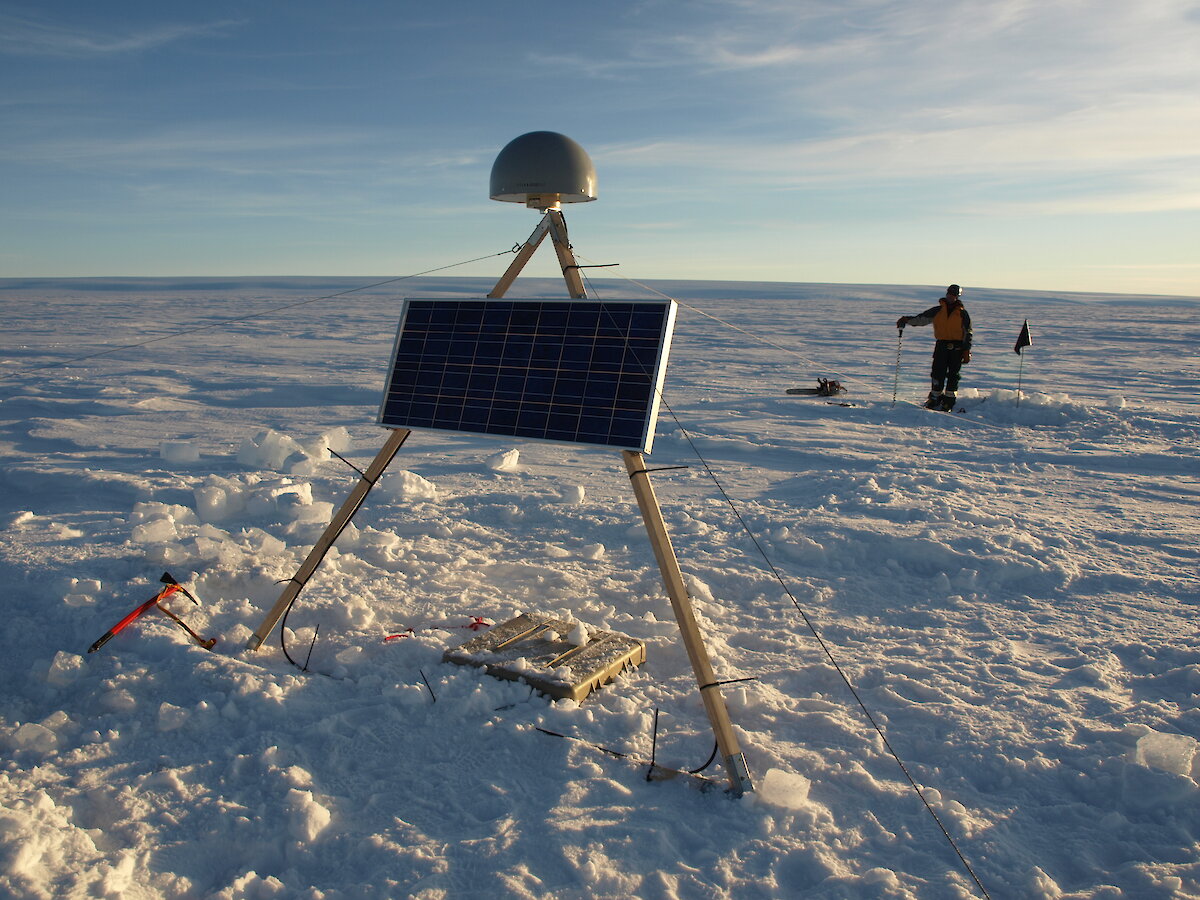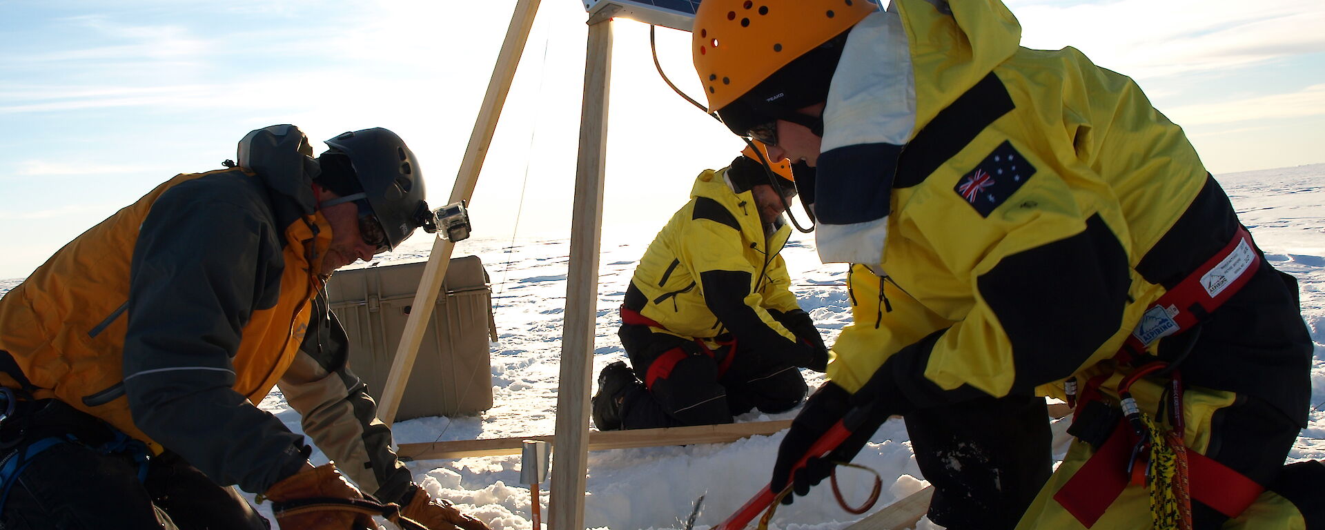

Last summer Sue Cook spent the season at Davis research station, in East Antarctica (from November 2015 to February 2016). Despite a summer that was plagued by weather that limited helicopter flights, Sue (with the help of Adam Christensen, James Hamilton and Marty Benavente) was able to achieve some significant milestones for the Sørsdal Glacier project. These milestones included the installation of a differential Global Positioning System receiver (GPS) and a phase sensitive radar system (ApRES) on the floating portion of the Sørsdal Glacier, as well as carrying out seismic surveys at two other locations near the grounding line. The grounding line is the region where the ice flowing off the continent begins to float; this floating portion forms an ice shelf. Identifying the location where the ice begins to float is a key research area of the Sørsdal Glacier project.
The GPS system continuously monitors ice motion as it flows along with the ice. Using this point measurement of ice speed, in conjunction with satellite imagery analyses, we will be able to calculate the velocity of ice flow for the entire glacier. Any variations in this speed over time will be identified. Understanding the causes of this variation is another key focus of the Sørsdal Glacier project.
The ApRES system monitors, sub-daily, the thickness of the ice, and from these measurements we will be able to see if the ice shelf section of the glacier is getting thicker or thinner over time. These thickness measurements tell us the rate of melting underneath the ice shelf, indicating whether warm ocean currents are reaching the glacier. The seismic survey information will be used to better constrain the geometry of the glacier, including defining the grounding line. Information on the glacier’s geometry is critical for modelling applications.
Our plans for this summer season
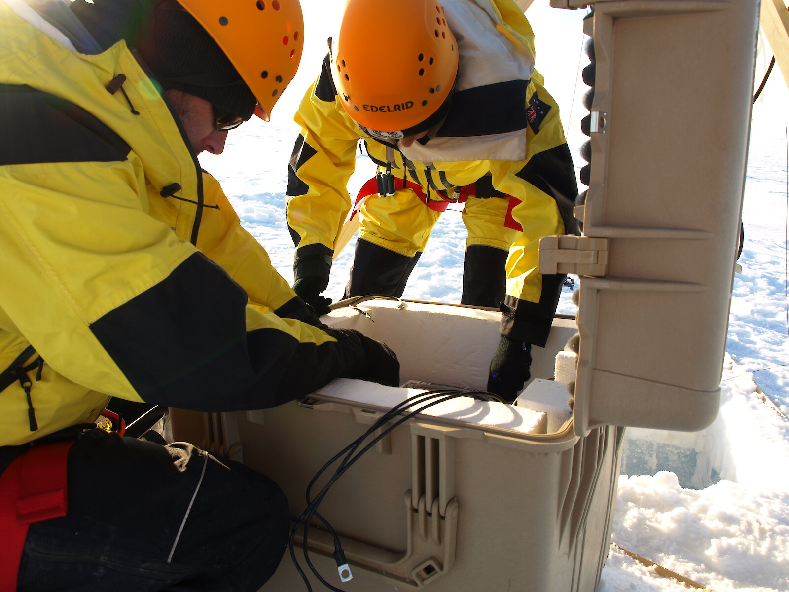
The upcoming field season (November 2016–March 2017) is a bit more varied than last year. At the start of the season Eleri Evans and Christian Schoof will travel on the Aurora Australis to Davis research station. Once there, they will revisit the site of the GPS and ApRES that Sue installed, to see if the equipment survived an Antarctic winter. The data that was collected by the instruments will be downloaded and the batteries exchanged.
Eleri and Christian will also install equipment that will be used to investigate the melt that occurs on the surface of the glacier, forming large melt water ponds. Two large towers with time-lapse cameras at the top will be installed close to these melt ponds and sensors will be placed in the lakes to find out what happens in these lakes as they start to melt over the summer season.
In mid-December, both Eleri and Christian will fly to Casey before leaving Antarctica and heading back to Hobart. At the same time Sue Cook and Tom Schaap will fly to Davis. They will continue to install more GPS and ApRES stations on the glacier as well as conducting more seismic and ground penetrating radar (GPR) surveys. All the equipment that will be installed this season will be left to continuing measuring through the winter until it is revisited next summer.
Eleri Evans