
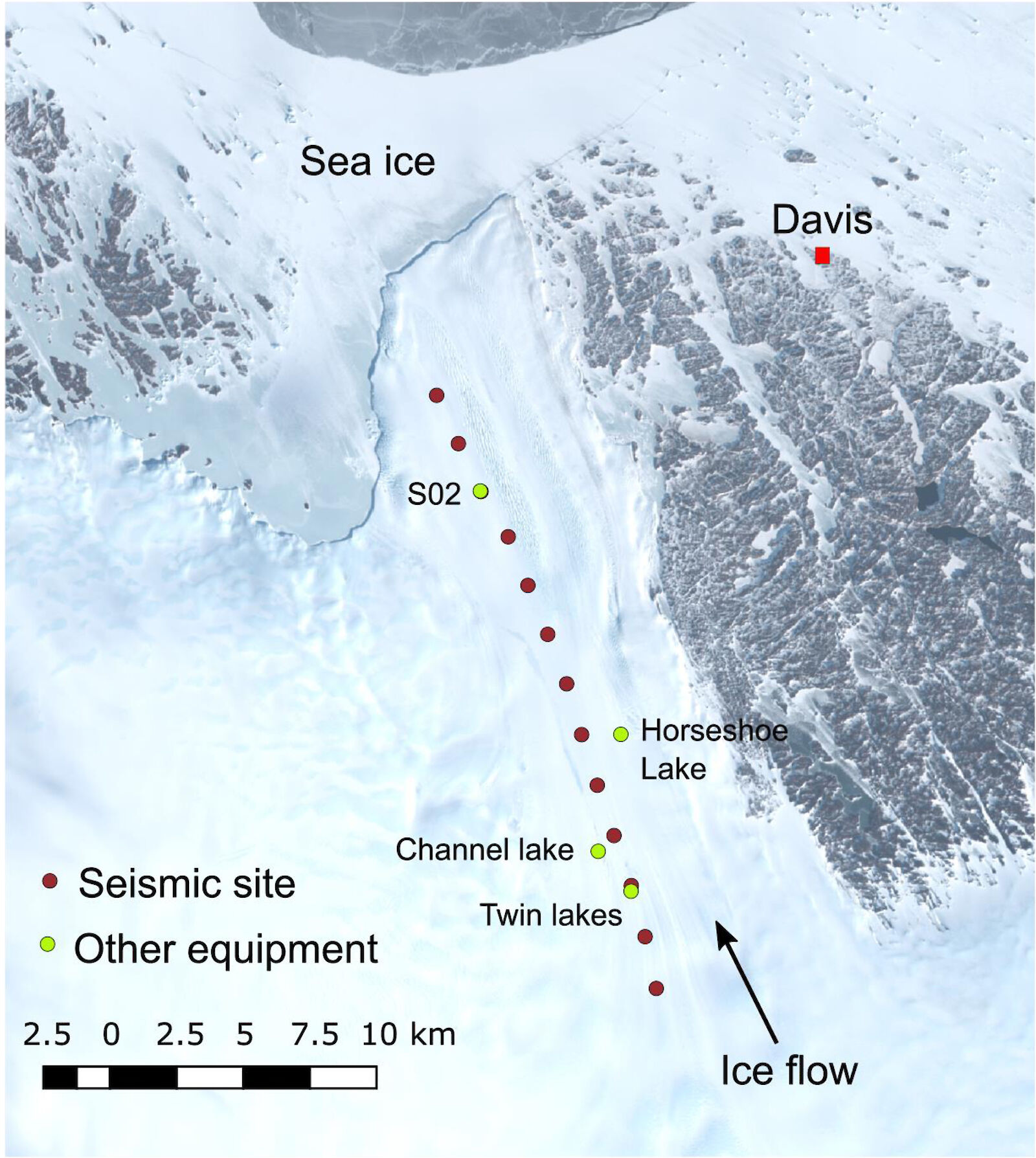
2–9 January
After weeks of thorough preparations for gear and logistics, as well as waiting for a calm window of weather for flying, seismic data acquisition began on the Sørsdal Glacier on the afternoon of New Year’s Eve. With the help of our wonderful FTOs (Field Training Officers) Nick and Gideon, we managed to complete a seismic survey of our first site (site S02) that afternoon. At the time of writing, we have since managed two more sites (S04 and S06, progressively further inland) on the 3rd of January.
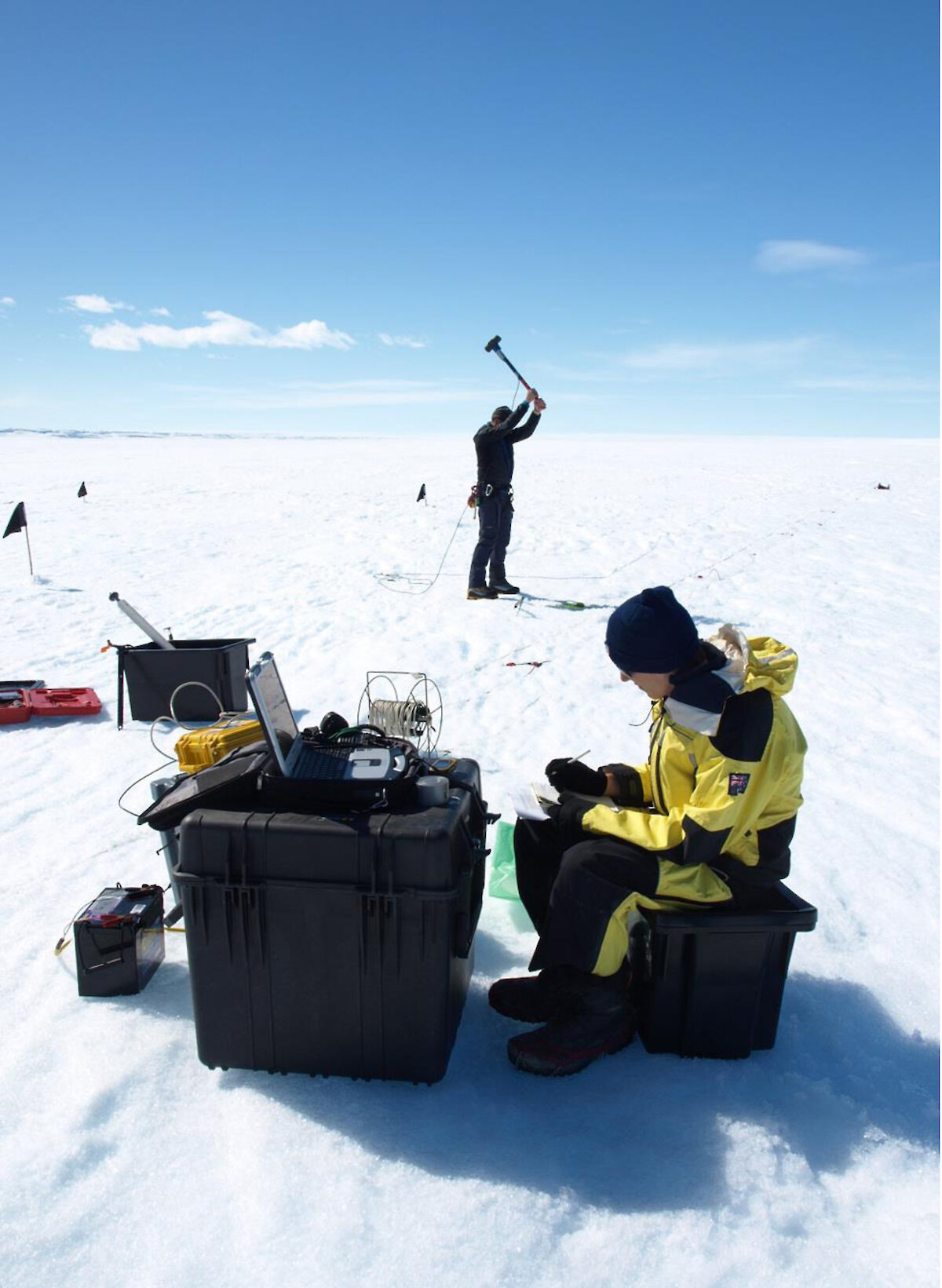
Seismic surveys utilise probes, or “geophones”, which stick into the ground along a straight line in order to measure vibrations in the subsurface. Much like a microphone detects sound waves, geophones detect seismic waves, which can be recorded by a computer. In order to produce these seismic waves, we need a singer for our microphones. Our choice is a sledgehammer which strikes a metal plate on the ground nearby. This gently rattles the glacier, and we use the recorded information to determine its physical properties as well as provide images of the subsurface which can tell us how thick it is, and whether it is sitting on solid rock or floating on water.
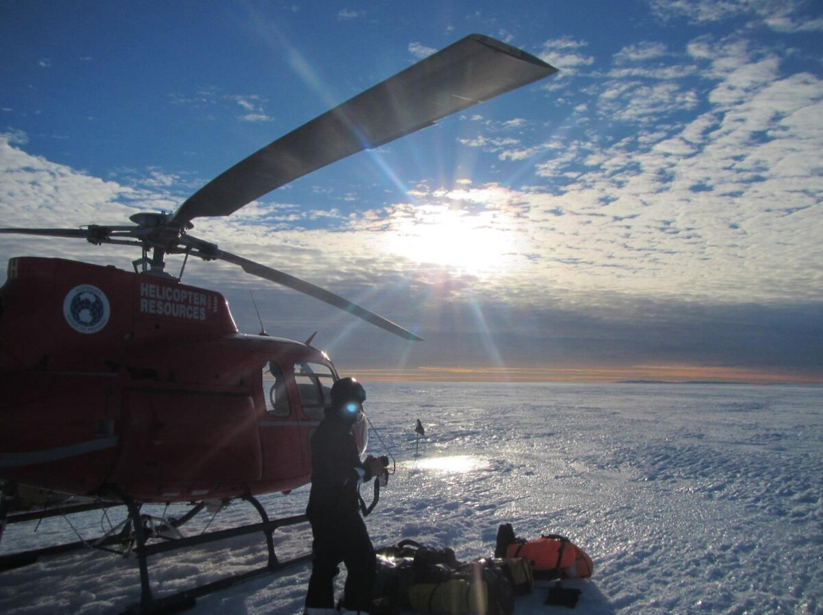
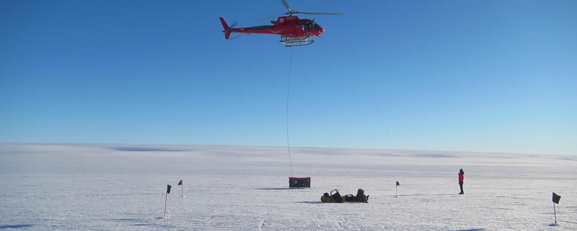
There is a lot of gear associated with a seismic survey, much of it heavy and delicate. We determined that it would not all fit in one helicopter, so to get it all out there quickly we loaded it all into a cage pallet, which could be lifted and transported in one helicopter trip. The cages aren’t much smaller than the choppers, so watching them being hooked up and lifted is pretty spectacular.
The data we have collected so far looks promising, but fully processed images of the subsurface won’t be produced until our return to Hobart. In the meantime, the geophysics continues as I begin my radiometrics surveys in the Vestfold Hills surrounding Davis research station. This involves walking over outcrops of bedrock with a gamma-ray spectrometer, which reads how much gamma-energy is being emitted from the rocks by elements such as potassium, uranium, and thorium. This information can tell us how much heat is being produced by the Earth below us, which is important from a glaciological perspective, as heat-producing rocks can cause the base of the glacier to melt and lubricate its movement into the Southern Ocean.
Future glacier visits plan to survey some lake sites as mentioned in previous blog posts, which will involve the addition of ground-penetrating radar (GPR) surveys. These give us similar images to seismic surveys with more emphasis on features within the glacier, such as meltwater channels. Now we play the waiting game for the conditions to align such that we can get out there and collect more data!
Tom Schaap