
Project information
Project aim
This airborne geophysics and oceanography project explores the Antarctic ice sheet structure, bedrock and changing ice volume to answer key questions about Antarctica and it's contribution to and current and future sea-level rise. Primarily, we will investigate one of the key drivers of rapid Antarctic Ice Sheet change: interaction between the ice sheet margins and the surrounding ocean. We will also investigate the stability of the grounded ice sheet for regions of enhanced basal force, factors leading to this enhancement, and conversely for areas particularly susceptible to rapid retreat of the ice sheet.
Additionally, this project will contribute to extending the long term record of atmospheric changes captured by the ice sheet by helping to identify sites suitable for ice core drilling to retrieve information over the previous one million+ years.
Project milestones
Summary of the project achievements 2018/19
ICECAP II fulfilled its mission to explore ice sheet structure, Antarctic bedrock and changing ice volume to answer key questions about Antarctica and current and future sea-level rise. In particular, ICECAP II undertook 53 flights, and deployed 58 ocean sensors. This data was included in 2 major data compilations (BedMachine and ADMAP-2) that has enabled 174 additional studies into the Antarctic ice sheet and underlying geology to-date (Feb 2020). ICECAP has contributed to 15 high profile peer-reviewed journal papers in fields including ice sheet modelling, geology, site selection for drilling ice cores and interactions between the ice sheet and surrounding oceans and presented at 23 international conferences and workshops.
Summary of the season 2017/18
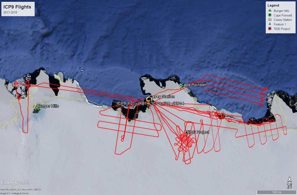
The ICECAP II project's 2017/18 operations in East Antarctica included 10 flights, and collected 13,430 line kilometres of science data. Science highlights include:
1. extensive bathymetric surveys between the Denman Glacier and Moscow University Ice Shelf
2. extending the mapping of ice thickness, surface elevation and bathymetry over the Shackleton, Totten and Moscow University ice shelves
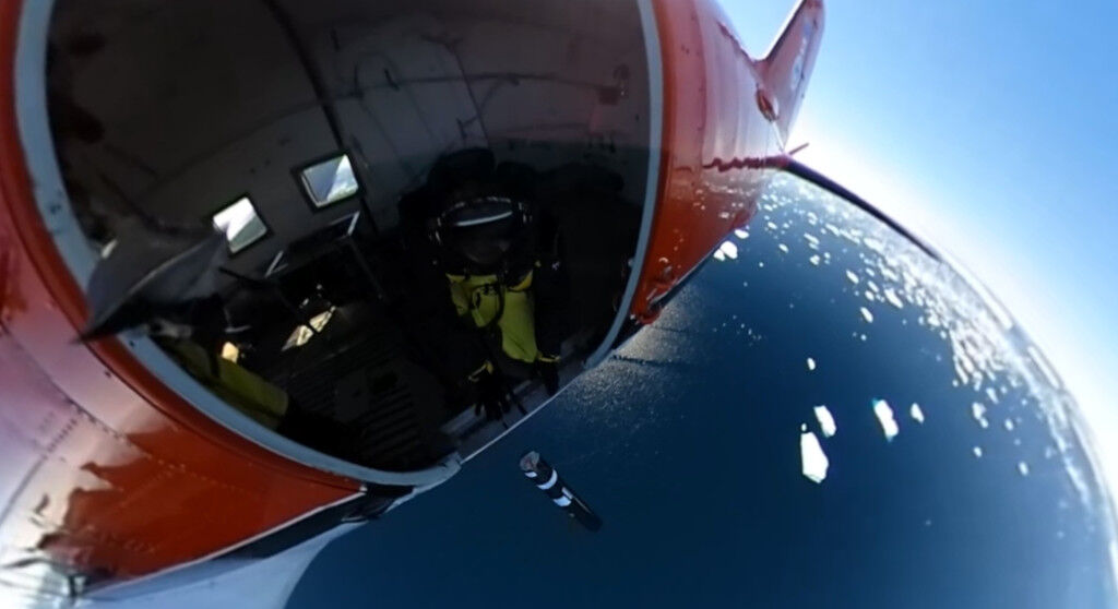
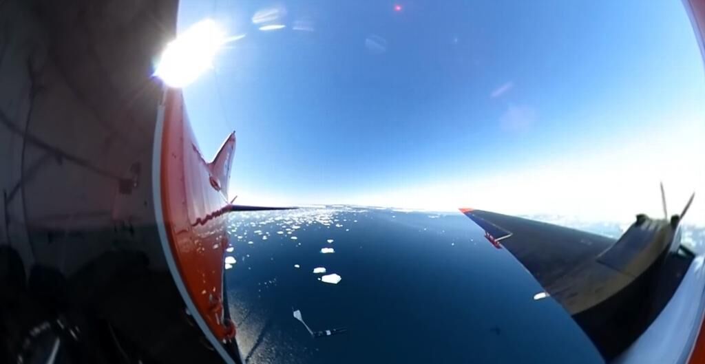
3. successful deployment of 25 Airborne eXpendable Bathymetry Temperature (AXBT) and 15 Airborne eXpendable Conductivity Temperature Depth (AXCTD) probes to measure ocean temperature and salinity profiles and water column thickness
In addition, conducted 5 survey flights with our Chinese colleagues as part of a quid-pro-quo agreement
Summary of the season 2016/17
The ICECAP II project's 2016/17 operations in East Antarctica included 15 flights, and collected 21,646 line kilometres of science data. Science highlights include:
1. extensive bathymetric surveys between the Denman Glacier and Moscow University Ice Shelf
2. extending the mapping of ice thickness, surface elevation and bathymetry over the Shackleton Ice Shelf in collaboration with our Chinese colleagues as part of a quid-pro-quo agreement
3. successful deployment of 18 Airborne eXpendable Bathymetry Temperature (AXBT) probes to measure ocean temperature profiles and water column thickness
Summary of the season 2015/16
The ICECAP II project's 2015/16 operations in East Antarctica included 24 flights, and collected 34,700 line kilometres of science data. Science highlights include:
1. comprehensive survey of "Oldest Ice" ice core drilling targets in the vicinity of Concordia Station.
2. extending the mapping of ice thickness and surface elevation of the East Antarctic grounding zone from Casey to Davis Stations.
3. surveys of the bathymetry beneath the West and Cook Ice Shelves.
4. survey of the newly discovered large subglacial lake in Princess Elizabeth Land.
Related publications
-
Fine-scale geothermal heat flow in Antarctica can increase simulated subglacial melt estimates Geophysical Research Letters, 2022
(Ref: 16591)
Category 1: Peer-reviewed literature
Antarctic geothermal heat flow (GHF) affects the thermal regime of ice sheets and simulations of ice and subglacial meltwater discharge to the ocean, but remains poorly constrained.
-
Estimating marine ice thickness beneath the Amery Ice Shelf from airborne radio-echo sounding Journal of Glaciology, 2025
(Ref: 17411)
Authors:Category 1: Peer-reviewed literature
Ice shelves affect the stability of ice sheets by supporting the mass balance of ice upstream of the grounding line. Marine ice, formed from supercooled water freezing at the base of ice shelves, contributes to mass gain and affects ice dynamics.
-
Amery Ice Shelf Grounding Line Datapoints Automated Extraction From Airborne Ice-Penetrating Radar IEEE Transactions on Geoscience and Remote Sensing, 2025
(Ref: 17407)
Authors:Category 1: Peer-reviewed literature
Understanding basal processes across ice-sheet grounding lines is crucial in accurately modeling ice-sheet dynamics and estimating global sea-level rise. The grounding line, which demarcates the specific boundary between a grounded ice sheet and a floating ice shelf…
-
Gravity-derived Antarctic bathymetry using the Tomofast-x open-source code: a case study of Vincennes Bay The Cryosphere, 2025
(Ref: 17370)
Authors:Category 1: Peer-reviewed literature
Vincennes Bay is a region of East Antarctica vulnerable to sub-ice shelf basal melting from warm ocean water intrusions. The sub-ice shelf bathymetry in this region is largely unknown, despite its importance for ocean dynamics within ice shelf cavities and associated sub-ice shelf basal melting.
-
Bedmap3 updated ice bed, surface and thickness gridded datasets for Antarctica Scientific Data, 2025
(Ref: 17227)
Authors:Pritchard H.D.Fretwell P.T.Frémand A.C.Bodart J.A.Kirkham J.D.Aitken A.Bamber J.Bell R.Bianchi C.Bingham R.G.Blankenship D.D.Casassa G.Christianson K.Conway H.Corr H.F.J.Cui X.Damaske D.Damm V.Dorschel B.Drews R.Eagles G.Eisen O.Eisermann H.Fausto F.Field E.Forsberg R.Franke S.Goel V.Gogineni S.P.Greenbaum J.Hills B.Hindmarsh R.C.A.Hoffman A.O.Holschuh N.Holt J.W.Humbert A.Jacobel R.W.Jansen D.Jenkins A.Jokat W.Jong L.Jordan T.A.King E.C.Kohler J.Krabill W.Maton J.Gillespie M.K.Langley K.Lee J.Leitchenkov G.Leuschen C.Luyendyk B.MacGregor J.A.MacKie E.Moholdt G.Matsuoka K.Morlighem M.Mouginot J.Nitsche F.O.Nost O.A.Paden J.Pattyn F.Popov S.Rignot E.Rippin D.M.Rivera A.Roberts J.L.Ross N.Ruppel A.Schroder D.M.Siegert M.J.Smith A.M.Steinhage D.Studinger M.Sun B.Tobacco I.Tinto K.J.Urbini S.Vaughan D.G.Wilson D.S.Young D.A.Zirizzotti A.Category 1: Peer-reviewed literature
We present Bedmap3, the latest suite of gridded products describing surface elevation, ice-thickness and the seafloor and subglacial bed elevation of the Antarctic south of 60?°S. Bedmap3 incorporates and adds to all post-1950s datasets previously used for Bedmap2…