
Dynamite is the tool of choice on the Totten Glacier this season, for Australian Antarctic Division ice-ocean modeller, Dr Ben Galton-Fenzi, and his team.
By creating small, controlled explosions beneath the ice surface, the team hopes to define the structure of the bedrock over which the glacier flows, and determine whether there is any sediment between the ice and the bedrock.
“Seismic surveys use sound waves generated by explosive or percussive forces, which reflect off different surfaces like bedrock and ice, revealing their shape,” Dr Galton-Fenzi said.
“The bedrock topography affects how the base of the glacier will melt once it reaches the ocean [where it becomes an ice shelf] and influences the rate of ice melt, while sediment can lubricate the passage of ice over the bedrock.”
Recent research shows the Totten Glacier (near Casey research station) is susceptible to substantial amounts of inter-annual variability in the melting and flow of ice at its base. Deep channels in the bedrock under the ice could also allow warm ocean water to infiltrate the base of the glacier, increasing the risk of melting and sea level rise.
Dr Galton-Fenzi* said the seismic surveys will contribute to a broader investigation into how the flow regime of the Totten Glacier varies with time, the melt rates at its base, and how the ocean is driving melting.
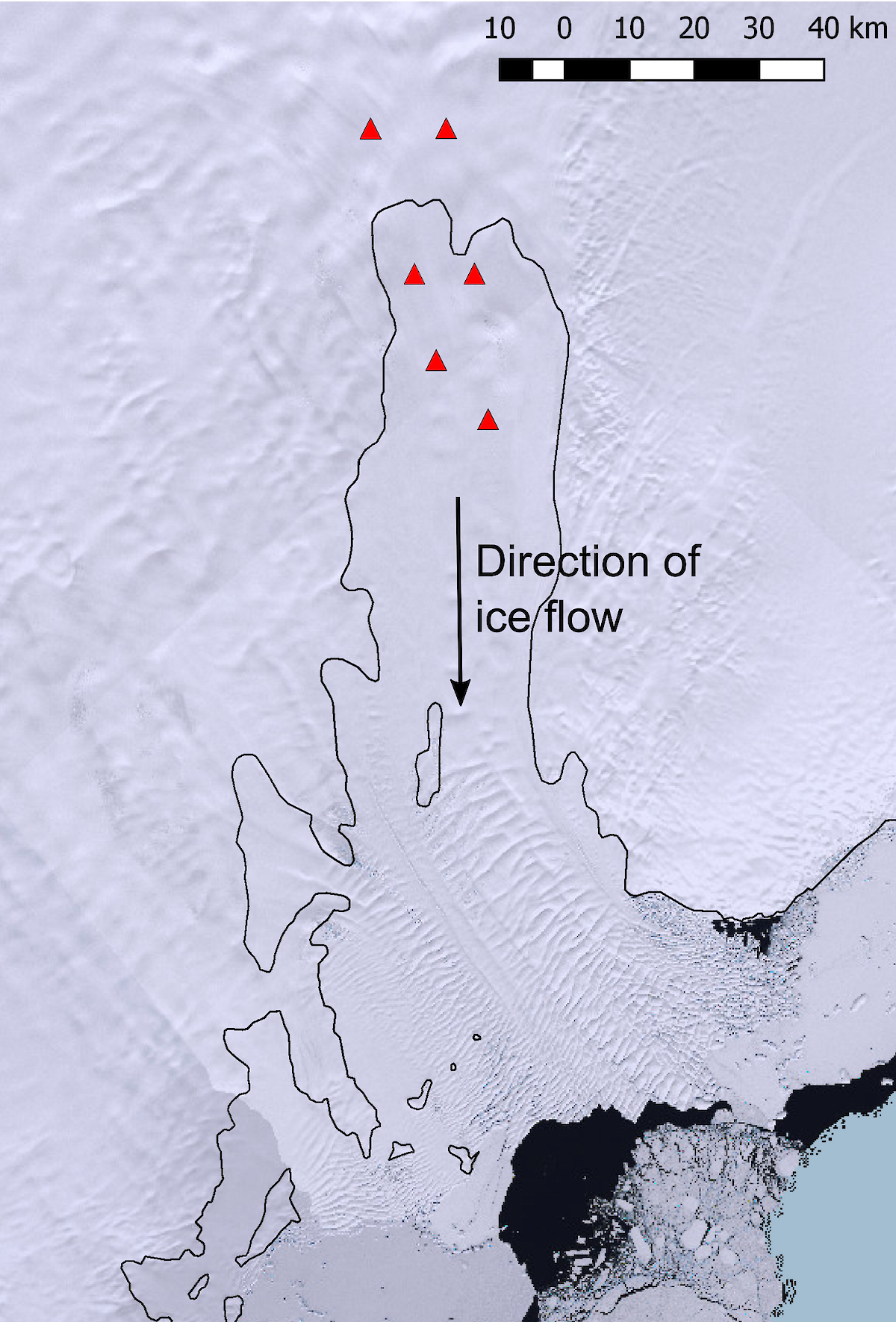
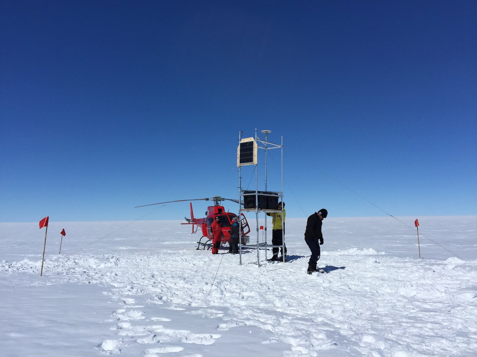
Last year the team installed six radar and six GPS units along two of the Totten’s glacial “flow lines”. The radar units allow scientists to see the internal layers and base of the ice, and measure changes in ice thickness. The GPS measure the speed with which the ice is flowing towards the ocean, and changes in surface height.
“We used satellite imagery to identify the flow lines, which are surface features related to ice flow,” Dr Galton-Fenzi said.
“We deployed our instruments on the grounded part of the glacier, as well as the section where it begins to float, with each instrument about 20km apart. One of the flow lines moves over a ‘rumple’ in the bedrock, beyond where the glacier begins to float, so it becomes grounded again. We want to see if the rumple affects how the ocean interacts with the glacier and, in turn, whether it affects melt rates.“
This season the team will download nearly a year’s worth of data from their instruments and leave them on the site for another year.
Their findings from both the instrument deployment and seismic survey will feed into representative models of the system, to improve the models and guide future research and instrument placement.
“The models represent the sum of our understanding of the system, so they’re a powerful predictive tool,” Dr Galton-Fenzi said.
“We’ve used them to identify the best location for our instruments to get the data that we need to test our hypotheses, and the results from the instruments are also used to refine the models.”
Sørsdal Glacier
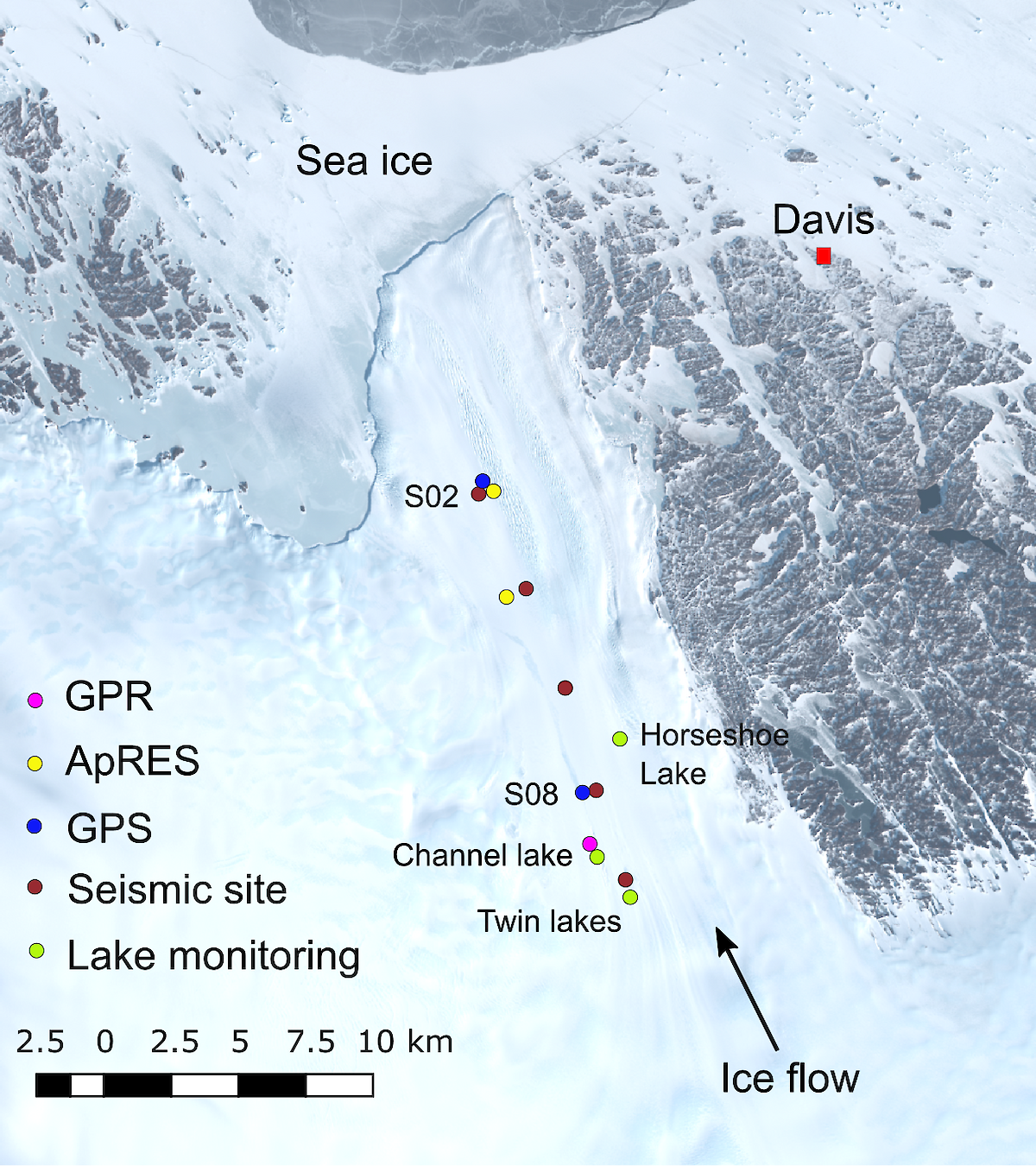
On the Sørsdal Glacier, near Davis research station, Dr Christian Schoof† of the University of British Columbia, Canada, will lead two teams of two people building on last season’s work monitoring lake formation on the glacier’s surface.
Dr Schoof and co-investigator Dr Sue Cook, of the Antarctic Climate and Ecosystems Cooperative Research Centre, installed radar and GPS units at various surface lake sites on the glacier last season, to measure ice thickness and ice flow speeds, as well as pressure transducers to record lake depth, and time-lapse cameras to monitor lake formation.
“In Greenland, lakes forming on the surface of the ice sheet are known to drain down to its base, changing how the ice sheet slides over the bedrock below,” Dr Cook said.
“We want to test a similar theory in Antarctica — that surface meltwater ponding is occurring more frequently on outlet glaciers, and potentially reaching the bedrock and driving increased lubrication and acceleration of glacier flow.”
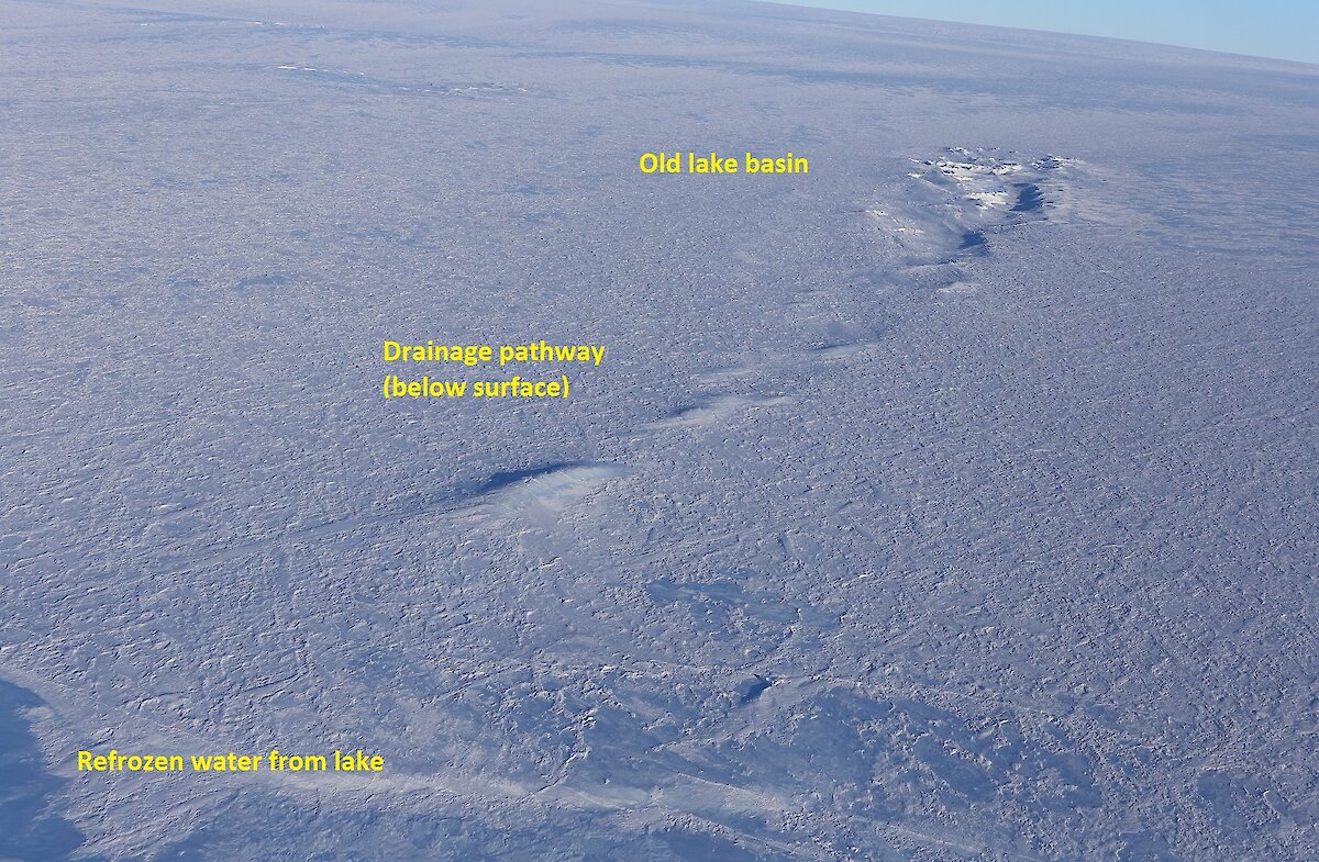
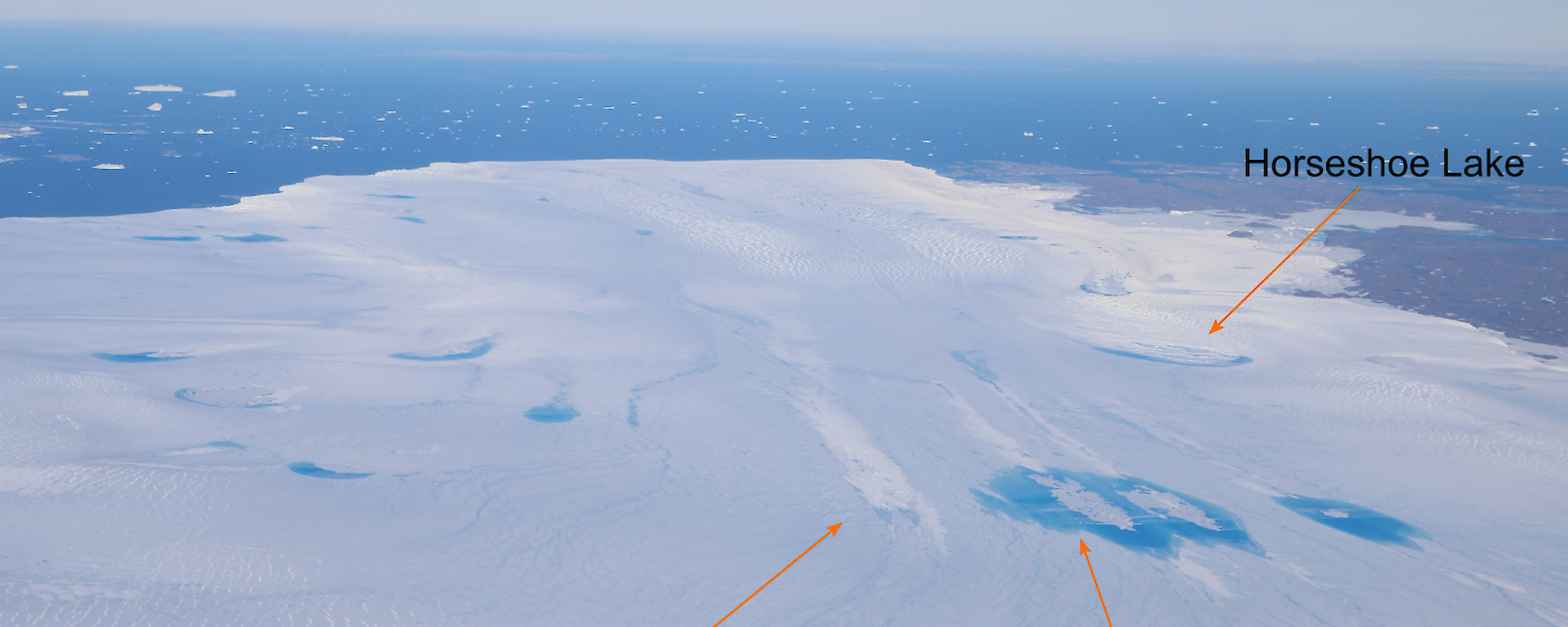
One lake of interest is Channel Lake, where water appears to drain below ground, before reappearing about five kilometres downstream. Last season the team used ground penetrating radar to try and map out the drainage pathway.
“We’re not sure if all the water comes back to the surface or if some of it drains to the base,” Dr Cook said.
To find out, this season the team will deploy six seismometers along the drainage pathway, to listen to the water flow. The instruments will pick up the sound of turbulent water movement, which scientists can then triangulate to reconstruct the drainage pathway.
The team will also run a ‘tracer’ experiment, adding salty water to the start of the drainage channel and using conductivity probes at the likely exit points to determine where and when it flows out.
“We observed an obvious line of surface features last year that we think were caused by drainage, so we will use these to position our tracer study,” Dr Cook said.
“The time it takes for the salty water to reach the probes will provide information about what the drainage system looks like.”
The team will also use a helicopter-based radar to fly over the glacier several times during the season, to look at meltwater formation, and to map out drainage pathways.
“Surface lake formation is more topical now in Antarctica because in future warming scenarios we expect the incidence of these phenomena to increase,” Dr Cook said.
“The extra weight of surface water could lead to fracturing of the ice, which may have been a contributing factor to the recent calving of the one trillion tonne iceberg from the Larsen C ice shelf in July.”
Wendy Pyper
Australian Antarctic Division
* Australian Antarctic Science Project 4287
† Australian Antarctic Science Project 4342