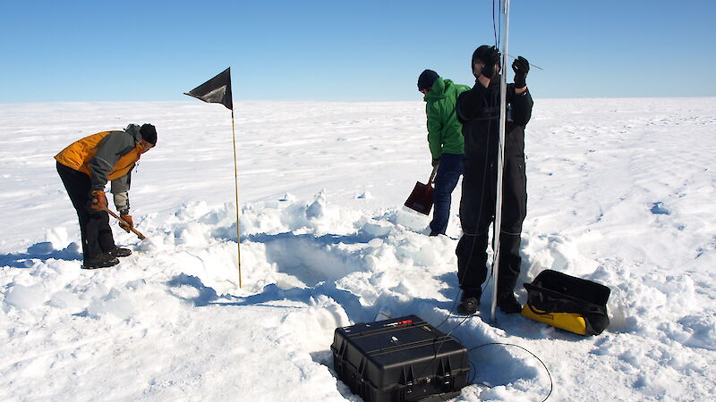
To understand the fundamental processes driving ice shelf thinning, Antarctic scientists will tackle the issue from above and below during the 2016–17 Antarctic season, deploying instruments on the surface of, and in the ocean beneath, the Amery and McMurdo ice shelves and on the Totten and Sørsdal glaciers.
By combining surface glaciological measurements with sub-ice oceanography, scientists hope to understand the ice shelves’ stability (ice gain versus loss) and their response to changes in environmental conditions, such as air and ocean temperatures and ocean currents.
The loss of ice shelves can also go hand-in-hand with faster ice loss from the land, as the flow of glaciers draining into the shelves also speed up. On the Sørsdal Glacier, near Davis research station, scientists will install monitoring equipment to observe changes in ice flow velocity and ice tongue melting.
The Outlet glacier dynamics in Princess Elizabeth Land project is led by Dr Christian Schoof of the University of British Columbia, Canada, in collaboration with Dr Sue Cook of the Antarctic Climate and Ecosystems Cooperative Research Centre, Dr Ben Galton-Fenzi of the Australian Antarctic Division, and other researchers from University of Tasmania, Victoria University of Wellington, New Zealand, and Swansea University, United Kingdom.
“In Greenland, lakes forming on the surface of the ice sheet are known to drain down to its base, changing how the ice sheet slides over the bedrock below,” Dr Cook said.
“So we want to test a similar theory in Antarctica – that surface meltwater ponding is occurring more frequently on outlet glaciers, and potentially reaching the bedrock and driving increased lubrication and acceleration of the glaciers.”
To do this Dr Schoof, Dr Cook, PhD student Eleri Evans and field assistant Tom Schaap, will install GPS on the surface of the Sørsdal Glacier, to measure ice flow speeds and surface elevation changes, and two autonomous phase sensitive radio echo sounders (ApRES), which measure the thickness of the ice with millimetre accuracy. Thermistors, pressure transducers and time-lapse camera systems will be installed to monitor lake formation on the glacier’s surface, and the team will also conduct seismic work using a hammer and plate system.
“The radar of the ApRES can’t penetrate salt water, so we just get measurements of the ice thickness. But the seismic system can penetrate through the water column below, so you can map out the size of the ocean cavity,” Dr Cook said.
“A common problem for many ice shelves is that we don’t know where the grounding line is or the bathymetry of the seafloor below it.
“The seismic work will allow us to identify this grounding line, as well as stratification [layers] in the water and the bathymetry of the seafloor, which both influence how the ocean interacts with the base of the ice shelf.”
The research will contribute data on the fundamental processes that drive ice shelf and glacier melting, as well as information about the bathymetry beneath ice shelves, ocean temperatures and the general state of the East Antarctic region. The information will be incorporated into numerical models to study regions potentially susceptible to rapid deglaciation (leading to sea level rise).

