
The calving of the Mertz Glacier tongue in February 2010 exposed a large section of the sea floor, about 80km long and over 30km wide, enabling access to an area where no information currently exists. Using an underwater camera, a team of scientists and technicians from Geoscience Australia and the Australian Antarctic Division collected the first images of the sea floor and the marine animals that live there.
Ecosystems under ice shelves or glacier tongues are unique. Any marine life living on the sea floor in these areas does not have the same opportunity for food as in the open ocean, where there is a regular supply of phytoplankton from the surface waters. There are very few opportunities to study ecosystems existing in such situations (because they are usually covered in ice), so we had little idea of what to expect.
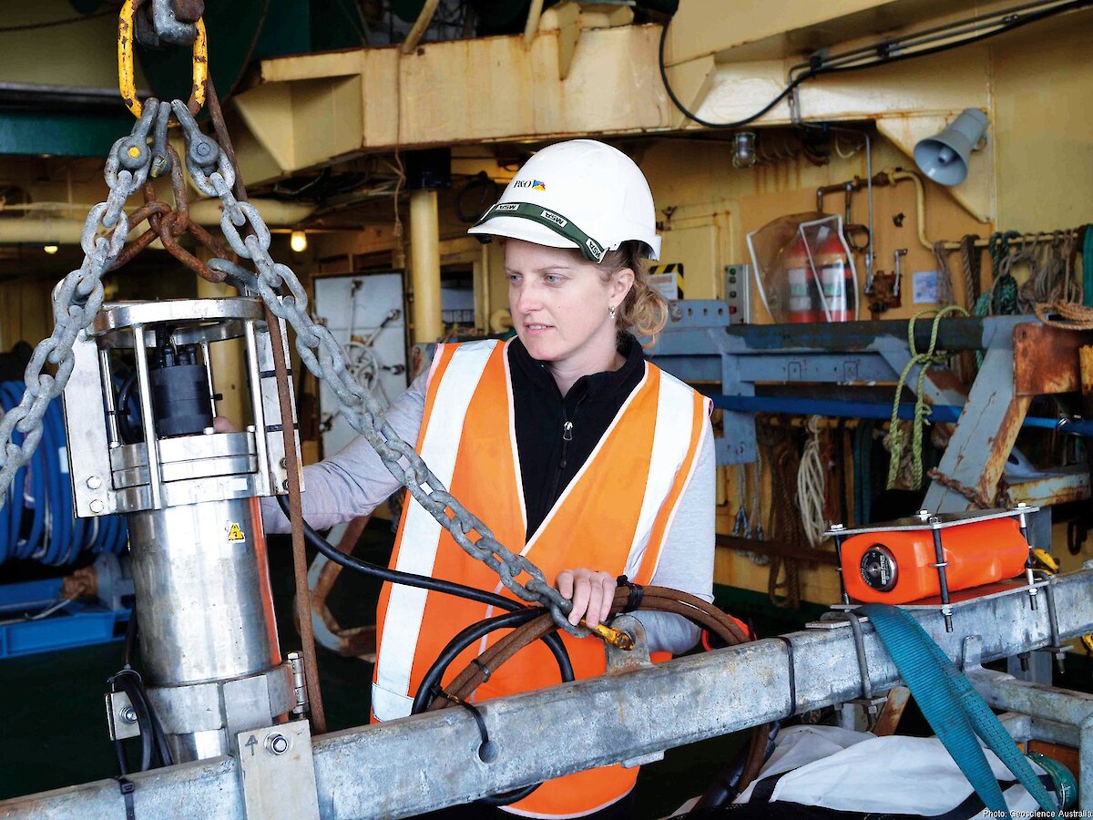
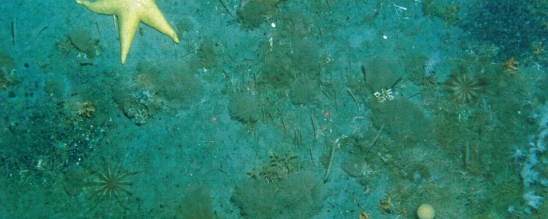
A digital SLR camera inside a waterproof casing was attached to a frame and lowered to just above the sea floor. We collected over 1800 still images of the sea floor at depths ranging from 170 to 2300m. At these depths there is little or no light reaching the sea floor so we used two strobe lights to illuminate it as we took photos. Parallel laser pointers set 50cm apart were used to provide a scale for the images.
There was much anticipation onboard as the camera was lowered, with speculation about what might (or might not) live on a sea floor previously covered by a glacier tongue. It typically took about an hour from the time the camera was attached to the frame and lowered into the water until it was retrieved again. We then had to remove the camera from its waterproof casing and download the images in the photo lab. This lab was a popular destination for expeditioners and crew on board, curious to know what lay below.
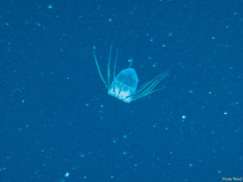
We found that life under the Mertz Glacier tongue is similar to life in the adjacent areas, although more sparse. A diversity of marine animals was observed, including sea pens, bryozoans, anemones, gorgonians, holothurians, urchins, brittlestars, crinoids, sponges, and even a sea star that measured more than 50 cm across.These animal communities must source their food from particles carried many tens of kilometres by currents that flow beneath the Mertz Glacier tongue. The animals live on a sea floor comprised mostly of mud with pebbles and cobbles scattered across the surface. These are known as ‘dropstones’ because they fall from the glacier tongue above.
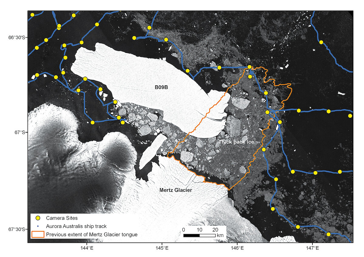
The Aurora Australis was prevented from getting into most of the area previously covered by the glacier tongue by the massive iceberg (B09B) that collided with the glacier tongue almost a year ago. Just before our journey south the iceberg started to move west, across the front of the remaining glacier tongue. We regularly downloaded the latest satellite images to check the position of B09B and hoped that it would move out of the way by the time we got there. Unfortunately it stopped just to the west of the glacier tongue and, due to its size (nearly 100km long and over 20km wide), a large amount of sea ice accumulated behind it, preventing access to the area where we wanted to take photos. The ice was too thick for the ship to move through and, as a result, limited the sites where photos could be collected to the northern tip of where the glacier tongue once sat. Such is the way things go when doing research in Antarctica!
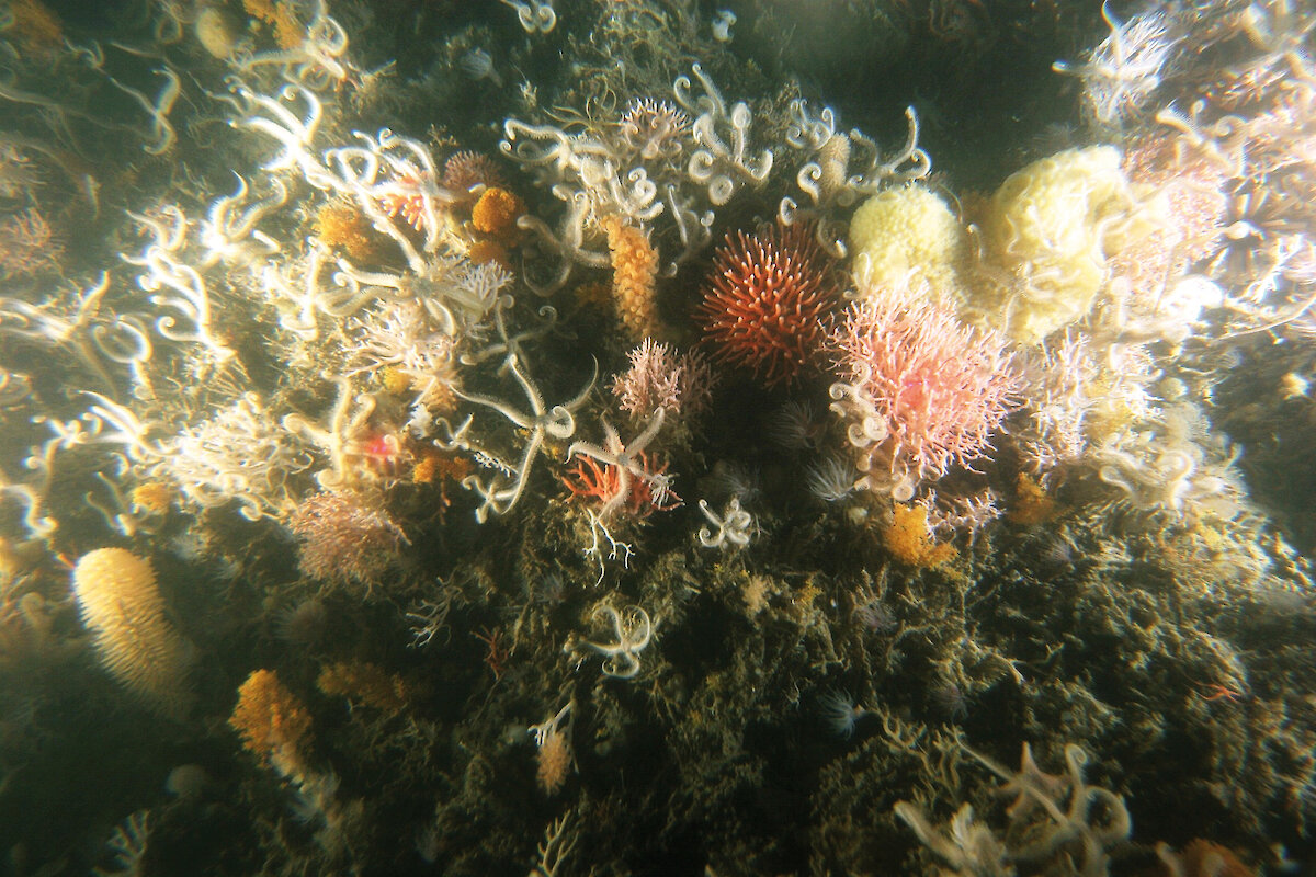
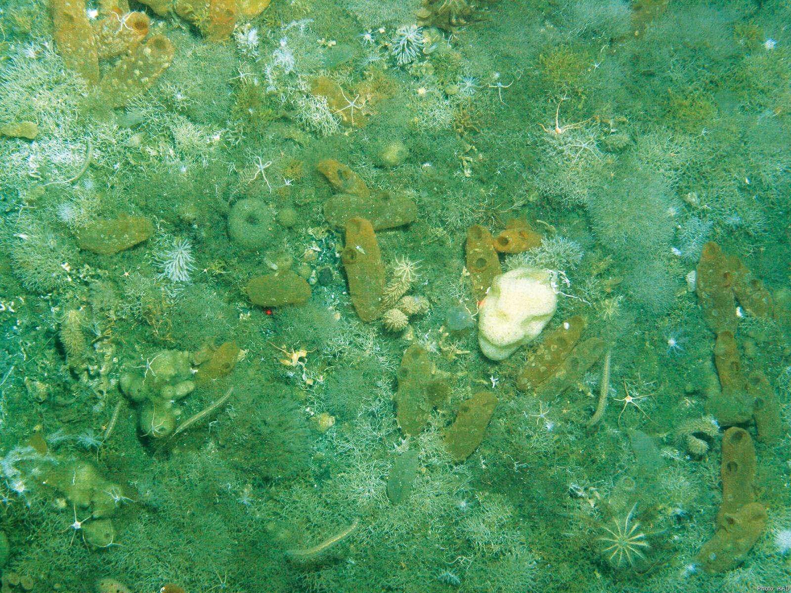
While we were in the Mertz region we were able to explore the area along the continental shelf, where deep sea corals have previously been found. These corals are so unique and fragile that they have been protected as ‘Vulnerable Marine Ecosystems’ by the Commission for the Conservation of Antarctic Marine Living Resources (CCAMLR) (Australian Antarctic Magazine 15: 19, 2008).
We found further evidence of deep water coral communities at several sites along the shelf break. The photos collected at these sites show a spectacular display of vulnerable marine life. This new information will be used to support the application to CCAMMLR for a Marine Protected Area in the Mertz region.The images from the voyage will be analysed to identify the organisms and communities at each site and their relationship to the physical and chemical environment. This information will be used to help answer some key research questions outlined in the Australian Antarctic Science Strategic Plan relating to ocean acidification and change in marine ecosystems, as well as protecting marine biodiversity.
JODIE SMITH1 and MARTIN RIDDLE2
1 Geoscience Australia, 2Australian Antarctic Division