
Maps
Maps are available for downloading from the Map Catalogue.
For best screen view and print quality, download PDF and open in Adobe Acrobat Reader. Go to Edit → Preferences → Page Display. In the Rendering box, uncheck “Enhance thin lines”.
Detailed maps
- Map 15994: Map 1: Denman Terrestrial Campaign – Overview A3 1:1,000,000
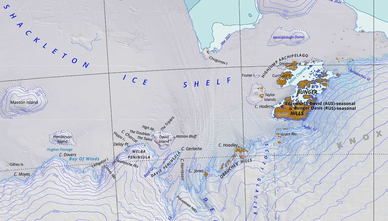
- Map 15991: Map 2: Bunger Hills A3 1:200,000
- Map 15992: Map 3: Obruchev Hills A3 1:150,000
- Map 15993: Map 4: Mt Strathcona A3 1:150,000
- Map 15995: Denman Terrestrial Campaign Base Map A1 1:500,000
- Map 16050: Shackleton Ice Shelf – Denman Glacier A0 1:350,000
- Map 16047: Shackleton Ice Shelf – Denman Glacier (with range rings) A0 1:350,000
Environmental maps
- Map 15942: Map 1: Denman Terrestrial Campaign – Overview A3 1:1,000,000
- Map 15943: Map 2: Bunger Hills A3 1:200,000
- Map 15944: Map 3: Obruchev Hills A3 1:150,000
- Map 15946: Map 4: Mt Strathcona A3 1:150,000
Satellite imagery maps
- Map 16030: Bunger Hills Satellite Image Map A0 1:25,000
Map 16030 broken down into A3 Maps - Map 16038: Bunger Hills Satellite Image Map - Map Series – Map Sheet: A1 A3 1:25,000
- Map 16039: Bunger Hills Satellite Image Map - Map Series – Map Sheet: A2 A3 1:25,000
- Map 16040: Bunger Hills Satellite Image Map - Map Series – Map Sheet: A3 A3 1:25,000
- Map 16041: Bunger Hills Satellite Image Map - Map Series – Map Sheet: B1 A3 1:25,000
- Map 16042: Bunger Hills Satellite Image Map - Map Series – Map Sheet: B2 A3 1:25,000
- Map 16043: Bunger Hills Satellite Image Map - Map Series – Map Sheet: B3 A3 1:25,000
- Map 16044: Bunger Hills Satellite Image Map - Map Series – Map Sheet: C1 A3 1:25,000
- Map 16045: Bunger Hills Satellite Image Map - Map Series – Map Sheet: C2 A3 1:25,000
- Map 16037: Obruchev Hills Satellite Image Map 750 mm × 594 mm 1:25,000
Other maps
- Maps 24 & 25: Spot satellite image maps, Bunger Hills East, Wilkes Land and Bunger Hills West, Wilkes Land, Queen Mary Land
- Map 11225: Simple A4 Bunger Hills Line Map
- Map 11226: Simple A4 Bunger Hills satellite image map
- Map 920: Bedrock geology of the Bunger Hills and Denman Glacier Region
- Map 14226: Crustal Heat Production in the Australian Antarctic Territory
- Map 13976: Aviation Map: Shackleton Ice Shelf
- Map 15740: Edgeworth David Base
- Map 15571: SQ47-48 1:1 million topographic map
- Map 16059: Denman Terrestrial Campaign – RPA operations A3 1:200,000
GIS data
New topographical data has been captured from Sentinel-2 satellite imagery. A new metadata record 1million_map_series_2023, provides more details. The data captured is that shown in map 15571 above. This data is suitable for use in Geographic Information System software.
The data is available to download from our GeoServer site in multiple formats. Search (the search box is at the top right of the screen) with the keyword Denman. The resulting list should show:
- Coastline line data for the Denman Terrestrial Campaign
- Contour data for the Denman Terrestrial Campaign
- Coastline polygon data for the Denman Terrestrial Campaign (importing to ArcGIS Pro and QGIS in fine, but KML has issues)
- Rock outcrop polygon data for the Denman Terrestrial Campaign
- Water body polygon data for the Denman Terrestrial Campaign
Survey control
Please let us know if you plan to bring any survey equipment. Email mapping@antarctica.gov.au
You can access the Survey Control database via the AADC.
Aerial photography
AADC currently hosts a spatiotemporal asset catalog (STAC) of all our aerial photography film holdings (Denman area included).
Access to the imagery in this catalog is through a self-request option on the AADC website.
Enter your email address and you will receive an email with your S3 credentials and links for instructions on how to access the data.
Access will be for a 2-week period and then expire. In the event you need access again after this time, simply use the above link again and new credentials will be provided to you.
Drone / uncrewed aerial vehicles / UAV Imagery
All planned activities should first be consulted on with the DCCEEW Deputy Chief Remote Pilot (AAD) on drones@aad.gov.au to discuss the project’s planned use of drones and for standard operating procedures.
To view a map showing planned drone activities see Map 16059: Denman Terrestrial Campaign – RPA operations.
Satellite imagery
All satellite imagery purchases should be made through the AADC on your behalf. This allows for broader sharing of imagery within the AAP and the educational discount to be applied. The AAD is able to sublicense satellite imagery for the duration of your project from Maxar Technologies. Additionally, tasking of satellites can be arranged and the AADC has access to SecureWatch to procure both recent and archive Maxar imagery.
All SAEF image requests must be addressed to:
Nzie Okpokam
Data Management Specialist
Securing Antarctica’s Environmental Future (SAEF)
Queensland University of Technology
Email: nzie.okpokam@qut.edu.au
Access to proprietary satellite imagery
Process:
- Request a sublicense agreement by emailing remotesensing@antarctica.gov.au
- Signed sublicense agreement per institution returned to above email*
- Request an image request form by above email
- Submit image request form detailing which images are being requested to above email
- Images are provided with both Maxar license and AADC sublicense terms
* Please note: If the Sublicensee uses the Material without returning a signed copy of this letter, it will be taken to have accepted that it has understood and agreed to be legally bound by these terms.
Current sublicense agreements exist for the following institutions:
- Monash University – SAEF and whole of Uni
- University of Tasmania – ACEAS and IMAS
- Geoscience Australia – AAPP Project 4620
- Queensland University of Technology – whole of Uni
- University of Canberra – ACEAS and whole of Uni
If your institution is already listed above, a sublicense already exists and only an image request form is required.
Spatial extent of imagery (existing and requested)
The attached map PDF shows existing and requested imagery as of 26 August 2023. This map will be updated as imagery is purchased. As of 24 October 2023, a significant amount of imagery has been purchased through the above sublicense holders and is available by request.
Existing imagery details
View the Worldview extents and imagery that the AADC holds on Discover Maxar.
The attached PDF map shows both Quickbird and Worldview imagery that the AADC already holds and can be sublicensed to interested parties free of cost. Please note, extensive work was done to try and align the Worldview and Quickbird imagery, however, there was considerable warping and misalignment resulting in their independent use. Areas currently under order and requests are also noted on the map.
If you are interested in particular areas, please refer to either the image ID from the Discover Maxar link above, or by the full timestamps on the attached PDF map.
Exploring additional imagery
If considering additional imagery, utilise the Maxar Discover website. Take note of the Image ID number for communication with the AADC and please include each individual area of interest (AOI) as either a KML or zipped shapefile folder.
Note that the AADC has a SecureWatch account and can search additional imagery that may not be visible on the Discover website.
Access to freely available satellite imagery
There is a wealth of freely available optical and radar imagery from a broad range of satellites. A great way to explore this imagery is through the EO Browser. Once you find an image of interest, use the link button to copy the S3 location and open in your GIS software of choice.
For help on importing S3 data using ArcGIS or QGIS, see the AADC help and resources page which will be updated to include step-by-step guides.
If having access difficulty with QGIS, please update to the most current version of QGIS (QGIS 3.32.0 ‘Lima’).
The AADC has summarised some potentially helpful Sentinel-2 imagery in the Denman area.