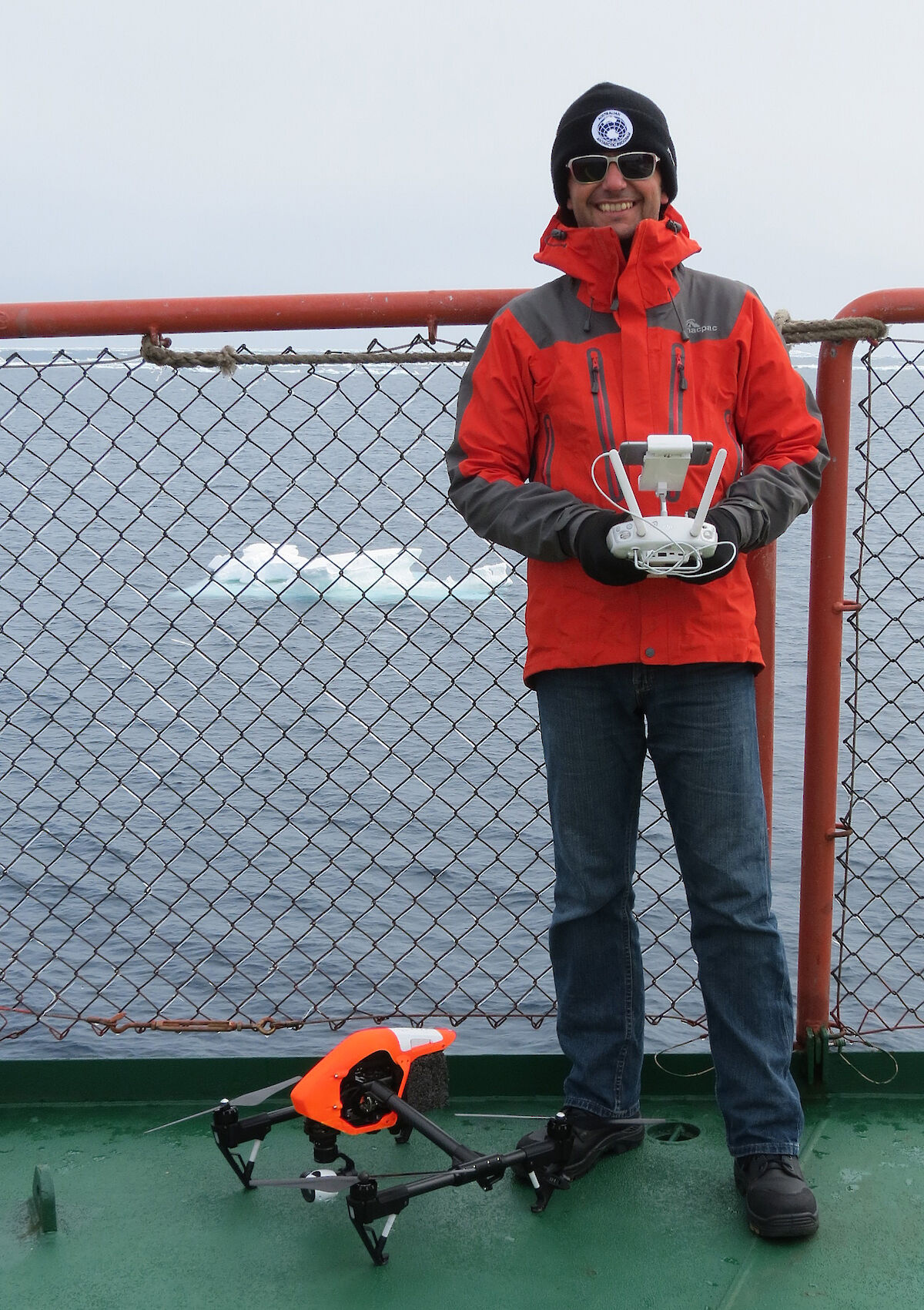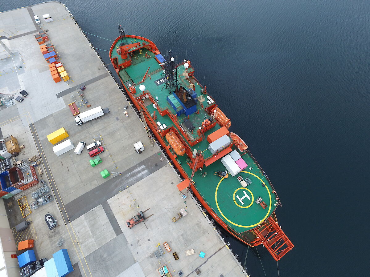

Three kilograms of bladed electronics sit poised for take-off from the edge of Aurora Australis’ helideck. Call-sign Inspire 1, a remotely piloted aircraft (RPA), or drone, is undergoing tests of its potential to assist the crew navigating through sea ice during the ship’s annual resupply voyage to Casey research station.
The 2015–16 summer marked the Australian Antarctic Division’s first operational use of this camera-carrying technology, and the custom-painted fluoro-orange ‘quadcopter’ passed with flying colours. The trial confirmed drones are an easy to deploy ‘eye in the sky,’ well-suited to supplementing satellite-obtained sea ice imagery with views of the conditions immediately ahead of the ship on any given day. Indeed, these small aircraft are a less expensive, easier to deploy and environmentally friendlier proposition than using helicopters to undertake quick reconnaissance flights.
Unsurprisingly, drones are becoming relatively commonplace in Antarctica. An eight-bladed model has been used by Australian Antarctic program researchers to collect data on the health of moss beds in Antarctic Specially Protected Areas. Elsewhere, fixed wing and vertical take-off and landing drones have supported wildlife monitoring, vessel surveillance and fuel spill mapping, and are flown for recreational purposes. Other potential applications include geophysical exploration, documenting glacial retreat, supporting meteorological and ocean–sea ice–atmosphere interaction studies, detecting crevasses and searching for missing persons.
Still, and notwithstanding rapid changes in technology, flying drones in Antarctica is not without challenges; the voyage carried several back-up units as a precaution. More than 100 degrees of compass declination must be factored when flying in the Casey region, alongside the magnetic interference generated by thousands of tonnes of steel ship. Indeed, compass calibration and GPS issues are likely behind the many anecdotal reports of drones’ erratic behaviour in high latitude environments; insufficiently experienced operators have lost their aircraft to ‘toilet-bowling’ (irrevocable circling) and ‘fly-aways.’ Landing on a moving platform can also be a problem if the aircraft heads back to the coordinates of its departure point. Furthermore, battery life is reduced by exposure to low temperatures, and strong winds are liable to affect drone stability.
The ice reconnaissance trial involved introducing increasingly complex flights to quantify and resolve the significance of each of the anticipated performance issues. Inspire 1 flew up to 75m above the ship’s deck, undertaking five incident-free sorties in the few days that the ship transited ice. They included one flight in 17 knot winds and another in lightly falling snow.
The regulation of drones is similarly complex. The safety aspects are regulated by the Civil Aviation Safety Authority, and the environmental aspects by the Antarctic Division. Alongside most other activities, Australians’ drone uses south of 60o S are subject to an environmental impact assessment and authorisation process under the Antarctic Treaty (Environment Protection) Act 1980. The Act makes it an offence to disturb wildlife. Unless a permit has been issued, a 2015 policy released by the Antarctic Division requires that buffers of 750m vertically and 930m horizontally are maintained from concentrations of birds and seals — the same distances applying to single-engine helicopter operations. Certain research uses, such as bird colony counts, may also be subject to the approval of an animal ethics committee. The intensity of operations, and the species exposed and the phase in their breeding season, are among relevant considerations. Problematically, there is limited empirical data on which regulators can draw. Studies undertaken in more northerly latitudes appear to give greater attention to the efficacy of ways of protecting drones from wildlife attack (such as noise-making devices, different livery, flight timings, and the development of rapid-climb functions to evade raptors) than they do to wildlife disturbance.
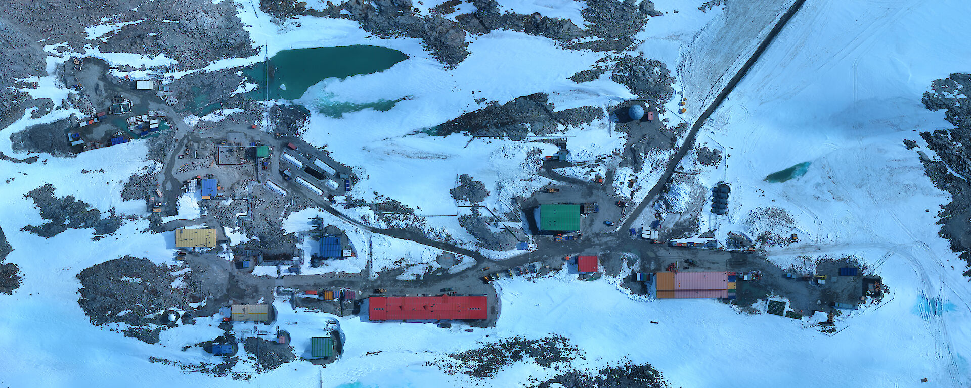
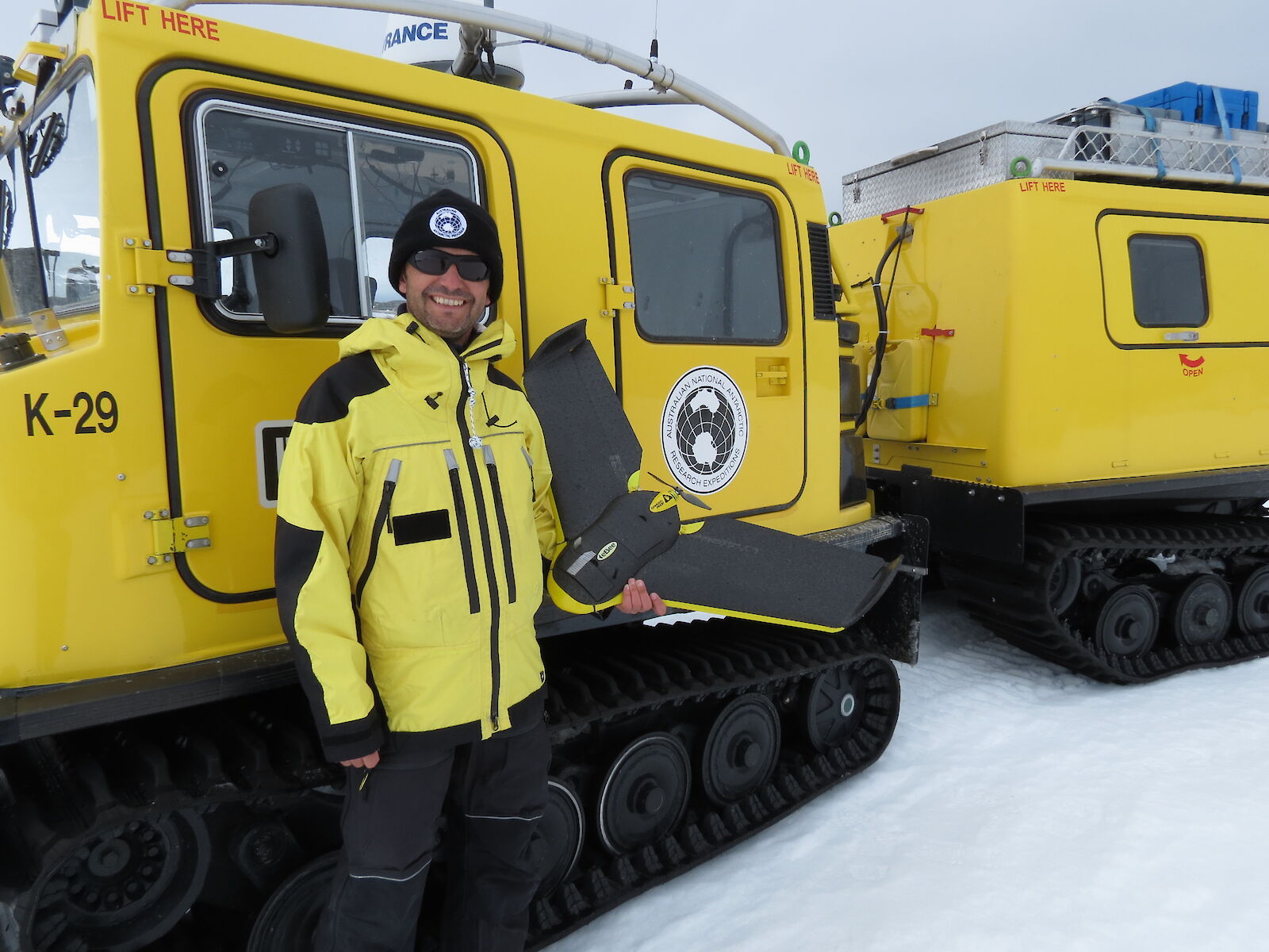
The ship-based trial was followed by the first Australian Antarctic program use of a fixed-wing model. Amidst the hive of Casey’s resupply, a Sensefly eBee flew transects 120m above ground level, quietly mapping the station area in 100m swathes at 3.5cm/pixel resolution. (Flown at a lower altitude, a ground sampling distance of 1.5cm/pixel is possible.) Marketed as green technology and powered by a 160 W brushless DC motor, these 690 gram foam units — ours from Victoria and replete with eagle talon holes — are thrown into the air to launch, and have a linear landing accuracy of approximately 5m. The imagery obtained will assist the Antarctic Division to gain a better understanding of Casey’s footprint and in turn, improve ‘town’ planning processes. The region’s flora includes more than 20 lichens, three mosses and a liverwort that are vulnerable to the impacts of station operations.
Both the DJI Inspire and Sensefly eBee drones were operated by CASA licensed pilot James Rennie of Australian UAV. Video footage taken above the ship may be viewed on the Antarctic Division’s news site.
Dr Sandra Potter
RPA Project Manager — Antarctic Modernisation Program
Australian Antarctic Division
Managing drones in Antarctica
Drones offer a unique perspective on Antarctica, but using them requires care and sensitivity to the environment. Also known as Unmanned Aerial Vehicles, Unmanned Aerial Systems, or Remotely Piloted Aircraft, drones have become more technologically advanced in recent years and more compact, lightweight and affordable. This increases their appeal, for a whole range of uses, to expeditioners, scientists and commercial operators. For anyone planning to use a drone in Antarctica, it is important to understand the rules for use.
The Civil Aviation Safety Authority (CASA) has legislation in place that applies to drones. This includes a licensing regime for operators likely to obtain commercial gain from the use of the drone, including for science, government operations and media, or for drones over a certain size. Information is available from the CASA website and anyone planning on taking a drone to Antarctica should check whether they first need to obtain a licence.
As operating drones in Antarctica offers some particular challenges and risks, the Australian Antarctic Division has prepared its own operational and environmental policies. These polices provide guidance on the appropriate use of drones in Antarctic conditions, including things like visibility, wind conditions, wildlife, and proximity to station facilities and aviation activities. Any drone flight has the potential to impact on the environment, including by disturbing wildlife, so all drone use in Antarctica must have an environmental authorisation and users must be aware of the conditions under which they can be used.
Some of the images and footage taken from drones in Antarctica is truly spectacular, and there is no doubt that more people will want to fly them, for a whole range of purposes, including just for fun. For more information about using drones in Antarctica contact the Territories, Environment and Treaties Section of the Australian Antarctic Division at eia@aad.gov.au.
Rhonda Bartley
Strategies Branch, Australian Antarctic Division