
Long-range drones took Australia’s East Antarctic Ice Sheet studies to new heights this past summer.
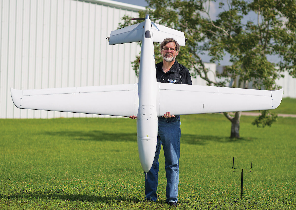
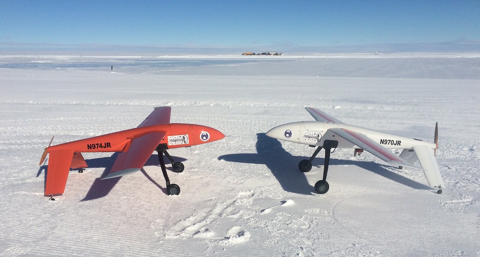
Between February and March 2016, Wilkins Runway hosted test flights of ‘Tiburon Junior’, developed by Intuitive Machines, a Houston (Texas) based engineering company. The flights represented the next phase of the ICECAP* project which, over the past seven years, has been simultaneously surveying ice sheet structure and underlying bedrock topography and geology, while monitoring how certain areas of the ice sheet are changing. Beginning in summer 2017–18, Tiburon Junior’s big brother, ‘Tiburon’, will join the survey team.
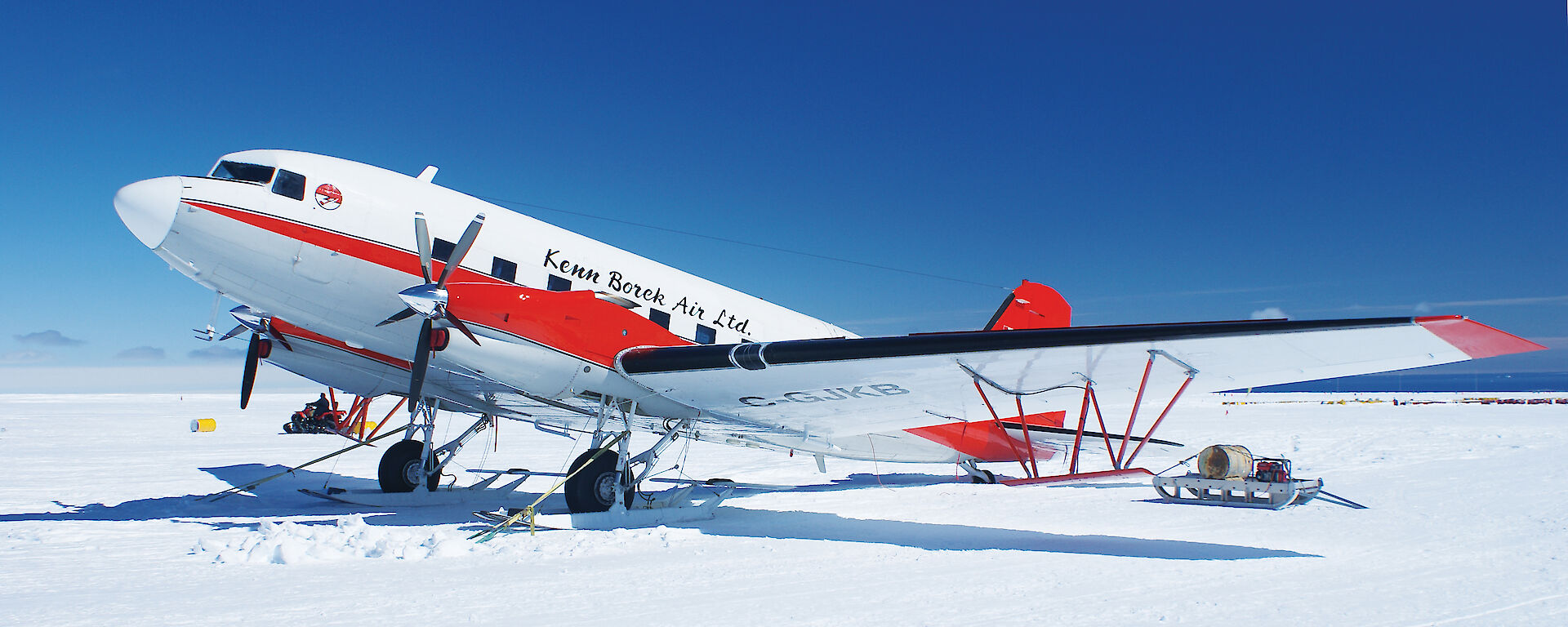
Australian Antarctic Division glaciologist Dr Jason Roberts said the drones, carrying variations of the scientific equipment normally installed in a seven tonne Basler BT-67 aircraft, will ultimately allow the project team to more efficiently monitor ice sheet change and explore new and difficult to access areas in the continental interior and offshore.
“While the Basler remains our primary workhorse, the drones give us more flexibility to operate over the continental shelf, because they don’t need safety equipment to fly over water. So they can fly further and they can fly over sea-ice covered areas that would be difficult to get to by ship,” he said.
“The larger drone also has about twice the range of the Basler, so we can fly further inland, and both drones can fly slower than the Basler, which improves the resolution of our data because we have less space between data points.”
Ice gains and losses
ICECAP aims to uncover information that will enhance modelling of ice sheet dynamics and the understanding of the role of the East Antarctic Ice Sheet in global climate and sea level rise. Antarctica has an annual accumulation rate of 2200 billion tonnes of snow, which is equivalent to about six millimetres of global sea level. This is offset by the loss of ice as it flows from the interior to the coast, where it calves off as icebergs, or melts into the ocean. The balance of these losses and gains determines whether Antarctica causes overall rises or falls in sea level. Understanding the flow path of this ice, and how it might be changing, is a critical piece of the puzzle.
”Bedrock topology and composition affect the path and speed of ice flow,” Dr Roberts said.
”So we want to know where there are mountain ranges, basins or flat plains under the ice and what type of rocks are under there. For example, are they ‘hot’, naturally radioactive rocks that can lubricate the movement of the ice sheet by contributing to the formation of liquid water at its base?”
To find out, the airborne ICECAP toolkit includes ice-penetrating radar, laser altimetry, a camera, gravity meter, and geomagnetic equipment, to measure ice thickness and structure, ice surface elevation, the presence of liquid water, and bedrock depth, structure and composition.
Drone deployment
This summer’s test flights of Junior, conducted by members of ICECAP and Intuitive Machines, focussed on cold weather operations and establishing the logistics required to operate in Antarctica. Junior carried a nine kilogram payload to observe the ice sheet surface, including multispectral imaging, high-definition video and a laser altimeter.
University of Texas Institute for Geophysics geophysicist, Dr Jamin Greenbaum, said that the deployment demonstrated Junior’s potential to accomplish a subset of ICECAP priorities next season.
”Given how well Junior flew and that it can fit within Wilkins’ operational scope, we’re confident that next summer it will be ready to offload some or all of the ice surface monitoring work that the ICECAP Basler normally does,” he said.
”Monitoring the ice sheet — observing whether the ice surface is rising or falling over time — with Junior, will allow the Basler to focus on areas requiring the combined set of heavier instruments. Junior also burns far less fuel than any piloted aircraft, so it is a more appropriate platform for flying where larger aircraft have already surveyed.”
This experience will set up scientists and the drone’s developers to operate the larger Tiburon, with its nine metre-wingspan and 130kg scientific payload, in two years.
”This season was primarily a pilot run with the smaller drone, and next season will focus on ice surface monitoring,” Dr Roberts said.
“In two years’ time we’ll begin flying heavier ICECAP instruments on the larger Tiburon drone, across the continental shelf and inland.”
A key task for Tiburon will be to better map the geometry of the bedrock beneath ice shelves, between Dumont D’Urville and the Shackleton Ice Shelf, to improve how ocean models represent the interaction of warm water with the ice sheet.
Using the Basler, the team will also deploy temperature/depth probes in the same region along the continental shelf, to measure the bedrock depth and provide temperature information to oceanographers.
Deep discoveries
This work follows the discovery in March 2015 of deep channels in the bedrock beneath the Totten Glacier that could allow warm ocean water to infiltrate its base, causing potentially destabilising melting (Australian Antarctic Magazine 28: 12, 2015). ICECAP has also shown that the Aurora Basin, which drains into the Totten Glacier, is much deeper than previously thought and sits on bedrock far below sea level.
”Twenty one percent of the Aurora Basin is more than 1000m below sea level, compared to earlier estimates of 0.2 per cent,” Dr Roberts said.
Leader of the Australian Antarctic Division’s climate program, Dr Tas van Ommen, said these findings suggest the region is more like West Antarctica, where there appears to be gradual but irreversible ice loss.
”If the Totten Glacier were to retreat all the way into the deep Aurora Basin it would lead to sea level rise of at least 3.5 metres,” he said.
”Such a change would take several centuries and is equal to, or a little larger than, the potential contribution from all of West Antarctica.”
The ICECAP team will also use the drones and Basler to continue the search for deep ice that could provide an ice core with a one million year climate record.
”We’ve found a site called ‘Blob-A’, near Dome C, that appears to have ice of the right thickness, about 2.5km deep, with nice, horizontal internal ice layers and no evidence of liquid water at its base,” Dr Roberts said.
”Horizontal layers allow us to accurately date the ice all the way to the base when we drill a core, unlike layers that are folded or twisted over each other.
”If Blob A harbours such an ice core, it will help us understand the cause of a dramatic shift in the frequency of ice ages about 800 000 years ago.”
Wendy Pyper
Australian Antarctic Division
*ICECAP (International Collaboration for Exploration of the Cryosphere through Aerogeophysical Profiling) is a collaboration between the Australian Antarctic Division, Antarctic Climate and Ecosystems Cooperative Research Centre, Australian Research Council Special Research Initiative, the University of Texas at Austin Institute for Geophysics, the US National Science Foundation, the UK’s Natural Environment Research Council, and the G. Unger Vetlesen Foundation.