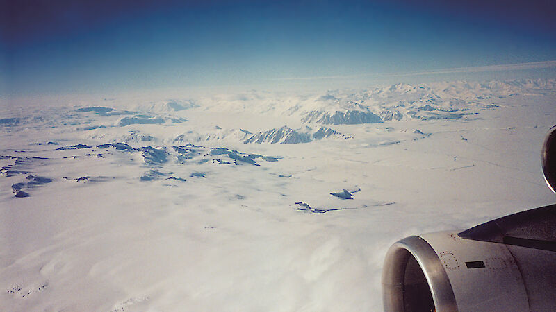
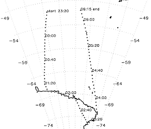
Each summer up to around ten tourists flights (using Boeing 747–400 aircraft chartered from Qantas by Croyden Travel) depart from Sydney, Melbourne, or Adelaide, and sometimes Perth, with the aim of seeing the magnificent views which the Antarctic has to offer. Figure 1 shows a flight path for such a sortie: the aircraft leaves Sydney at about 8 am DST (2100 UTC), reaches 50º S at about 10 a.m. (2300 UTC), and the Cape Adare area at around 12.20 p.m. (0140 UTC). The route shown on this example sees the plane then fly westwards along the coast to depart the Antarctic Continent over Dumont d'Urville at around 3 p.m. (04000 UTC). The actual route depends on the viewing conditions: on another day the flight might firstly fly over the Dumont d'Urville area then head towards the Transantarctic Mountains which are a very popular target (see photo).
The success of these flights depends critically on the viewing conditions, in other words on the presence or otherwise of cloud. The Bureau of Meteorology plays a vital role in providing the flight pilot with information and forecasts which enable him or her to over-fly the least cloudy viewing regions. The forecast information is provided by the Australian Bureau of Meteorology Regional Forecasting Centre in Hobart, Tasmania, Australia or by Antarctic Meteorological Centre at Casey (when staffed). Typically an experienced Antarctic weather forecaster will be assigned to a particular flight. On a Friday evening they will prepare a preliminary outlook for the flight which will take place the following Sunday. This outlook will be in general terms giving a general idea of where the best viewing conditions might be. Overnight Saturday night-Sunday morning this forecaster will be back on-deck producing detailed forecasts of route-winds, weather, and, in particular, cloud conditions.
The relevant forecast products are generally compiled using the best Numerical Weather Prediction (NWP) computer models available globally and are complemented by satellite imagery obtained from the polar orbiting and geostationary meteorological satellites. In keeping with state-of-the art communications Qantas Operations are able to download the forecasts from their web site: this usually happens a few hours prior to the estimated flight departure time. Communications and the Bureau of Meteorology next play a vital role as the aircraft is approaching the Antarctic Coast: the pilot rings the Bureau for any updates in the information, and is usually able to fine-tune the flight path to maximise the viewing time of Antarctic features. Generally a splendid time is had by all and most flights provide wonderful visual experiences for the passengers, even hard-bitten Antarctic expeditioners who have seen it all before.
Steve Pendlebury, Neil Adams and Mike Ball
Bureau of Meteorology


