
Maps
Maps are available for downloading from the Map Catalogue in multiple formats. For best screen view and print quality, download PDF and open in Adobe Acrobat Reader. Go to Edit → Preferences → Page Display. In the Rendering box, uncheck “Enhance thin lines”.
Enquiries to mapping@antarctica.gov.au.
Location, boundary and overview maps
- A4 location map or small location map showing the location of Heard Island and McDonald Islands in relation to Australia and Antarctica.
- Map showing the boundaries and marine zones of the Heard Island and McDonald Islands Marine Reserve.
- This map list shows all maps of Heard Island and McDonald Island in the Map Catalogue.
- This map list shows maps of the Kerguelen Plateau in the Map Catalogue.
Detailed topographic maps
- Map 16289: Heard Island – Topographic Map: Map 1 of 5 A3 1:50 000
- Map 16290: Heard Island – Topographic Map: Map 2 of 5 A3 1:50 000
- Map 16291: Heard Island – Topographic Map: Map 3 of 5 A3 1:50 000
- Map 16292: Heard Island – Topographic Map: Map 4 of 5 A3 1:50 000
- Map 16293: Heard Island – Topographic Map: Map 5 of 5 A3 1:50 000
- Map 16294: Map 16294: Heard Island and McDonald Islands Topographic Map poster size 75 cm x 106 cm 1:50 000
Environmental/science maps
2003 maps
- Map 13013: Heard Island – Science Map 1 of 5 A3 1:50 000
- Map 13014: Heard Island – Science Map 2 of 5 A3 1:50 000
- Map 13015: Heard Island – Science Map 3 of 5 A3 1:50 000
- Map 13016: Heard Island – Science Map 4 of 5 A3 1:50 000
- Map 13017: Heard Island – Science Map 5 of 5 A3 1:50 000
Satellite imagery maps
- Map 31: Heard Island & McDonald Islands (satellite image map) poster size 1:50,000, published in 1991 using SPOT and aerial photography
- Map 16187: Heard Island and McDonald Islands Satellite Image Map poster size 1:50,000, published in 2024 using Quickbird and Worldview imagery
This map published as 5 maps at A3 - Map 16182: Heard Island Satellite Image Mosaic 2017–2019: Map 1 of 5 A3 1:50 000
- Map 16183: Heard Island Satellite Image Mosaic 2017–2019: Map 2 of 5 A3 1:50 000
- Map 16184: Heard Island Satellite Image Mosaic 2017–2019: Map 3 of 5 A3 1:50 000
- Map 16185: Heard Island Satellite Image Mosaic 2017–2019: Map 4 of 5 A3 1:50 000
- Map 16186: Heard Island Satellite Image Mosaic 2017–2019: Map 5 of 5 A3 1:50 000
Spatial information for people involved in Australian Antarctic Program (AAP) field campaigns to HIMI
GIS data
Individual geopackages for Heard Island and Macdonald Islands can be downloaded directly from GeoServer for use in QGIS and ArcGIS Pro using the following links:
- HIMI Coastline Line
- HIMI Coastline Polygon
- HIMI Hydrology Line
- HIMI Hydrology Polygon
- HIMI Ice Feature Polygon
- HIMI Landform Polygon
- HIMI Relief Line
- HIMI Vegetation Polygon
- HIMI Sea Mask Polygon
Spatial data can also be accessed from our GeoServer site using server connections in QGIS or ArcGIS Pro. In GeoServer, right click on the desired service (eg WFS 2.0.0) to copy the URL and paste into the server connection dialogue box or the GIS platform you are using. Refer to QGIS instructions or ESRI instructions if you need further information on connecting to external servers.
Survey control
For projects that include a surveying component, please contact the AAD surveyor via email surveying@aad.gov.au. The AAD also has a Survey Control database.
- Map 16279: Heard Island Survey Control A4 1:160,000
| Station Code | Location | Datum | Latitude (decimal degrees) | Longitude (decimal degrees) | MSL |
| NMOS85 | Drygalski | ITRF2000 | −53.03679311 | 73.39741689 | 210 |
| NMOS86 | Dovers Initial Point | ITRF2000 | −53.01922825 | 73.39325747 | 1.35 |
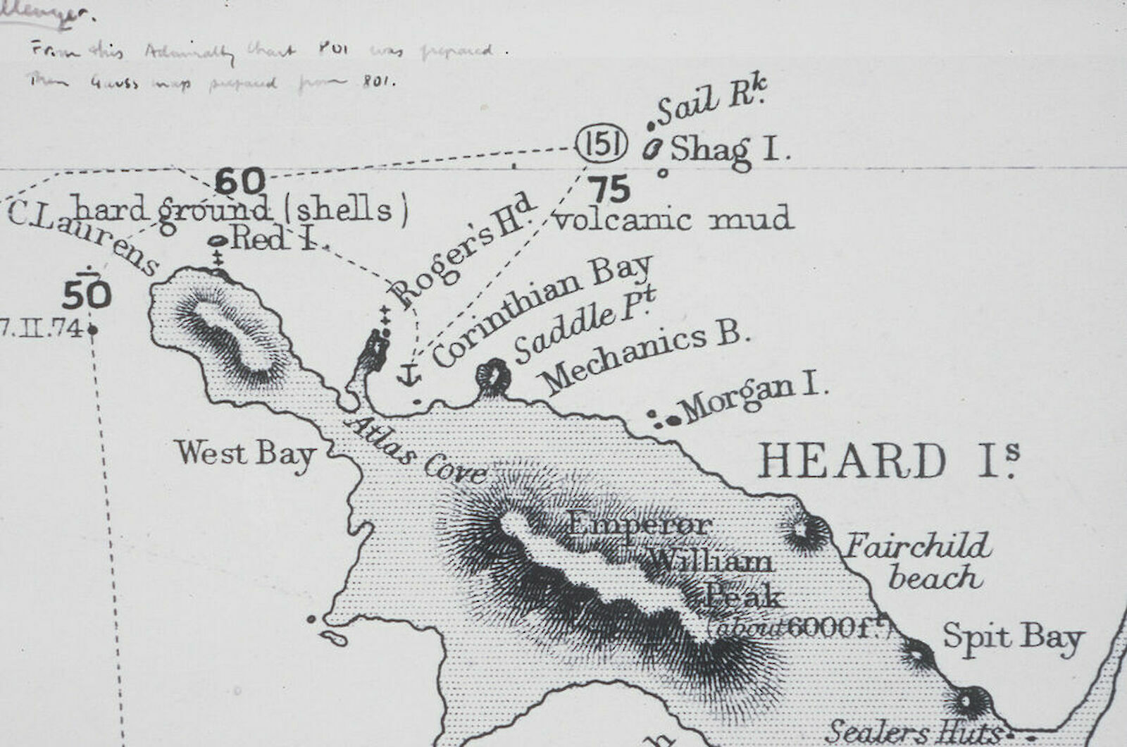
| NMOS87 | Atlas Cove | ITRF2000 | −53.01909761 | 73.39338781 | 2.23 |
| NMOS88 | Red Island | ITRF2000 | −52.96492886 | 73.30375008 | 94 |
| NMOS89 | Dovers Crater | ITRF2000 | −53.00608453 | 73.40391253 | 97 |
| NMY05 | Doppler Hill | ITRF2000 | −53.13586972 | 73.72255397 | |
| NMOS90 | Corinth Head | ITRF2000 | −53.00803678 | 73.41562272 | 180 |
| NMOS91 | Saddle Point | ITRF2000 | −53.01277119 | 73.49846119 | 105.98 |
| NMOS92 | Aubert De La Rue | ITRF2000 | −53.02268936 | 73.37297375 | 124 |
| NMOS93 | Andrée | ITRF2000 | −53.03285219 | 73.36751492 | 141 |
| NMOS94 | Round Hill | ITRF2000 | −53.06991231 | 73.64683806 | 382 |
| NMOS96 | Cape Gazert | ITRF2000 | −53.07545756 | 73.37222697 | 95.3 |
| NMOS97 | Railway Station | ITRF2000 | −53.0190005 | 73.39205906 | 4.06 |
| AUS093 | Atlas Cove | ITRF2000 | −53.01861725 | 73.39340983 | 4.69 |
| AUS094 | Spit Bay | ITRF2000 | −53.10728189 | 73.72060608 | 10.87 |
| AUS095 | ITRF2000 | −53.13778289 | 73.41269475 | 132.05 | |
| AUS096 | Cape Arkona | ITRF2000 | −53.16362944 | 73.43889875 | 218.54 |
| AUS097 | Cape Labuan | ITRF2000 | −53.19067522 | 73.49105186 | 45.84 |
| NMOS95 | Scarlet Hill | ITRF2000 | −53.09579703 | 73.66650172 | 409.18 |
| AUS331 | Spit Bay | ITRF2000@2000 | −53.10742392 | 73.72042664 | 13.615 |
| AUS346 | Atlas Cove | ITRF2000@2000 | −53.01825783 | 73.39347583 | 4.453 |
| AUS347 | Atlas Cove | ITRF2000@2000 | −53.01888867 | 73.39205128 | 3.784 |
| AUS348 | Spit Bay | ITRF2000@2000 | −53.01945717 | 73.39256928 | 2.754 |
Aerial photography
AADC stores aerial photography film holdings (including the HIMI area) in Amazon S3 storage in the cloud. The imagery can be searched and browsed through a spatiotemporal asset catalog (STAC) which provides information on image collection and on individual images. Information includes flightline data, photo centres and a thumbnail for each scanned image.
To search, view and download the full-sized images you will need to search for the image(s) you want using the STAC and then access and download the imagery from Amazon S3 using an S3 client. This requires the following steps:
Install and configure an S3 client:
- Request access to AADC Amazon S3 storage. This is an automatically generated request form – click the hyperlink and enter your email in the space provided and you will receive an email with your S3 credentials (access key and secret key) and links for instructions on how to access the data.
- Follow the instructions in the email and in the S3 download guide to install an S3 client and configure with the access credentials provided.
- This will provide you with access to the aadc-aerial-photography-film bucket from which you can navigate to the folder containing the image you want.
- Access will be for a 2-week period and then expire. In the event you need access again after this time, simply use the above link again and new credentials will be provided to you.
Browse the STAC for imagery:
- The aerial photography is organised by film number. Key HIMI coverage numbers are listed below. You can click directly on the hyperlinks provided below or use the filter function to search on specific film collections.
- To locate the imagery in S3 you will need to click the “Copy URL for Amazon S3” button in an individual image entry page. This can be found by opening an individual image entry within a film collection (eg image “antc1068-r1-f1” within collection “ANTC1068”) and locating the link for the TIFF file which is under “Assets”. Copy and paste the URL into a word document or note pad.
Download your image:
- You can paste the entire URL copied into your browser. It will ask to open your S3 client and prompt you to enter your S3 credentials – access key and secret key. It will then download your selected image.
- Alternatively, open your S3 client and navigate to the aadc-aerial-photography-film bucket. Use trailing elements of the URL (after the bucket name) to navigate to the file you have requested and download from there.
Key film numbers for HIMI coverage include:
- ANT202
- ANTC1068
- ANTC1069
- ANTC1070
- ANTC1071
- ANTC1072
- ANTC1073
- ANTC1074
- ANTC1075
- ANTC1082
- ANTC1201
- ANTC1202
- ANTC1203
- ANTC1204
- ANTC1205
- ANTC1206
- ANTC1207
- ANTC1208
- ANTC1209
- ANTC1210
- CAS9490
- CAS9492
- CAS9493
- CAS9496
- CAS9497
- CASC9491
- CASC9492
- CASC9494
- CASC9495
- CASC9498
- CASC9499
- CASC9500
Drone / uncrewed aerial vehicles / UAV Imagery
All planned UAV activities should first be consulted on with the DCCEEW Deputy Chief Remote Pilot (AAD) on drones@aad.gov.au to discuss the project’s planned use of drones and for standard operating procedures.
Satellite imagery
Satellite imagery is purchased subject to licence agreements which stipulate use and distribution. Where multiple AAP projects are planned in overlapping areas the purchase of new satellite imagery can be coordinated and shared across projects and institutions and the educational discount can be applied. To do this, purchases need to be made through the AADC on behalf of each project. The AAD is able to sub-license satellite imagery from Maxar Technologies for the duration of individual projects to the associated users. Additionally, tasking of satellites can be arranged and the AADC is currently in the process of obtaining access to MGP Pro (Maxar imagery) and OneAtlas (Airbus imagery) to procure both recent and archive imagery.
Access to proprietary satellite imagery (currently only Maxar)
If you are not a listed investigator on an AAS project, please proceed with the below steps to engage with a Chief Investigator (CI) on an existing project.
- Discuss your project with a CI of an existing project.
- To find an existing project, search the projects database and select 2025/26 from the Season drop down list. Select the project number from the left column to identify the CI’s name and affiliation, title and project aims. If the project has already had a previous season, project summary notes are provided further down the page along with a list of relevant publications.
- If none of the projects are relevant, reach out to planning@aad.gov.au to discuss further
- If the CI agrees to add you to the project, an email directly from the CI must be sent to planning@aad.gov.au detailing the additional names (each person who will want access to the imagery – including students) to be added to the project and in what capacity.
- Upon review and acceptance from the Science Planning and Coordination team, the additional names will be added to the project.
- Once all names are added to the project, follow the below steps.
If you are a listed investigator on an AAS project, please proceed with the below steps:
- Request a sub-license agreement by emailing remotesensing@antarctica.gov.au
- Signed sub-license agreement per institution returned to above email*
- Request an image request form by above email
- Submit image request form detailing which images are being requested to above email
- Images are provided with both Maxar license and AADC sub-license terms
* Please note: If the Sub-licensee uses the Material without returning a signed copy of this letter, it will be taken to have accepted that it has understood and agreed to be legally bound by these terms.
Spatial extent of imagery (existing and requested)
A map is currently being produced. This map will be updated as imagery is purchased.
Exploring additional imagery
If considering additional imagery, utilise the Maxar Xpress website. Take note of the Image ID number for communication with the AADC and please include EACH individual area of interest (AOI) as either a KML or zipped shapefile folder.
Note that the AADC will soon have an MGP Pro account and will be able to search additional imagery that may not be visible on the MGP Xpress website.
Access to freely available satellite imagery
There is a wealth of freely available optical and radar imagery from a broad range of satellites. A great way to explore this imagery is through the EO Browser. Once you find an image of interest, use the link button to copy the S3 location and open in your GIS software of choice.
For help on importing S3 data using ArcGIS or QGIS, see the AADC help and resources page which will be updated to include step-by-step guides.
If having access difficulty with QGIS, please update to the most current version of QGIS.