
Why satellite calibration matters
Monitoring Antarctica from space helps Australia meet scientific and environmental commitments – while minimizing human impact on the land. However, the calibration and validation of satellite data have historically relied on test sites outside Antarctica, leading to assumptions that may not hold true for icy terrain and extreme conditions.
Corner reflectors act as known reference points for satellites, allowing for fine-tuning of imagery and measurements. When radar or optical sensors scan over these reflectors, they create bright, easily identifiable signals that can be tracked over time. The result is improved mapping due to an enhanced ability to align satellite imagery over time with a greater level of precision and accuracy.
The role of corner reflectors
The plan includes:
- Installing 8 small reflectors on Heard Island for geometric corrections
- Placing one larger reflector at each Antarctic station (as well as Macquarie Island station) for both radiometric and geometric calibration
These reflectors will:
- Aid radar satellites in tracking changes all year, even in winter when there's no sunlight for optical sensors
- Larger reflectors will be covered with radomes to shield them from snow, debris, and curious wildlife
- Be survey measured for precision
- Require no electricity, aligning with net-zero goals
The corner reflectors
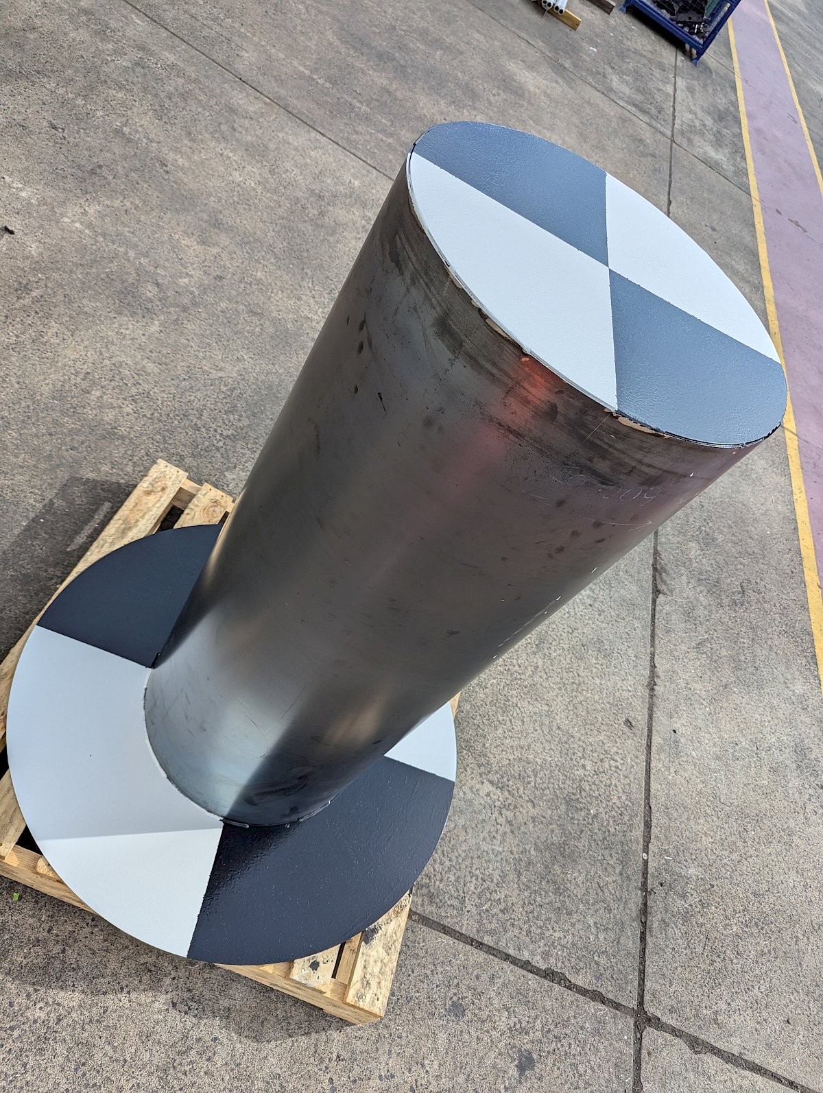
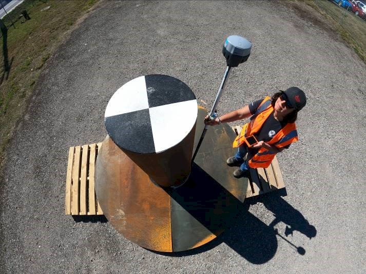
Small reflectors – Tophat cylindrical dihedral corner reflectors
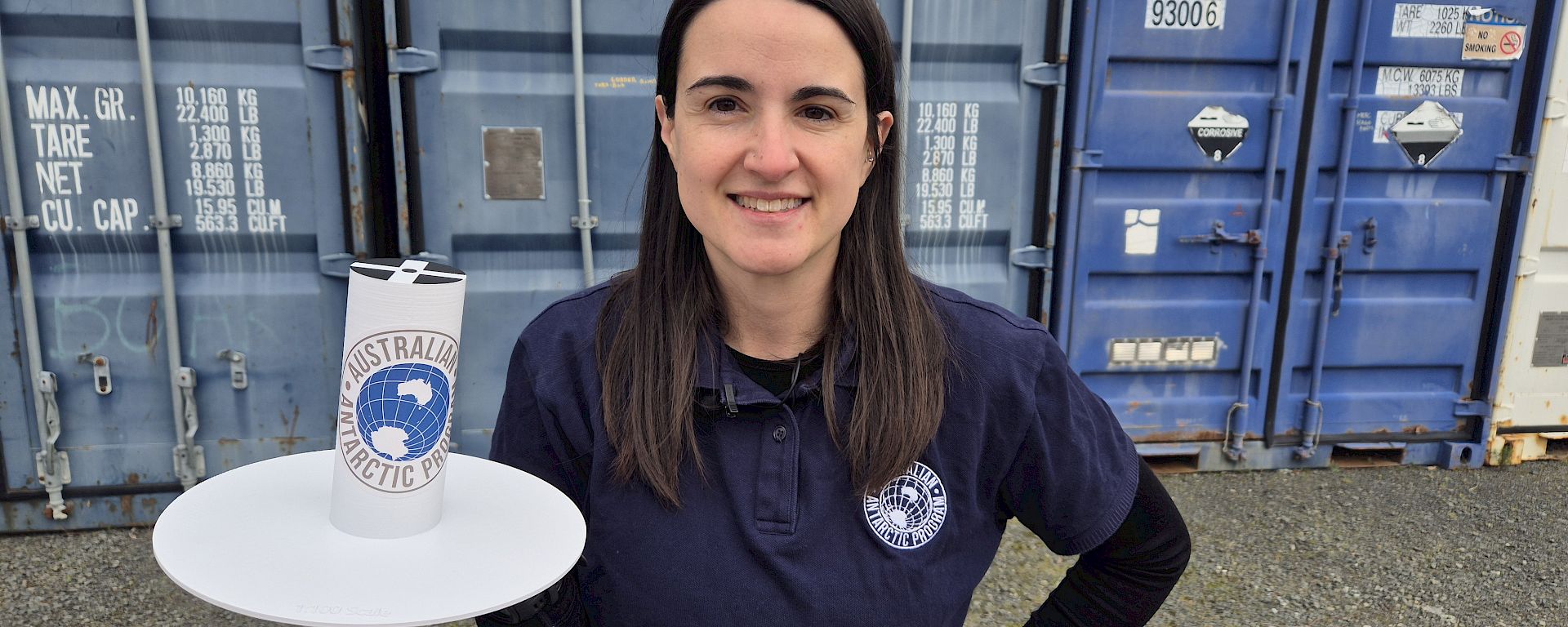
The tophat design is the first of its kind and was co-developed by Dr Melissa Fedrigo at the AAD and Dr Matt Garthwaite at CSIRO. They are shaped like a top hat with a wide apron and tall cylindrical middle column. The cylinder design ensures that any satellite orbit can view the tophat with leveling the ground before installation being the only requirement. The white apron and column with an “X” design on the top of the cylinder was selected for visibility by optical satellites – particularly the panchromatic band which is a spectrum from black to white. Tophat reflectors will be placed around Heard Island after being sling loaded by helicopter into position and then accurately surveyed on the ground.
During the Heard Island visit, a series of medium lift remotely piloted aircraft and piloted aircraft will also be carrying, in addition to optical sensors, light detection and ranging (lidar) instrumentation that will utilise the corner reflectors for calibration as well.
A prototype was manufactured in March 2025 and imagery acquired from a range of X-band and C-band satellites (Umbra, Capella, ICEYE, RadarSAT-2, TerraSAR-X) to ensure visibility at varying incidence angles and orbits. A slight modification of a wider apron was also tested midway through March resulting in the final design.
The tophat corner reflectors are being manufactured in Hobart, Tasmania ready for installation in the 2025/2026 season.
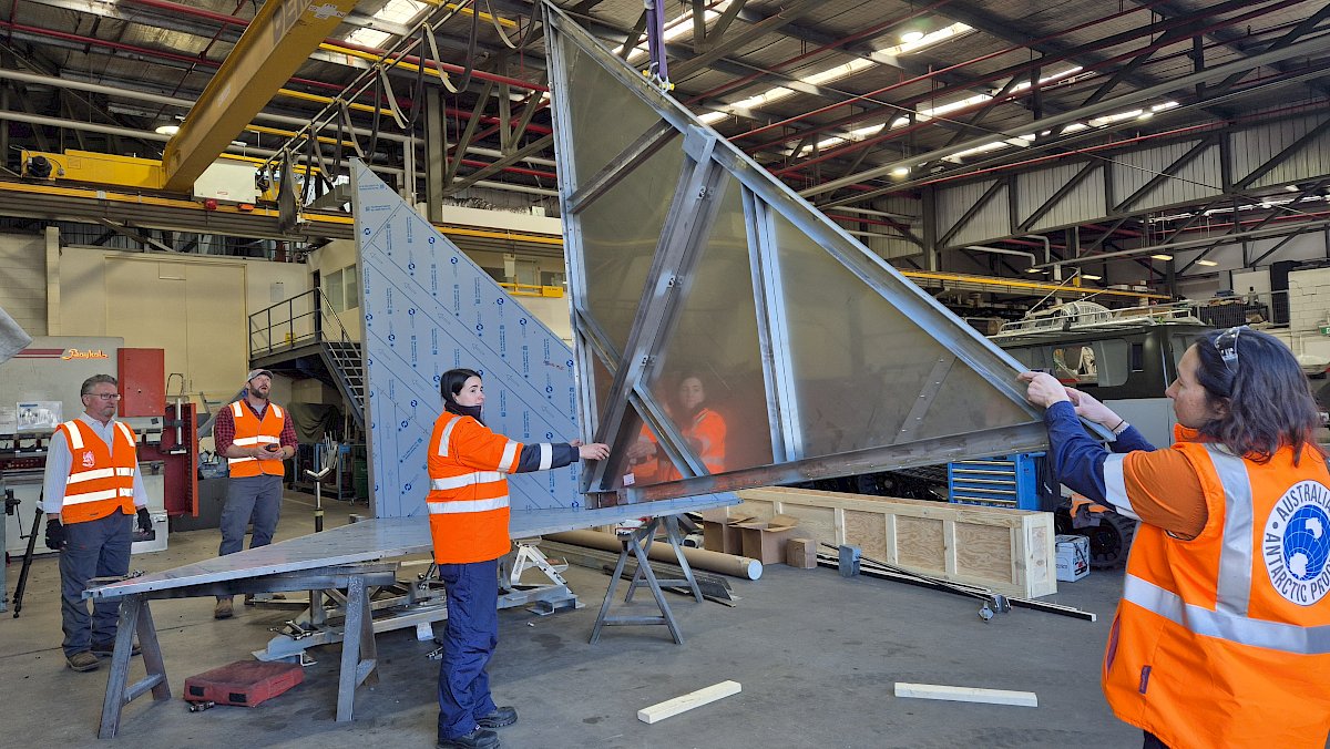
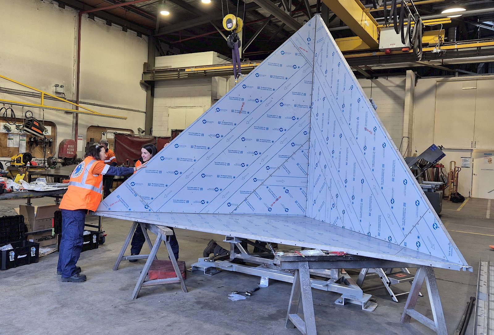
Large reflectors – Trihedral corner reflectors
The trihedral corner reflectors are an Antarctic-specific custom redesign for the Australian Antarctic Division by VerQuin Geodetic Engineering in the USA. It is the largest stainless steel corner reflector to be installed in Antarctica. Design specifications improved the wind loading of the reflectors to withstand 350 km/h winds using a large series of turnbuckles with an added radome material covering the aperture to minimise snow and debris accumulation.
All four trihedral corner reflectors have been manufactured with shipping to stations commencing in the 2025/2026 season for installation in the near future. The Australian Antarctic Division along with VerQuin Geodetic Engineering staff assembled one of the reflectors at Kingston in July 2025 to be installed semi-permanently on site later in the year until redeployment at a station.
These new reflectors will provide a ground reference points for the newly launched NISAR satellite, which will capture information right across Antarctica, but they can be adjusted for other satellites as well.
Closing the gap
This work supports the Australian Antarctic Strategy and 20 Year Action Plan Update, which depends on long-term satellite data to map and monitor the region.
By expanding the infrastructure for calibration and validation directly in Antarctica and remote subantarctic islands, the programme fills a crucial gap in global earth observation efforts.
Long-term science, minimal impact
With corner reflectors strategically designed with modularity and adaptability in mind – future satellites may require different designs, and these reflectors can be replaced without extensive infrastructure changes on our stations. At Heard Island, the unique cylindrical design ensures that any future satellites with varying look directions and orbits should still see them – an important feature due to the limited revisit opportunities on island.
Ultimately, this initiative supports Australia’s science goals, strengthens its international collaborations, and ensures that the data used to protect and understand the Antarctic is as accurate as possible.
Contact Details
Dr Melissa Fedrigo
Australian Antarctic Data Centre – Remote Sensing
remotesensing@antarctica.gov.au