Nudging a sleeping giant

For 60 days, 60 scientists joined Australia’s icebreaker, RSV Nuyina, to study the ocean, atmosphere, seafloor, geology, biology and history of the Denman Glacier region, off East Antarctica.
The voyage was part of an Australian Antarctic Program campaign, drawing together scientists from across research institutions and disciplines, to study the factors affecting the Denman Glacier's accelerated melt, and its impact on the surrounding environment, sea level rise and global climate.
Why the Denman Glacier?
The Denman Glacier is one of the fastest retreating glaciers in East Antarctica, with the potential to increase global sea levels by 1.5 metres.
The glacier is just one part of the wider East Antarctic “sleeping giant”, which contains enough ice to raise global sea levels by up to 52 metres, if it all melted.
"We know West Antarctica had been changing a lot in recent years, but the east is like the sleeping giant. It holds quite a bit of sea level rise potential," Professor Delphine Lannuzel, a chemical oceanographer said.
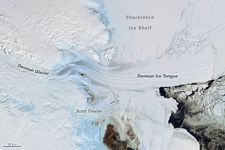
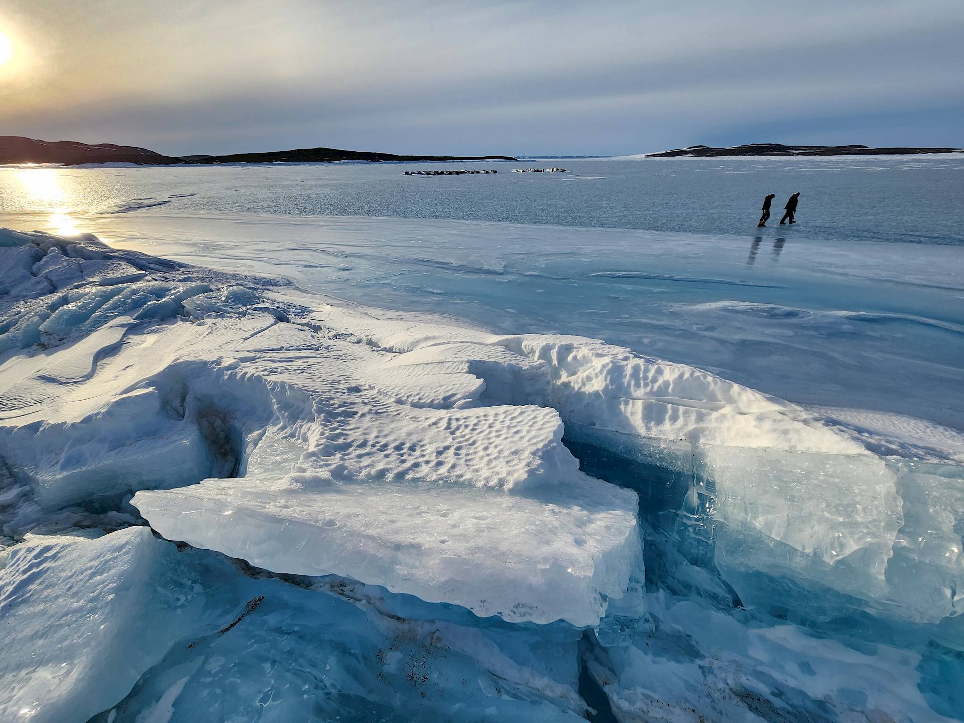
The 110 kilometre-long Denman Glacier terminates in the massive 34,000 square kilometre Shackleton Ice Shelf. Like all Antarctic ice shelves, this floating wall of ice slows the flow of glacial ice draining from the continent’s interior to the ocean.
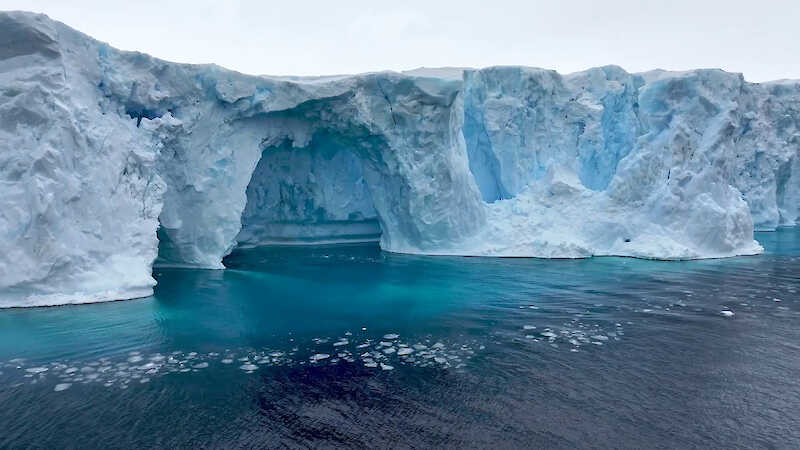
In 2019 scientists reported the deepest canyon on land beneath the Denman Glacier – an ice-filled ‘subglacial trough’ 3500 metres deep.
This canyon makes the glacier vulnerable to collapse as climate change causes it to retreat.
From 1996 to 2018, the glacier’s grounding line – the point where the ice shelf last touches the seafloor before it begins to float – retreated 5.4 kilometres.
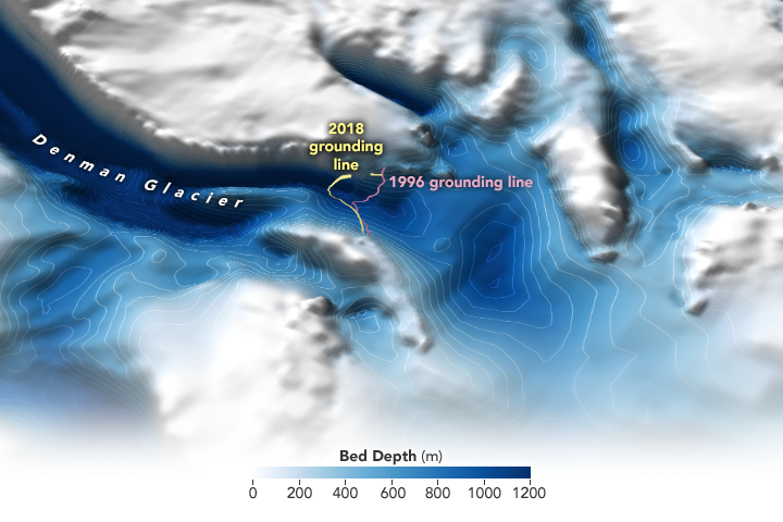
This means more of the glacier’s underside is now in contact with water that could warm and melt it from below.
To learn more about the factors influencing this retreat, including the glacier's history and stability, and its likely impacts on biodiversity and global sea level rise, the Australian Antarctic Program is researching the glacier from the land and sea.
These studies draw together scientists from the Australian Antarctic Division (AAD), Australian Centre for Excellence in Antarctic Science (ACEAS), Securing Antarctica’s Environmental Future (SAEF), and the Australian Antarctic Program Partnership (AAPP).

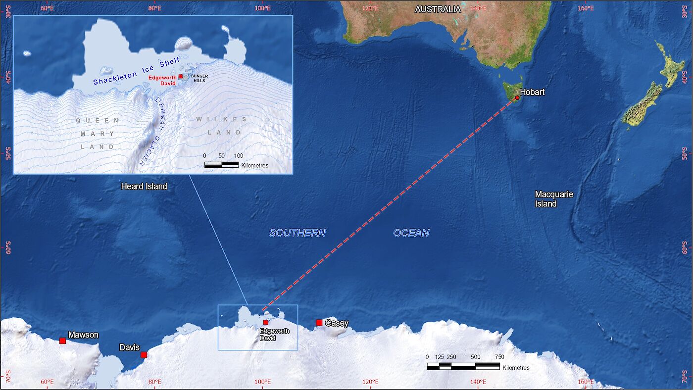
From 2022 to 2025 Denman Terrestrial Campaign, based from a deep-field camp in the Bunger Hills, examined the glacier and the Shackleton Ice Shelf from the land.
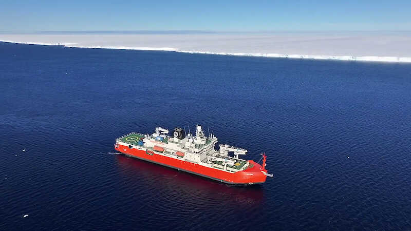
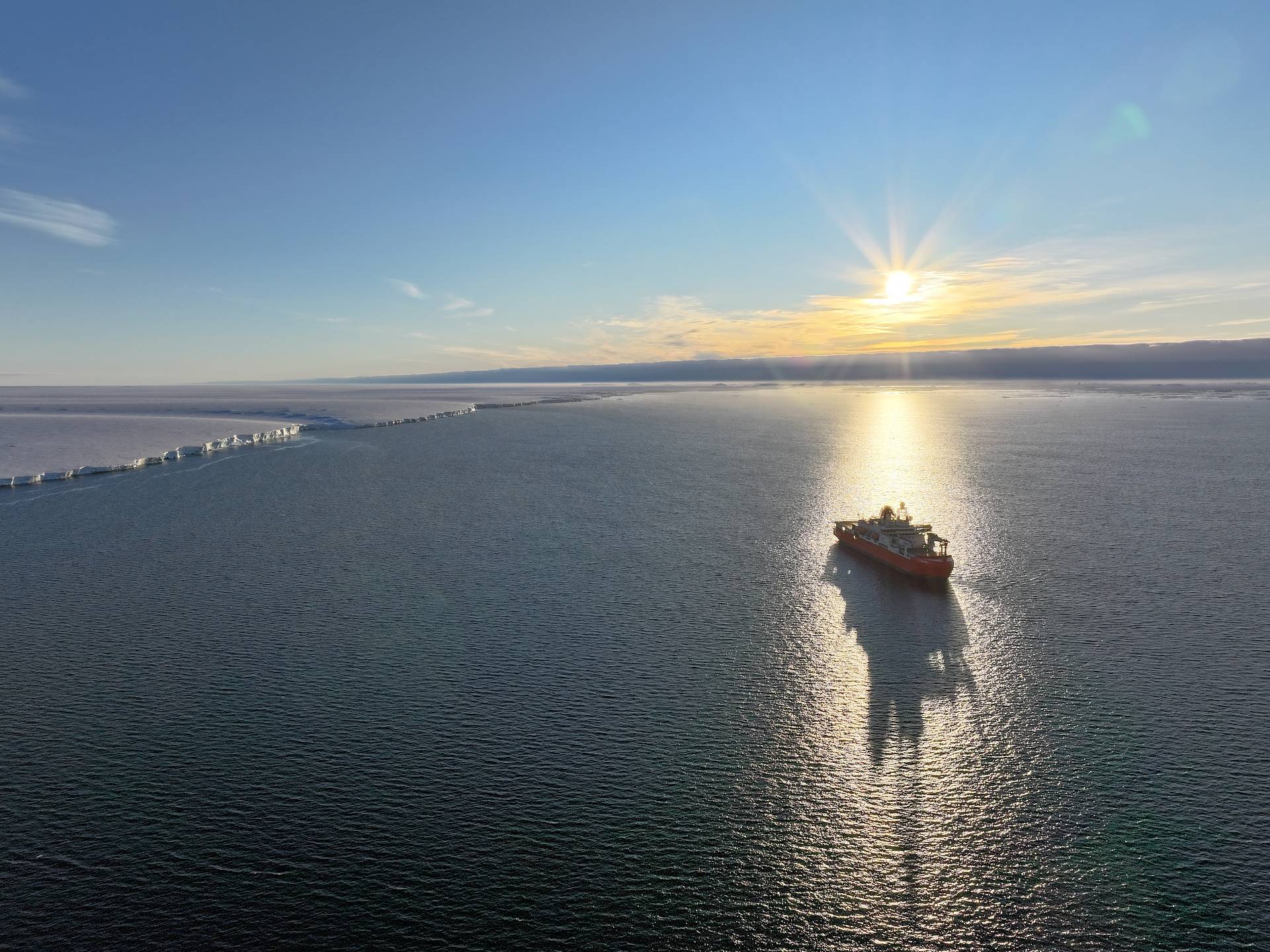
Between March and May 2025, the Denman Marine Voyage used RSV Nuyina's state-of-the-art scientific laboratories to study the glacier and surrounding environment from the sea.
Both campaigns will inform national and global decision-making about climate change responses and deliver on priorities in the Australian Antarctic Science Decadal Strategy.
Denman Marine Studies
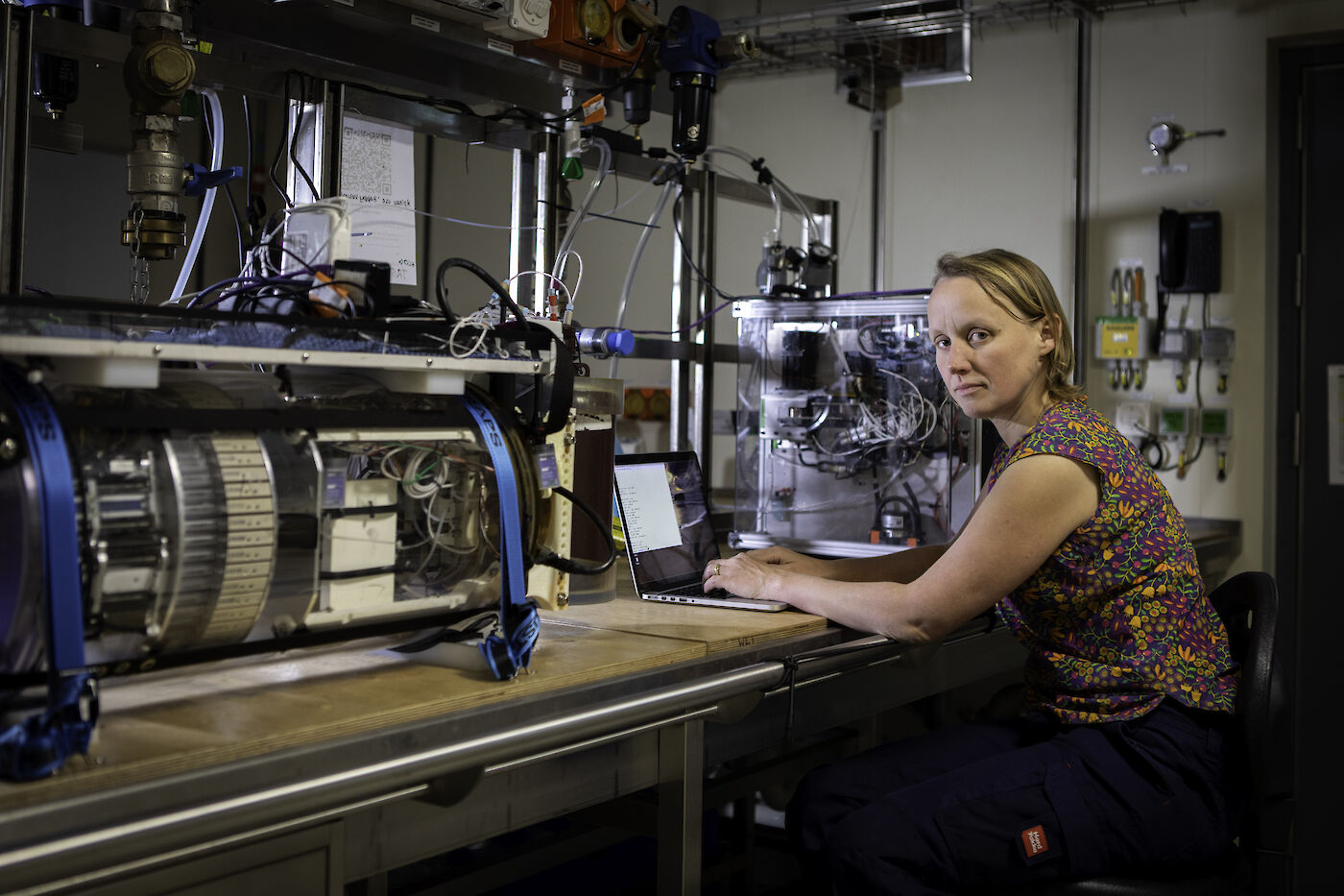
In March 2025, 60 scientists departed Hobart on RSV Nuyina to study the Denman Glacier system from the ocean.
Over two months, the team worked around the clock to understand the factors contributing to the accelerated melt rate of the glacier and its impact on the local and global environment.
The research included:
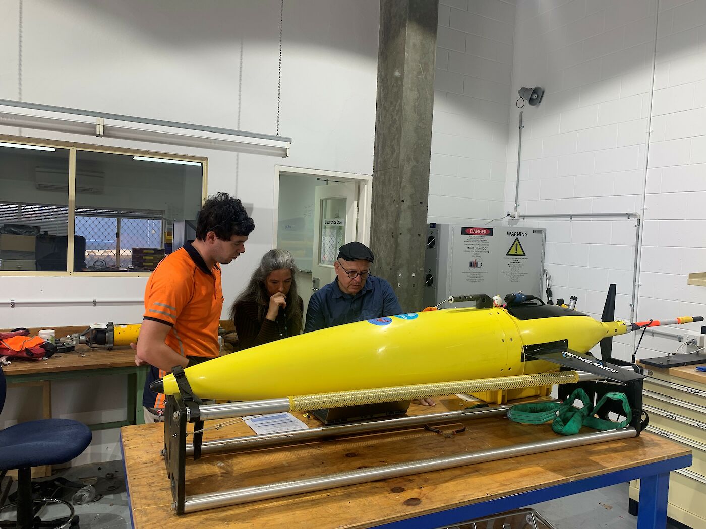
- Measuring physical and chemical properties of the ocean using sea gliders, floats and moorings to determine its role in current and future ice mass loss and therefore, sea level rise.
- Mapping the bathymetry (shape and depth) of the ocean floor to determine the pathways for warm water to travel from the edge of the continental shelf to the Denman Glacier.
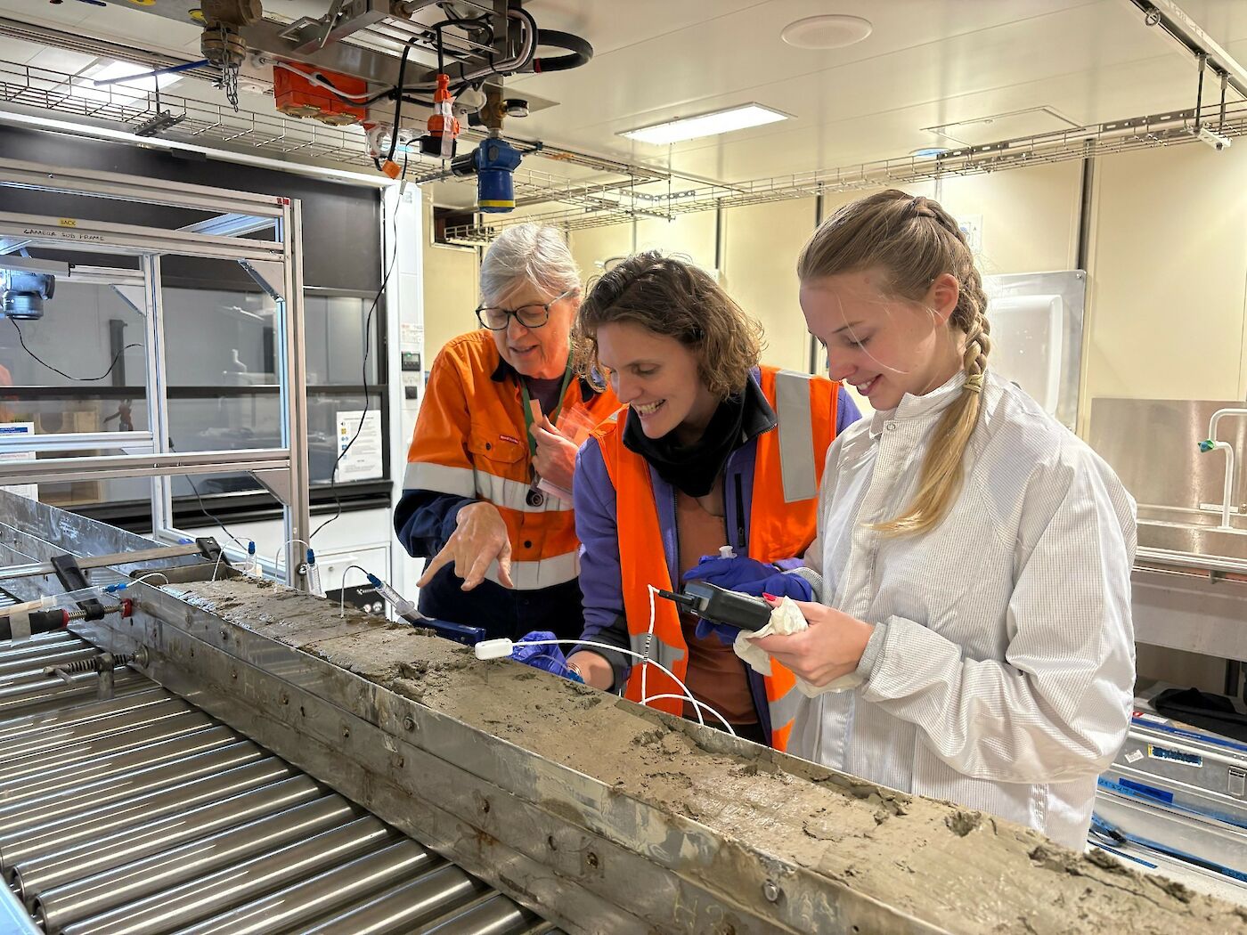
- Collecting rock samples and cores of ocean sediments to reconstruct the advance and retreat of the Denman Glacier over thousands of years.
- Undertaking deep-sea camera surveys and seawater sampling for trace metals, nutrients, and gas flux measurements to understand marine productivity.
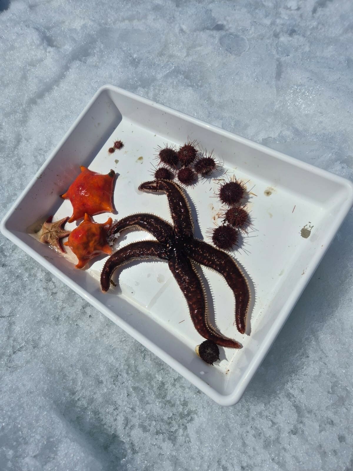
- Revealing life on the seafloor, such as octopus, sea spiders, starfish and urchins, to understand its diversity and distribution and inform conservation.
- Sampling seawater for traces of environmental DNA to determine what lives in the region.
- Using radar, atmospheric monitors and weather balloons to improve climate projections by tracing how clouds form near Antarctica.
- Documenting how krill and other zooplankton respond to ocean warming and acidification to understand the future health of the Antarctic marine ecosystem.
- Tagging seals with ocean monitoring devices to measure the physical structure of the water column and bathymetry.
View a full wrap-up of the voyage in this video.
Watch scientists collect creatures from the seafloor in the video below.

Denman Terrestrial Studies
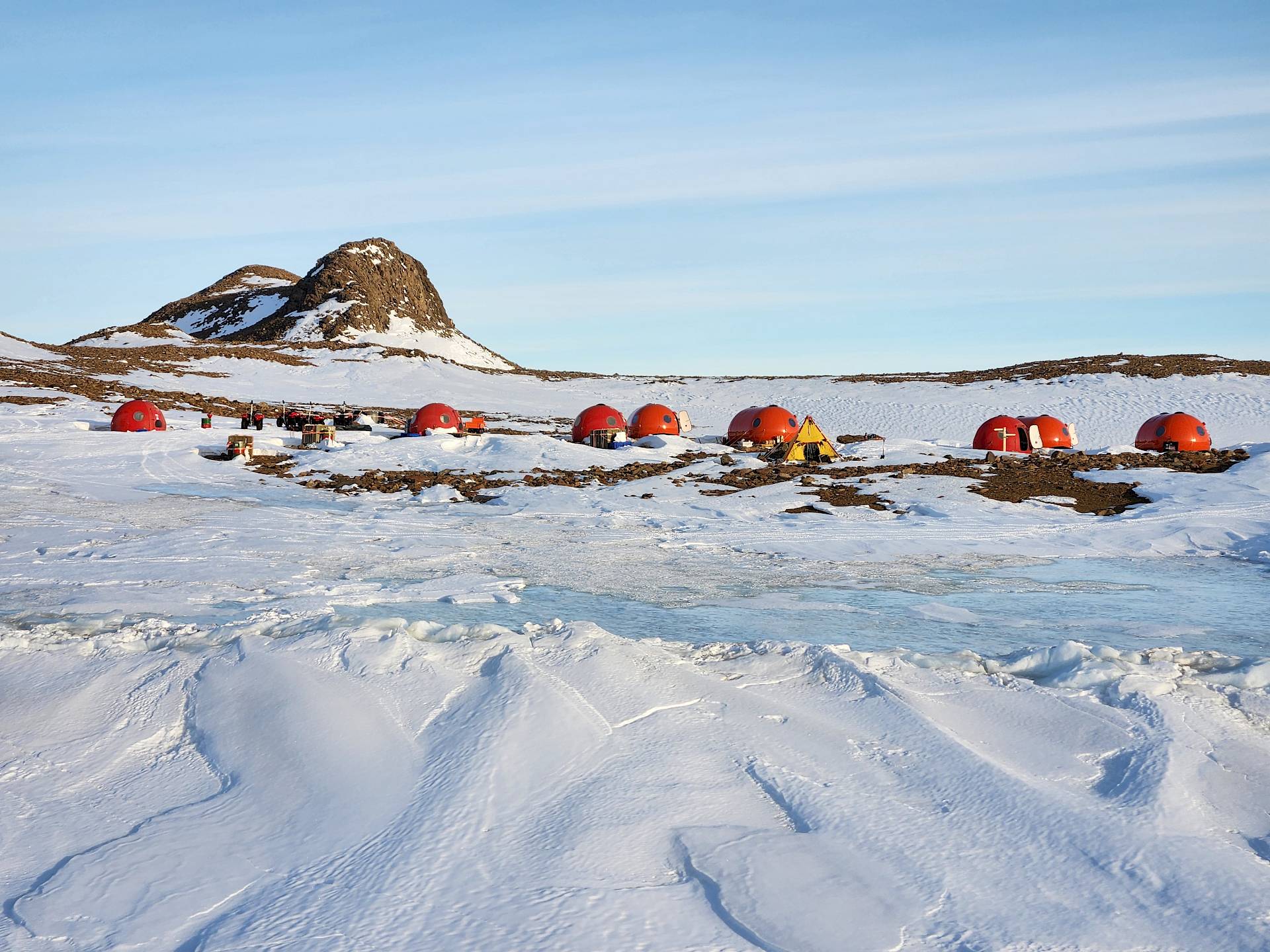
The Denman Terrestrial Campaign, which ran from December 2022 to February 2025, aims to increase our understanding of the Denman Glacier's history and stability through research projects staged from a deep field camp at Bunger Hills, about 450 kilometres from Australia's Casey research station.
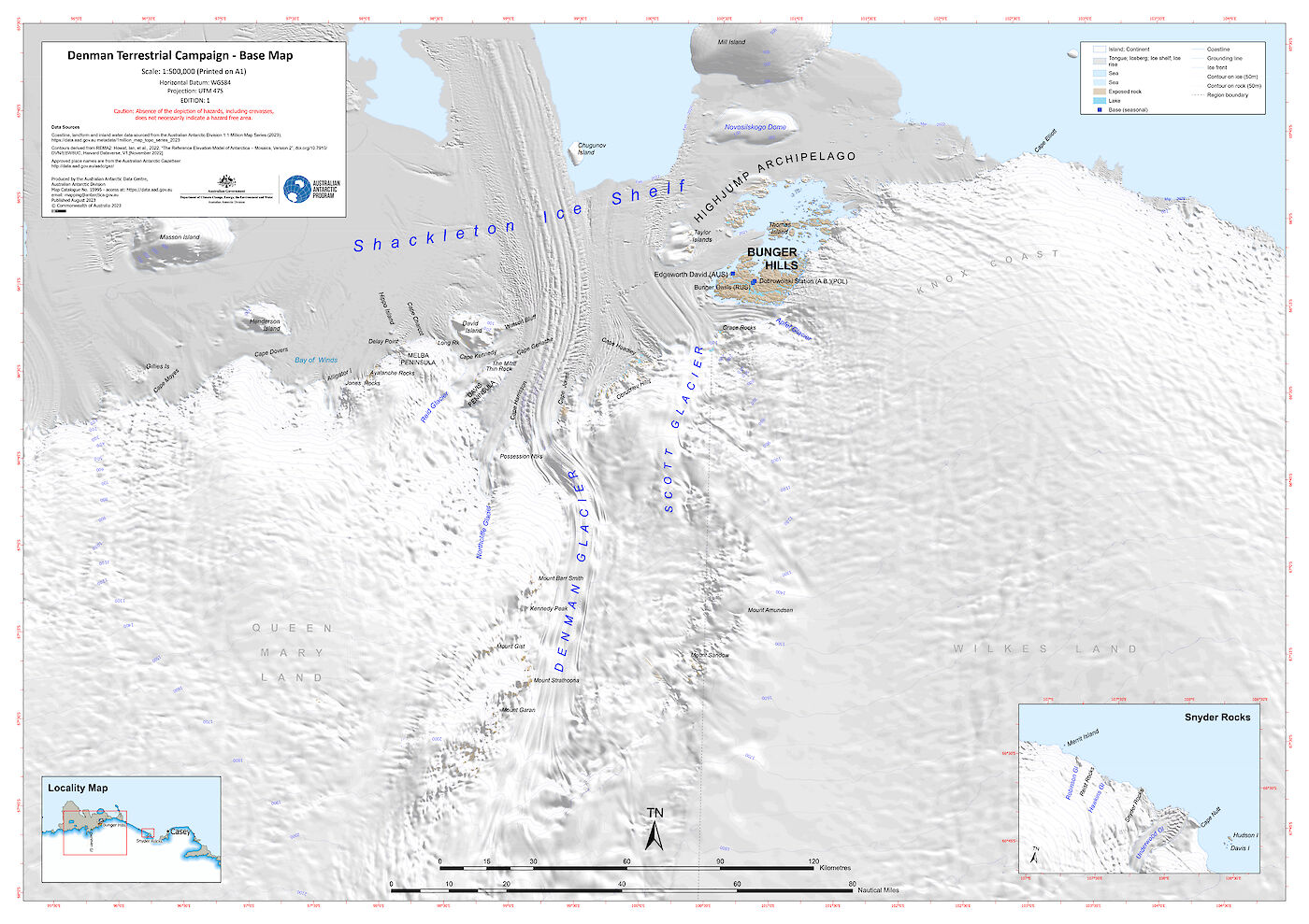
Over the 2022–2023 summer, building supplies were air-dropped in to Edgeworth David base camp and a small team of expeditioners built huts and timber platforms for tents, ready for the scientists' arrival.
The following season, 27 scientists spent eight weeks examining the glacier system and the Shackleton Ice Shelf.
The science included:
- drilling and analysis of ice chip records
- analysis of subglacial water flow
- collection and analysis of sediments to understand environmental histories
- geological studies of the deeper-earth
- ocean circulation and biogeochemical analysis
- remote sensing and airborne radar
- wildlife, microbial and biodiversity surveys
- landscape and ocean mapping
- deployment of autonomous environmental monitoring stations
“The campaign is really considering four main questions,” the Australian Antarctic Division’s Chief Research Officer, Dr David Souter, said.
“The first is how the glacier has changed over time and how it’s changed in the most recent period. The second is the stability of the glacier.
"The third is what the geology of the Denman Glacier is, and the fourth is what the biodiversity of the region is and how that’s changing with the climate."
Glacier stability
Glaciologist Dr Sarah Thompson and a team from AAPP and ACEAS, studied he stability of the Denman Glacier system, to better understand how sea levels will be affected if it melts.
The team used instruments to measure ice thickness and ocean depth, to predict where different ocean currents might gain access to the ice shelf.
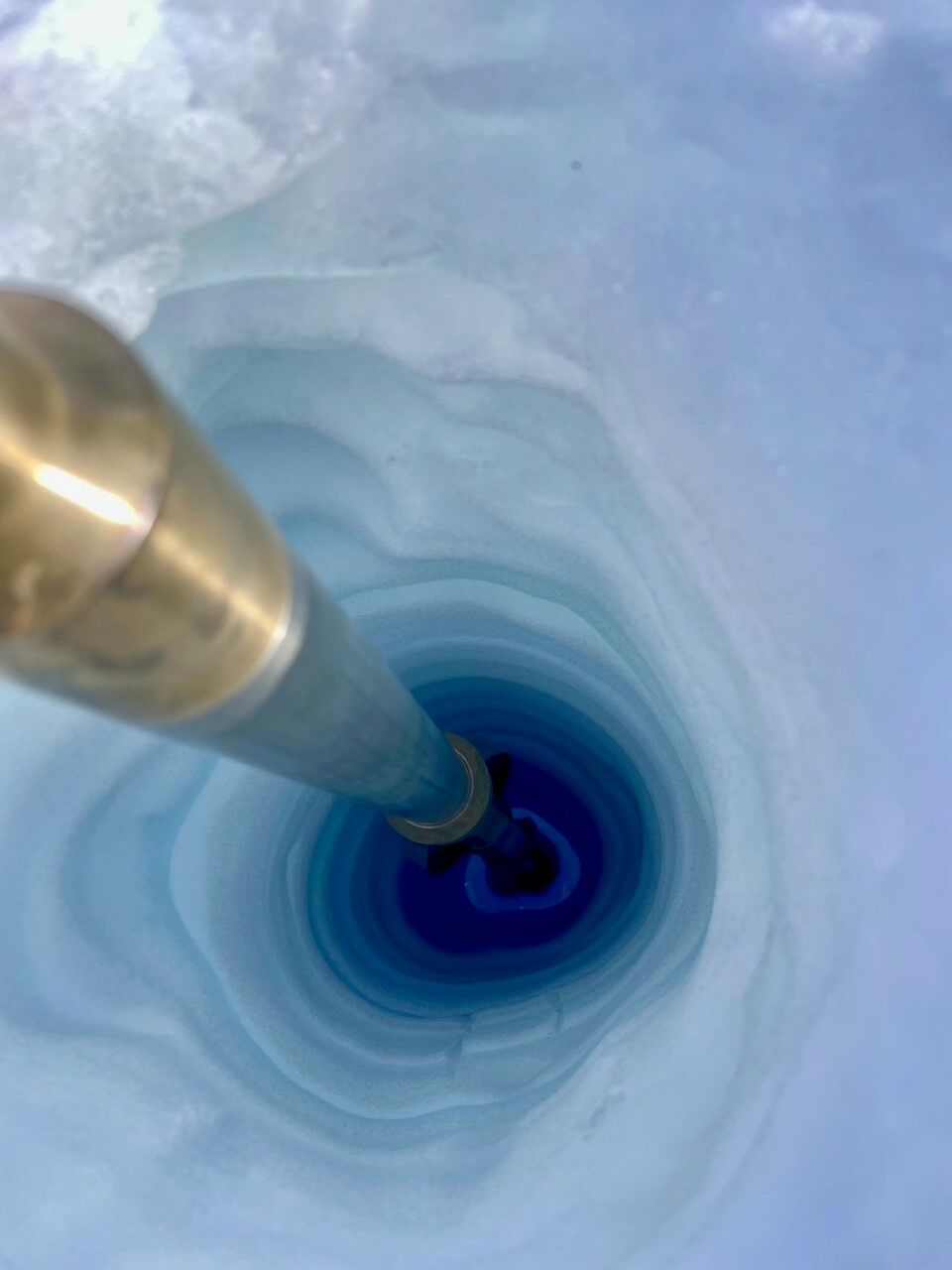
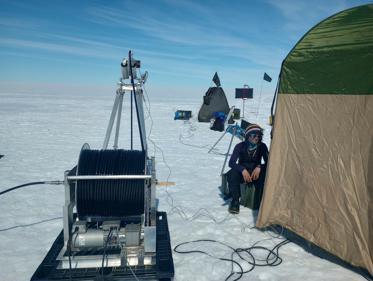
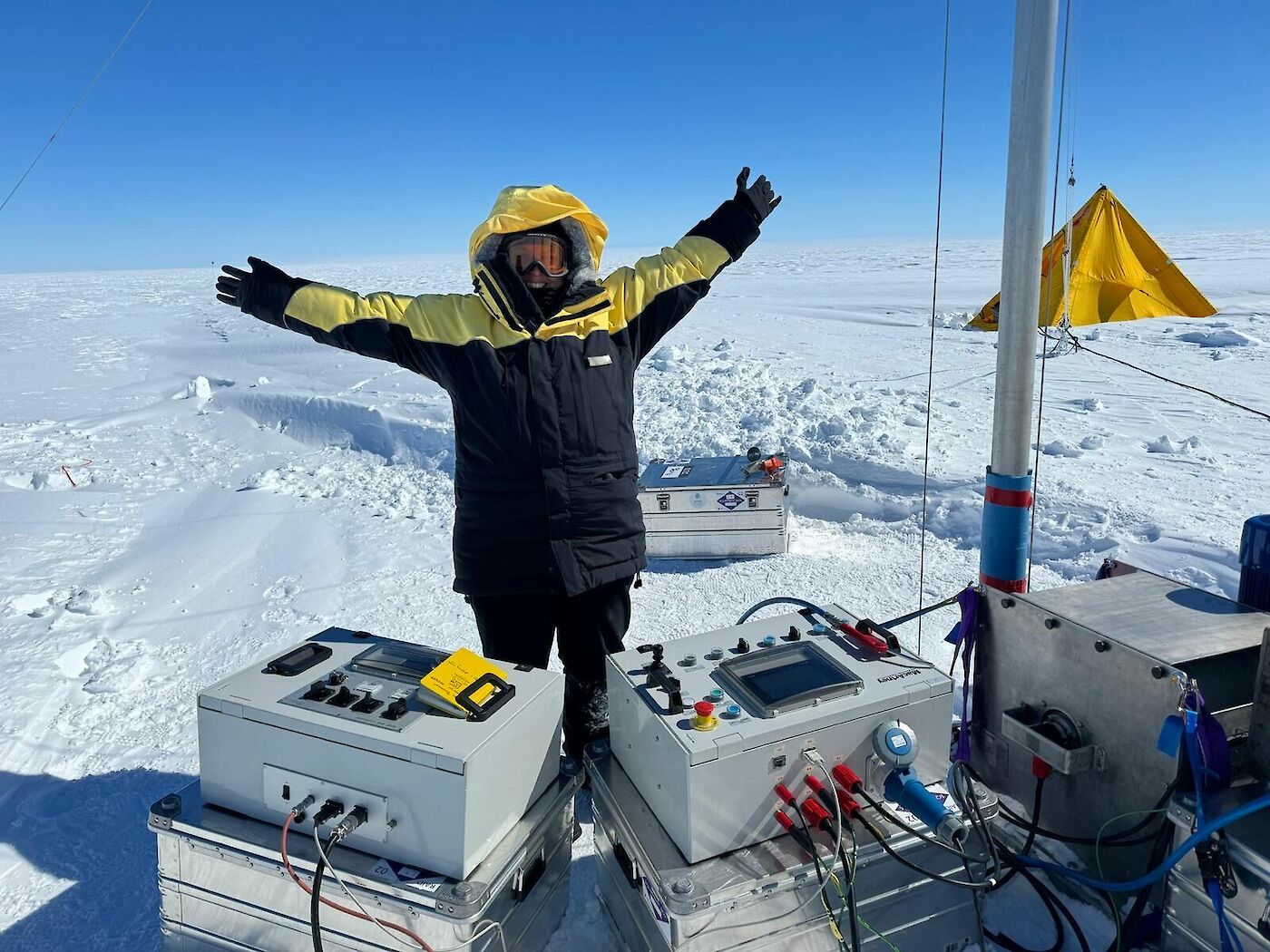
Dr Thompson also used a hot water drill to drill over 203 metres through the glacier, to reach the boundary between the base of the ice and the ocean.
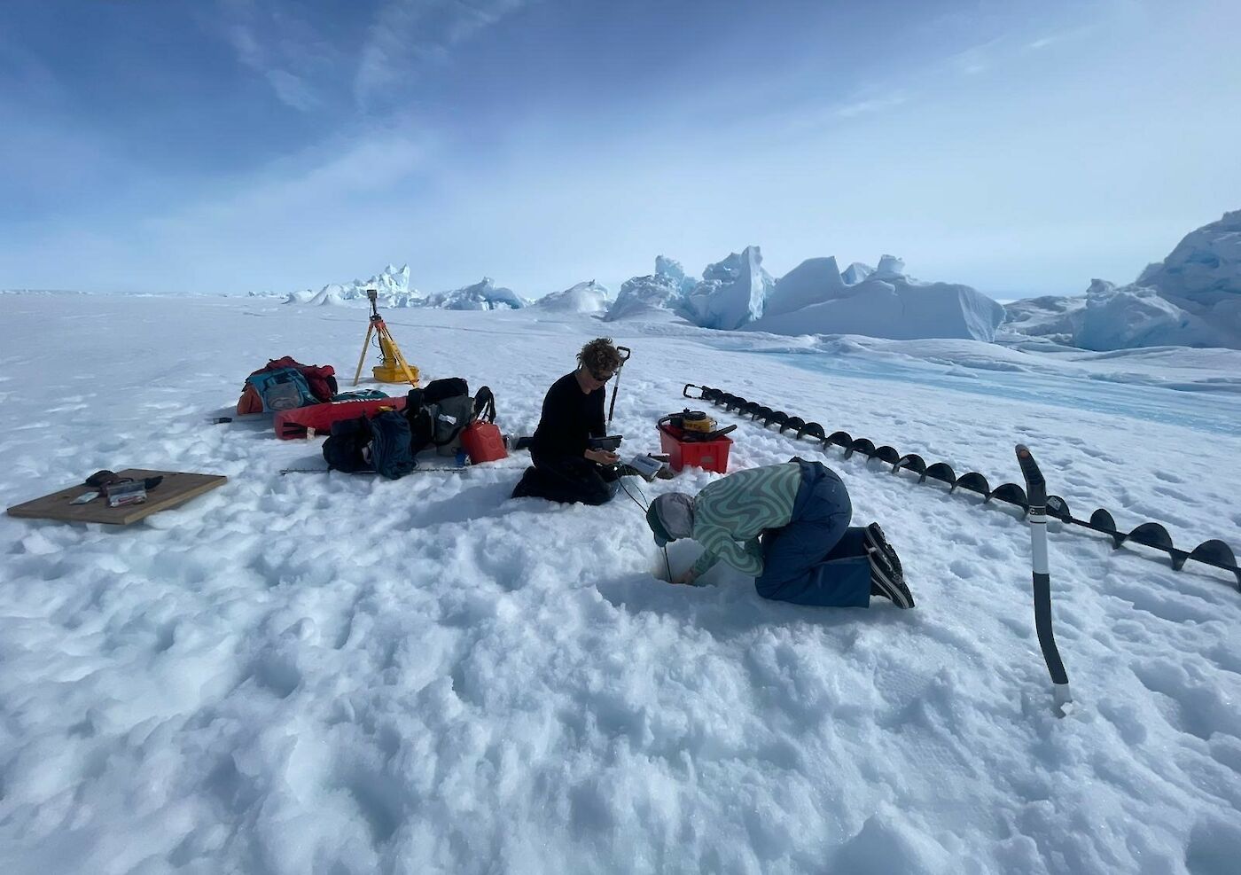
To run the drill, the team melted 60,000 litres of snow in a collapsible 10,000 litre round ('onion') tank. This meant shovelling snow for up to 12 hours a day. The meltwater was then heated to about 75°C, pressurised, and pumped into the drill system.
Once they reached the bottom of the glacier, the team deployed an instrument to measure temperature, depth and salinity.
ACEAS oceanographer Dr Madelaine Rosevear said they discovered a 300 metre-thick layer of warm salty water sitting above the 1000 metre-deep seafloor.
“At minus 1.3 degrees, it’s over 1 degree warmer than the local freezing temperature, which means it has the potential to drive rapid melting,” she said.
“Now we know that this water can travel beneath the ice and occupies the deep depression that we discovered there. However, we still have questions about the pathway that the water takes,” she said.
Learn more about Dr Thompson’s research in the AAPP feature stories How to drill an ice shelf – and why. and Fishing for a glacier's secrets.
History and geology
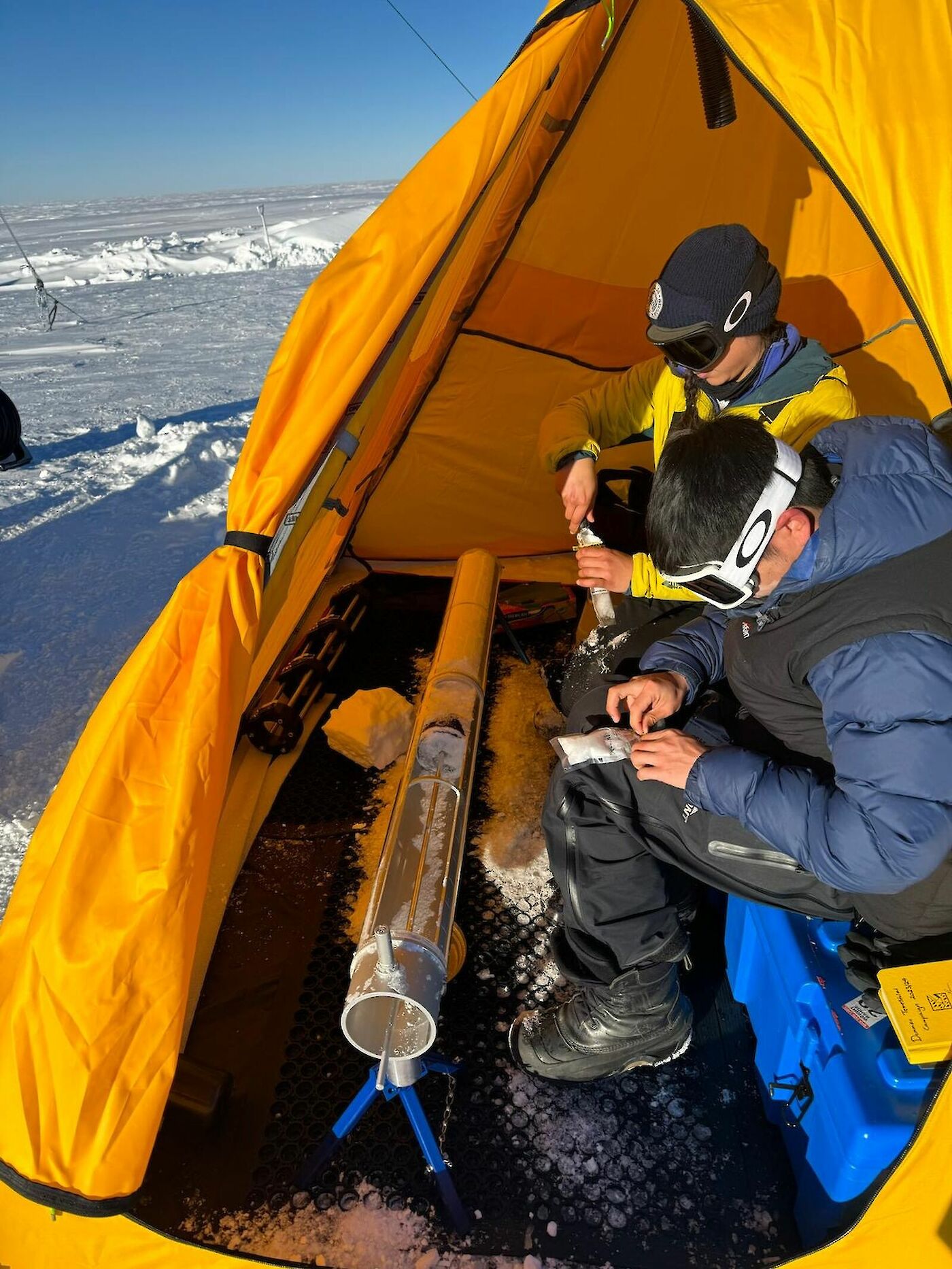
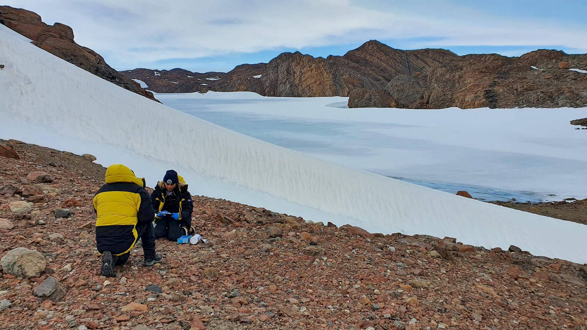
To explore the history of the Denman Glacier ACEAS climate scientist Professor Nerilie Abram led a small team drilling ice chips near the glacier.
Water ‘isotopes’ (different molecular forms of water) and trace chemicals trapped in the ice, provide information on how the climate and atmosphere has changed over time, allowing scientists to reconstruct the region’s climate history.
The team was based at a satellite camp about 90 kilometres from the main Edgeworth David campsite for 3.5 weeks and collected 5,000 samples of ice chips using a Rapid Access Ice Drill (RAID).
“It’s the first time Australia has done this type of ice drilling, so the team had a lot to learn along the way,” Professor Abram said.
“Once we got into a good rhythm, it only took us five drilling days to drill from 50 metres to 200 metres depth.
“The ice chips came out of the drill in order, and every five to ten centimetres along the barrel of chips, we'd scoop the samples into small zip-lock bags to bring back to Australia to be measured in the lab.
“These measurements will give us a history of past climate variations and recent climate changes for the region, going back around 500 years.”
The team also drilled 30 metres of ice chips (400 samples) from Mill Island, on the coast near the Bunger Hills – the site of a previous drilling effort in 2010 for an ice core.
“Our initial results from Mill Island show that the water isotope signals from the ice chips match beautifully with the same type of measurements made on the Mill Island ice core,” Professor Abram said.
“The overlap of our ice chip samples with the ice core climate record will allow us to study how recent climate conditions in the Denman Glacier region compare to past natural climate variability.”
In an effort to understand the glacier’s behaviour over thousands of years, a SAEF research team collected samples of beach sand, lake mud and glacial rocks.
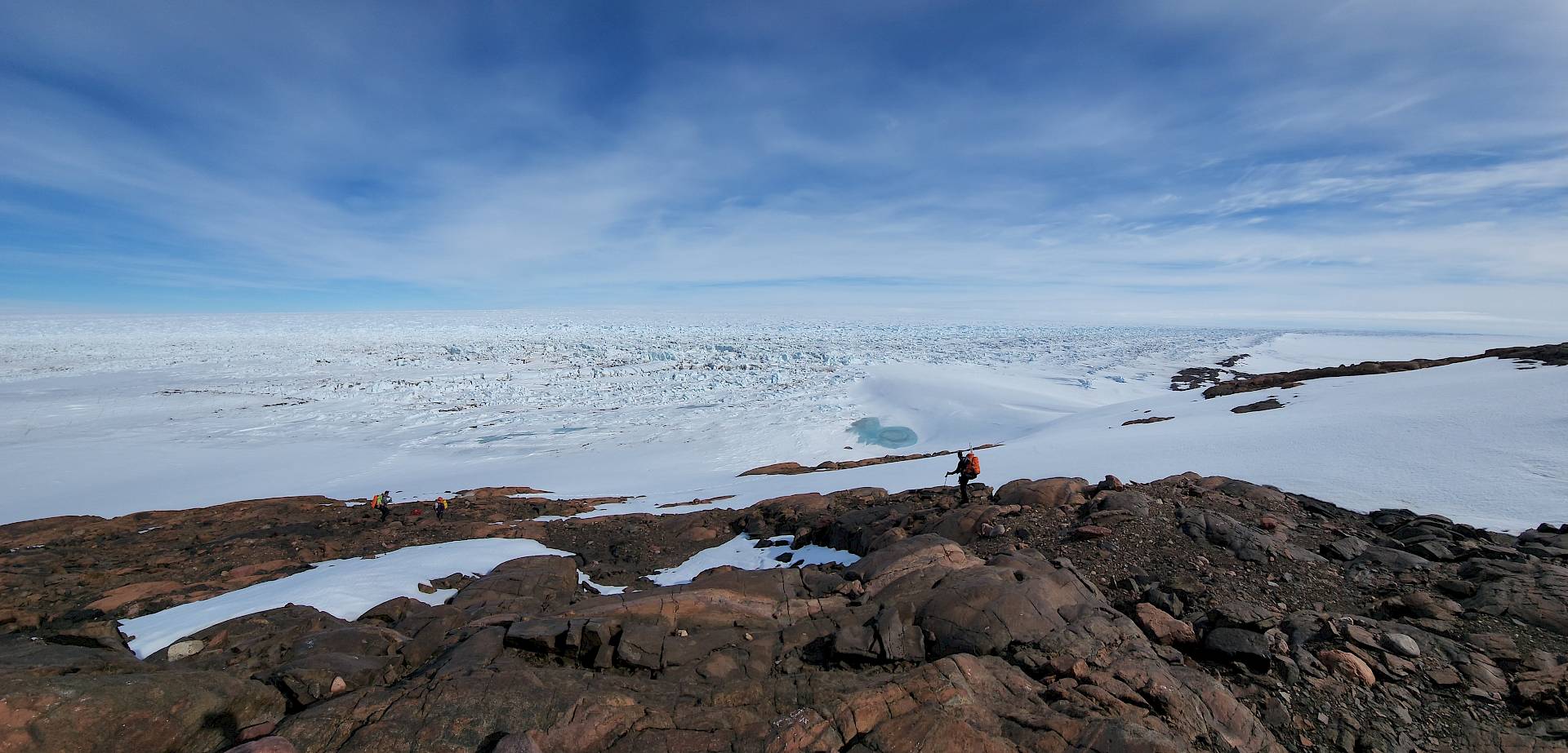
“The Denman Glacier has retreated over five kilometres in recent decades but we don’t know if that’s normal or the start of a worrying new trend,” SAEF glaciologist Dr Richard Jones said.
“The rocks record ice thickening and thinning, and the lake mud and beach sand record local sea level rise and fall in response to the ice growing and shrinking.
“We’ll try to estimate how the glacier changed prior to the 20th Century – was it retreating, stable, or even advancing?”
Read more about the SAEF research in the feature story Researchers of the Lost Ice.

Biodiversity
Eighteen scientists returned to the Denman Glacier region in December 2024 to study the biodiversity and the behaviour and structure of the Denman Glacier.
“The biodiversity work is terrestrial and under the sea ice, while the glacier work is classic glaciology, looking at seismology, movement and what’s happening to that environment,” Field Leader Simon Cross said.
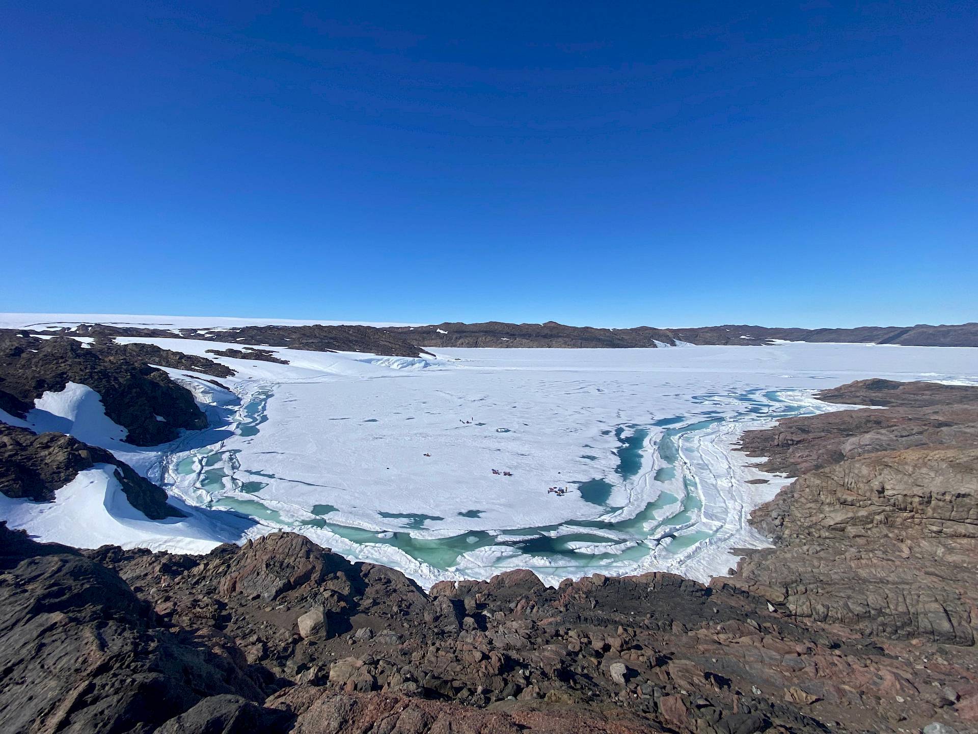
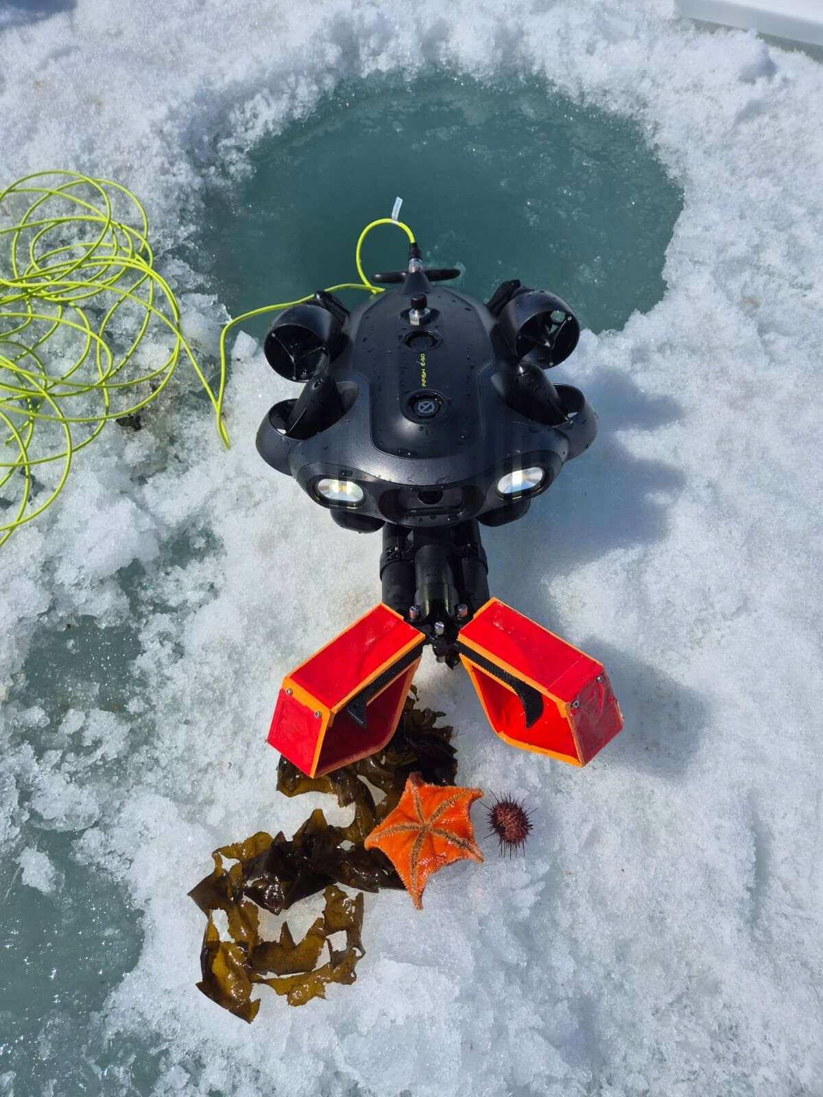
Dr Jonny Stark and a team from the Australian Antarctic Division and SAEF used remotely operated vehicles (ROVs) to get the first glimpse of Antarctic seafloor communities potentially isolated for thousands of years.
Small ROVs were deployed on 300 metre-long tethers through 40 centimetre-wide holes drilled into the sea ice, and were used to explore beneath the sea ice, and take photos, videos and samples.
“The marine environment around the Bunger Hills is unlike anywhere else in Antarctica,” Dr Stark said.
“We discovered a thriving, healthy marine ecosystem. There was so much colourful life on the seabed.
“It’s important to document what the biodiversity looks like now, in a rapidly changing environment, and understand what factors influence it, such as sea ice cover or proximity to the glacier or ice shelf.
“This will contribute to our understanding of East Antarctic biodiversity and help us manage the impacts of human activity in the area.”
Read more about Dr Stark's research in Marine mystery in the Bunger Hills.
In the previous (2023–24) season, SAEF scientists were roaming the landscape, surveying mosses, lichens and algae, and soil microbial communities and invertebrates.
The team returned to Australia with over 850 bags of soil, 41 moss samples, and 100 litres of water, which were sent to team members based in Melbourne, Wollongong, and Canberra.
The research seeks to answer questions about what species live in the region, which environmental variables are driving their distribution, how the organisms are related and how they will be affected by the changing environment.
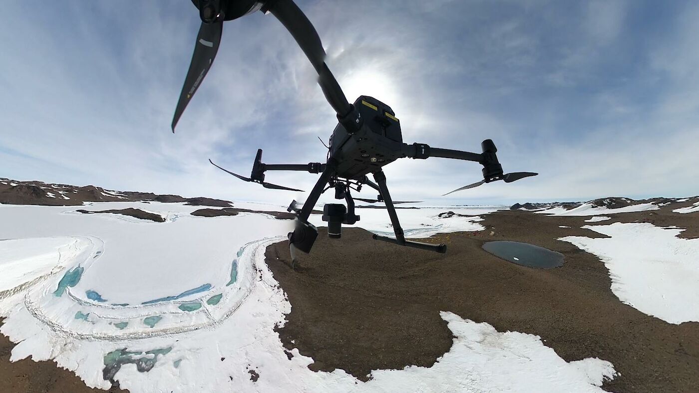
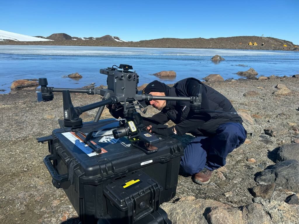
Two other SAEF team members also mapped five regions of the Bunger Hills using drones fitted with a range of scientific cameras.
The resulting high-resolution maps will show the location, condition and distribution of vegetation, such as moss, lichen and cyanobacteria, which can be used for monitoring and conservation planning.
Read more about the SAEF research in the feature story Researchers of the Lost Ice.
With so many measurements, observations and samples from the marine and terrestrial realms, there are many years of analysis to come.
One thing is certain, scientists now have a lot more information about the Denman Glacier region to better understand how the system behaved in the past, how it will behave in the future, and to improve projections of local, regional and global impacts.