Seafloor features and potential shipping hazards on the approach to Mawson research station, have been precisely mapped for the first time using RSV Nuyina’s acoustic instruments.
The work* will enable updates to navigation charts to improve ship safety, and can be used for a variety of scientific research, including understanding seafloor geology and biology, in oceanography and climate modelling, and managing fisheries and marine resources.
3D echo sounder fly-through of seafloor features on the approach to Mawson research station
Mapping and Spatial Data Manager, Ursula Harris, from the Department of Climate Change, Energy, Environment and Water’s Australian Antarctic Division (AAD), said the Nuyina’s advanced acoustic capability will enable updates to the bathymetry (depth of the seafloor) at all the approaches of Australia’s Antarctic and sub-Antarctic stations.
“Nuyina allows us to do modern seafloor surveys that meet new data and safety standards required by the Australian Hydrographic Office,” Ms Harris said.
“We’ll be able to use these data to produce new electronic and hard copy charts that will improve navigational safety and support our stations’ resupply operations each season.”
During a recent voyage, 719 square kilometres of seafloor was mapped off Mawson research station with depths ranging between 20 and greater than 550 metres.
The area was previously mapped by the icebreaker Aurora Australis using a single beam echo sounder – an instrument that maps narrow sections of the seafloor by transmitting pings of sound and listening for the returning echoes.
In contrast, Nuyina’s multibeam echo sounder mapped the seafloor on the approaches to Mawson with swaths up to 1.8 km wide in one pass, and at far greater resolution.
Unlike single beam echo sounders, which survey only a narrow path under the vessel and can miss significant features, multibeam echo sounders cover the whole surface of a target area (‘swath mapping’) and allow generation of 3D images of the seafloor.
The deeper the seafloor, the wider the swath, with Nuyina capable of mapping up to 20 kilometre-wide swaths at water depths of around 5000 metres.
“There are a lot of islands, exposed rocks, seamounts, knolls and other hazards around Mawson, so we were really pleased to be able to update our data after more than 20 years,” Ms Harris said.
Nuyina's multibeam echo sounder sends pings of sound towards the seafloor and uses the returning echos to create a 3D map of the topography. (Click to view full image)Photo: AAD
Ship safety
RSV Nuyina Master, Gerry O’Doherty, said the mapping significantly improved the accuracy of the position of geographical features, and their identity, and included shipping hazards.
One such hazard was the informally named ‘Notta Rock’, an exposed rock that was shown as being below the waterline on charts, affecting the ability to navigate and maintain ship safety.
“At the same time we discovered Notta Rock, we also found that another feature known as Ryrie Rock, was about 2.8 nautical miles south-south-west of its charted position,” Mr O’Doherty said.
“When you consider that many of the soundings and observations in this area were done long before satellite navigation, it’s no wonder inaccuracies exist.”
As well as mapping the Mawson station approach, technicians and bridge officers on board Nuyina operated the echo sounders throughout the ship’s seven week voyage, mapping the seafloor between Hobart, Casey, Davis and Mawson, and covering more than 85,971 square kilometres.
AAD acoustician Mr Floyd Howard said that while transiting between the stations, they detected seafloor depths up to 3000 metres off the continental shelf, and a range of interesting features, including very steep terrain with drowned glacial valleys, uncharted shoals and grounded icebergs and scours.
“The features and depths we observed were similar to areas we’ve recently mapped off the Adams and Vanderford glaciers, near Casey research station,” he said.
“It’s not uncommon to find that the ocean floor drops thousands of metres off the continental shelf.”
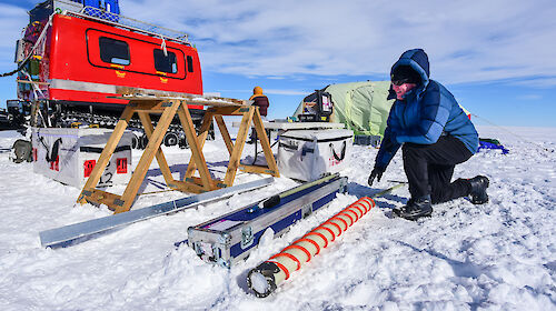
Acousticians Floyd Howard and Jill Brouwer mapped more than 85,000 square kilometres of seafloor during their seven-week voyage.Photo: Pete Harmsen
The big picture
Over the lifetime of Nuyina, as it travels similar and different routes between Australia and Antarctica, the multibeam echo sounders will build a comprehensive picture of the seafloor.
“We’ll continue this work at our other stations and while transiting to and from Antarctica, and use Nuyina’s smaller science tender to map shallower areas and areas where Nuyina can’t go,” Ms Harris said.
The mapping data will feed in to AusSeabed and from there into the Seabed 2030 initiative to map the world’s ocean floors by 2030. The data will also be included in the International Bathymetric Chart of the Southern Ocean (IBCSO).
*The project is a collaboration between the Australian Antarctic Division, Geoscience Australia and the Australian Hydrographic Office.
RSV Nuyina's acoustic instruments are being used to precisely map the seafloor terrain around Mawson, Davis and Casey (pictured) research stations.Photo: Pete Harmsen