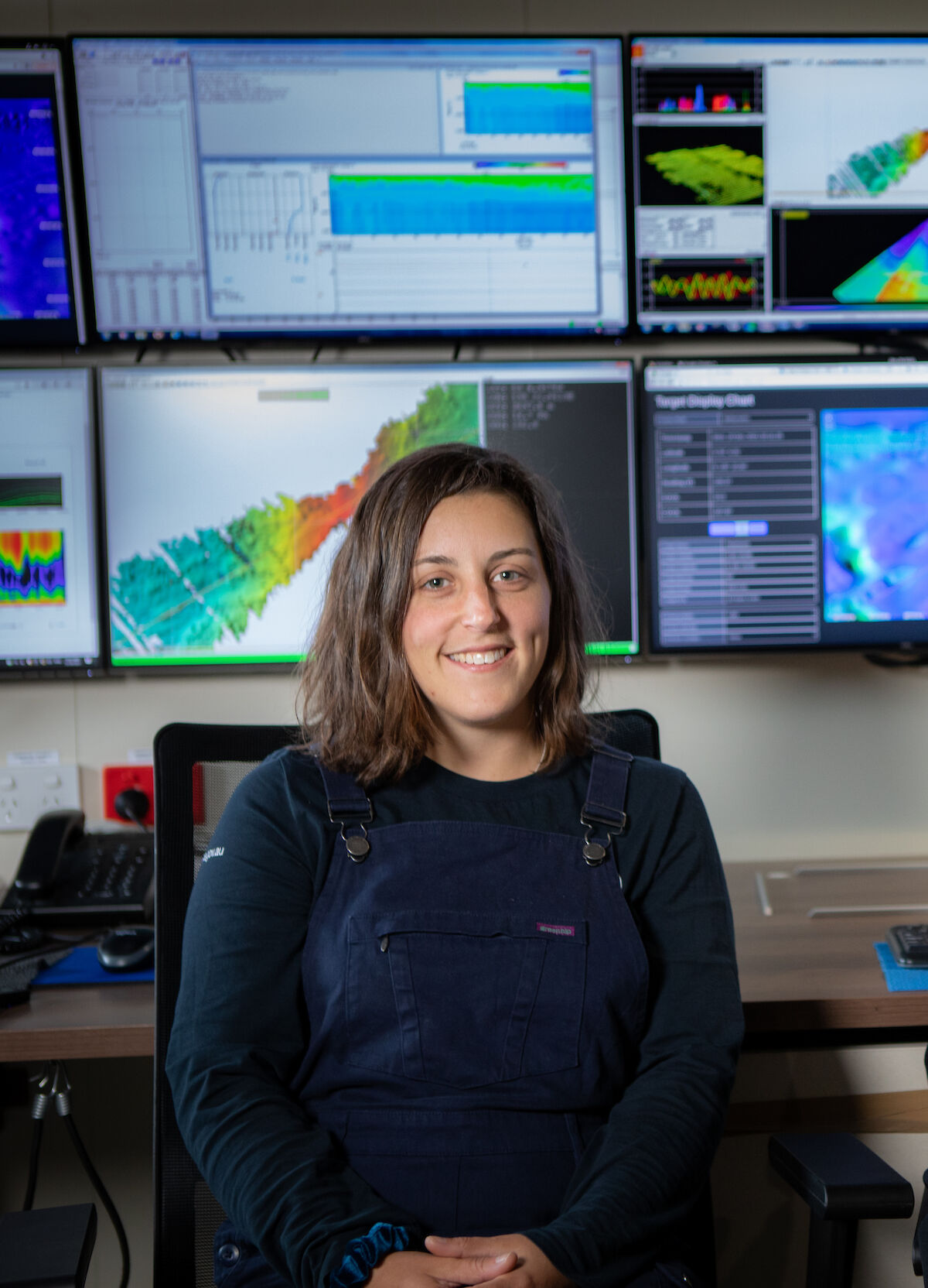
For senior acoustician Alison Herbert, and science systems engineer Tom Rushton Brumby, it’s the second time they’ve discovered an impressive Antarctic seafloor feature using the ship’s acoustic instruments.
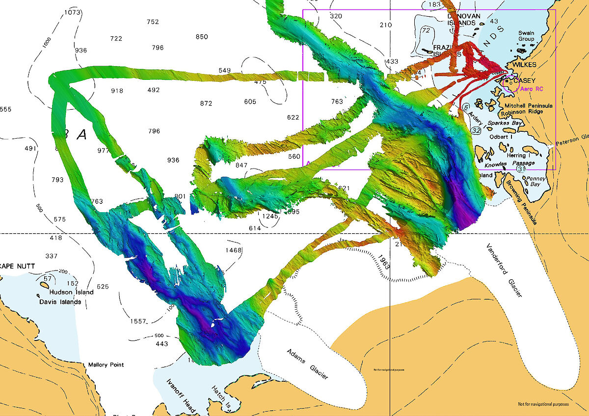
“This latest mapping adds to our initial discovery two years ago, on Nuyina’s maiden voyage to Casey, when we mapped the nearby Vanderford Canyon, which is 2200 metres deep, 2000 metres wide and at least 55 kilometres-long,” Ms Herbert said.
“Nuyina’s multibeam echosounder gives us much greater capability for detailed mapping of the seafloor than we’ve ever had before, and these two new discoveries suggest there will be many more to come.”
The acoustics team initially discovered just the southern tip of the canyon before the ship had to return to Casey for cargo operations.
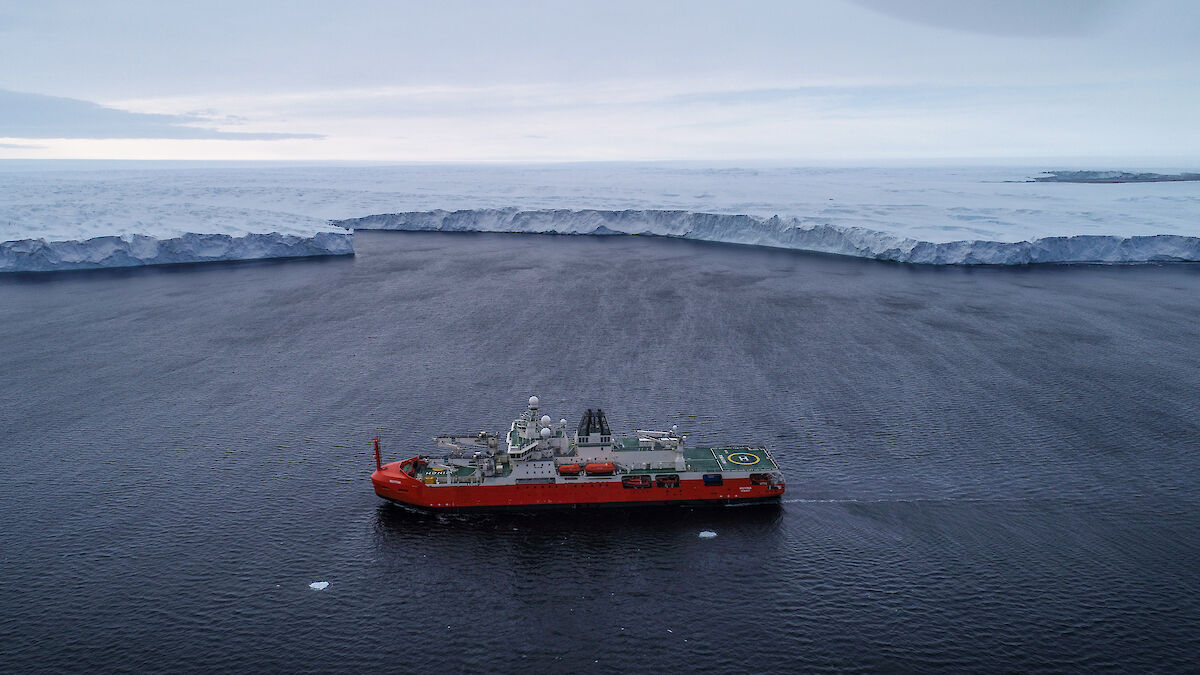
Voyage Leader Keith Ashby said that, fortunately, bad weather enabled the return of the vessel to the area a few days later, when further observations were taken in very difficult conditions.
“Four metre seas and 50 knot winds put a hold on our resupply operations at Casey, so we decided to ride out the weather in open water, allowing our acoustics team to conduct about 15 hours of mapping in front of Adams Glacier,” Mr Ashby said.
“Then on our way back to Australia we made another fleeting visit to fill in some remaining gaps, resulting in a comprehensive picture of this deep, glacial trough.
“As the voyage was primarily for station resupply, the fact that we had any opportunity to complete some seabed mapping was really pleasing. To discover a substantial feature like a large canyon was genuinely exciting.”
The Nuyina’s multibeam echosounder works by sending out pings of sound in a fan-shape beneath the ship and ‘listens’ to the returning echoes to build a picture of the seafloor.
“I always find it fun, and almost mesmerising, to make a rainbow road of the seabed ping by ping,” Ms Herbert said.
Among other things, maps of the seabed generated using multibeam echosounder data provide insights into the geological and glacial history of the area and allow scientists to identify areas for further study.
RSV Nuyina technology manager, Lloyd Symons, said the ship had risen to the challenge it was designed for.
“One of the specific objectives in building RSV Nuyina was to provide Australia with the capability to map the Antarctic continental shelf,” Mr Symons said.
“Discovery and mapping of these deep glacial canyons is key to developing better models of the interaction between the Antarctic ice sheet and the ocean. This is just the beginning.”