
A trio of American research technicians assembled and deployed almost 13 kilometres of cable and instruments, to monitor the flow of Antarctic Bottom Water from the Mertz polynya.
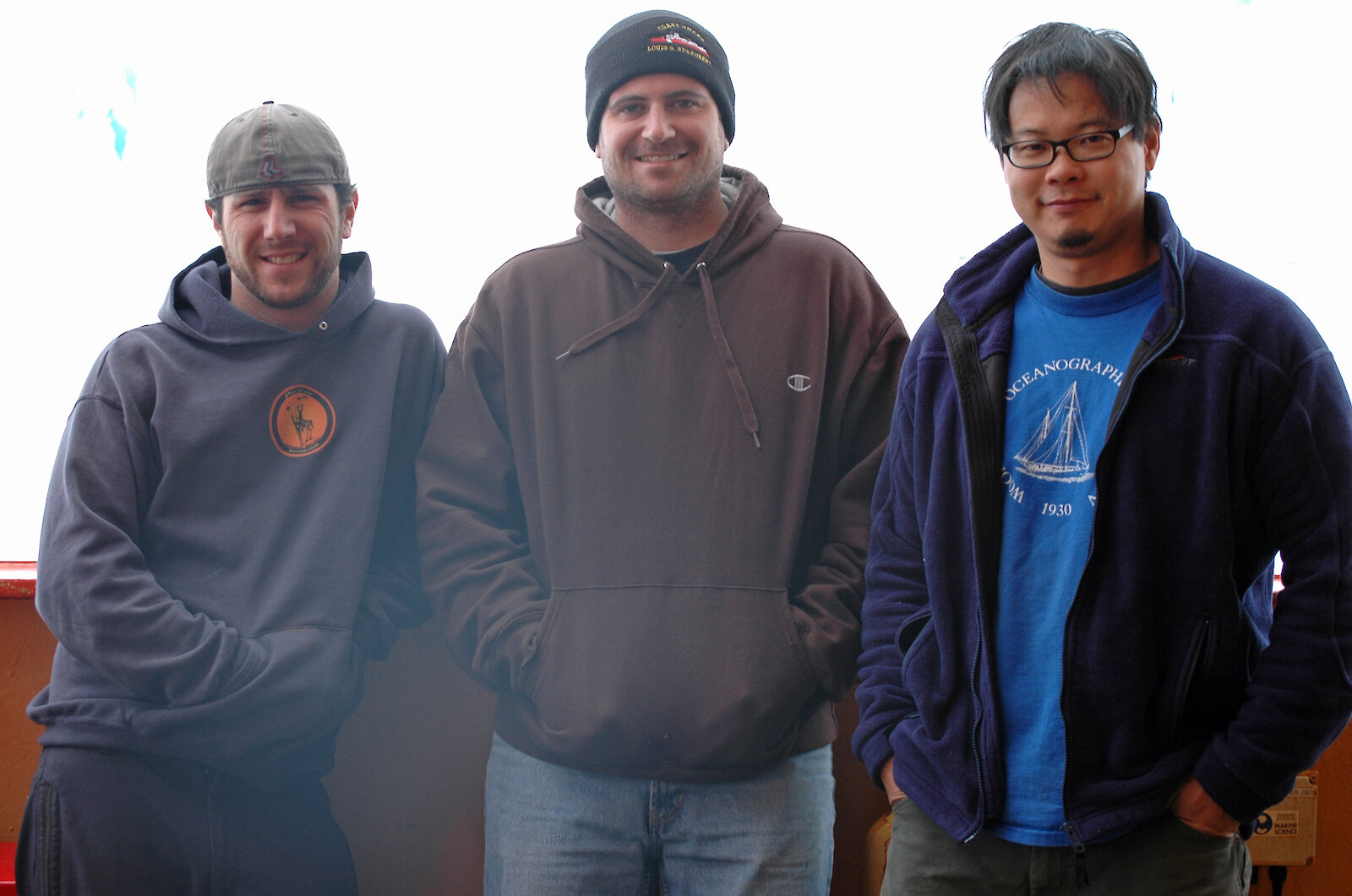
Jeff Pietro, Brian Hogue and Daniel Bogorff, from the Woods Hole Oceanographic Institute (WHOI), based at Cape Cod on the east coast of the United States, are edgy. After a year of preparation the technical trio, dubbed ‘Team America', are itching to deploy five oceanographic moorings from the trawl deck of the Aurora Australis. But after days of calm seas, the swell has picked up for the first scheduled mooring deployment, and the team must wait for conditions to be declared safe.
The team’s work is part of a collaboration involving WHOI, CSIRO and the Antarctic Climate and Ecosystems Cooperative Research Centre (ACE CRC) to measure some of the outflow of dense (cold and salty) Antarctic Bottom Water produced in the Mertz polynya (near Dumont d'Urville). Recent work by the ACE CRC in the region (see CASO project) has found that dense water near the sea floor is becoming fresher (less salty and less dense). This may be because of increased precipitation (rain, snow), a decrease in sea ice formation (sea ice formation increases the saltiness of water beneath the ice), or increased glacial melt in Antarctica. The five moorings will help scientists determine the cause.
The moorings will also measure the average currents over the Antarctic continental slope for the first time. Previous measurements from ships suggest that a strong, deep-reaching clockwise gyre fills the deep basin off the Antarctic territory and the moorings will test this hypothesis.
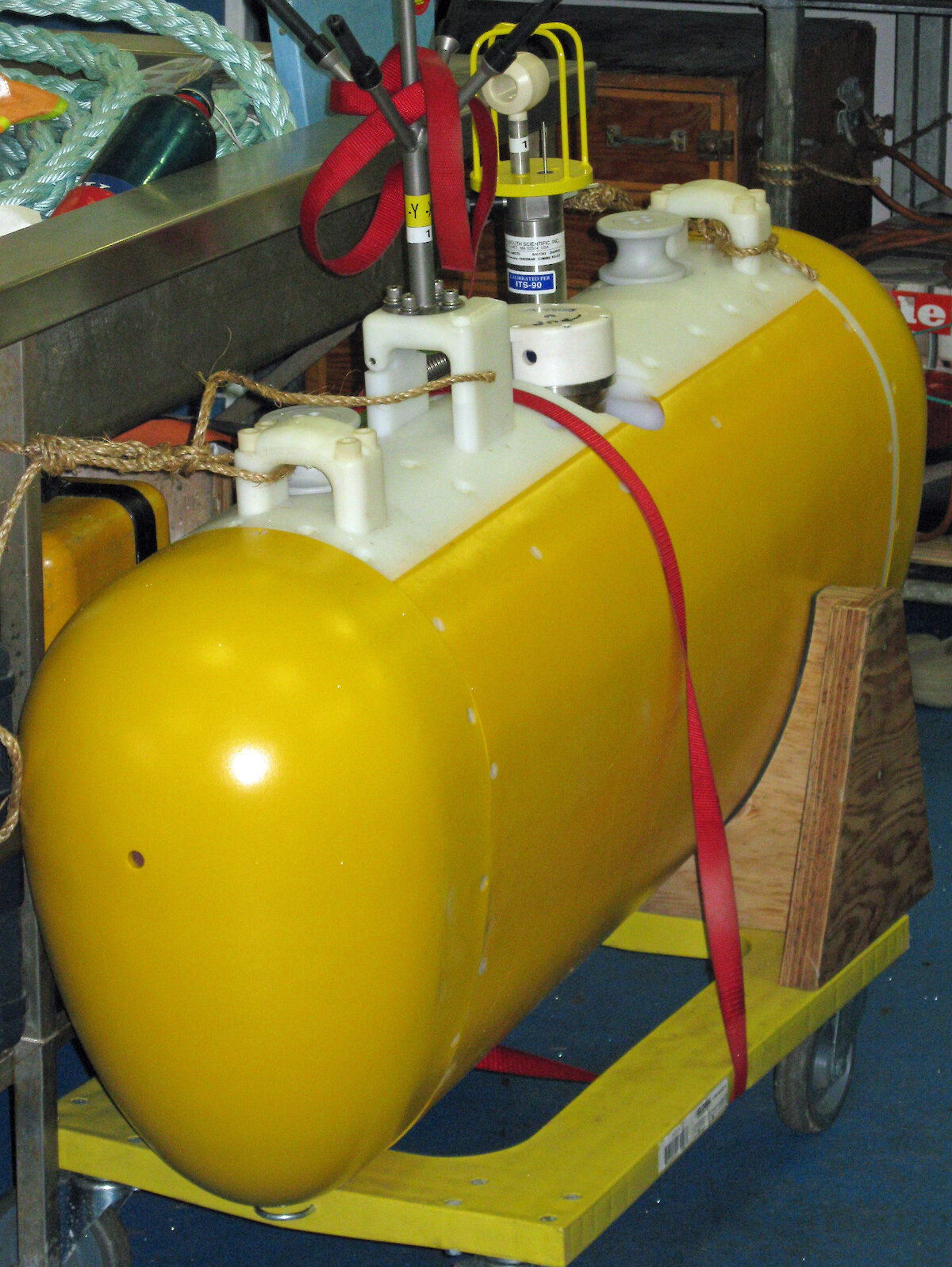
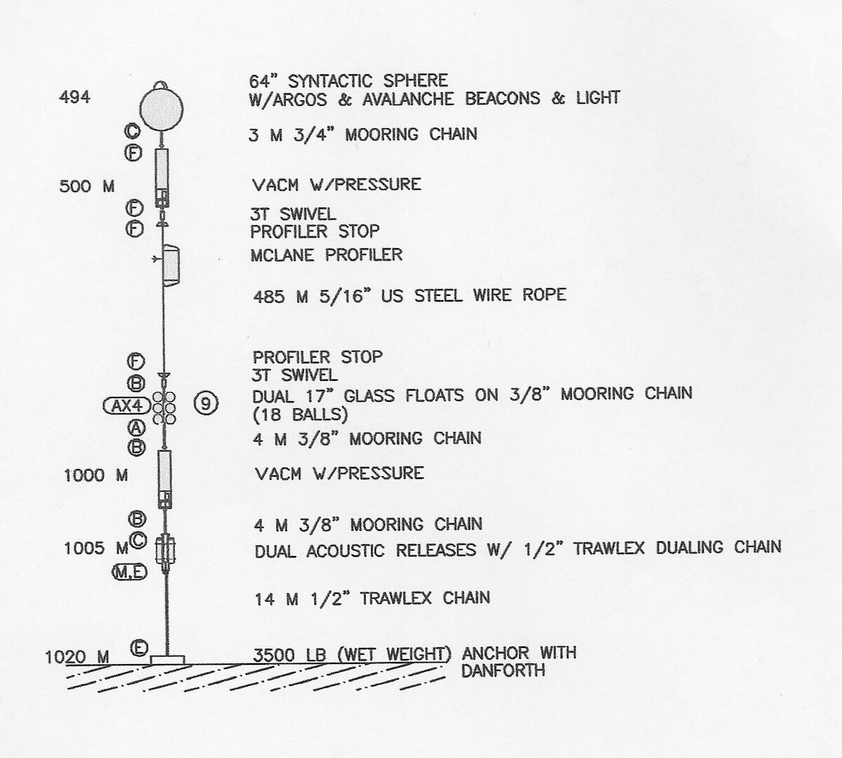
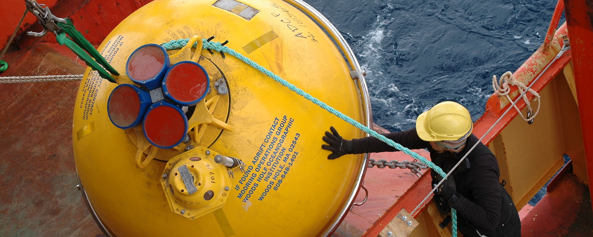
The moorings will be deployed at different depths in a line running from 62–65°S and 113°E. Each mooring is a different length — 4220m, 3520m, 2520m, 1520m, and 1020m — and various instruments are attached at critical points along the wire to correspond to regions of the ocean profile the scientists want to study. The moorings are anchored to the sea floor by about two tonnes of steel, and the cable and instruments are suspended in a straight line above using a series of small floats every 500m and one large, yellow, buoyant sphere at the top. The whole package sits almost 500m below the ocean surface, lending it the name ‘sub-surface mooring'.
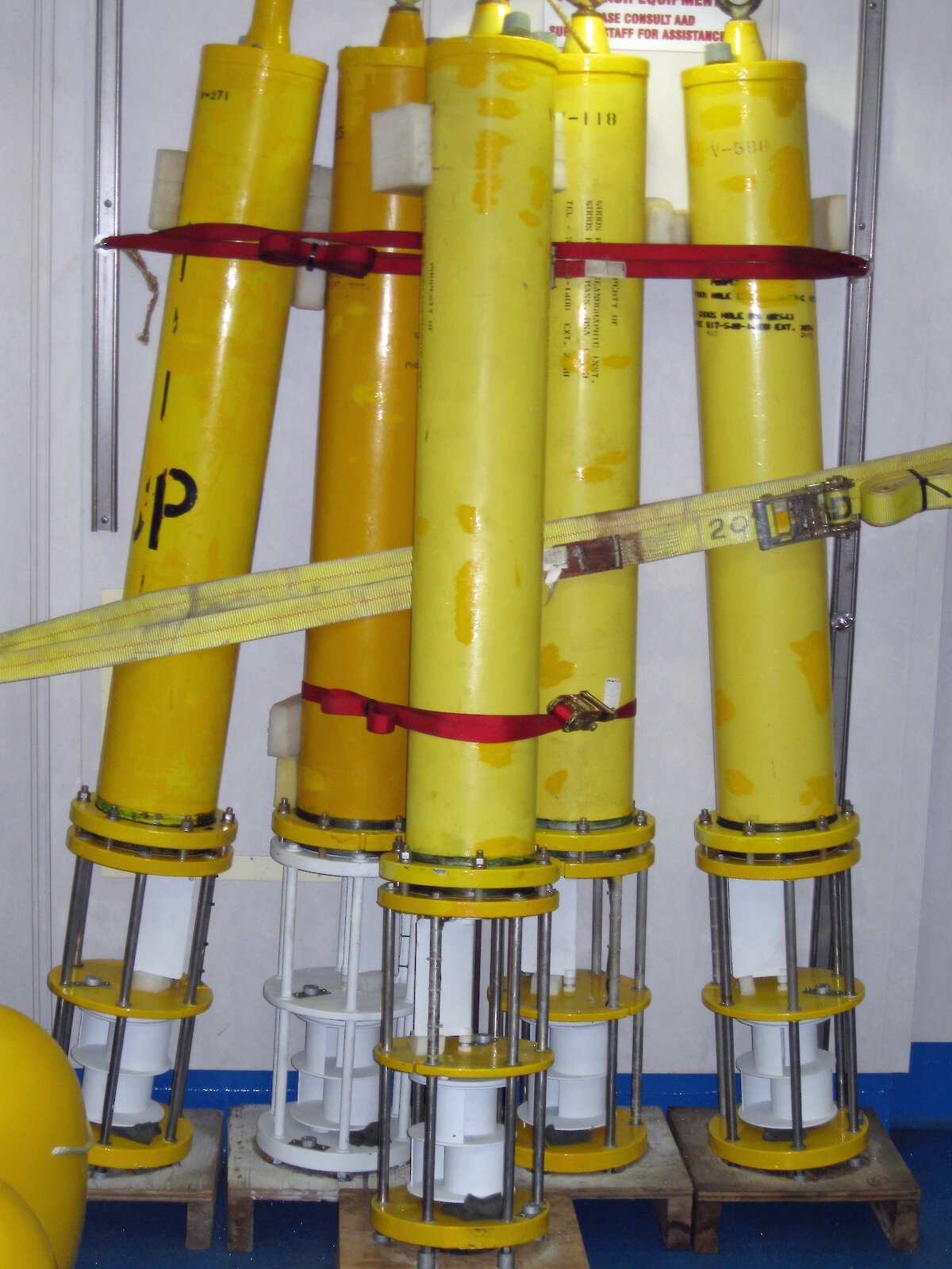
Among the many gizmos attached to each mooring cable is a McLane Moored Profiler. This robot is programmed to move up and down its section of cable measuring current speed, temperature, conductivity and depth. In two years it will profile over 1 million metres of water.
Each mooring also has a number of stationary Vector Averaging Current Meters (VACM) — the workhorses of physical oceanography — which measure current speed and direction, temperature, and pressure. Every 30 minutes, these instruments record an average of their measurements over that time. Two moorings also have Acoustic Doppler Current Profilers which sit on the top buoy and profile the top 500 m of water.
Finally, Team America receive the call to proceed. Over six hours they, and the ship’s crew, painstakingly assemble the first mooring in 500m sections, beginning with the big yellow buoy at the top. Four kilometres of cable is gradually winched out, instruments and smaller buoys are attached, and the 500m sections are lowered into the ocean.
The ship moves slowly towards the final mooring position trailing a string of yellow buoys behind it. Once in place, the two tonne anchor is attached to the final section of cable and the whole lot is released. The anchor sinks to the spot scientists have selected to study, dragging down the entire mooring in a straight line.
Over the next two days Team America and the crew repeat this procedure and successfully deploy all five moorings. In the sea ice zone the order of assembly is reversed, with the anchor going in first at the designated spot, and the top buoy last.
In two years time the team will return to collect the moorings which each have an acoustic release at their base. An acoustic code will unlock the moorings from their anchors and the buoys will float each mooring to the surface, where they can be winched back to the ship.
Two months after the moorings were deployed the Mertz Glacier tongue broke away from the Antarctic continent, after another massive iceberg crashed into it. This may lead to changes in the polynya and in the volume, temperature and salinity of the dense water formed there. The US-Australian mooring experiment is perfectly timed to detect any changes in the deep ocean resulting from this unexpected change in the geography of Antarctica.
WENDY PYPER
Corporate Communications, Australian Antarctic Division