


The intense cold of the Antarctic ice sheet affects the global climate system through changes in surface energy and moisture, clouds, precipitation, and atmospheric and ocean circulation. If the Antarctic ice sheet melted, it would raise global sea level by nearly 60 metres. However, the response of the ice sheet to global warming is the largest unknown in projecting future sea level over the next 100 to 1,000 years.
Are the Antarctic and Greenland ice sheets growing or shrinking?
Studies of snowfall and ice loss (‘mass budget’) in Antarctica and Greenland have been made using satellite measurements and estimates of the difference between net snowfall and ice loss. These confirm that both the Greenland and Antarctic ice sheets are losing ice mass and contributing to sea level rise.
In 2013, the Fifth Assessment Report of the Intergovernmental Panel on Climate Change (IPCC AR5) concluded that the Antarctic Ice Sheet, as a whole, was contributing to sea level rise at a rate of 0.41 millimetres per year. This represents an increase in ice loss, mainly from increased discharge by large outlet glaciers in the Amundsen Sea and Bellingshausen Sea regions of West Antarctica. Loss also occurred by melt along the Antarctic Peninsula, where air temperatures have risen over the past 50 years.
The IPCC AR5 concluded that the average rate of ice loss from the Antarctic Ice Sheet has likely increased from about 30 Gt (gigatonnes; 1 Gt = 1 billion tonnes) per year between 1992 and 2001 to about 147 Gt per year between 2002 and 2011. (100 Gt per year of ice is equivalent to approximately 0.28 mm per year of global sea level rise). While the range of estimates from the different studies is large, they all suggest a current net loss.
While ice loss has been greatest along coastal sectors of the Antarctic Peninsula and West Antarctica, ice thickening (gain) further inland and over much of East Antarctica (from increased snowfall) may have partially offset this loss. All of the available estimates, however, show that the loss of mass in West Antarctica (due to acceleration in ice flow) is greater than any added mass in East Antarctica.
In Greenland, the average rate of ice mass loss from 2002 to 2011 has been about 215 Gt per year – almost 1.5 times that of Antarctica and contributing approximately 0.60 mm per year to sea level rise. This loss has increased from about 34 Gt per year between 1992 and 2001 (IPCC AR5). This negative mass balance results from an increase in surface melt and runoff and enhanced ice discharge due to the increased speed of some outlet glaciers.
For a few days in July 2012 there was an extreme surface melt event covering more than 90% of the Greenland Ice Sheet. Such extreme melt events are rare and have been observed in ice core records only twice; once in 1889, and once more 7 centuries earlier in the Medieval Warm Period.
Why is Antarctic ice loss occurring faster over the Peninsula and in West Antarctica than in East Antarctica?
The Antarctic Ice Sheet is connected to global climate through the atmosphere and ocean in complex ways, and different regions respond differently.
Ice loss along the Antarctic Peninsula is a direct result of increased ocean and air temperatures. The rate of air temperature rise in this region (2.5°C over the last 50 years) is one of the highest on our planet.
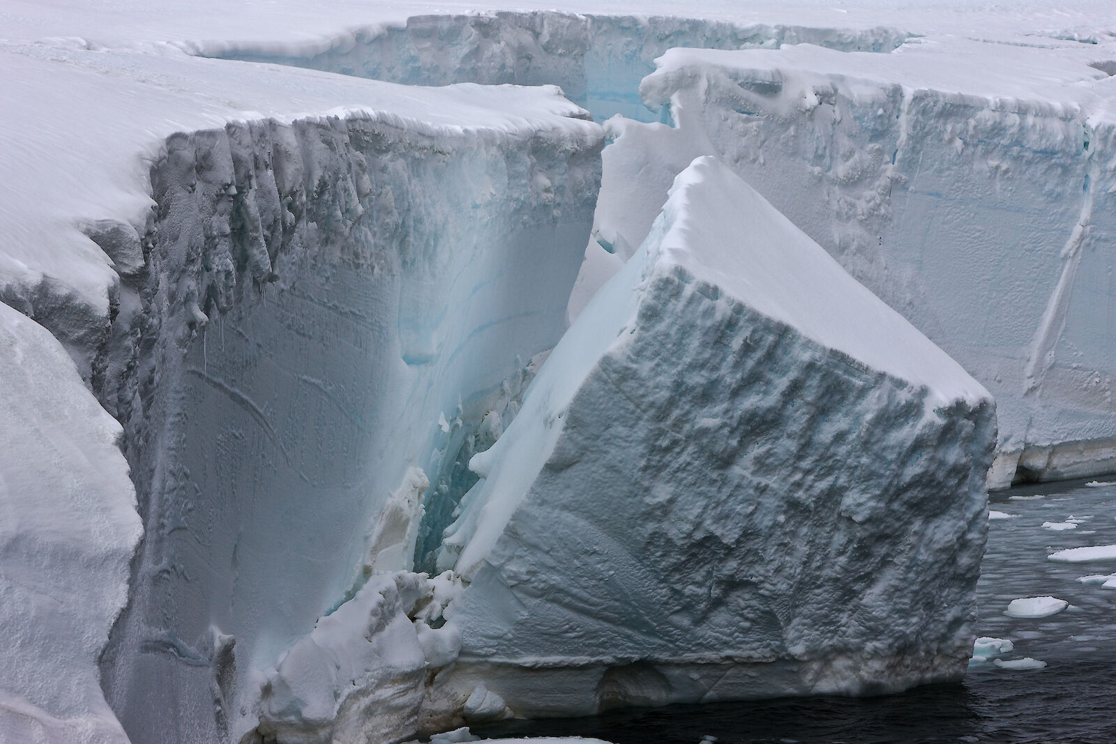
Increased ice discharge from glaciers is, in some cases, a result of the collapse of floating ice shelves. In the more northerly parts of the Antarctic Peninsula large ice shelves are being eroded from beneath by warming ocean waters. They are also affected by the warmer summer air temperatures, which enhances surface melt. A number of these ice shelves have catastrophically disintegrated, including the Larsen B Ice Shelf in 2002. This unusual mode of collapse indicates a strong interaction between surface melt-water and crevasse growth.
Although the collapse of a floating ice shelf does not directly add to sea level, the removal of buttressing restraints by the ice shelves may ‘unplug’ land-based glaciers behind the former ice shelves, and these can then flow more rapidly into the sea. In some regions thick, perennial sea ice may also help to stabilise vulnerable ice shelf margins, so the loss of sea ice in polar coastal regions could also contribute to this process.
The causes of acceleration of other large outlet glaciers in West Antarctica are not fully understood, but may be related to marine ice shelf instability (discussed under the next question).
Over most of East Antarctica surface temperatures are well below the freezing point, and a small increase in temperature cannot initiate significant additional surface melt. Warmer temperatures, however, do allow the atmosphere to hold more water vapour and thus lead to increased snowfall. An increased input of snow may be causing East Antarctica to grow slightly, but any gain here is more than offset by increased losses from West Antarctica and the Antarctic Peninsula.
Could the West Antarctic Ice Sheet continue to add to sea level rise?
Yes. The West Antarctic Ice Sheet forms what is called a marine ice sheet – the ice is resting on bedrock, but that bedrock is below sea level. (Parts of the East Antarctic Ice Sheet are also below sea level.)
Where the bedrock under a marine ice sheet slopes down towards the interior of the continent, such as under parts of West Antarctica, the ice sheet may be unstable. If the coastal part of the ice sheet flows more rapidly and thins (e.g. in response to ice shelf changes), it will start to float. This reduces the forces restraining the ice sheet, which is then able to flow even more rapidly. This will drain more ice from further inland, thinning the ice sheet upstream, which may also start to float. With bedrock that slopes backwards, becoming deeper towards the interior, continued retreat of the boundary of the grounded ice sheet may proceed very rapidly.
In this way, a small initial retreat could in theory destabilize large sections of the West Antarctic Ice Sheet, leading to rapid ice loss. However, uncertainty remains around how likely this process is and how much it might affect sea level rise by 2100.
What will be the contribution of the ice sheets to future sea level rise?
The IPCC AR5 states that, based on a wide range of emission scenarios, sea level rise from thermal expansion of the ocean, melt of glaciers and small ice caps, and from Greenland and Antarctica, would be in the range 0.26 to 0.82 m by 2081–2100.
Estimating extra sea level rise from a further acceleration of outlet glaciers is not straightforward. Processes such as those controlling basal sliding of glaciers (where water at the bed of the glacier lubricates it and allows it to move more rapidly) are not well understood.
IPCC AR5 concluded that only the collapse of marine-based sectors of the Antarctic Ice Sheet, if initiated, could cause global mean sea level to rise substantially above the likely range during the 21st Century, and that this additional contribution would not exceed several tenths of a metre of sea level rise during the 21st Century.
Do ice shelves contribute to sea level rise?
No. Disintegrating ice shelves do not contribute to sea level rise as they are already floating.
A number of ice shelves along the Antarctic Peninsula have disintegrated dramatically over the last 2 decades. The cause of their catastrophic collapse is thought to be a combination of melting at their base, which thins the shelves and makes them more vulnerable, and warmer summer temperatures causing increased surface melt that can lead to structural weakening of the shelves. Large areas of ice shelves (thousands of square kilometres of ice that is 100 to 200 m thick) have broken into small pieces and disintegrated within a few weeks.
An example of this is the Wilkins Ice Shelf in the western Antarctic Peninsula. The Wilkins Ice Shelf underwent significant changes in 2008 with two significant break-up events in February and May 2008 and further losses in the depth of winter in June and July 2008.
These changes were attributed to a combination of factors: strong regional warming and production of summer meltwater at the ice shelf surface, and fracturing by buoyancy stresses set up by uneven melting of the ice shelf from below. As with the Larsen B Ice Shelf in 2002, in 2008 whole areas of Wilkins Ice Shelf suddenly disintegrated into a proliferation of ‘sliver’ icebergs.
While ice shelf loss does not contribute to sea level rise, when ice shelves buttress glaciers flowing into the sea, accelerated glacier outflow can add to sea level rise. This is not the case with the Wilkins Ice Shelf, which has few tributary glaciers and is largely replenished by local snowfall, but did occur when the Larsen B Ice Shelf dramatically collapsed in 2002.
What are the gaps in our knowledge that restrict better estimates of future sea level rise?
The main knowledge gaps are in some aspects of ice sheet dynamics and of the interaction between ice shelves and the ocean.
There is a need to improve the quantitative mathematical models of the dynamics of glaciers, ice sheets and ice shelves to better project future changes. We also need more detailed measurements of how deep the bedrock is under the ice sheets, for use in the models.
Another major gap concerns what is happening at the bed of the ice sheets – how they react with liquid water at the base, what role water may have in the ice sliding over the bedrock, and the role of conditions at the base – whether hard rock surface or deformable sediments. We now know that there is liquid water under much of the ice sheet, but we don’t know much about its distribution – in lakes, saturated sediments, or flowing in channels – and how changes in these environments may affect the ice flow.
Increasingly, we recognise the importance of interaction between Antarctic ice shelves and the ocean, with about half the ice that leaves the continent being melted away at the ice shelf base rather than surviving to form icebergs. Increasing heat delivery to the base of ice shelves by changes in both ocean waters and currents appears to be a powerful climatic influence on the entire Antarctic Ice Sheet system, yet few observations exist concerning the processes at work beneath the ice shelves.
What ice sheet research is Australia involved in?
To help address gaps in the scientific knowledge about ice sheets, an international team from Australia, the US and UK are involved in the ‘ICECAP’ project – ‘Investigating Cryospheric Evolution through Collaborative Aerogeophysical Profiling'. This project is studying the underlying geology and the structure of the East Antarctic Ice Sheet and processes beneath the ice sheet. Data collected about the ice sheet structure and conditions at the ice-bedrock interface will be used to improve computer models of ice flow for Antarctica. In turn, this will improve estimates of ice sheet stability and forecasts of its reaction to climate change and impact on global sea level.
East Antarctica was previously regarded as being less responsive to climatic changes than the smaller marine-based West Antarctic Ice Sheet. However, numerous sub-glacial lakes have recently been discovered beneath East Antarctica, indicating that the ice sheet is potentially more mobile than if it were frozen solid to the bedrock. There are also ‘hotspots’ on the East Antarctic margin, including the Totten Glacier, where the ice sheet is thinning in response to changes in ice flow dynamics.
Using Casey and McMurdo stations as bases, the ICECAP team is exploring the vast Aurora and Wilkes sub-glacial basins, using instruments fitted to a Basler aircraft to measure the glaciological and geological properties of the basins. These instruments include a high resolution ice-penetrating radar, to image the underside of the ice sheet and layers within the ice, which provides insight into bedrock conditions and past ice flow. A gravity sensor and a magnetometer measure the density and composition of the rock lying beneath the ice, providing information on the geological character of this region. The aircraft also carries a laser altimeter to map ice-surface elevation, and GPS receivers to accurately locate all the measurements.
This research has shown that the Aurora Basin inland from Casey station is very deep, and has a larger submarine area than previously thought. ICECAP also found deep channels cutting through sub-glacial mountain ranges to the ocean. This has raised the prospect that substantial regions of East Antarctica might, in future, also be susceptible to the marine ice sheet instability.
Australia also has a long-running program of field work on the Amery Ice Shelf – East Antarctica’s largest ice shelf. Using instruments installed via holes drilled through the ice shelf, scientists are measuring ocean properties below the ice and exploring the melting and freezing processes that occur at its base. They are also studying how temperatures vary through the ice shelf.
Another major strand of our ice sheet research involves building and testing computer models of the processes of ice flow in ice sheets and ice shelves, and coupling them to models that simulate the ocean circulation and thermodynamics beneath the ice shelves. In this way, scientists are refining our understanding of current processes and developing the capacity to estimate future changes with greater confidence.


